
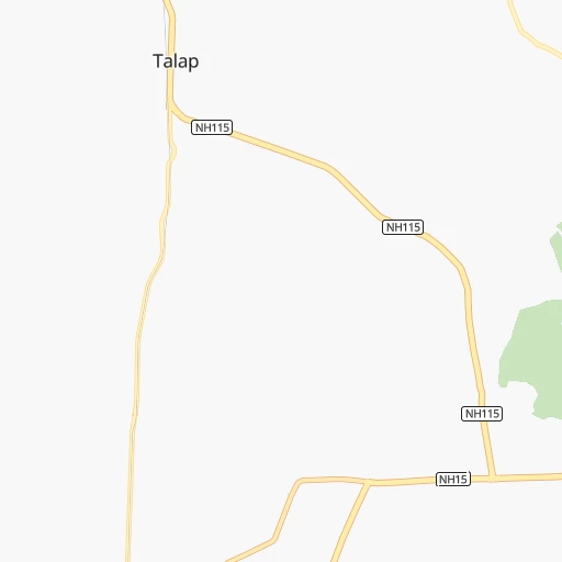


How to get from Tālāp (Assam) to Bongaigaon (Assam)
Calculate route from Tālāp (Assam, India) to Bongaigaon (Assam, India).
The flight distance (as the crow flies) between Tālāp and Bongaigaon is 512.6 km.
Roadmap (route) to go from Tālāp to Bongaigaon detailed above, you can also see the course layout on the map.
While doing trip Tālāp - Bongaigaon by car, the calculated route ends at a distance , or more straight.
Distance and duration of the route between Tālāp and Bongaigaon
An error occured: undefined - for url https://router.cartes.cc/route?point=27.65774%2C95.56608&point=26.47703%2C90.55815&vehicle=car&debug=false&data_type=application%2Fjson&locale=en&points_encoded=true&instructions=true&elevation=false&optimize=false&timeout=10000&skip.host=true&skip.basePath=true&graphhopper_maps_host=https%3A%2F%2Fgraphhopper.com%2Fmaps%2F%3F&turn_sign_map.0=continue&turn_sign_map.1=turn%20slight%20right&turn_sign_map.2=turn%20right&turn_sign_map.3=turn%20sharp%20right&turn_sign_map.4=finish&turn_sign_map.5=reached%20via%20point&turn_sign_map.6=enter%20roundabout&turn_sign_map.-6=leave%20roundabout&turn_sign_map.-3=turn%20sharp%20left&turn_sign_map.-2=turn%20left&turn_sign_map.-1=turn%20slight%20left&key=&position=topleft
Calculation of distance and route from Bongaigaon to Tālāp :
512.6618.3 km9h30mn
Continue 0h2mn 455 mTurn left 0h0mn 110 mTurn slight left 0h0mn 78 mTurn left 0h7mn 7.1 kmContinue 0h24mn 26.7 kmContinue onto NH315A 0h0mn 257 mContinue 0h13mn 14.2 kmKeep right 0h1mn 838 mTurn left onto NH15 0h22mn 25.3 kmKeep right onto NH15 0h0mn 13 mKeep left onto NH15 0h11mn 13.0 kmAt roundabout, take exit 2 onto NH15 0h5mn 6.1 kmKeep right 0h16mn 12.9 kmTurn left 0h0mn 182 mKeep right 0h2mn 836 mTurn sharp right 0h2mn 806 mKeep left 0h2mn 803 mTurn right 0h17mn 14.2 kmTurn right onto NH2 0h14mn 16.9 kmKeep left onto Assam Trunk Road 0h2mn 1.9 kmContinue 0h5mn 4.5 kmTurn right 0h5mn 4.6 kmContinue onto Assam Trunk Road 1h37mn 42.8 kmTurn left onto AT Road 0h7mn 7.1 kmKeep left 0h0mn 216 mContinue onto NH715 2h52mn 130.3 kmTurn right 0h6mn 6.0 kmTurn left 0h0mn 374 mKeep right 0h8mn 7.0 kmTurn right onto NH715 0h9mn 10.2 kmKeep left onto NH715 0h3mn 3.0 kmAt roundabout, take exit 2 0h2mn 2.5 kmAt roundabout, take exit 2 onto NH15 1h59mn 68.7 kmContinue 0h3mn 2.6 kmTurn left 0h0mn 42 mTurn right 0h1mn 612 mTurn slight right onto SH10 0h19mn 18.6 kmTurn right onto SH4, 10 0h2mn 2.1 kmTurn left onto SH10 0h19mn 20.9 kmKeep right 0h5mn 5.1 kmTurn left 0h12mn 12.2 kmContinue onto SH10 0h2mn 2.6 kmTurn right onto NH127D 0h2mn 2.7 kmTurn sharp left onto SH10 0h11mn 12.6 kmTurn left onto SH10 0h12mn 13.7 kmTurn right onto NH27 0h15mn 17.4 kmKeep right onto NH 27 0h12mn 13.5 kmTurn right 0h5mn 4.1 kmTurn right 0h2mn 1.9 kmTurn left 0h2mn 1.3 kmTurn right 0h5mn 4.4 kmTurn right 0h1mn 765 mTurn left 0h0mn 199 mTurn left onto SH6 0h0mn 366 mKeep right 0h0mn 67 mTurn sharp right onto NH27 1h33mn 39.0 kmTurn right onto NH27 0h6mn 7.0 kmTurn left 0h1mn 561 mTurn slight left 0h1mn 618 mKeep right 0h3mn 1.4 kmTurn left 0h0mn 126 mTurn right 0h0mn 182 mTurn left onto SH2 0h0mn 409 mTurn right onto SH2 0h1mn 1.5 kmArrive at destination 0h0mn 0 m
Travel from Tālāp (Assam) to a selection of major cities.
Distances from Tālāp to biggest cities in Assam
- Hailakandi,31,031 inhabitants.447 km
- Rangia,26,388 inhabitants.414 km
- Lumding Railway Colony,25,283 inhabitants.319 km
- Mangaldai,24,871 inhabitants.376 km
- Gauripur,24,694 inhabitants.583 km
- Mariani,23,640 inhabitants.167 km
- Duliagaon,23,528 inhabitants.41 km
- Silapathar,22,307 inhabitants.83 km
- Dum Duma,21,706 inhabitants.10 km
- Dhekiajuli,21,271 inhabitants.324 km
- Dhing,20,826 inhabitants.334 km
- Morigaon,20,807 inhabitants.356 km
- Digboi,20,685 inhabitants.30 km
Other major cities in country :
- Vadodara [09], 1,409,476 inhabitants. 2,330 km
- Gorakhpur [10], 1,324,570 inhabitants. 1,953 km
- Nashik [16], 1,289,497 inhabitants. 2,371 km
- Pimpri [16], 1,284,606 inhabitants. 2,439 km
- Kalyan [16], 1,262,255 inhabitants. 2,470 km
- Thane [16], 1,261,517 inhabitants. 2,488 km
- Meerut [36], 1,223,184 inhabitants. 1,755 km
- Nowrangapur [21], 1,220,946 inhabitants. 1,625 km
- Faridabad [10], 1,220,229 inhabitants. 1,794 km
- Ghaziabad [36], 1,199,191 inhabitants. 1,781 km
- Dombivli [16], 1,193,000 inhabitants. 2,476 km
- Rajkot [09], 1,177,362 inhabitants. 2,565 km
- Varanasi [36], 1,164,404 inhabitants. 1,277 km
- Amritsar [23], 1,092,450 inhabitants. 2,047 km
- Allahabad [36], 1,073,438 inhabitants. 1,388 km
- Visakhapatnam [02], 1,063,178 inhabitants. 1,685 km
- Teni [25], 1,034,724 inhabitants. 2,729 km
- Jabalpur [35], 1,030,168 inhabitants. 1,646 km
- Haora [28], 1,027,672 inhabitants. 923 km
- Aurangabad [16], 1,016,441 inhabitants. 2,231 km
Route from Bongaigaon to major cities (India).
- Distance Bongaigaon Mumbai1,990 km
- Distance Bongaigaon Delhi1,336 km
- Distance Bongaigaon Bengaluru2,023 km
- Distance Bongaigaon Kolkata489 km
- Distance Bongaigaon Chennai1,837 km
- Distance Bongaigaon Ahmedabad1,855 km
- Distance Bongaigaon Hyderabad1,606 km
- Distance Bongaigaon Pune1,930 km
- Distance Bongaigaon Surat1,896 km
- Distance Bongaigaon Kanpur1,017 km
- Distance Bongaigaon Jaipur1,469 km
- Distance Bongaigaon Navi Mumbai1,979 km
- Distance Bongaigaon Lucknow959 km
- Distance Bongaigaon Nagpur1,310 km
- Distance Bongaigaon Indore1,547 km
- Distance Bongaigaon Patna551 km
- Distance Bongaigaon Bhopal1,375 km
- Distance Bongaigaon Ludhiana1,517 km
- Distance Bongaigaon Tirunelveli2,398 km
- Distance Bongaigaon Agra1,248 km
Nearest cities to Tālāp :
- Imphal, 223,523 inhabitants. 356 km
- Silchar, 152,393 inhabitants. 419 km
- Dimapur, 135,860 inhabitants. 267 km
- Dibrugarh, 122,155 inhabitants. 68 km
- Kohima, 92,113 inhabitants. 264 km
- Tinsukia, 89,373 inhabitants. 28 km
- Jorhat, 69,033 inhabitants. 168 km
- Sibsagar, 62,104 inhabitants. 119 km
- North Lakhimpur, 59,841 inhabitants. 152 km
- Tezpur, 58,851 inhabitants. 297 km
- Diphu, 57,097 inhabitants. 293 km
- Wokha, 54,010 inhabitants. 217 km
- Itanagar, 44,971 inhabitants. 204 km
- Haflong, 39,982 inhabitants. 376 km
- Hojai, 36,869 inhabitants. 326 km
- Golaghat, 34,372 inhabitants. 204 km
- Mokokchung, 34,021 inhabitants. 181 km
- Tuensang, 33,748 inhabitants. 171 km
- Zunheboto, 29,499 inhabitants. 215 km
- Naharlagun, 26,912 inhabitants. 195 km
- Pasighat, 25,581 inhabitants. 51 km
- Lumding Railway Colony, 25,283 inhabitants. 319 km
- Margherita, 24,428 inhabitants. 43 km
- Mariani, 23,640 inhabitants. 167 km
- Duliagaon, 23,528 inhabitants. 41 km
- Silapathar, 22,307 inhabitants. 83 km
- Dum Duma, 21,706 inhabitants. 10 km
- Digboi, 20,685 inhabitants. 30 km
- Sonari, 19,672 inhabitants. 89 km
- Mon, 18,742 inhabitants. 114 km
- Rangapara, 18,739 inhabitants. 301 km
- Namrup, 18,432 inhabitants. 57 km
- Along, 18,425 inhabitants. 94 km
- Bokajan, 16,561 inhabitants. 254 km
- Makum, 16,225 inhabitants. 23 km
- Nahorkatiya, 15,548 inhabitants. 47 km
- Phek, 15,118 inhabitants. 246 km
- Tezu, 14,927 inhabitants. 62 km
- Nazira, 14,302 inhabitants. 116 km
- Ziro, 13,893 inhabitants. 171 km
- Dergaon, 13,366 inhabitants. 191 km
- Dhemaji, 13,058 inhabitants. 99 km
- Lakhipur, 12,871 inhabitants. 409 km
- Bihpuriagaon, 11,780 inhabitants. 178 km
- Badarpur, 11,028 inhabitants. 429 km
- Khonsa, 10,187 inhabitants. 71 km
- Gohpur, 9,896 inhabitants. 211 km
- Sarupathar, 9,827 inhabitants. 203 km
- Bokakhat, 9,554 inhabitants. 225 km
- Yairipok, 8,797 inhabitants. 365 km
Location Tālāp (Assam) :
| Country flag |  |
| Location | Tālāp |
| State | Assam |
| County | Tinsukia |
| Country | India |
| Country code / ISO 2 | IN |
| Latitude | 27.6577400 |
| Longitude | 95.5660800 |
| Altitude | 0 meters |
| Time zone | Asia/Kolkata |
Location Bongaigaon (Assam) :
| Country flag | |
| Location | Bongaigaon |
| State | Assam |
| County | Chirang |
| Country | India |
| Country code / ISO 2 | IN |
| Latitude | 26.4770300 |
| Longitude | 90.5581500 |
| Altitude | 0 meters |
| Time zone | Asia/Kolkata |

