

How to get from Kępa (Subcarpathian Voivodeship) to Tarnobrzeg (Subcarpathian Voivodeship)
Calculate route from Kępa (Subcarpathian Voivodeship, Poland) to Tarnobrzeg (Subcarpathian Voivodeship, Poland).
The flight distance (as the crow flies) between Kępa and Tarnobrzeg is 27.5 km.
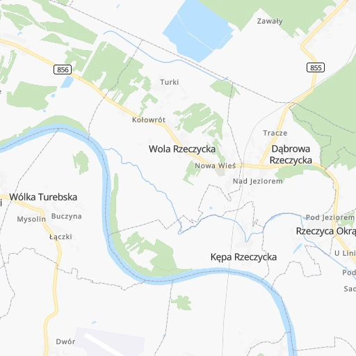
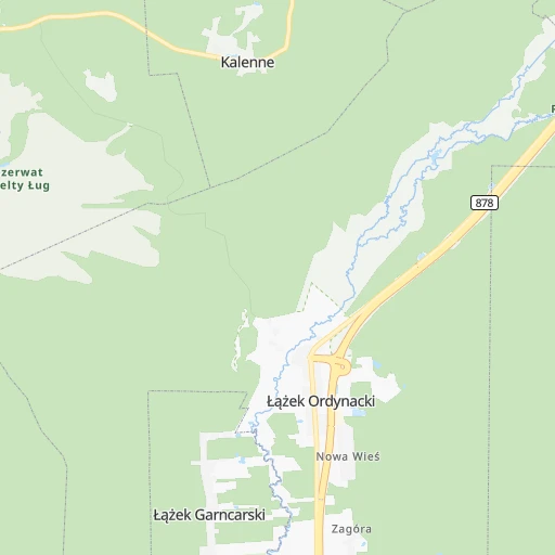
Roadmap (route) to go from Kępa to Tarnobrzeg detailed above, you can also see the course layout on the map.
While doing trip Kępa - Tarnobrzeg by car, the calculated route ends at a distance , or more straight.
Distance and duration of the route between Kępa and Tarnobrzeg
An error occured: undefined - for url https://router.cartes.cc/route?point=50.65%2C22.05&point=50.57304%2C21.67937&vehicle=car&debug=false&data_type=application%2Fjson&locale=en&points_encoded=true&instructions=true&elevation=false&optimize=false&timeout=10000&skip.host=true&skip.basePath=true&graphhopper_maps_host=https%3A%2F%2Fgraphhopper.com%2Fmaps%2F%3F&turn_sign_map.0=continue&turn_sign_map.1=turn%20slight%20right&turn_sign_map.2=turn%20right&turn_sign_map.3=turn%20sharp%20right&turn_sign_map.4=finish&turn_sign_map.5=reached%20via%20point&turn_sign_map.6=enter%20roundabout&turn_sign_map.-6=leave%20roundabout&turn_sign_map.-3=turn%20sharp%20left&turn_sign_map.-2=turn%20left&turn_sign_map.-1=turn%20slight%20left&key=&position=topleft
Calculation of distance and route from Tarnobrzeg to Kępa :
27.537.0 km1h36mn
Continue 0h0mn 93 mTurn left 0h1mn 475 mTurn right onto 855 0h6mn 5.5 kmTurn left onto Trasa Podskarpowa 0h2mn 1.6 kmKeep right onto 871 and drive toward Centrum 0h1mn 713 mContinue onto 11 Listopada 0h1mn 600 mContinue onto Przemysłowa 0h1mn 518 mAt roundabout, take exit 1 onto Przemysłowa 0h12mn 13.1 kmAt roundabout, take exit 2 onto 871 0h12mn 13.2 kmAt roundabout, take exit 1 onto Henryka Sienkiewicza 0h0mn 272 mAt roundabout, take exit 2 onto Henryka Sienkiewicza 0h1mn 870 mArrive at destination 0h0mn 0 m
Travel from Kępa (Subcarpathian Voivodeship) to a selection of major cities.
Distances from Kępa to biggest cities in Subcarpathian Voivodeship
Other major cities in country :
- Bytom [83], 189,186 inhabitants. 223 km
- Praga Poludnie [78], 187,845 inhabitants. 190 km
- Bielsko-Biala [83], 176,515 inhabitants. 233 km
- Olsztyn [85], 171,803 inhabitants. 364 km
- Ursynow [78], 147,676 inhabitants. 181 km
- Ruda Slaska [83], 146,189 inhabitants. 230 km
- Wola [78], 143,996 inhabitants. 192 km
- Rybnik [83], 142,510 inhabitants. 257 km
- Bielany [78], 134,854 inhabitants. 198 km
- Srodmiescie [78], 134,306 inhabitants. 190 km
- Dabrowa Gornicza [83], 130,601 inhabitants. 203 km
- Tychy [83], 130,000 inhabitants. 226 km
- Opole [79], 127,676 inhabitants. 291 km
- Elblag [85], 127,558 inhabitants. 429 km
- Plock [78], 127,474 inhabitants. 266 km
- Walbrzych [72], 127,431 inhabitants. 407 km
- Gorzow Wielkopolski [76], 124,430 inhabitants. 525 km
- Targowek [78], 124,316 inhabitants. 196 km
- Wloclawek [73], 120,339 inhabitants. 303 km
- Zielona Gora [76], 118,433 inhabitants. 477 km
Route from Tarnobrzeg to major cities (Poland).
- Distance Tarnobrzeg Warsaw190 km
- Distance Tarnobrzeg Lodz204 km
- Distance Tarnobrzeg Krakow136 km
- Distance Tarnobrzeg Wroclaw332 km
- Distance Tarnobrzeg Poznan387 km
- Distance Tarnobrzeg Gdansk468 km
- Distance Tarnobrzeg Szczecin582 km
- Distance Tarnobrzeg Bydgoszcz380 km
- Distance Tarnobrzeg Lublin98 km
- Distance Tarnobrzeg Katowice191 km
- Distance Tarnobrzeg Bialystok303 km
- Distance Tarnobrzeg Gdynia488 km
- Distance Tarnobrzeg Czestochowa182 km
- Distance Tarnobrzeg Sosnowiec185 km
- Distance Tarnobrzeg Radom100 km
- Distance Tarnobrzeg Mokotow186 km
- Distance Tarnobrzeg Torun345 km
- Distance Tarnobrzeg Kielce81 km
- Distance Tarnobrzeg Gliwice215 km
- Distance Tarnobrzeg Zabrze207 km
Nearest cities to Kępa :
- Warsaw, 1,702,139 inhabitants. 190 km
- Lodz, 768,755 inhabitants. 219 km
- Krakow, 755,050 inhabitants. 164 km
- Lublin, 360,044 inhabitants. 76 km
- Bialystok, 291,855 inhabitants. 287 km
- Czestochowa, 248,125 inhabitants. 207 km
- Sosnowiec, 227,295 inhabitants. 213 km
- Radom, 226,794 inhabitants. 105 km
- Mokotow, 212,670 inhabitants. 186 km
- Kielce, 208,598 inhabitants. 103 km
- Praga Poludnie, 187,845 inhabitants. 190 km
- Rzeszow, 158,382 inhabitants. 68 km
- Ursynow, 147,676 inhabitants. 181 km
- Wola, 143,996 inhabitants. 192 km
- Bielany, 134,854 inhabitants. 198 km
- Srodmiescie, 134,306 inhabitants. 190 km
- Dabrowa Gornicza, 130,601 inhabitants. 203 km
- Plock, 127,474 inhabitants. 266 km
- Targowek, 124,316 inhabitants. 196 km
- Wloclawek, 120,339 inhabitants. 303 km
- Tarnow, 117,799 inhabitants. 104 km
- Bemowo, 102,393 inhabitants. 195 km
- Jaworzno, 96,541 inhabitants. 203 km
- Praga Polnoc, 93,192 inhabitants. 192 km
- Ochota, 93,192 inhabitants. 190 km
- Bialoleka, 89,324 inhabitants. 200 km
- Nowy Sacz, 84,376 inhabitants. 150 km
- Piotrkow Trybunalski, 80,128 inhabitants. 185 km
- Siedlce, 77,185 inhabitants. 170 km
- Myslowice, 75,281 inhabitants. 210 km
- Ostrowiec Swietokrzyski, 73,989 inhabitants. 56 km
- Pabianice, 70,542 inhabitants. 219 km
- Chelm, 68,043 inhabitants. 114 km
- Tomaszow Mazowiecki, 67,197 inhabitants. 173 km
- Przemysl, 67,013 inhabitants. 109 km
- Stalowa Wola, 66,495 inhabitants. 7 km
- Zamosc, 66,034 inhabitants. 85 km
- Lomza, 63,723 inhabitants. 281 km
- Belchatow, 62,896 inhabitants. 205 km
- Wawer, 62,656 inhabitants. 183 km
- Mielec, 60,993 inhabitants. 60 km
- Bedzin, 58,236 inhabitants. 210 km
- Zgierz, 58,036 inhabitants. 228 km
- Biala Podlaska, 57,541 inhabitants. 171 km
- Pruszkow, 55,371 inhabitants. 190 km
- Ostroleka, 53,740 inhabitants. 273 km
- Starachowice, 53,739 inhabitants. 81 km
- Zawiercie, 53,159 inhabitants. 187 km
- Zoliborz, 50,934 inhabitants. 195 km
- Legionowo, 50,786 inhabitants. 210 km
Location Kępa (Subcarpathian Voivodeship) :
| Country flag |  |
| Location | Kępa |
| State | Subcarpathian Voivodeship |
| County | Powiat stalowowolski |
| Country | Poland |
| Country code / ISO 2 | PL |
| Latitude | 50.6500000 |
| Longitude | 22.0500000 |
| Altitude | 0 meters |
| Time zone | Europe/Warsaw |
Location Tarnobrzeg (Subcarpathian Voivodeship) :
| Country flag | |
| Location | Tarnobrzeg |
| State | Subcarpathian Voivodeship |
| County | Tarnobrzeg |
| Country | Poland |
| Country code / ISO 2 | PL |
| Latitude | 50.5730400 |
| Longitude | 21.6793700 |
| Altitude | 0 meters |
| Time zone | Europe/Warsaw |
