
How to get from Umeå Östra (Västerbotten) to Kramfors (Västernorrland)
Calculate route from Umeå Östra (Västerbotten, Sweden) to Kramfors (Västernorrland, Sweden).
The flight distance (as the crow flies) between Umeå Östra and Kramfors is 159.4 km.
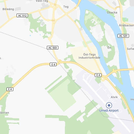
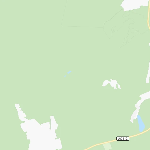
Roadmap (route) to go from Umeå Östra to Kramfors detailed above, you can also see the course layout on the map.
While doing trip Umeå Östra - Kramfors by car, the calculated route ends at a distance , or more straight.
Distance and duration of the route between Umeå Östra and Kramfors
An error occured: undefined - for url https://router.cartes.cc/route?point=63.81755%2C20.29357&point=62.93161%2C17.77646&vehicle=car&debug=false&data_type=application%2Fjson&locale=en&points_encoded=true&instructions=true&elevation=false&optimize=false&timeout=10000&skip.host=true&skip.basePath=true&graphhopper_maps_host=https%3A%2F%2Fgraphhopper.com%2Fmaps%2F%3F&turn_sign_map.0=continue&turn_sign_map.1=turn%20slight%20right&turn_sign_map.2=turn%20right&turn_sign_map.3=turn%20sharp%20right&turn_sign_map.4=finish&turn_sign_map.5=reached%20via%20point&turn_sign_map.6=enter%20roundabout&turn_sign_map.-6=leave%20roundabout&turn_sign_map.-3=turn%20sharp%20left&turn_sign_map.-2=turn%20left&turn_sign_map.-1=turn%20slight%20left&key=&position=topleft
Calculation of distance and route from Kramfors to Umeå Östra :
159.4193.9 km2h22mn
Continue 0h0mn 14 mTurn left 0h0mn 46 mTurn right onto Storgatan 0h0mn 131 mAt roundabout, take exit 2 onto Storgatan 0h2mn 1.3 kmTurn left onto Kyrkbron 0h1mn 794 mAt roundabout, take exit 2 onto Tegsvägen 0h1mn 655 mAt roundabout, take exit 1 onto Verkstadsgatan 0h0mn 112 mTurn right onto Tankvägen 0h1mn 607 mAt roundabout, take exit 1 onto AC 503 0h0mn 210 mAt roundabout, take exit 1 onto AC 503 0h1mn 893 mAt roundabout, take exit 1 onto Söderslättsrondellen 1h7mn 104.0 kmAt roundabout, take exit 2 onto E 4 0h2mn 1.5 kmTurn right onto Korsgatan 0h0mn 80 mKeep right onto Korsgatan 0h0mn 110 mAt roundabout, take exit 3 onto Hantverkaregatan 0h1mn 376 mContinue onto Terrassvägen 0h2mn 786 mKeep left onto Åsgatan 0h0mn 15 mTurn right onto Själevadsgatan 0h1mn 419 mTurn left onto Själevadsgatan 0h0mn 54 mTurn right onto E 4 1h42mn 58.6 kmKeep right onto 332 0h13mn 15.0 kmTurn right onto Postvägen 0h0mn 193 mTurn right onto Vikavägen 0h1mn 634 mTurn left onto Lerviksvägen 0h1mn 479 mTurn right onto Rotevägen 0h0mn 209 mTurn right onto Strömnäsvägen 0h0mn 57 mTurn right onto 90 0h7mn 6.6 kmTurn right onto Torggatan 0h0mn 76 mArrive at destination 0h0mn 0 m
Travel from Umeå Östra (Västernorrland) to a selection of major cities.
Distances from Umeå Östra to biggest cities in Västerbotten
Other major cities in country :
- Solna [26], 66,909 inhabitants. 511 km
- Halmstad [06], 66,124 inhabitants. 894 km
- Vaexjoe [12], 65,383 inhabitants. 829 km
- Karlstad [22], 61,492 inhabitants. 610 km
- Bromma [26], 61,000 inhabitants. 514 km
- Moelndal [28], 59,430 inhabitants. 819 km
- Vasastan [26], 58,458 inhabitants. 512 km
- Taby [26], 58,123 inhabitants. 501 km
- Sundsvall [24], 57,606 inhabitants. 219 km
Route from Kramfors to major cities (Sweden).
- Distance Kramfors Stockholm401 km
- Distance Kramfors Goeteborg663 km
- Distance Kramfors Malmoe859 km
- Distance Kramfors Uppsala342 km
- Distance Kramfors Sollentuna390 km
- Distance Kramfors Soedermalm403 km
- Distance Kramfors Vaesteras375 km
- Distance Kramfors OErebro430 km
- Distance Kramfors Linkoeping517 km
- Distance Kramfors Helsingborg818 km
- Distance Kramfors Joenkoeping607 km
- Distance Kramfors Norrkoeping491 km
- Distance Kramfors Huddinge411 km
- Distance Kramfors Lund845 km
- Distance Kramfors Umea159 km
- Distance Kramfors Haninge419 km
- Distance Kramfors Gaevle253 km
- Distance Kramfors Boras638 km
- Distance Kramfors Soedertaelje416 km
- Distance Kramfors Kungsholmen401 km
Nearest cities to Umeå Östra :
- Umea, 83,249 inhabitants. 2 km
- Sundsvall, 57,606 inhabitants. 219 km
- Lulea, 43,574 inhabitants. 216 km
- Skelleftea, 35,516 inhabitants. 109 km
- OErnskoeldsvik, 32,493 inhabitants. 98 km
- Pitea, 23,067 inhabitants. 176 km
- Haernoesand, 18,426 inhabitants. 177 km
- Boden, 16,830 inhabitants. 233 km
- Timra, 10,495 inhabitants. 210 km
- Kvissleby, 8,785 inhabitants. 225 km
- Lycksele, 8,545 inhabitants. 117 km
- Kalix, 7,495 inhabitants. 264 km
- Kramfors, 6,582 inhabitants. 160 km
- Holmsund, 5,962 inhabitants. 13 km
- Vi, 5,841 inhabitants. 211 km
- AElvsbyn, 4,976 inhabitants. 210 km
- Gammelstad, 4,892 inhabitants. 219 km
- Arvidsjaur, 4,655 inhabitants. 204 km
- Bjoerkskatan, 4,388 inhabitants. 219 km
- Vaennaes, 4,373 inhabitants. 28 km
- Ursviken, 3,913 inhabitants. 108 km
- Viken, 3,753 inhabitants. 105 km
- Bergnaeset, 3,604 inhabitants. 214 km
- Soedra Sunderbyn, 3,162 inhabitants. 219 km
- Saevast, 3,093 inhabitants. 228 km
- Skelleftehamn, 3,069 inhabitants. 107 km
Location Umeå Östra (Västerbotten) :
| Country flag |  |
| Location | Umeå Östra |
| State | Västerbotten |
| County | Umeå Kommun |
| Country | Sweden |
| Country code / ISO 2 | SE |
| Latitude | 63.8175500 |
| Longitude | 20.2935700 |
| Altitude | 20 meters |
| Time zone | Europe/Stockholm |
Location Kramfors (Västernorrland) :
| Country flag | |
| Location | Kramfors |
| State | Västernorrland |
| County | Kramfors Kommun |
| Country | Sweden |
| Country code / ISO 2 | SE |
| Latitude | 62.9316100 |
| Longitude | 17.7764600 |
| Altitude | 0 meters |
| Time zone | Europe/Stockholm |
