
How to get from Sanam Bin Mae Sot (Tak) to Uthai Thani (Uthai Thani)
Calculate route from Sanam Bin Mae Sot (Tak, Thailand) to Uthai Thani (Uthai Thani, Thailand).
The flight distance (as the crow flies) between Sanam Bin Mae Sot and Uthai Thani is 215.6 km.
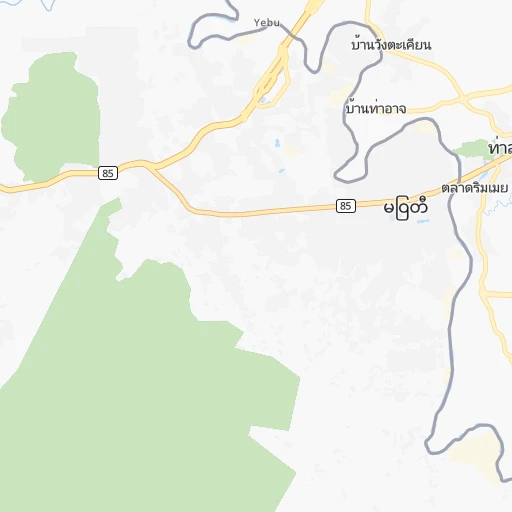
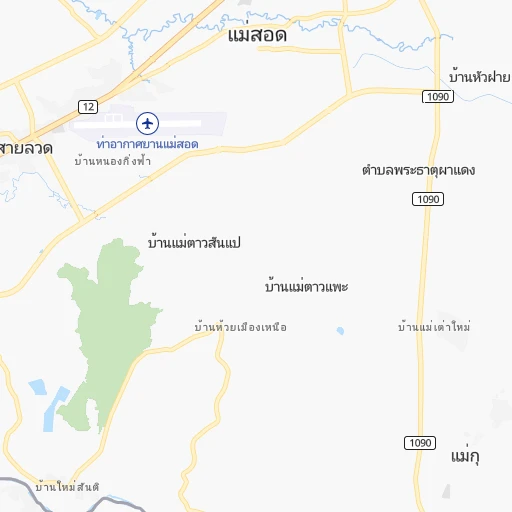
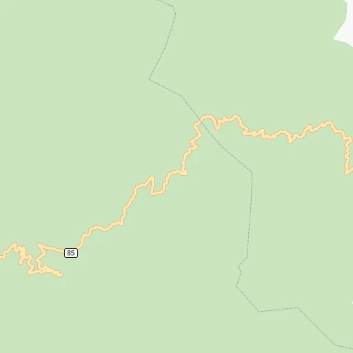
Roadmap (route) to go from Sanam Bin Mae Sot to Uthai Thani detailed above, you can also see the course layout on the map.
While doing trip Sanam Bin Mae Sot - Uthai Thani by car, the calculated route ends at a distance , or more straight.
Distance and duration of the route between Sanam Bin Mae Sot and Uthai Thani
An error occured: undefined - for url https://router.cartes.cc/route?point=16.69978%2C98.54508&point=15.37939%2C100.0245&vehicle=car&debug=false&data_type=application%2Fjson&locale=en&points_encoded=true&instructions=true&elevation=false&optimize=false&timeout=10000&skip.host=true&skip.basePath=true&graphhopper_maps_host=https%3A%2F%2Fgraphhopper.com%2Fmaps%2F%3F&turn_sign_map.0=continue&turn_sign_map.1=turn%20slight%20right&turn_sign_map.2=turn%20right&turn_sign_map.3=turn%20sharp%20right&turn_sign_map.4=finish&turn_sign_map.5=reached%20via%20point&turn_sign_map.6=enter%20roundabout&turn_sign_map.-6=leave%20roundabout&turn_sign_map.-3=turn%20sharp%20left&turn_sign_map.-2=turn%20left&turn_sign_map.-1=turn%20slight%20left&key=&position=topleft
Calculation of distance and route from Uthai Thani to Sanam Bin Mae Sot :
215.6297.2 km4h22mn
Continue 0h0mn 229 mTurn right 0h0mn 52 mTurn sharp right 0h0mn 78 mTurn slight left 0h0mn 20 mTurn right onto 12 0h6mn 6.7 kmAt roundabout, take exit 1 onto 12 1h4mn 74.9 kmTurn right onto ถนนพหลโยธิน (สายเก่า) 0h3mn 3.1 kmTurn sharp left onto ถนนพหลโยธิน 0h0mn 119 mMake a U-turn onto ถนนพหลโยธิน 2h23mn 166.7 kmKeep right 0h10mn 11.2 kmKeep left 0h0mn 221 mKeep right 0h0mn 57 mAt roundabout, take exit 3 onto 3005 0h0mn 142 mAt roundabout, take exit 2 onto 3005 0h10mn 10.0 kmTurn right 0h4mn 4.2 kmTurn left onto 3220 0h16mn 16.2 kmTurn right onto 3221 0h0mn 102 mTurn sharp left 0h1mn 726 mTurn left 0h0mn 87 mTurn right onto 3220 0h1mn 1.2 kmContinue onto 333 0h1mn 759 mKeep left 0h0mn 72 mTurn slight left onto ถนนท่าช้าง 0h0mn 310 mTurn right 0h0mn 57 mArrive at destination 0h0mn 0 m
Travel from Sanam Bin Mae Sot (Uthai Thani) to a selection of major cities.
Distances from Sanam Bin Mae Sot to biggest cities in Tak
Other major cities in country :
- Chanthaburi [48], 99,819 inhabitants. 595 km
- Pattaya [46], 97,296 inhabitants. 489 km
- Yala [70], 93,558 inhabitants. 1,170 km
- Ratchaburi [52], 92,448 inhabitants. 378 km
- Nakhon Sawan [16], 91,802 inhabitants. 203 km
- Phuket [62], 89,072 inhabitants. 981 km
- Ban Mai [68], 86,899 inhabitants. 1,079 km
- Songkhla [68], 84,264 inhabitants. 1,081 km
- Phra Nakhon Si Ayutthaya [36], 81,962 inhabitants. 340 km
- Chiang Rai [03], 78,756 inhabitants. 382 km
- Bang Kruai [38], 78,305 inhabitants. 383 km
- Sakon Nakhon [20], 76,237 inhabitants. 599 km
- Krathum Baen [55], 72,819 inhabitants. 386 km
- Saraburi [37], 67,763 inhabitants. 350 km
- Trang [65], 66,713 inhabitants. 1,024 km
- Sattahip [46], 65,444 inhabitants. 516 km
- Kanchanaburi [50], 63,699 inhabitants. 319 km
- Nong Khai [17], 63,609 inhabitants. 465 km
- Samut Sakhon [55], 63,498 inhabitants. 397 km
- Ban Lam Luk Ka [39], 60,700 inhabitants. 386 km
Route from Uthai Thani to major cities (Thailand).
- Distance Uthai Thani Bangkok188 km
- Distance Uthai Thani Samut Prakan208 km
- Distance Uthai Thani Mueang Nonthaburi177 km
- Distance Uthai Thani Udon Thani372 km
- Distance Uthai Thani Chon Buri247 km
- Distance Uthai Thani Nakhon Ratchasima228 km
- Distance Uthai Thani Chiang Mai395 km
- Distance Uthai Thani Hat Yai933 km
- Distance Uthai Thani Pak Kret171 km
- Distance Uthai Thani Si Racha264 km
- Distance Uthai Thani Phra Pradaeng199 km
- Distance Uthai Thani Lampang329 km
- Distance Uthai Thani Khon Kaen323 km
- Distance Uthai Thani Surat Thani699 km
- Distance Uthai Thani Ubon Ratchathani518 km
- Distance Uthai Thani Nakhon Si Thammarat773 km
- Distance Uthai Thani Khlong Luang161 km
- Distance Uthai Thani Nakhon Pathom174 km
- Distance Uthai Thani Rayong329 km
- Distance Uthai Thani Phitsanulok163 km
Nearest cities to Sanam Bin Mae Sot :
- Bangkok, 5,104,476 inhabitants. 389 km
- Mueang Nonthaburi, 291,555 inhabitants. 380 km
- Chiang Mai, 200,952 inhabitants. 237 km
- Pak Kret, 182,926 inhabitants. 374 km
- Lampang, 156,139 inhabitants. 204 km
- Khlong Luang, 118,551 inhabitants. 370 km
- Nakhon Pathom, 117,927 inhabitants. 359 km
- Phitsanulok, 103,427 inhabitants. 183 km
- Nakhon Sawan, 91,802 inhabitants. 203 km
- Phra Nakhon Si Ayutthaya, 81,962 inhabitants. 340 km
- Bang Kruai, 78,305 inhabitants. 383 km
- Saraburi, 67,763 inhabitants. 350 km
- Kanchanaburi, 63,699 inhabitants. 319 km
- Ban Lam Luk Ka, 60,700 inhabitants. 386 km
- Kamphaeng Phet, 58,787 inhabitants. 107 km
- Uttaradit, 58,313 inhabitants. 194 km
- Lop Buri, 57,761 inhabitants. 310 km
- Ban Pong, 57,559 inhabitants. 351 km
- Phra Phutthabat, 57,008 inhabitants. 326 km
- Suphan Buri, 53,399 inhabitants. 300 km
- Tha Maka, 52,907 inhabitants. 338 km
- Phetchabun, 50,656 inhabitants. 281 km
- Pak Chong, 48,999 inhabitants. 379 km
- Mae Sot, 44,563 inhabitants. 3 km
- Lamphun, 43,196 inhabitants. 215 km
- Bang Bua Thong, 41,567 inhabitants. 370 km
- Nong Khae, 41,067 inhabitants. 362 km
- Ban Na, 40,174 inhabitants. 131 km
- Wichian Buri, 39,272 inhabitants. 297 km
- Phrae, 38,538 inhabitants. 234 km
- Sam Phran, 37,115 inhabitants. 376 km
- Sukhothai, 37,000 inhabitants. 140 km
- Phichit, 35,760 inhabitants. 195 km
- San Kamphaeng, 32,950 inhabitants. 236 km
- Prachin Buri, 32,600 inhabitants. 423 km
- Kaeng Khoi, 30,332 inhabitants. 353 km
- Ban Bang Kadi Pathum Thani, 27,911 inhabitants. 370 km
- Nong Phai, 27,756 inhabitants. 280 km
- Tha Muang, 26,746 inhabitants. 327 km
- Si Satchanalai, 25,942 inhabitants. 158 km
- Chai Badan, 25,196 inhabitants. 323 km
- Nan, 24,670 inhabitants. 332 km
- Pathum Thani, 24,547 inhabitants. 367 km
- Tak, 24,149 inhabitants. 65 km
- Dok Kham Tai, 23,824 inhabitants. 314 km
- Uthai Thani, 22,219 inhabitants. 216 km
- Taphan Hin, 21,895 inhabitants. 207 km
- Khanu Woralaksaburi, 21,889 inhabitants. 157 km
- Nakhon Nayok, 21,309 inhabitants. 399 km
- Phayao, 21,058 inhabitants. 311 km
Location Sanam Bin Mae Sot (Tak) :
| Country flag |  |
| Location | Sanam Bin Mae Sot |
| State | Tak |
| County | |
| Country | Thailand |
| Country code / ISO 2 | TH |
| Latitude | 16.6997800 |
| Longitude | 98.5450800 |
| Altitude | 0 meters |
| Time zone | Asia/Bangkok |
Location Uthai Thani (Uthai Thani) :
| Country flag | |
| Location | Uthai Thani |
| State | Uthai Thani |
| County | |
| Country | Thailand |
| Country code / ISO 2 | TH |
| Latitude | 15.3793900 |
| Longitude | 100.0245000 |
| Altitude | 0 meters |
| Time zone | Asia/Bangkok |