
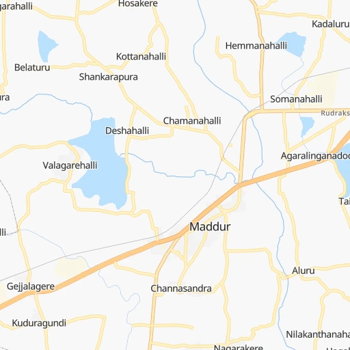
How to get from Maddūr Railroad Station (Karnataka) to Gorakhpur (Haryana)
Calculate route from Maddūr Railroad Station (Karnataka, India) to Gorakhpur (Haryana, India).
The flight distance (as the crow flies) between Maddūr Railroad Station and Gorakhpur is 1,877.0 km.
Roadmap (route) to go from Maddūr Railroad Station to Gorakhpur detailed above, you can also see the course layout on the map.
While doing trip Maddūr Railroad Station - Gorakhpur by car, the calculated route ends at a distance , or more straight.
Distance and duration of the route between Maddūr Railroad Station and Gorakhpur
An error occured: undefined - for url https://router.cartes.cc/route?point=12.6047%2C77.04967&point=29.44768%2C75.67206&vehicle=car&debug=false&data_type=application%2Fjson&locale=en&points_encoded=true&instructions=true&elevation=false&optimize=false&timeout=10000&skip.host=true&skip.basePath=true&graphhopper_maps_host=https%3A%2F%2Fgraphhopper.com%2Fmaps%2F%3F&turn_sign_map.0=continue&turn_sign_map.1=turn%20slight%20right&turn_sign_map.2=turn%20right&turn_sign_map.3=turn%20sharp%20right&turn_sign_map.4=finish&turn_sign_map.5=reached%20via%20point&turn_sign_map.6=enter%20roundabout&turn_sign_map.-6=leave%20roundabout&turn_sign_map.-3=turn%20sharp%20left&turn_sign_map.-2=turn%20left&turn_sign_map.-1=turn%20slight%20left&key=&position=topleft
Calculation of distance and route from Gorakhpur to Maddūr Railroad Station :
1,877.02,174.7 km32h29mn
Continue 0h1mn 357 mTurn left onto Bangalore-Mysore Road 0h1mn 1.3 kmKeep left 0h0mn 62 mTurn slight left onto SH33 0h22mn 23.7 kmKeep right 0h0mn 79 mTurn slight right onto SH33 0h23mn 24.8 kmTurn right onto SH33 0h2mn 2.1 kmKeep right 0h1mn 294 mTurn slight right onto SH33 0h29mn 33.0 kmAt roundabout, take exit 3 onto SH33 0h2mn 2.7 kmContinue onto Jaya Chamarajendra Road 0h1mn 717 mTurn right 0h0mn 24 mTurn left 0h1mn 580 mTurn sharp left 0h0mn 7 mTurn right 0h1mn 546 mTurn right 0h1mn 744 mTurn right 0h0mn 79 mTurn left 0h0mn 45 mContinue 0h0mn 56 mTurn right 0h0mn 142 mTurn right 0h0mn 31 mTurn left 0h0mn 164 mTurn right 0h0mn 90 mTurn sharp left onto Honnenahalli Road 0h0mn 18 mTurn sharp right onto Honnenahalli Road 0h0mn 59 mTurn left onto SH33 0h2mn 2.3 kmKeep right 1h32mn 36.8 kmTurn slight right 0h1mn 454 mKeep right 1h39mn 45.4 kmKeep left 0h1mn 1.1 kmKeep left 0h1mn 1.4 kmTurn slight right onto NH150A 0h1mn 1.4 kmAt roundabout, take exit 1 1h36mn 42.5 kmKeep left toward NH50 2h51mn 129.6 kmKeep left onto Bijapur Road 3h38mn 183.9 kmContinue onto Bijapur Bypass 0h8mn 9.7 kmKeep left onto NH561A 1h8mn 78.8 kmContinue 0h4mn 4.0 kmContinue onto NH561A 0h17mn 20.0 kmTurn sharp left onto Shivaji Chowk 0h0mn 45 mTurn left onto NH561A 0h0mn 466 mTurn left onto NH965, NH561A 0h1mn 610 mTurn right onto NH561A 0h2mn 2.7 kmTurn left onto NH561A 1h31mn 36.4 kmTurn left onto NH561A 0h1mn 1.1 kmTurn right 0h0mn 12 mTurn right onto NH65, NH561A 0h0mn 388 mTurn left onto MDR5 0h7mn 7.1 kmTurn slight right onto MDR5 0h0mn 73 mTurn left onto MDR5 0h4mn 3.5 kmKeep left 0h6mn 5.4 kmContinue onto MDR12 0h3mn 2.8 kmKeep left onto MDR8 0h7mn 7.1 kmTurn left 0h6mn 5.7 kmKeep right 0h1mn 514 mTurn sharp left 0h0mn 313 mTurn right onto MDR8 0h13mn 12.9 kmTurn sharp right onto NH561A 0h0mn 8 mKeep left onto SH141 0h2mn 1.7 kmKeep left onto SH141 0h1mn 628 mContinue onto NH561A 1h20mn 92.9 kmTurn slight left onto Ahmednagar Bhoom Road 0h1mn 716 mTurn sharp right 0h1mn 1.1 kmTurn left 0h0mn 23 mTurn right onto Kotla Road 0h1mn 695 mTurn slight right onto Sarjepura Road 0h1mn 461 mAt roundabout, take exit 2 onto Ahmednagar Loni Dhanora Road 0h10mn 11.1 kmTurn left 0h0mn 64 mTurn left onto NH160 1h38mn 44.8 kmKeep right onto NH160 1h49mn 57.4 kmTurn left 0h0mn 33 mTurn left onto NH752G 1h51mn 59.4 kmTurn sharp left onto NH160H 0h0mn 28 mTurn sharp right onto State Highway 10 - State Highway 16 0h2mn 2.4 kmAt roundabout, take exit 3 onto NH160H 0h0mn 382 mAt roundabout, take exit 1 onto NH160H 0h1mn 595 mTurn right onto NH160H 0h0mn 10 mTurn slight left onto NH160H 0h3mn 3.8 kmKeep left 1h35mn 40.5 kmKeep left 0h1mn 1.2 kmTurn left onto Dhule Malegaon Road 0h3mn 3.4 kmTurn right 0h1mn 573 mAt roundabout, take exit 3 onto State Highway 14 0h1mn 621 mContinue 0h3mn 2.7 kmKeep left 0h1mn 1.2 kmTurn right 0h0mn 6 mTurn left onto NH52 2h42mn 118.5 kmTurn right 0h1mn 912 mContinue onto NH347B 0h1mn 1.1 kmTurn left 0h0mn 77 mTurn right onto NH52 0h25mn 29.6 kmTurn right onto NH347B 0h1mn 1.2 kmContinue onto MD4802 0h1mn 1.5 kmTurn right onto NH52 0h13mn 14.9 kmTurn right onto SH36 0h7mn 7.6 kmTurn right onto NH52, NH347C 0h4mn 4.6 kmKeep right onto NH52 0h20mn 21.7 kmKeep left onto Indore Bypass 1h30mn 34.2 kmKeep left onto SH40 1h22mn 87.7 kmKeep left 0h3mn 4.0 kmAt roundabout, take exit 2 onto NH927A 0h0mn 438 mKeep right 0h4mn 4.3 kmKeep left 1h10mn 74.9 kmTurn right 0h4mn 4.3 kmKeep left 0h2mn 2.2 kmAt roundabout, take exit 2 0h6mn 6.5 kmTurn right onto Mandsaur Bypass 1h33mn 34.8 kmKeep left 0h8mn 8.4 kmAt roundabout, take exit 1 0h1mn 1.3 kmAt roundabout, take exit 3 onto Chopra Circle 0h1mn 1.4 kmTurn left 0h5mn 5.7 kmKeep left 0h15mn 15.0 kmKeep left onto MDR11A 0h0mn 80 mContinue onto MDR11A 0h3mn 3.8 kmKeep left onto MDR11A 0h0mn 247 mTurn left onto MDR11A 0h2mn 2.1 kmTurn right 0h1mn 683 mTurn left 0h3mn 1.3 kmTurn right onto NH56 0h16mn 15.8 kmTurn right 0h3mn 2.4 kmTurn right onto NH56 0h7mn 6.1 kmKeep right 0h6mn 5.7 kmAt roundabout, take exit 2 0h0mn 354 mTurn slight left onto By Pass Road 0h3mn 2.3 kmTurn left 0h2mn 1.4 kmAt roundabout, take exit 2 0h8mn 7.4 kmTurn left 0h0mn 199 mTurn right 0h0mn 326 mKeep right 0h28mn 32.7 kmKeep left onto Hamirgarh Road 0h12mn 13.0 kmAt roundabout, take exit 2 onto SH12 0h4mn 4.7 kmAt roundabout, take exit 3 onto SH 12 0h1mn 728 mContinue onto NH758 0h0mn 12 mKeep right 0h0mn 76 mTurn left 0h0mn 55 mTurn right 0h0mn 529 mTurn left onto NH48 2h31mn 105.7 kmKeep right onto NH48 0h27mn 32.0 kmTurn sharp left 0h2mn 1.2 kmTurn sharp right onto SH7E 0h3mn 3.4 kmTurn left 0h1mn 490 mTurn left 0h0mn 48 mKeep left 0h1mn 271 mTurn sharp left 0h0mn 66 mTurn sharp right 0h21mn 23.5 kmContinue 0h1mn 1.5 kmKeep right onto SH7 0h11mn 12.0 kmKeep left onto SH2D 0h2mn 2.0 kmTurn right 0h2mn 2.3 kmContinue onto SH7 0h26mn 28.7 kmKeep left onto SH7, 90 0h10mn 10.6 kmTurn right 0h27mn 23.8 kmKeep left 0h3mn 2.1 kmTurn slight right onto SH7, 87 0h7mn 7.3 kmAt roundabout, take exit 1 onto SH37B, 84 0h23mn 25.6 kmTurn left onto SH37B, 84 0h0mn 185 mTurn right onto SH37B, 84 0h2mn 2.2 kmTurn left onto SH37B, 84 0h0mn 429 mTurn right onto SH37B, 84 0h0mn 527 mAt roundabout, take exit 1 0h5mn 3.8 kmKeep left 0h22mn 24.3 kmAt roundabout, take exit 2 onto SH8 1h31mn 35.2 kmAt roundabout, take exit 2 onto SH8 0h1mn 664 mAt roundabout, take exit 3 onto SH8 0h1mn 1.5 kmTurn left onto NH11 0h0mn 260 mTurn right 0h0mn 265 mTurn slight left 0h1mn 994 mTurn right 0h0mn 87 mTurn left 0h0mn 245 mTurn slight right 0h1mn 311 mTurn slight left 0h1mn 830 mAt roundabout, take exit 2 onto SH41B 1h40mn 43.6 kmTurn right onto SH41, 41B 0h12mn 13.6 kmKeep right 0h1mn 813 mContinue onto NH709 0h1mn 688 mTurn sharp left 0h0mn 345 mTurn left 0h0mn 158 mContinue 0h0mn 37 mTurn right 0h0mn 180 mTurn right 0h0mn 54 mTurn left 0h0mn 139 mTurn left 0h0mn 18 mTurn right 0h1mn 416 mTurn right 0h2mn 1.0 kmTurn right 0h3mn 2.9 kmTurn right onto NH52 1h34mn 39.8 kmTurn right 0h3mn 2.8 kmTurn right onto NH52 0h13mn 15.5 kmKeep right 0h1mn 577 mKeep right 0h0mn 186 mContinue 0h6mn 6.9 kmKeep left 0h1mn 1.4 kmAt roundabout, take exit 4 0h0mn 218 mAt roundabout, take exit 1 0h2mn 2.1 kmKeep left 0h13mn 18.7 kmTurn right 0h6mn 4.9 kmKeep right 0h1mn 828 mKeep left 0h7mn 5.8 kmKeep left 0h4mn 2.9 kmTurn left 0h1mn 452 mTurn left 0h0mn 26 mTurn right 0h0mn 178 mTurn left 0h0mn 139 mArrive at destination 0h0mn 0 m
Travel from Maddūr Railroad Station (Haryana) to a selection of major cities.
Distances from Maddūr Railroad Station to biggest cities in Karnataka
- Mandya,134,845 inhabitants.19 km
- Hassan,128,531 inhabitants.113 km
- Kolar,126,441 inhabitants.131 km
- Chikmagalur,121,484 inhabitants.160 km
- Yelahanka,116,447 inhabitants.81 km
- Gangawati,106,250 inhabitants.320 km
- Ranibennur,99,105 inhabitants.272 km
- Bagalkot,97,269 inhabitants.425 km
- Closepet,93,528 inhabitants.28 km
- Dod Ballapur,78,676 inhabitants.93 km
- Harihar,78,034 inhabitants.251 km
- Rabkavi,73,835 inhabitants.479 km
- Gokak,73,478 inhabitants.464 km
- Chintamani,71,798 inhabitants.140 km
- Sindhnur,68,793 inhabitants.354 km
- Chamrajnagar,67,992 inhabitants.77 km
- Channapatna,66,647 inhabitants.18 km
- Basavakalyan,65,805 inhabitants.587 km
- Yadgir,65,376 inhabitants.464 km
- Karwar,64,457 inhabitants.400 km
Other major cities in country :
- Gorakhpur [10], 1,324,570 inhabitants. 1,880 km
- Nashik [16], 1,289,497 inhabitants. 893 km
- Pimpri [16], 1,284,606 inhabitants. 755 km
- Kalyan [16], 1,262,255 inhabitants. 849 km
- Thane [16], 1,261,517 inhabitants. 854 km
- Meerut [36], 1,223,184 inhabitants. 1,824 km
- Nowrangapur [21], 1,220,946 inhabitants. 943 km
- Faridabad [10], 1,220,229 inhabitants. 1,760 km
- Ghaziabad [36], 1,199,191 inhabitants. 1,788 km
- Dombivli [16], 1,193,000 inhabitants. 850 km
- Rajkot [09], 1,177,362 inhabitants. 1,266 km
- Varanasi [36], 1,164,404 inhabitants. 1,547 km
- Amritsar [23], 1,092,450 inhabitants. 2,129 km
- Allahabad [36], 1,073,438 inhabitants. 1,515 km
- Visakhapatnam [02], 1,063,178 inhabitants. 869 km
- Teni [25], 1,034,724 inhabitants. 292 km
- Jabalpur [35], 1,030,168 inhabitants. 1,215 km
- Haora [28], 1,027,672 inhabitants. 1,630 km
- Aurangabad [16], 1,016,441 inhabitants. 830 km
- Shivaji Nagar [16], 1,000,000 inhabitants. 743 km
Route from Gorakhpur to major cities (India).
- Distance Gorakhpur Mumbai1,189 km
- Distance Gorakhpur Delhi176 km
- Distance Gorakhpur Bengaluru1,845 km
- Distance Gorakhpur Kolkata1,482 km
- Distance Gorakhpur Chennai1,882 km
- Distance Gorakhpur Ahmedabad778 km
- Distance Gorakhpur Hyderabad1,373 km
- Distance Gorakhpur Pune1,230 km
- Distance Gorakhpur Surat962 km
- Distance Gorakhpur Kanpur567 km
- Distance Gorakhpur Jaipur282 km
- Distance Gorakhpur Navi Mumbai1,190 km
- Distance Gorakhpur Lucknow591 km
- Distance Gorakhpur Nagpur986 km
- Distance Gorakhpur Indore749 km
- Distance Gorakhpur Patna1,028 km
- Distance Gorakhpur Bhopal711 km
- Distance Gorakhpur Ludhiana164 km
- Distance Gorakhpur Tirunelveli2,316 km
- Distance Gorakhpur Agra341 km
Nearest cities to Maddūr Railroad Station :
- Bengaluru, 5,104,047 inhabitants. 72 km
- Teni, 1,034,724 inhabitants. 292 km
- Coimbatore, 959,823 inhabitants. 178 km
- Madurai, 909,908 inhabitants. 321 km
- Mysore, 868,313 inhabitants. 56 km
- Hubli, 840,214 inhabitants. 369 km
- Salem, 778,396 inhabitants. 160 km
- Tiruchirappalli, 775,484 inhabitants. 268 km
- Cochin, 604,696 inhabitants. 309 km
- Kozhikode, 439,922 inhabitants. 205 km
- Davangere, 435,128 inhabitants. 240 km
- Mangalore, 417,387 inhabitants. 241 km
- Nellore, 404,158 inhabitants. 378 km
- Tiruppur, 397,521 inhabitants. 169 km
- Bellary, 336,681 inhabitants. 283 km
- Trichur, 325,110 inhabitants. 250 km
- Shimoga, 319,550 inhabitants. 218 km
- Tumkur, 307,359 inhabitants. 82 km
- Tirupati, 250,821 inhabitants. 281 km
- Anantapur, 240,442 inhabitants. 239 km
- Puducherry, 227,411 inhabitants. 311 km
- Tanjore, 219,571 inhabitants. 305 km
- Dindigul, 200,797 inhabitants. 269 km
- Hospet, 197,846 inhabitants. 305 km
- Proddatur, 177,797 inhabitants. 289 km
- Vellore, 177,081 inhabitants. 229 km
- Ongole, 172,872 inhabitants. 457 km
- Gadag-Betageri, 172,813 inhabitants. 349 km
- Nandyal, 165,337 inhabitants. 355 km
- Udupi, 165,000 inhabitants. 263 km
- Bhadravati, 163,903 inhabitants. 201 km
- Gadag, 162,569 inhabitants. 350 km
- Cuddalore, 158,569 inhabitants. 310 km
- Kanchipuram, 155,029 inhabitants. 289 km
- Erode, 147,270 inhabitants. 159 km
- Kumbakonam, 139,264 inhabitants. 314 km
- Chitradurga, 138,587 inhabitants. 193 km
- Tiruvannamalai, 138,243 inhabitants. 224 km
- Robertsonpet, 135,218 inhabitants. 139 km
- Mandya, 134,845 inhabitants. 19 km
- Hindupur, 133,298 inhabitants. 144 km
- Palghat, 132,728 inhabitants. 208 km
- Hassan, 128,531 inhabitants. 113 km
- Cuddapah, 127,010 inhabitants. 284 km
- Kolar, 126,441 inhabitants. 131 km
- Chikmagalur, 121,484 inhabitants. 160 km
- Guntakal Junction, 120,964 inhabitants. 288 km
- Yelahanka, 116,447 inhabitants. 81 km
- Dharmavaram, 114,050 inhabitants. 214 km
- Pudukkottai, 112,118 inhabitants. 314 km
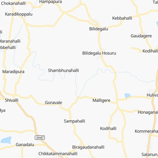
Location Maddūr Railroad Station (Karnataka) :
| Country flag |  |
| Location | Maddūr Railroad Station |
| State | Karnataka |
| County | Mandya |
| Country | India |
| Country code / ISO 2 | IN |
| Latitude | 12.6047000 |
| Longitude | 77.0496700 |
| Altitude | 0 meters |
| Time zone | Asia/Kolkata |
Location Gorakhpur (Haryana) :
| Country flag | |
| Location | Gorakhpur |
| State | Haryana |
| County | Fatehabad District |
| Country | India |
| Country code / ISO 2 | IN |
| Latitude | 29.4476800 |
| Longitude | 75.6720600 |
| Altitude | 0 meters |
| Time zone | Asia/Kolkata |