
How to get from Badnera Jn (Maharashtra) to Itārsi (Madhya Pradesh)
Calculate route from Badnera Jn (Maharashtra, India) to Itārsi (Madhya Pradesh, India).
The flight distance (as the crow flies) between Badnera Jn and Itārsi is 195.4 km.
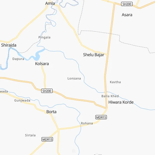
Roadmap (route) to go from Badnera Jn to Itārsi detailed above, you can also see the course layout on the map.
While doing trip Badnera Jn - Itārsi by car, the calculated route ends at a distance , or more straight.
Distance and duration of the route between Badnera Jn and Itārsi
An error occured: undefined - for url https://router.cartes.cc/route?point=20.85679%2C77.73232&point=22.61477%2C77.76222&vehicle=car&debug=false&data_type=application%2Fjson&locale=en&points_encoded=true&instructions=true&elevation=false&optimize=false&timeout=10000&skip.host=true&skip.basePath=true&graphhopper_maps_host=https%3A%2F%2Fgraphhopper.com%2Fmaps%2F%3F&turn_sign_map.0=continue&turn_sign_map.1=turn%20slight%20right&turn_sign_map.2=turn%20right&turn_sign_map.3=turn%20sharp%20right&turn_sign_map.4=finish&turn_sign_map.5=reached%20via%20point&turn_sign_map.6=enter%20roundabout&turn_sign_map.-6=leave%20roundabout&turn_sign_map.-3=turn%20sharp%20left&turn_sign_map.-2=turn%20left&turn_sign_map.-1=turn%20slight%20left&key=&position=topleft
Calculation of distance and route from Itārsi to Badnera Jn :
195.4239.9 km4h44mn
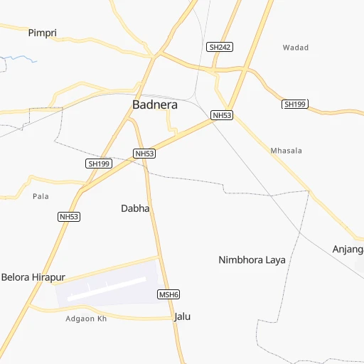
Continue 0h0mn 29 mTurn left 0h0mn 151 mTurn left 0h0mn 389 mTurn right 0h0mn 11 mTurn right 0h1mn 876 mTurn sharp right onto MSH6, SH199 0h8mn 7.6 kmContinue onto Amravati Paratwada Road 0h1mn 683 mKeep left 0h1mn 846 mKeep left 0h1mn 1.1 kmKeep left 0h2mn 1.5 kmTurn left onto SH242 0h1mn 1.1 kmTurn right onto MDR27 0h4mn 4.5 kmContinue onto SH194, MDR27 0h1mn 556 mTurn slight left onto MDR27 0h26mn 25.8 kmContinue onto SH24A 0h1mn 740 mTurn left onto NH353J 0h1mn 1.0 kmTurn right onto SH24A 0h9mn 10.2 kmTurn sharp left onto SH24A 0h0mn 371 mTurn right onto SH24A 0h5mn 5.8 kmTurn right onto SH24A 0h1mn 1.2 kmKeep right 0h1mn 463 mKeep right 0h10mn 4.9 kmKeep left 0h2mn 1.1 kmTurn slight left onto MD3518 0h3mn 2.7 kmTurn right onto NH548C 1h5mn 75.8 kmKeep left 0h6mn 6.9 kmTurn slight left onto Nagpur-Betul-Itarsi-Bhopal 1h3mn 73.4 kmKeep left 0h1mn 329 mKeep left 0h7mn 7.8 kmAt roundabout, take exit 1 onto MD3318 0h1mn 1.0 kmTurn right 0h1mn 750 mTurn left 0h0mn 162 mTurn right 0h0mn 23 mTurn sharp left 0h0mn 140 mTurn left 0h0mn 57 mTurn right 0h0mn 23 mArrive at destination 0h0mn 0 m
Travel from Badnera Jn (Madhya Pradesh) to a selection of major cities.
Distances from Badnera Jn to biggest cities in Maharashtra
- Malegaon,435,362 inhabitants.335 km
- Jalgaon,429,298 inhabitants.226 km
- Akola,428,857 inhabitants.78 km
- Ahmadnagar,367,140 inhabitants.370 km
- Dhulia,366,980 inhabitants.307 km
- Latur,348,967 inhabitants.300 km
- Chanda,328,351 inhabitants.192 km
- Parbhani,289,629 inhabitants.203 km
- Ichalkaranji,274,383 inhabitants.578 km
- Jalna,262,034 inhabitants.223 km
- Amarnath,217,780 inhabitants.512 km
- Bhusaval,183,001 inhabitants.204 km
- Virar,150,357 inhabitants.537 km
- Yavatmal,128,175 inhabitants.66 km
- Panvel,128,046 inhabitants.527 km
- Gondia,124,897 inhabitants.264 km
- Wardha,113,759 inhabitants.91 km
- Satara,112,793 inhabitants.528 km
- Achalpur,111,278 inhabitants.50 km
- Barsi,110,983 inhabitants.362 km
Other major cities in country :
- Faridabad [10], 1,220,229 inhabitants. 842 km
- Ghaziabad [36], 1,199,191 inhabitants. 870 km
- Rajkot [09], 1,177,362 inhabitants. 736 km
- Varanasi [36], 1,164,404 inhabitants. 734 km
- Amritsar [23], 1,092,450 inhabitants. 1,232 km
- Allahabad [36], 1,073,438 inhabitants. 662 km
- Visakhapatnam [02], 1,063,178 inhabitants. 675 km
- Teni [25], 1,034,724 inhabitants. 1,208 km
- Jabalpur [35], 1,030,168 inhabitants. 344 km
- Haora [28], 1,027,672 inhabitants. 1,111 km
- Srinagar [12], 975,857 inhabitants. 1,501 km
- Chandigarh [05], 960,787 inhabitants. 1,104 km
- Coimbatore [25], 959,823 inhabitants. 1,100 km
- Jodhpur [24], 921,476 inhabitants. 771 km
- Madurai [25], 909,908 inhabitants. 1,218 km
- Guwahati [03], 899,094 inhabitants. 1,547 km
- Gwalior [35], 882,458 inhabitants. 600 km
- Vijayawada [02], 874,587 inhabitants. 573 km
- Mysore [19], 868,313 inhabitants. 960 km
- Ranchi [38], 846,454 inhabitants. 829 km
Route from Itārsi to major cities (India).
- Distance Itārsi Mumbai643 km
- Distance Itārsi Delhi674 km
- Distance Itārsi Bengaluru1,074 km
- Distance Itārsi Kolkata1,089 km
- Distance Itārsi Chennai1,093 km
- Distance Itārsi Ahmedabad533 km
- Distance Itārsi Hyderabad587 km
- Distance Itārsi Pune611 km
- Distance Itārsi Surat533 km
- Distance Itārsi Kanpur502 km
- Distance Itārsi Jaipur519 km
- Distance Itārsi Navi Mumbai634 km
- Distance Itārsi Lucknow569 km
- Distance Itārsi Nagpur213 km
- Distance Itārsi Patna819 km
- Distance Itārsi Ludhiana943 km
- Distance Itārsi Tirunelveli1,546 km
- Distance Itārsi Agra509 km
- Distance Itārsi Vadodara470 km
- Distance Itārsi Gorakhpur789 km
Nearest cities to Badnera Jn :
- Nagpur, 2,228,018 inhabitants. 144 km
- Indore, 1,837,041 inhabitants. 285 km
- Bhopal, 1,599,914 inhabitants. 269 km
- Jabalpur, 1,030,168 inhabitants. 344 km
- Aurangabad, 1,016,441 inhabitants. 272 km
- Amravati, 603,837 inhabitants. 9 km
- Warangal, 557,802 inhabitants. 373 km
- Nanded, 550,564 inhabitants. 194 km
- Ujjain, 457,346 inhabitants. 328 km
- Ramgundam, 452,261 inhabitants. 291 km
- Jalgaon, 429,298 inhabitants. 226 km
- Akola, 428,857 inhabitants. 78 km
- Ahmadnagar, 367,140 inhabitants. 370 km
- Dhulia, 366,980 inhabitants. 307 km
- Punasa, 350,000 inhabitants. 207 km
- Latur, 348,967 inhabitants. 300 km
- Chanda, 328,351 inhabitants. 192 km
- Nizamabad, 305,438 inhabitants. 246 km
- Parbhani, 289,629 inhabitants. 203 km
- Jalna, 262,034 inhabitants. 223 km
- Dewas, 261,218 inhabitants. 292 km
- Saugor, 247,333 inhabitants. 348 km
- Ratlam, 236,843 inhabitants. 391 km
- Ramagundam, 235,000 inhabitants. 297 km
- Karimnagar, 228,745 inhabitants. 306 km
- Bidar, 204,071 inhabitants. 328 km
- Burhanpur, 202,695 inhabitants. 164 km
- Murwara, 195,856 inhabitants. 430 km
- Bhusaval, 183,001 inhabitants. 204 km
- Khandwa, 182,841 inhabitants. 179 km
- Vidisha, 140,045 inhabitants. 297 km
- Chhindwara, 134,847 inhabitants. 183 km
- Yavatmal, 128,175 inhabitants. 66 km
- Gondia, 124,897 inhabitants. 264 km
- Damoh, 118,776 inhabitants. 375 km
- Adilabad, 118,526 inhabitants. 156 km
- Wardha, 113,759 inhabitants. 91 km
- Achalpur, 111,278 inhabitants. 50 km
- Barsi, 110,983 inhabitants. 362 km
- Hoshangabad, 109,358 inhabitants. 210 km
- Nagda, 103,501 inhabitants. 375 km
- Seoni, 101,379 inhabitants. 233 km
- Udgir, 101,064 inhabitants. 282 km
- Itarsi, 100,574 inhabitants. 196 km
- Sehore, 99,284 inhabitants. 269 km
- Jagtial, 99,035 inhabitants. 261 km
- Hinganghat, 97,568 inhabitants. 120 km
- Amalner, 97,369 inhabitants. 279 km
- Chalisgaon, 96,381 inhabitants. 286 km
- Khargone, 94,985 inhabitants. 245 km
Location Badnera Jn (Maharashtra) :
| Country flag |  |
| Location | Badnera Jn |
| State | Maharashtra |
| County | Amravati Division |
| Country | India |
| Country code / ISO 2 | IN |
| Latitude | 20.8567900 |
| Longitude | 77.7323200 |
| Altitude | 0 meters |
| Time zone | Asia/Kolkata |
Location Itārsi (Madhya Pradesh) :
| Country flag | |
| Location | Itārsi |
| State | Madhya Pradesh |
| County | Hoshangābād |
| Country | India |
| Country code / ISO 2 | IN |
| Latitude | 22.6147700 |
| Longitude | 77.7622200 |
| Altitude | 0 meters |
| Time zone | Asia/Kolkata |