

How to get from Mallappa Gate (Andhra Pradesh) to Bhīmavaram (Andhra Pradesh)
Calculate route from Mallappa Gate (Andhra Pradesh, India) to Bhīmavaram (Andhra Pradesh, India).
The flight distance (as the crow flies) between Mallappa Gate and Bhīmavaram is 465.6 km.
Roadmap (route) to go from Mallappa Gate to Bhīmavaram detailed above, you can also see the course layout on the map.
While doing trip Mallappa Gate - Bhīmavaram by car, the calculated route ends at a distance , or more straight.
Distance and duration of the route between Mallappa Gate and Bhīmavaram
An error occured: undefined - for url https://router.cartes.cc/route?point=15.22503%2C77.38715&point=16.54078%2C81.52322&vehicle=car&debug=false&data_type=application%2Fjson&locale=en&points_encoded=true&instructions=true&elevation=false&optimize=false&timeout=10000&skip.host=true&skip.basePath=true&graphhopper_maps_host=https%3A%2F%2Fgraphhopper.com%2Fmaps%2F%3F&turn_sign_map.0=continue&turn_sign_map.1=turn%20slight%20right&turn_sign_map.2=turn%20right&turn_sign_map.3=turn%20sharp%20right&turn_sign_map.4=finish&turn_sign_map.5=reached%20via%20point&turn_sign_map.6=enter%20roundabout&turn_sign_map.-6=leave%20roundabout&turn_sign_map.-3=turn%20sharp%20left&turn_sign_map.-2=turn%20left&turn_sign_map.-1=turn%20slight%20left&key=&position=topleft
Calculation of distance and route from Bhīmavaram to Mallappa Gate :
465.6549.9 km8h18mn
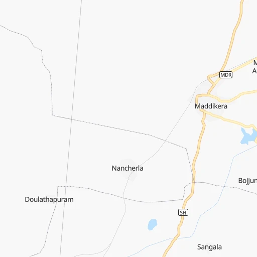
Continue 0h1mn 542 mTurn right 0h6mn 3.1 kmTurn left onto Guntakal - Maddikera Road 0h5mn 6.0 kmTurn left onto Maddikera - Pattikonda - Devanakonda Road 0h0mn 452 mTurn left onto Maddikera - Pattikonda - Devanakonda Road 0h19mn 20.9 kmKeep right onto Maddikera - Pattikonda - Devanakonda Road 0h17mn 18.5 kmTurn right onto Kurnool - Ballari Road 1h57mn 61.4 kmKeep right 0h0mn 301 mTurn left 0h1mn 788 mTurn left 0h0mn 12 mKeep right 0h0mn 24 mTurn right 0h0mn 7 mTurn left onto Vaddegeri Road 0h0mn 232 mTurn right onto Osmania College Road 0h1mn 531 mTurn left 0h1mn 568 mTurn right onto Phool Bazar 0h2mn 1.8 kmTurn left onto Nandyal Chaurasta Road 0h0mn 99 mTurn left 0h3mn 2.6 kmTurn slight left 0h0mn 21 mTurn left onto Nandikottur Road 0h9mn 7.5 kmTurn left onto NH340C 2h59mn 138.3 kmTurn sharp right onto NH565, NH544D, NH544F 0h0mn 9 mKeep left onto NH565, NH544D, NH544F 0h1mn 1.4 kmTurn left 0h0mn 388 mTurn left 0h4mn 3.0 kmContinue 0h0mn 100 mTurn right onto NH565, NH544D, NH544F 0h0mn 314 mKeep left onto NH565, NH544D, NH544F 1h47mn 54.6 kmTurn right onto Guntur-Vinukonda 1h5mn 76.4 kmTurn right onto Narasaraopet Guntur Road 0h8mn 9.7 kmKeep left onto NH544D, NH544F 0h2mn 2.2 kmTurn right 0h0mn 280 mAt roundabout, take exit 1 onto Grand Trunk Road 0h1mn 1.0 kmAt roundabout, take exit 2 0h5mn 5.0 kmKeep left 0h24mn 27.9 kmKeep right onto NH16, NH65 0h0mn 484 mAt roundabout, take exit 3 onto Vijayawada - Machilipatnam Road 0h10mn 12.2 kmTurn left onto Gudivada - Kankipadu Road 0h25mn 26.6 kmAt roundabout, take exit 2 onto Gudivada - Kankipadu Road 0h0mn 86 mAt roundabout, take exit 3 onto Machilipatnam - Nuzvid - Kalluru Road 0h0mn 338 mKeep left 0h1mn 1.1 kmTurn slight left onto NH165 0h11mn 12.3 kmTurn sharp right onto Bhimavaram - Gudivada Road 0h4mn 4.7 kmTurn left onto Bhimavaram - Gudivada Road 0h12mn 13.4 kmTurn sharp right onto Bhimavaram - Gudivada Road 1h33mn 31.8 kmTurn right 0h1mn 360 mTurn left 0h0mn 24 mTurn right onto Bhimavaram - Dongapindi Road 0h0mn 115 mTurn left 0h0mn 116 mContinue 0h0mn 200 mTurn right 0h0mn 104 mTurn left 0h0mn 52 mTurn right 0h0mn 44 mArrive at destination 0h0mn 0 m
Travel from Mallappa Gate (Andhra Pradesh) to a selection of major cities.
Distances from Mallappa Gate to biggest cities in Andhra Pradesh
- Guntakal Junction,120,964 inhabitants.7 km
- Chicacole,118,299 inhabitants.774 km
- Gudivada,116,161 inhabitants.409 km
- Dharmavaram,114,050 inhabitants.97 km
- Madanapalle,108,593 inhabitants.222 km
- Tadepallegudem,108,167 inhabitants.477 km
- Narasaraopet,97,194 inhabitants.307 km
- Chilakalurupet,94,011 inhabitants.313 km
- Tadpatri,93,044 inhabitants.76 km
- Chirala,87,001 inhabitants.325 km
- Anakapalle,84,357 inhabitants.659 km
- Kavali,83,352 inhabitants.282 km
- Kadiri,81,498 inhabitants.149 km
- Rayachoti,81,433 inhabitants.196 km
- Emmiganur,80,933 inhabitants.62 km
- Gudur,74,851 inhabitants.291 km
- Bapatla,70,117 inhabitants.339 km
- Tanuku,68,290 inhabitants.490 km
- Attili,68,196 inhabitants.480 km
- Palasa,65,833 inhabitants.845 km
Other major cities in country :
- Vadodara [09], 1,409,476 inhabitants. 902 km
- Gorakhpur [10], 1,324,570 inhabitants. 1,593 km
- Nashik [16], 1,289,497 inhabitants. 654 km
- Pimpri [16], 1,284,606 inhabitants. 537 km
- Kalyan [16], 1,262,255 inhabitants. 636 km
- Thane [16], 1,261,517 inhabitants. 645 km
- Meerut [36], 1,223,184 inhabitants. 1,532 km
- Nowrangapur [21], 1,220,946 inhabitants. 707 km
- Faridabad [10], 1,220,229 inhabitants. 1,468 km
- Ghaziabad [36], 1,199,191 inhabitants. 1,496 km
- Dombivli [16], 1,193,000 inhabitants. 638 km
- Rajkot [09], 1,177,362 inhabitants. 1,049 km
- Varanasi [36], 1,164,404 inhabitants. 1,267 km
- Amritsar [23], 1,092,450 inhabitants. 1,843 km
- Allahabad [36], 1,073,438 inhabitants. 1,229 km
- Teni [25], 1,034,724 inhabitants. 580 km
- Jabalpur [35], 1,030,168 inhabitants. 924 km
- Haora [28], 1,027,672 inhabitants. 1,411 km
- Aurangabad [16], 1,016,441 inhabitants. 562 km
- Shivaji Nagar [16], 1,000,000 inhabitants. 526 km
Route from Bhīmavaram to major cities (India).
- Distance Bhīmavaram Mumbai958 km
- Distance Bhīmavaram Delhi1,418 km
- Distance Bhīmavaram Bengaluru580 km
- Distance Bhīmavaram Kolkata982 km
- Distance Bhīmavaram Chennai407 km
- Distance Bhīmavaram Ahmedabad1,181 km
- Distance Bhīmavaram Hyderabad340 km
- Distance Bhīmavaram Pune843 km
- Distance Bhīmavaram Surat1,052 km
- Distance Bhīmavaram Kanpur1,111 km
- Distance Bhīmavaram Jaipur1,298 km
- Distance Bhīmavaram Navi Mumbai943 km
- Distance Bhīmavaram Lucknow1,148 km
- Distance Bhīmavaram Nagpur573 km
- Distance Bhīmavaram Indore910 km
- Distance Bhīmavaram Patna1,075 km
- Distance Bhīmavaram Bhopal863 km
- Distance Bhīmavaram Ludhiana1,700 km
- Distance Bhīmavaram Tirunelveli964 km
- Distance Bhīmavaram Agra1,239 km
Nearest cities to Mallappa Gate :
- Bengaluru, 5,104,047 inhabitants. 252 km
- Chennai, 4,328,063 inhabitants. 392 km
- Hyderabad, 3,597,816 inhabitants. 266 km
- Solapur, 997,281 inhabitants. 315 km
- Mysore, 868,313 inhabitants. 336 km
- Hubli, 840,214 inhabitants. 242 km
- Sangli, 601,214 inhabitants. 352 km
- Warangal, 557,802 inhabitants. 388 km
- Gulbarga, 483,615 inhabitants. 242 km
- Kurnool, 460,184 inhabitants. 97 km
- Davangere, 435,128 inhabitants. 178 km
- Belgaum, 428,720 inhabitants. 317 km
- Mangalore, 417,387 inhabitants. 375 km
- Nellore, 404,158 inhabitants. 293 km
- Kukatpalli, 341,709 inhabitants. 274 km
- Ambattur, 341,049 inhabitants. 382 km
- Bellary, 336,681 inhabitants. 51 km
- Shimoga, 319,550 inhabitants. 243 km
- Tumkur, 307,359 inhabitants. 212 km
- Ichalkaranji, 274,383 inhabitants. 353 km
- Bijapur, 271,064 inhabitants. 252 km
- Lal Bahadur Nagar, 261,987 inhabitants. 267 km
- Tirupati, 250,821 inhabitants. 282 km
- Avadi, 250,044 inhabitants. 376 km
- Tiruvottiyur, 248,059 inhabitants. 390 km
- Anantapur, 240,442 inhabitants. 65 km
- Raichur, 225,962 inhabitants. 109 km
- Quthbullapur, 225,816 inhabitants. 278 km
- Secunderabad, 204,182 inhabitants. 282 km
- Bidar, 204,071 inhabitants. 300 km
- Hospet, 197,846 inhabitants. 108 km
- Proddatur, 177,797 inhabitants. 136 km
- Vellore, 177,081 inhabitants. 319 km
- Tambaram, 174,787 inhabitants. 391 km
- Ongole, 172,872 inhabitants. 287 km
- Gadag-Betageri, 172,813 inhabitants. 191 km
- Khammam, 170,503 inhabitants. 371 km
- Nandyal, 165,337 inhabitants. 121 km
- Udupi, 165,000 inhabitants. 354 km
- Bhadravati, 163,903 inhabitants. 237 km
- Adoni, 163,631 inhabitants. 46 km
- Gadag, 162,569 inhabitants. 190 km
- Pallavaram, 157,145 inhabitants. 390 km
- Kanchipuram, 155,029 inhabitants. 365 km
- Alandur, 153,775 inhabitants. 392 km
- Serilingampalle, 150,525 inhabitants. 271 km
- Malkajgiri, 150,000 inhabitants. 276 km
- Chitradurga, 138,587 inhabitants. 154 km
- Tiruvannamalai, 138,243 inhabitants. 380 km
- Mahbubnagar, 136,135 inhabitants. 181 km
Location Mallappa Gate (Andhra Pradesh) :
| Country flag |  |
| Location | Mallappa Gate |
| State | Andhra Pradesh |
| County | Kurnool |
| Country | India |
| Country code / ISO 2 | IN |
| Latitude | 15.2250300 |
| Longitude | 77.3871500 |
| Altitude | 0 meters |
| Time zone | Asia/Kolkata |
Location Bhīmavaram (Andhra Pradesh) :
| Country flag | |
| Location | Bhīmavaram |
| State | Andhra Pradesh |
| County | West Godāvari |
| Country | India |
| Country code / ISO 2 | IN |
| Latitude | 16.5407800 |
| Longitude | 81.5232200 |
| Altitude | 0 meters |
| Time zone | Asia/Kolkata |