

How to get from Matigara (West Bengal) to Jangipur (West Bengal)
Calculate route from Matigara (West Bengal, India) to Jangipur (West Bengal, India).
The flight distance (as the crow flies) between Matigara and Jangipur is 251.6 km.
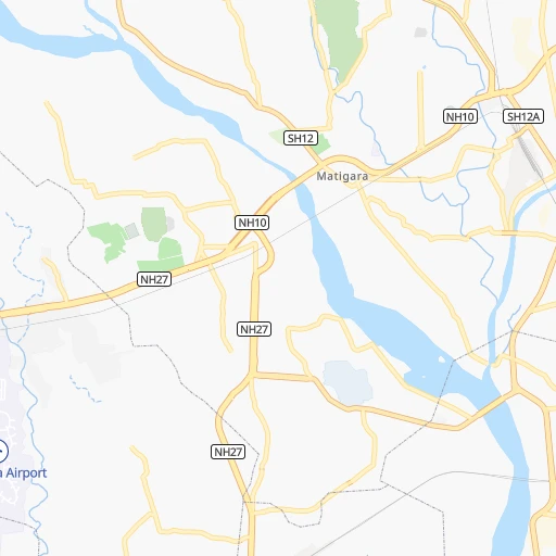
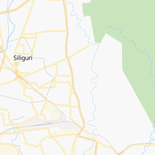
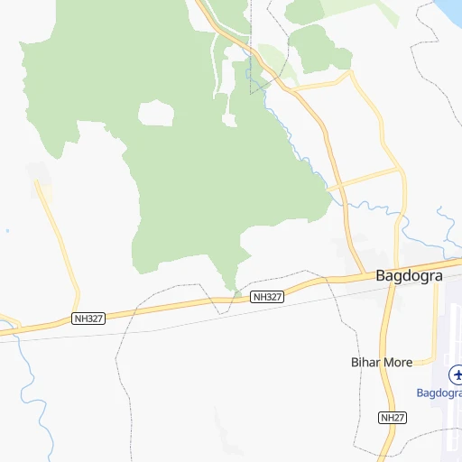
Roadmap (route) to go from Matigara to Jangipur detailed above, you can also see the course layout on the map.
While doing trip Matigara - Jangipur by car, the calculated route ends at a distance , or more straight.
Distance and duration of the route between Matigara and Jangipur
An error occured: undefined - for url https://router.cartes.cc/route?point=26.71682%2C88.38407&point=24.47001%2C88.07659&vehicle=car&debug=false&data_type=application%2Fjson&locale=en&points_encoded=true&instructions=true&elevation=false&optimize=false&timeout=10000&skip.host=true&skip.basePath=true&graphhopper_maps_host=https%3A%2F%2Fgraphhopper.com%2Fmaps%2F%3F&turn_sign_map.0=continue&turn_sign_map.1=turn%20slight%20right&turn_sign_map.2=turn%20right&turn_sign_map.3=turn%20sharp%20right&turn_sign_map.4=finish&turn_sign_map.5=reached%20via%20point&turn_sign_map.6=enter%20roundabout&turn_sign_map.-6=leave%20roundabout&turn_sign_map.-3=turn%20sharp%20left&turn_sign_map.-2=turn%20left&turn_sign_map.-1=turn%20slight%20left&key=&position=topleft
Calculation of distance and route from Jangipur to Matigara :
251.6306.5 km5h45mn
Continue 0h0mn 162 mTurn left 0h1mn 257 mTurn left 0h0mn 138 mTurn sharp left 0h1mn 674 mTurn left onto NH10 0h1mn 778 mKeep left 0h1mn 686 mTurn left onto NH27 0h2mn 2.5 kmAt roundabout, take exit 2 onto NH27 0h5mn 5.9 kmTurn right onto NH27 0h5mn 6.2 kmKeep left 0h1mn 886 mTurn left 0h3mn 1.9 kmKeep right 0h6mn 2.8 kmKeep left 0h7mn 7.2 kmTurn left 0h1mn 1.3 kmTurn sharp left 0h1mn 1.1 kmTurn right 0h3mn 3.0 kmTurn right 0h23mn 25.3 kmTurn right 0h0mn 72 mContinue onto NH27 0h7mn 7.7 kmTurn right onto Islampur Bypass 0h6mn 7.4 kmTurn left 0h26mn 25.7 kmTurn left 0h18mn 17.5 kmTurn left 0h5mn 5.1 kmKeep left onto Botolbari Road 0h1mn 1.2 kmTurn left onto Botolbari Road 0h11mn 10.7 kmTurn left onto NH12 0h8mn 9.8 kmKeep right onto Raiganj Bypass 1h3mn 76.4 kmTurn right 0h0mn 88 mTurn slight left 0h4mn 4.0 kmContinue onto NH31 1h42mn 49.8 kmTurn left 0h6mn 6.1 kmTurn left onto NH12 0h7mn 7.9 kmKeep right 0h1mn 592 mTurn left 0h2mn 1.2 kmTurn left 0h9mn 7.2 kmTurn left 0h7mn 5.7 kmTurn right 0h1mn 1.4 kmTurn left 0h0mn 131 mArrive at destination 0h0mn 0 m
Travel from Matigara (West Bengal) to a selection of major cities.
Distances from Matigara to biggest cities in West Bengal
- Kultali,187,942 inhabitants.536 km
- Chandannagar,180,623 inhabitants.429 km
- Baharampur,180,547 inhabitants.291 km
- Hugli,177,005 inhabitants.424 km
- Haldia,170,695 inhabitants.519 km
- Raiganj,170,252 inhabitants.126 km
- Ingraj Bazar,170,039 inhabitants.192 km
- Madhyamgram,161,126 inhabitants.448 km
- Jamuria,160,242 inhabitants.360 km
- Jaigaon,158,664 inhabitants.100 km
- Medinipur,153,349 inhabitants.490 km
- Shantipur,149,983 inhabitants.386 km
- Barakpur,148,174 inhabitants.440 km
- Krishnanagar,145,926 inhabitants.369 km
- Balurghat,141,404 inhabitants.171 km
- Habra,139,297 inhabitants.432 km
- Kanchrapara,136,954 inhabitants.418 km
- Bankura,133,966 inhabitants.410 km
- Raniganj,131,261 inhabitants.368 km
- Khardah,128,346 inhabitants.445 km
Other major cities in country :
- Gorakhpur [10], 1,324,570 inhabitants. 1,284 km
- Nashik [16], 1,289,497 inhabitants. 1,667 km
- Pimpri [16], 1,284,606 inhabitants. 1,745 km
- Kalyan [16], 1,262,255 inhabitants. 1,768 km
- Thane [16], 1,261,517 inhabitants. 1,786 km
- Meerut [36], 1,223,184 inhabitants. 1,080 km
- Nowrangapur [21], 1,220,946 inhabitants. 1,025 km
- Faridabad [10], 1,220,229 inhabitants. 1,108 km
- Ghaziabad [36], 1,199,191 inhabitants. 1,100 km
- Dombivli [16], 1,193,000 inhabitants. 1,774 km
- Rajkot [09], 1,177,362 inhabitants. 1,847 km
- Varanasi [36], 1,164,404 inhabitants. 560 km
- Amritsar [23], 1,092,450 inhabitants. 1,421 km
- Allahabad [36], 1,073,438 inhabitants. 669 km
- Visakhapatnam [02], 1,063,178 inhabitants. 1,139 km
- Teni [25], 1,034,724 inhabitants. 2,185 km
- Jabalpur [35], 1,030,168 inhabitants. 938 km
- Aurangabad [16], 1,016,441 inhabitants. 1,534 km
- Shivaji Nagar [16], 1,000,000 inhabitants. 1,747 km
- Solapur [16], 997,281 inhabitants. 1,631 km
Route from Jangipur to major cities (India).
- Distance Jangipur Mumbai1,680 km
- Distance Jangipur Delhi1,175 km
- Distance Jangipur Bengaluru1,689 km
- Distance Jangipur Chennai1,509 km
- Distance Jangipur Ahmedabad1,586 km
- Distance Jangipur Hyderabad1,273 km
- Distance Jangipur Pune1,614 km
- Distance Jangipur Surat1,605 km
- Distance Jangipur Kanpur808 km
- Distance Jangipur Jaipur1,262 km
- Distance Jangipur Navi Mumbai1,669 km
- Distance Jangipur Lucknow765 km
- Distance Jangipur Nagpur994 km
- Distance Jangipur Indore1,264 km
- Distance Jangipur Patna322 km
- Distance Jangipur Bhopal1,095 km
- Distance Jangipur Ludhiana1,401 km
- Distance Jangipur Tirunelveli2,071 km
- Distance Jangipur Agra1,052 km
- Distance Jangipur Vadodara1,537 km
Nearest cities to Matigara :
- Shiliguri, 515,574 inhabitants. 4 km
- Bokaro, 418,533 inhabitants. 408 km
- Bhagalpur, 361,548 inhabitants. 216 km
- Muzaffarpur, 333,200 inhabitants. 306 km
- Kulti, 305,405 inhabitants. 367 km
- Darbhanga, 287,150 inhabitants. 256 km
- Bihar Sharif, 244,230 inhabitants. 332 km
- Dhanbad, 219,636 inhabitants. 379 km
- Agartala, 203,264 inhabitants. 433 km
- Monghyr, 203,163 inhabitants. 242 km
- Purnia, 198,453 inhabitants. 138 km
- Katihar, 192,555 inhabitants. 154 km
- Baharampur, 180,547 inhabitants. 291 km
- Raiganj, 170,252 inhabitants. 126 km
- Ingraj Bazar, 170,039 inhabitants. 192 km
- Jaigaon, 158,664 inhabitants. 100 km
- Saharsa, 145,764 inhabitants. 202 km
- Balurghat, 141,404 inhabitants. 171 km
- Darjiling, 123,797 inhabitants. 37 km
- Jalpaiguri, 107,832 inhabitants. 41 km
- Begusarai, 103,060 inhabitants. 267 km
- Jamalpur, 100,780 inhabitants. 246 km
- Nawada, 96,730 inhabitants. 350 km
- Sahibganj, 95,890 inhabitants. 180 km
- Kishanganj, 94,807 inhabitants. 81 km
- Luckeesarai, 89,500 inhabitants. 286 km
- Jharia, 86,938 inhabitants. 386 km
- Baruni, 84,888 inhabitants. 278 km
- Jangipur, 82,548 inhabitants. 252 km
- Koch Bihar, 78,737 inhabitants. 114 km
- Jamui, 78,181 inhabitants. 294 km
- Dhulian, 77,070 inhabitants. 231 km
- Jumri Tilaiya, 76,341 inhabitants. 383 km
- Madhubani, 71,582 inhabitants. 234 km
- Araria, 67,474 inhabitants. 107 km
- Goyerkata, 66,358 inhabitants. 64 km
- Gangarampur, 65,316 inhabitants. 147 km
- Alipur Duar, 65,232 inhabitants. 116 km
- Bongaigaon, 64,902 inhabitants. 218 km
- Siuri, 64,659 inhabitants. 324 km
- Tura, 63,645 inhabitants. 226 km
- Dhuburi, 62,525 inhabitants. 178 km
- Supaul, 60,020 inhabitants. 191 km
- Giridih, 60,000 inhabitants. 351 km
- Bangaon, 60,000 inhabitants. 209 km
- Samastipur, 57,575 inhabitants. 277 km
- Katras, 57,349 inhabitants. 387 km
- Naksalbari, 57,283 inhabitants. 17 km
- Sitamarhi, 57,095 inhabitants. 288 km
- Islampur, 55,691 inhabitants. 54 km
Location Matigara (West Bengal) :
| Country flag |  |
| Location | Matigara |
| State | West Bengal |
| County | Darjiling |
| Country | India |
| Country code / ISO 2 | IN |
| Latitude | 26.7168200 |
| Longitude | 88.3840700 |
| Altitude | 0 meters |
| Time zone | Asia/Kolkata |
Location Jangipur (West Bengal) :
| Country flag | |
| Location | Jangipur |
| State | West Bengal |
| County | Murshidabad |
| Country | India |
| Country code / ISO 2 | IN |
| Latitude | 24.4700100 |
| Longitude | 88.0765900 |
| Altitude | 0 meters |
| Time zone | Asia/Kolkata |