


How to get from Manjari Budruk (Maharashtra) to Amrāvati (Maharashtra)
Calculate route from Manjari Budruk (Maharashtra, India) to Amrāvati (Maharashtra, India).
The flight distance (as the crow flies) between Manjari Budruk and Amrāvati is 478.1 km.
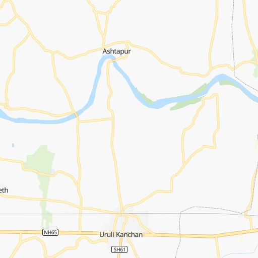
Roadmap (route) to go from Manjari Budruk to Amrāvati detailed above, you can also see the course layout on the map.
While doing trip Manjari Budruk - Amrāvati by car, the calculated route ends at a distance , or more straight.
Distance and duration of the route between Manjari Budruk and Amrāvati
Calculation of distance and route from Amrāvati to Manjari Budruk :
478.1535.9 km7h48mn
Continue 0h0mn 162 mTurn left 0h0mn 221 mTurn sharp right onto Hadapsar - Manjari Road 0h8mn 9.3 kmTurn right onto Nagar Road 0h18mn 20.5 kmKeep left onto NH753F 1h8mn 80.3 kmAt roundabout, take exit 2 onto NH753F, NH160 2h36mn 113.1 kmAt roundabout, take exit 3 onto Jalna Road 0h1mn 1.2 kmKeep left onto Chhatrapati Shivaji Highway 0h0mn 446 mAt roundabout, take exit 2 onto Chhatrapati Shivaji Highway 1h42mn 48.8 kmTurn left 0h4mn 3.4 kmTurn right onto Mumbai - Nagpur Expressway 2h53mn 193.6 kmKeep left 0h1mn 1.5 kmKeep right and drive toward Karanja 0h0mn 296 mKeep right 0h8mn 9.5 kmTurn right onto NH161E 0h24mn 29.2 kmKeep left 0h0mn 44 mTurn sharp right 0h10mn 12.0 kmKeep left 0h0mn 113 mKeep right 0h0mn 38 mTurn left 0h0mn 4 mTurn right 0h11mn 10.1 kmContinue onto Amravati Paratwada Road 0h0mn 308 mKeep left 0h1mn 984 mTurn left 0h0mn 25 mTurn right 0h1mn 556 mTurn left 0h0mn 52 mArrive at destination 0h0mn 0 m
Travel from Manjari Budruk (Maharashtra) to a selection of major cities.
Distances from Manjari Budruk to biggest cities in Maharashtra
- Malegaon,435,362 inhabitants.234 km
- Jalgaon,429,298 inhabitants.324 km
- Akola,428,857 inhabitants.401 km
- Ahmadnagar,367,140 inhabitants.104 km
- Dhulia,366,980 inhabitants.279 km
- Latur,348,967 inhabitants.274 km
- Chanda,328,351 inhabitants.582 km
- Parbhani,289,629 inhabitants.307 km
- Ichalkaranji,274,383 inhabitants.209 km
- Jalna,262,034 inhabitants.250 km
- Amarnath,217,780 inhabitants.114 km
- Bhusaval,183,001 inhabitants.340 km
- Virar,150,357 inhabitants.161 km
- Yavatmal,128,175 inhabitants.484 km
- Panvel,128,046 inhabitants.105 km
- Gondia,124,897 inhabitants.729 km
- Wardha,113,759 inhabitants.545 km
- Satara,112,793 inhabitants.92 km
- Achalpur,111,278 inhabitants.480 km
- Barsi,110,983 inhabitants.184 km
Other major cities in country :
- Faridabad [10], 1,220,229 inhabitants. 1,153 km
- Ghaziabad [36], 1,199,191 inhabitants. 1,184 km
- Rajkot [09], 1,177,362 inhabitants. 536 km
- Varanasi [36], 1,164,404 inhabitants. 1,201 km
- Amritsar [23], 1,092,450 inhabitants. 1,462 km
- Allahabad [36], 1,073,438 inhabitants. 1,120 km
- Visakhapatnam [02], 1,063,178 inhabitants. 981 km
- Teni [25], 1,034,724 inhabitants. 1,019 km
- Jabalpur [35], 1,030,168 inhabitants. 809 km
- Haora [28], 1,027,672 inhabitants. 1,562 km
- Srinagar [12], 975,857 inhabitants. 1,736 km
- Chandigarh [05], 960,787 inhabitants. 1,390 km
- Coimbatore [25], 959,823 inhabitants. 896 km
- Jodhpur [24], 921,476 inhabitants. 869 km
- Madurai [25], 909,908 inhabitants. 1,056 km
- Guwahati [03], 899,094 inhabitants. 2,017 km
- Gwalior [35], 882,458 inhabitants. 962 km
- Vijayawada [02], 874,587 inhabitants. 743 km
- Mysore [19], 868,313 inhabitants. 749 km
- Ranchi [38], 846,454 inhabitants. 1,295 km
Route from Amrāvati to major cities (India).
- Distance Amrāvati Delhi861 km
- Distance Amrāvati Bengaluru886 km
- Distance Amrāvati Kolkata1,112 km
- Distance Amrāvati Chennai914 km
- Distance Amrāvati Ahmedabad582 km
- Distance Amrāvati Hyderabad402 km
- Distance Amrāvati Surat512 km
- Distance Amrāvati Kanpur670 km
- Distance Amrāvati Jaipur696 km
- Distance Amrāvati Lucknow732 km
- Distance Amrāvati Indore281 km
- Distance Amrāvati Patna916 km
- Distance Amrāvati Bhopal261 km
- Distance Amrāvati Ludhiana1,127 km
- Distance Amrāvati Tirunelveli1,359 km
- Distance Amrāvati Agra696 km
- Distance Amrāvati Vadodara494 km
- Distance Amrāvati Gorakhpur971 km
- Distance Amrāvati Meerut896 km
- Distance Amrāvati Nowrangapur536 km
Nearest cities to Manjari Budruk :
- Mumbai, 12,691,836 inhabitants. 131 km
- Pune, 2,935,744 inhabitants. 12 km
- Surat, 2,894,504 inhabitants. 322 km
- Navi Mumbai, 2,600,000 inhabitants. 116 km
- Nashik, 1,289,497 inhabitants. 166 km
- Pimpri, 1,284,606 inhabitants. 21 km
- Kalyan, 1,262,255 inhabitants. 120 km
- Thane, 1,261,517 inhabitants. 131 km
- Dombivli, 1,193,000 inhabitants. 122 km
- Aurangabad, 1,016,441 inhabitants. 209 km
- Shivaji Nagar, 1,000,000 inhabitants. 13 km
- Solapur, 997,281 inhabitants. 226 km
- Bhiwandi, 707,035 inhabitants. 130 km
- Borivli, 609,617 inhabitants. 142 km
- Sangli, 601,214 inhabitants. 195 km
- Bhayandar, 520,301 inhabitants. 147 km
- Ulhasnagar, 516,584 inhabitants. 117 km
- Kolhapur, 516,142 inhabitants. 204 km
- Bilimora, 510,879 inhabitants. 273 km
- Gulbarga, 483,615 inhabitants. 331 km
- Malegaon, 435,362 inhabitants. 234 km
- Jalgaon, 429,298 inhabitants. 324 km
- Belgaum, 428,720 inhabitants. 301 km
- Ahmadnagar, 367,140 inhabitants. 104 km
- Dhulia, 366,980 inhabitants. 279 km
- Latur, 348,967 inhabitants. 274 km
- Parbhani, 289,629 inhabitants. 307 km
- Ichalkaranji, 274,383 inhabitants. 209 km
- Bijapur, 271,064 inhabitants. 264 km
- Jalna, 262,034 inhabitants. 250 km
- Amarnath, 217,780 inhabitants. 114 km
- Burhanpur, 202,695 inhabitants. 391 km
- Bhusaval, 183,001 inhabitants. 340 km
- Virar, 150,357 inhabitants. 161 km
- Panvel, 128,046 inhabitants. 105 km
- Satara, 112,793 inhabitants. 92 km
- Barsi, 110,983 inhabitants. 184 km
- Badlapur, 104,636 inhabitants. 103 km
- Nandurbar, 100,703 inhabitants. 319 km
- Airoli, 100,000 inhabitants. 125 km
- Amalner, 97,369 inhabitants. 304 km
- Bagalkot, 97,269 inhabitants. 317 km
- Chalisgaon, 96,381 inhabitants. 243 km
- Pandharpur, 95,665 inhabitants. 171 km
- Parli Vaijnath, 94,863 inhabitants. 273 km
- Khamgaon, 94,604 inhabitants. 366 km
- Roha, 90,000 inhabitants. 90 km
- Osmanabad, 85,521 inhabitants. 222 km
- Kundla, 76,809 inhabitants. 421 km
- Manmad, 76,722 inhabitants. 200 km
Location Manjari Budruk (Maharashtra) :
| Country flag |  |
| Location | Manjari Budruk |
| State | Maharashtra |
| County | Pune Division |
| Country | India |
| Country code / ISO 2 | IN |
| Latitude | 18.5120400 |
| Longitude | 73.9714200 |
| Altitude | 0 meters |
| Time zone | Asia/Kolkata |
Location Amrāvati (Maharashtra) :
| Country flag | |
| Location | Amrāvati |
| State | Maharashtra |
| County | Amravati Division |
| Country | India |
| Country code / ISO 2 | IN |
| Latitude | 20.9333300 |
| Longitude | 77.7500000 |
| Altitude | 0 meters |
| Time zone | Asia/Kolkata |


