
How to get from Pudukād Railway Station (Kerala) to Kolār (Karnataka)
Calculate route from Pudukād Railway Station (Kerala, India) to Kolār (Karnataka, India).
The flight distance (as the crow flies) between Pudukād Railway Station and Kolār is 364.0 km.
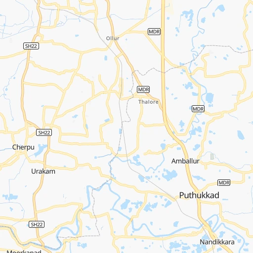
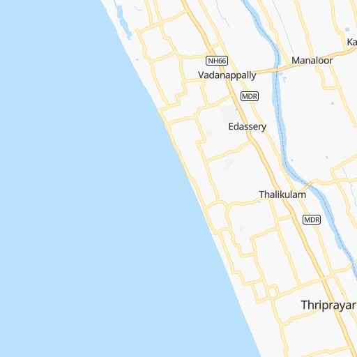
Roadmap (route) to go from Pudukād Railway Station to Kolār detailed above, you can also see the course layout on the map.
While doing trip Pudukād Railway Station - Kolār by car, the calculated route ends at a distance , or more straight.
Distance and duration of the route between Pudukād Railway Station and Kolār
An error occured: undefined - for url https://router.cartes.cc/route?point=10.42079%2C76.26104&point=13.13768%2C78.12999&vehicle=car&debug=false&data_type=application%2Fjson&locale=en&points_encoded=true&instructions=true&elevation=false&optimize=false&timeout=10000&skip.host=true&skip.basePath=true&graphhopper_maps_host=https%3A%2F%2Fgraphhopper.com%2Fmaps%2F%3F&turn_sign_map.0=continue&turn_sign_map.1=turn%20slight%20right&turn_sign_map.2=turn%20right&turn_sign_map.3=turn%20sharp%20right&turn_sign_map.4=finish&turn_sign_map.5=reached%20via%20point&turn_sign_map.6=enter%20roundabout&turn_sign_map.-6=leave%20roundabout&turn_sign_map.-3=turn%20sharp%20left&turn_sign_map.-2=turn%20left&turn_sign_map.-1=turn%20slight%20left&key=&position=topleft
Calculation of distance and route from Kolār to Pudukād Railway Station :
364.0448.8 km7h35mn
Continue onto Vadakkethoravu Road 0h0mn 150 mTurn left onto Urakam-Pudukad Road 0h1mn 827 mTurn right onto Urakam-Pudukad Road 0h0mn 149 mTurn left onto Urakam-Pudukad Road 0h0mn 25 mKeep left onto Salem - Kochi - Kanyakumari Highway 1h30mn 36.0 kmKeep right 1h58mn 61.9 kmKeep left 0h1mn 428 mKeep left onto Salem - Cochin - Kanniyakumari Road (Old NH47) 0h2mn 2.6 kmContinue 0h1mn 439 mKeep right 0h2mn 1.9 kmKeep left 0h20mn 20.8 kmContinue onto Coimbatore Bypass 0h28mn 38.8 kmTurn sharp left 0h0mn 31 mTurn sharp right 0h0mn 461 mAt roundabout, take exit 2 0h1mn 744 mKeep left 0h1mn 711 mTurn right 0h0mn 108 mTurn left onto Salem - Cochin - Kanniyakumari Road (Old NH47) 0h3mn 3.2 kmTurn left 0h0mn 123 mTurn right 1h32mn 47.7 kmKeep left 0h3mn 2.1 kmTurn slight left onto Thoppur - Mettur - Bhavani - Erode Road 0h1mn 1.1 kmContinue onto Erode - Bhavani - Mettur - Thoppur Road 1h34mn 39.5 kmKeep left 0h4mn 4.9 kmContinue onto NH544H 0h1mn 547 mKeep left onto NH544H 0h24mn 27.7 kmKeep left 0h0mn 284 mKeep left 0h6mn 4.9 kmTurn left onto NH44 0h18mn 22.0 kmKeep left 0h15mn 17.0 kmContinue onto Hosur - Adiyamankottai Road 0h4mn 4.5 kmContinue onto Malur - Hosur - Adhiyamankottai Road 0h2mn 2.1 kmContinue onto Hosur - Adiyamankottai Road 0h22mn 25.1 kmTurn right onto Krishnagiri - Rayakottai Road 0h0mn 15 mKeep left onto Shoolagiri - Rayakottai Road 0h0mn 298 mTurn left onto Shoolagiri - Rayakottai Road 0h0mn 417 mTurn right onto Shoolagiri - Rayakottai Road 0h17mn 17.3 kmTurn left 0h1mn 991 mTurn right 0h0mn 33 mTurn right 0h0mn 140 mKeep left onto Shollagiri - Uddanapalli Road 0h0mn 234 mTurn left onto Varanasi - Kanniyakumari Road (Old NH7) 0h0mn 100 mTurn sharp right onto Shoolagiri - Berigai Road 0h1mn 549 mTurn left onto Shoolagiri - Berigai Road 0h1mn 596 mKeep right 0h17mn 14.1 kmTurn left onto Krishnagiri - Berigai Road 0h0mn 21 mTurn right 0h4mn 3.6 kmTurn right 0h8mn 6.8 kmTurn right onto SH99 0h13mn 13.9 kmTurn left onto SH95 0h1mn 1.1 kmKeep right onto SH95 0h0mn 20 mKeep right onto SH95 0h0mn 25 mTurn right onto SH95 0h0mn 190 mTurn sharp left onto SH99 0h17mn 18.3 kmContinue 0h0mn 127 mTurn left 0h0mn 25 mTurn right 0h0mn 69 mTurn left 0h0mn 43 mTurn right 0h0mn 135 mTurn right 0h1mn 592 mTurn left 0h0mn 40 mTurn left onto SH99 0h0mn 87 mArrive at destination 0h0mn 0 m
Travel from Pudukād Railway Station (Karnataka) to a selection of major cities.
Distances from Pudukād Railway Station to biggest cities in Kerala
- Kannur,62,836 inhabitants.189 km
- Malappuram,61,743 inhabitants.72 km
- Kottayam,59,437 inhabitants.97 km
- Nedumangad,58,278 inhabitants.218 km
- Tiruvalla,57,223 inhabitants.121 km
- Tirur,54,934 inhabitants.66 km
- Kasaragod,53,309 inhabitants.270 km
- Changanacheri,51,430 inhabitants.113 km
- Mannarakkat,50,921 inhabitants.67 km
- Ottappalam,50,913 inhabitants.41 km
- Kizhake Chalakudi,49,330 inhabitants.16 km
- Punalur,47,263 inhabitants.172 km
- Cherthala,45,827 inhabitants.82 km
- Mattanur,45,521 inhabitants.184 km
- Shertallai,45,474 inhabitants.82 km
- Varkala,43,276 inhabitants.194 km
- Shoranur,42,694 inhabitants.38 km
- Nadapuram,39,512 inhabitants.155 km
- Aroor,39,214 inhabitants.62 km
- Paravur Tekkumbhagam,38,946 inhabitants.186 km
Other major cities in country :
- Vadodara [09], 1,409,476 inhabitants. 1,362 km
- Gorakhpur [10], 1,324,570 inhabitants. 2,119 km
- Nashik [16], 1,289,497 inhabitants. 1,098 km
- Pimpri [16], 1,284,606 inhabitants. 951 km
- Kalyan [16], 1,262,255 inhabitants. 1,038 km
- Thane [16], 1,261,517 inhabitants. 1,039 km
- Meerut [36], 1,223,184 inhabitants. 2,071 km
- Nowrangapur [21], 1,220,946 inhabitants. 1,191 km
- Faridabad [10], 1,220,229 inhabitants. 2,006 km
- Ghaziabad [36], 1,199,191 inhabitants. 2,035 km
- Dombivli [16], 1,193,000 inhabitants. 1,037 km
- Rajkot [09], 1,177,362 inhabitants. 1,444 km
- Varanasi [36], 1,164,404 inhabitants. 1,805 km
- Amritsar [23], 1,092,450 inhabitants. 2,364 km
- Allahabad [36], 1,073,438 inhabitants. 1,773 km
- Visakhapatnam [02], 1,063,178 inhabitants. 1,102 km
- Teni [25], 1,034,724 inhabitants. 141 km
- Jabalpur [35], 1,030,168 inhabitants. 1,472 km
- Haora [28], 1,027,672 inhabitants. 1,865 km
- Aurangabad [16], 1,016,441 inhabitants. 1,057 km
Route from Kolār to major cities (India).
- Distance Kolār Mumbai867 km
- Distance Kolār Delhi1,730 km
- Distance Kolār Kolkata1,508 km
- Distance Kolār Chennai233 km
- Distance Kolār Ahmedabad1,247 km
- Distance Kolār Hyderabad474 km
- Distance Kolār Pune754 km
- Distance Kolār Surat1,059 km
- Distance Kolār Kanpur1,502 km
- Distance Kolār Jaipur1,554 km
- Distance Kolār Navi Mumbai854 km
- Distance Kolār Lucknow1,553 km
- Distance Kolār Nagpur897 km
- Distance Kolār Indore1,094 km
- Distance Kolār Patna1,569 km
- Distance Kolār Bhopal1,129 km
- Distance Kolār Ludhiana1,992 km
- Distance Kolār Tirunelveli493 km
- Distance Kolār Agra1,564 km
- Distance Kolār Vadodara1,145 km
Nearest cities to Pudukād Railway Station :
- Bengaluru, 5,104,047 inhabitants. 319 km
- Tirunelveli, 1,435,844 inhabitants. 245 km
- Teni, 1,034,724 inhabitants. 141 km
- Coimbatore, 959,823 inhabitants. 101 km
- Madurai, 909,908 inhabitants. 211 km
- Mysore, 868,313 inhabitants. 213 km
- Thiruvananthapuram, 784,153 inhabitants. 228 km
- Salem, 778,396 inhabitants. 248 km
- Tiruchirappalli, 775,484 inhabitants. 270 km
- Cochin, 604,696 inhabitants. 54 km
- Kozhikode, 439,922 inhabitants. 106 km
- Mangalore, 417,387 inhabitants. 317 km
- Thoothukudi, 410,760 inhabitants. 276 km
- Tiruppur, 397,521 inhabitants. 142 km
- Kollam, 394,163 inhabitants. 175 km
- Trichur, 325,110 inhabitants. 12 km
- Tumkur, 307,359 inhabitants. 338 km
- Tanjore, 219,571 inhabitants. 318 km
- Nagercoil, 213,858 inhabitants. 281 km
- Dindigul, 200,797 inhabitants. 188 km
- Vellore, 177,081 inhabitants. 419 km
- Alleppey, 176,783 inhabitants. 104 km
- Udupi, 165,000 inhabitants. 364 km
- Erode, 147,270 inhabitants. 190 km
- Tiruvannamalai, 138,243 inhabitants. 367 km
- Robertsonpet, 135,218 inhabitants. 358 km
- Mandya, 134,845 inhabitants. 244 km
- Palghat, 132,728 inhabitants. 58 km
- Hassan, 128,531 inhabitants. 288 km
- Kolar, 126,441 inhabitants. 365 km
- Rajapalaiyam, 124,168 inhabitants. 178 km
- Chikmagalur, 121,484 inhabitants. 327 km
- Yelahanka, 116,447 inhabitants. 332 km
- Pudukkottai, 112,118 inhabitants. 280 km
- Ambur, 109,873 inhabitants. 376 km
- Ponnani, 105,512 inhabitants. 53 km
- Hosur, 103,724 inhabitants. 310 km
- Ooty, 98,238 inhabitants. 120 km
- Tellicherry, 97,201 inhabitants. 170 km
- Gudiyatham, 93,973 inhabitants. 400 km
- Closepet, 93,528 inhabitants. 279 km
- Karaikkudi, 91,908 inhabitants. 277 km
- Valparai, 90,353 inhabitants. 76 km
- Kovilpatti, 90,296 inhabitants. 225 km
- Vaniyambadi, 90,288 inhabitants. 360 km
- Manjeri, 89,201 inhabitants. 79 km
- Pollachi, 88,214 inhabitants. 86 km
- Neyyattinkara, 88,104 inhabitants. 243 km
- Tiruchengode, 87,123 inhabitants. 208 km
- Paramagudi, 85,695 inhabitants. 273 km
Location Pudukād Railway Station (Kerala) :
| Country flag |  |
| Location | Pudukād Railway Station |
| State | Kerala |
| County | Thrissur District |
| Country | India |
| Country code / ISO 2 | IN |
| Latitude | 10.4207900 |
| Longitude | 76.2610400 |
| Altitude | 0 meters |
| Time zone | Asia/Kolkata |
Location Kolār (Karnataka) :
| Country flag | |
| Location | Kolār |
| State | Karnataka |
| County | Kolar |
| Country | India |
| Country code / ISO 2 | IN |
| Latitude | 13.1376800 |
| Longitude | 78.1299900 |
| Altitude | 0 meters |
| Time zone | Asia/Kolkata |