
How to get from Nazarbagh (Gujarat) to Una (Gujarat)
Calculate route from Nazarbagh (Gujarat, India) to Una (Gujarat, India).
The flight distance (as the crow flies) between Nazarbagh and Una is 223.1 km.
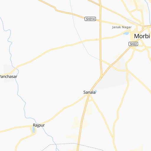
Roadmap (route) to go from Nazarbagh to Una detailed above, you can also see the course layout on the map.
While doing trip Nazarbagh - Una by car, the calculated route ends at a distance , or more straight.
Distance and duration of the route between Nazarbagh and Una
An error occured: undefined - for url https://router.cartes.cc/route?point=22.8234%2C70.84706&point=20.82318%2C71.03795&vehicle=car&debug=false&data_type=application%2Fjson&locale=en&points_encoded=true&instructions=true&elevation=false&optimize=false&timeout=10000&skip.host=true&skip.basePath=true&graphhopper_maps_host=https%3A%2F%2Fgraphhopper.com%2Fmaps%2F%3F&turn_sign_map.0=continue&turn_sign_map.1=turn%20slight%20right&turn_sign_map.2=turn%20right&turn_sign_map.3=turn%20sharp%20right&turn_sign_map.4=finish&turn_sign_map.5=reached%20via%20point&turn_sign_map.6=enter%20roundabout&turn_sign_map.-6=leave%20roundabout&turn_sign_map.-3=turn%20sharp%20left&turn_sign_map.-2=turn%20left&turn_sign_map.-1=turn%20slight%20left&key=&position=topleft
Calculation of distance and route from Una to Nazarbagh :
223.1261.7 km4h57mn
Continue 0h2mn 1.3 kmTurn slight left onto SH22 0h14mn 15.5 kmKeep left onto Rajkot - Morbi Highway 0h16mn 16.0 kmKeep left onto Service Road 0h28mn 26.7 kmTurn sharp right 0h0mn 191 mTurn left 0h4mn 3.7 kmAt roundabout, take exit 2 onto SH25 0h0mn 453 mTurn sharp left 0h1mn 768 mTurn right onto Lakhaj Rai Road 0h1mn 619 mTurn left onto Dhebar Road 0h2mn 1.7 kmTurn right 0h0mn 108 mTurn left onto Gondal Road 0h4mn 3.8 kmTurn left 0h0mn 361 mAt roundabout, take exit 2 onto By pass Circle 0h21mn 29.3 kmKeep left 0h2mn 2.0 kmTurn left 0h1mn 543 mKeep left 0h0mn 51 mTurn left 0h1mn 251 mTurn sharp right 0h1mn 779 mTurn right onto SH1 1h31mn 33.6 kmTurn left onto SH104 0h28mn 30.9 kmTurn right 0h0mn 18 mTurn left 0h0mn 220 mTurn left 0h0mn 136 mTurn right 0h0mn 226 mTurn left 0h2mn 1.6 kmContinue onto SH104, SH112 0h5mn 6.1 kmTurn right 0h1mn 1.1 kmTurn sharp right onto SH104 0h11mn 13.2 kmTurn right onto SH33, SH96, SH104 0h0mn 103 mTurn right 0h0mn 368 mContinue onto NH351K 1h59mn 68.3 kmTurn slight right onto NH51 0h1mn 1.2 kmTurn slight right 0h0mn 306 mTurn right 0h0mn 83 mArrive at destination 0h0mn 0 m
Travel from Nazarbagh (Gujarat) to a selection of major cities.
Distances from Nazarbagh to biggest cities in Gujarat
- Jetpur,118,068 inhabitants.121 km
- Morbi,118,022 inhabitants.1 km
- Patan,117,863 inhabitants.174 km
- Botad,117,053 inhabitants.111 km
- Gondal,101,801 inhabitants.96 km
- Amreli,99,742 inhabitants.141 km
- Disa,92,224 inhabitants.210 km
- Dohad,83,966 inhabitants.350 km
- Dhoraji,81,445 inhabitants.128 km
- Khambhat,81,328 inhabitants.191 km
- Kundla,76,809 inhabitants.172 km
- Dhrangadhra,75,578 inhabitants.66 km
- Ankleshwar,74,742 inhabitants.258 km
- Savarkundla,73,695 inhabitants.172 km
- Valsad,72,929 inhabitants.328 km
- Vapi,71,395 inhabitants.346 km
- Visnagar,68,619 inhabitants.200 km
- Keshod,68,518 inhabitants.180 km
- Anjar,66,888 inhabitants.90 km
- Himatnagar,60,634 inhabitants.233 km
Other major cities in country :
- Pimpri [16], 1,284,606 inhabitants. 560 km
- Kalyan [16], 1,262,255 inhabitants. 464 km
- Thane [16], 1,261,517 inhabitants. 460 km
- Meerut [36], 1,223,184 inhabitants. 970 km
- Nowrangapur [21], 1,220,946 inhabitants. 1,279 km
- Faridabad [10], 1,220,229 inhabitants. 899 km
- Ghaziabad [36], 1,199,191 inhabitants. 927 km
- Dombivli [16], 1,193,000 inhabitants. 464 km
- Varanasi [36], 1,164,404 inhabitants. 1,267 km
- Amritsar [23], 1,092,450 inhabitants. 1,057 km
- Allahabad [36], 1,073,438 inhabitants. 1,154 km
- Visakhapatnam [02], 1,063,178 inhabitants. 1,411 km
- Teni [25], 1,034,724 inhabitants. 1,591 km
- Jabalpur [35], 1,030,168 inhabitants. 933 km
- Haora [28], 1,027,672 inhabitants. 1,793 km
- Aurangabad [16], 1,016,441 inhabitants. 570 km
- Shivaji Nagar [16], 1,000,000 inhabitants. 571 km
- Solapur [16], 997,281 inhabitants. 780 km
- Srinagar [12], 975,857 inhabitants. 1,312 km
- Chandigarh [05], 960,787 inhabitants. 1,060 km
Route from Una to major cities (India).
- Distance Una Mumbai274 km
- Distance Una Delhi1,073 km
- Distance Una Bengaluru1,118 km
- Distance Una Kolkata1,801 km
- Distance Una Chennai1,307 km
- Distance Una Hyderabad869 km
- Distance Una Pune391 km
- Distance Una Kanpur1,138 km
- Distance Una Jaipur833 km
- Distance Una Navi Mumbai287 km
- Distance Una Lucknow1,208 km
- Distance Una Nagpur837 km
- Distance Una Indore539 km
- Distance Una Patna1,536 km
- Distance Una Bhopal710 km
- Distance Una Ludhiana1,222 km
- Distance Una Tirunelveli1,524 km
- Distance Una Agra1,002 km
- Distance Una Gorakhpur1,067 km
- Distance Una Nashik302 km
Nearest cities to Nazarbagh :
- Ahmedabad, 3,719,710 inhabitants. 180 km
- Surat, 2,894,504 inhabitants. 273 km
- Vadodara, 1,409,476 inhabitants. 250 km
- Nashik, 1,289,497 inhabitants. 438 km
- Rajkot, 1,177,362 inhabitants. 59 km
- Bhavnagar, 554,978 inhabitants. 179 km
- Bilimora, 510,879 inhabitants. 316 km
- Jamnagar, 492,056 inhabitants. 89 km
- Udaipur, 422,784 inhabitants. 352 km
- Pali, 210,103 inhabitants. 413 km
- Nadiad, 202,067 inhabitants. 207 km
- Gandhinagar, 195,985 inhabitants. 193 km
- Junagadh, 184,447 inhabitants. 151 km
- Surendranagar, 179,628 inhabitants. 83 km
- Gandhidham, 166,388 inhabitants. 79 km
- Veraval, 163,326 inhabitants. 219 km
- Bharuch, 153,528 inhabitants. 253 km
- Porbandar, 138,872 inhabitants. 183 km
- Anand, 138,009 inhabitants. 219 km
- Bhuj, 133,459 inhabitants. 130 km
- Godhra, 131,913 inhabitants. 284 km
- Palanpur, 123,294 inhabitants. 221 km
- Vejalpur, 121,610 inhabitants. 279 km
- Jetpur, 118,068 inhabitants. 121 km
- Morbi, 118,022 inhabitants. 1 km
- Patan, 117,863 inhabitants. 174 km
- Botad, 117,053 inhabitants. 111 km
- Gondal, 101,801 inhabitants. 96 km
- Amreli, 99,742 inhabitants. 141 km
- Disa, 92,224 inhabitants. 210 km
- Barmer, 89,487 inhabitants. 330 km
- Dhoraji, 81,445 inhabitants. 128 km
- Khambhat, 81,328 inhabitants. 191 km
- Kundla, 76,809 inhabitants. 172 km
- Dhrangadhra, 75,578 inhabitants. 66 km
- Ankleshwar, 74,742 inhabitants. 258 km
- Savarkundla, 73,695 inhabitants. 172 km
- Valsad, 72,929 inhabitants. 328 km
- Vapi, 71,395 inhabitants. 346 km
- Visnagar, 68,619 inhabitants. 200 km
- Keshod, 68,518 inhabitants. 180 km
- Anjar, 66,888 inhabitants. 90 km
- Himatnagar, 60,634 inhabitants. 233 km
- Borsad, 60,271 inhabitants. 216 km
- Mangrol, 58,989 inhabitants. 204 km
- Modasa, 58,970 inhabitants. 261 km
- Kadi, 58,066 inhabitants. 161 km
- Bardoli, 57,810 inhabitants. 301 km
- Una, 56,545 inhabitants. 224 km
- Upleta, 56,354 inhabitants. 134 km
Location Nazarbagh (Gujarat) :
| Country flag |  |
| Location | Nazarbagh |
| State | Gujarat |
| County | Rājkot |
| Country | India |
| Country code / ISO 2 | IN |
| Latitude | 22.8234000 |
| Longitude | 70.8470600 |
| Altitude | 0 meters |
| Time zone | Asia/Kolkata |
Location Una (Gujarat) :
| Country flag | |
| Location | Una |
| State | Gujarat |
| County | Jūnāgadh |
| Country | India |
| Country code / ISO 2 | IN |
| Latitude | 20.8231800 |
| Longitude | 71.0379500 |
| Altitude | 0 meters |
| Time zone | Asia/Kolkata |
