


How to get from Ga Bình Định (Bình Định) to Kon Tum (Kon Tum)
Calculate route from Ga Bình Định (Bình Định, Vietnam) to Kon Tum (Kon Tum, Vietnam).
The flight distance (as the crow flies) between Ga Bình Định and Kon Tum is 128.8 km.
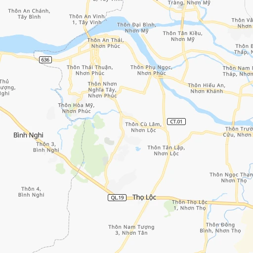
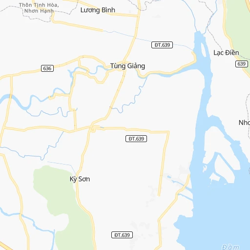
Roadmap (route) to go from Ga Bình Định to Kon Tum detailed above, you can also see the course layout on the map.
While doing trip Ga Bình Định - Kon Tum by car, the calculated route ends at a distance , or more straight.
Distance and duration of the route between Ga Bình Định and Kon Tum
An error occured: undefined - for url https://router.cartes.cc/route?point=13.88333%2C109.1&point=14.35451%2C108.00759&vehicle=car&debug=false&data_type=application%2Fjson&locale=en&points_encoded=true&instructions=true&elevation=false&optimize=false&timeout=10000&skip.host=true&skip.basePath=true&graphhopper_maps_host=https%3A%2F%2Fgraphhopper.com%2Fmaps%2F%3F&turn_sign_map.0=continue&turn_sign_map.1=turn%20slight%20right&turn_sign_map.2=turn%20right&turn_sign_map.3=turn%20sharp%20right&turn_sign_map.4=finish&turn_sign_map.5=reached%20via%20point&turn_sign_map.6=enter%20roundabout&turn_sign_map.-6=leave%20roundabout&turn_sign_map.-3=turn%20sharp%20left&turn_sign_map.-2=turn%20left&turn_sign_map.-1=turn%20slight%20left&key=&position=topleft
Calculation of distance and route from Kon Tum to Ga Bình Định :
128.8172.8 km3h36mn
Continue 0h0mn 93 mTurn right 0h1mn 483 mTurn right onto Đường Tăng Bạt Hổ 0h1mn 518 mTurn left onto Đường Cần Vương 0h1mn 353 mTurn left onto Đường Ngô Đức Đệ 0h6mn 6.1 kmKeep right 0h1mn 713 mContinue onto Đường tỉnh 636 0h6mn 6.2 kmContinue onto Đướng tỉnh 636 0h3mn 2.7 kmTurn sharp right onto Quốc lộ 19 1h38mn 43.3 kmAt roundabout, take exit 2 onto Đường Quang Trung 1h45mn 52.9 kmKeep right onto Đường Lý Thái Tổ 1h40mn 44.4 kmTurn slight right onto Quốc lộ 14 - Đường Hồ Chí Minh 0h3mn 3.2 kmContinue onto Quốc lộ 14 0h4mn 4.8 kmAt roundabout, take exit 2 onto Phạm Văn Đồng 0h5mn 5.4 kmTurn right onto Quốc lộ 14 0h0mn 344 mTurn right onto Trần Hưng Đạo 0h1mn 544 mTurn left onto Trần Phú 0h0mn 411 mTurn right 0h0mn 204 mTurn right onto Thi Sách 0h0mn 32 mTurn left 0h0mn 13 mTurn left 0h0mn 33 mTurn right 0h0mn 77 mArrive at destination 0h0mn 0 m
Travel from Ga Bình Định (Kon Tum) to a selection of major cities.
Distances from Ga Bình Định to biggest cities in Bình Định
Other major cities in country :
- Buon Ma Thuot [88], 146,975 inhabitants. 178 km
- Cam Ranh [54], 146,771 inhabitants. 218 km
- Sa Pa [90], 138,622 inhabitants. 1,093 km
- Cam Pha Mines [30], 135,477 inhabitants. 817 km
- Thanh Pho Thai Nguyen [85], 133,877 inhabitants. 925 km
- My Tho [37], 122,310 inhabitants. 493 km
- Soc Trang [65], 114,453 inhabitants. 586 km
- Pleiku [49], 114,225 inhabitants. 119 km
- Thanh Hoa [34], 112,473 inhabitants. 748 km
- Ca Mau [77], 111,894 inhabitants. 678 km
- Thanh pho Bac Lieu [73], 107,911 inhabitants. 629 km
- Yen Vinh [58], 107,082 inhabitants. 647 km
- Thanh Pho Hoa Binh [53], 105,260 inhabitants. 869 km
- Vinh Long [69], 103,314 inhabitants. 528 km
- Yen Bai [70], 96,540 inhabitants. 979 km
- Song Cau [61], 94,066 inhabitants. 49 km
- Viet Tri [83], 93,475 inhabitants. 916 km
- Phan Rang-Thap Cham [60], 91,520 inhabitants. 258 km
- Thu Dau Mot [75], 91,009 inhabitants. 419 km
- Cung Kiem [74], 80,000 inhabitants. 871 km
Route from Kon Tum to major cities (Vietnam).
- Distance Kon Tum Ho Chi Minh City421 km
- Distance Kon Tum Hanoi777 km
- Distance Kon Tum Da Nang192 km
- Distance Kon Tum Haiphong738 km
- Distance Kon Tum Bien Hoa401 km
- Distance Kon Tum Hue239 km
- Distance Kon Tum Nha Trang268 km
- Distance Kon Tum Can Tho538 km
- Distance Kon Tum Rach Gia579 km
- Distance Kon Tum Qui Nhon146 km
- Distance Kon Tum Vung Tau457 km
- Distance Kon Tum Da Lat272 km
- Distance Kon Tum Thanh Pho Nam Dinh704 km
- Distance Kon Tum Vinh541 km
- Distance Kon Tum GJuc Trong294 km
- Distance Kon Tum La Gi412 km
- Distance Kon Tum Phan Thiet381 km
- Distance Kon Tum Long Xuyen523 km
- Distance Kon Tum Can Giuoc442 km
- Distance Kon Tum Bao Loc313 km
Nearest cities to Ga Bình Định :
- Da Nang, 752,493 inhabitants. 261 km
- Bien Hoa, 407,208 inhabitants. 410 km
- Hue, 287,217 inhabitants. 329 km
- Nha Trang, 283,441 inhabitants. 183 km
- Qui Nhon, 210,338 inhabitants. 18 km
- Da Lat, 197,000 inhabitants. 227 km
- GJuc Trong, 161,232 inhabitants. 252 km
- Phan Thiet, 160,652 inhabitants. 346 km
- Bao Loc, 151,915 inhabitants. 295 km
- Buon Ma Thuot, 146,975 inhabitants. 178 km
- Cam Ranh, 146,771 inhabitants. 218 km
- Pleiku, 114,225 inhabitants. 119 km
- Song Cau, 94,066 inhabitants. 49 km
- Phan Rang-Thap Cham, 91,520 inhabitants. 258 km
- Thu Dau Mot, 91,009 inhabitants. 419 km
- Cu Chi, 75,000 inhabitants. 430 km
- Tuy Hoa, 69,596 inhabitants. 91 km
- Tam Ky, 59,000 inhabitants. 200 km
- Phu Khuong, 47,966 inhabitants. 433 km
- Kon Tum, 47,409 inhabitants. 129 km
- Quang Ngai, 32,992 inhabitants. 142 km
- Hoi An, 32,757 inhabitants. 237 km
- Don Luan, 23,978 inhabitants. 355 km
- Dong Ha, 17,662 inhabitants. 391 km
- GJinh Van, 16,036 inhabitants. 251 km
- Binh Long, 15,000 inhabitants. 368 km
Location Ga Bình Định (Bình Định) :
| Country flag |  |
| Location | Ga Bình Định |
| State | Bình Định |
| County | |
| Country | Vietnam |
| Country code / ISO 2 | VN |
| Latitude | 13.8833300 |
| Longitude | 109.1000000 |
| Altitude | 0 meters |
| Time zone | Asia/Ho_Chi_Minh |
Location Kon Tum (Kon Tum) :
| Country flag | |
| Location | Kon Tum |
| State | Kon Tum |
| County | |
| Country | Vietnam |
| Country code / ISO 2 | VN |
| Latitude | 14.3545100 |
| Longitude | 108.0075900 |
| Altitude | 0 meters |
| Time zone | Asia/Ho_Chi_Minh |
