


How to get from Santa Ana (Central Luzon) to Cabanatuan City (Central Luzon)
Calculate route from Santa Ana (Central Luzon, Philippines) to Cabanatuan City (Central Luzon, Philippines).
The flight distance (as the crow flies) between Santa Ana and Cabanatuan City is 48.4 km.
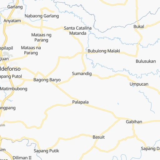
Roadmap (route) to go from Santa Ana to Cabanatuan City detailed above, you can also see the course layout on the map.
While doing trip Santa Ana - Cabanatuan City by car, the calculated route ends at a distance , or more straight.
Distance and duration of the route between Santa Ana and Cabanatuan City
An error occured: undefined - for url https://router.cartes.cc/route?point=15.0955%2C120.767&point=15.48586%2C120.96648&vehicle=car&debug=false&data_type=application%2Fjson&locale=en&points_encoded=true&instructions=true&elevation=false&optimize=false&timeout=10000&skip.host=true&skip.basePath=true&graphhopper_maps_host=https%3A%2F%2Fgraphhopper.com%2Fmaps%2F%3F&turn_sign_map.0=continue&turn_sign_map.1=turn%20slight%20right&turn_sign_map.2=turn%20right&turn_sign_map.3=turn%20sharp%20right&turn_sign_map.4=finish&turn_sign_map.5=reached%20via%20point&turn_sign_map.6=enter%20roundabout&turn_sign_map.-6=leave%20roundabout&turn_sign_map.-3=turn%20sharp%20left&turn_sign_map.-2=turn%20left&turn_sign_map.-1=turn%20slight%20left&key=&position=topleft
Calculation of distance and route from Cabanatuan City to Santa Ana :
48.453.9 km1h1mn
Continue onto Jose Abad Santos Avenue 1h31mn 30.7 kmTurn left onto Vallarta Street 0h6mn 3.8 kmTurn right 0h5mn 3.0 kmTurn left onto Maharlika Highway 0h18mn 16.3 kmTurn left onto General Luna Street 0h0mn 210 mArrive at destination 0h0mn 0 m
Travel from Santa Ana (Central Luzon) to a selection of major cities.
Distances from Santa Ana to biggest cities in Central Luzon
- Gapan,79,064 inhabitants.30 km
- Apalit,77,418 inhabitants.16 km
- Pulilan,77,186 inhabitants.23 km
- Guiguinto,76,613 inhabitants.32 km
- Balanga,72,954 inhabitants.53 km
- Capas,72,070 inhabitants.32 km
- Bulacan,71,274 inhabitants.36 km
- Plaridel,70,781 inhabitants.25 km
- Magalang,68,988 inhabitants.18 km
- Subic,67,664 inhabitants.62 km
- Dinalupihan,66,670 inhabitants.42 km
- San Ildefonso,65,669 inhabitants.19 km
- San Miguel,65,661 inhabitants.23 km
- Talavera,64,610 inhabitants.57 km
- Concepcion,64,402 inhabitants.28 km
- Obando,59,929 inhabitants.47 km
- Balagtas,59,826 inhabitants.33 km
- Lubao,55,645 inhabitants.25 km
- Limay,52,824 inhabitants.62 km
- Cabiao,49,980 inhabitants.19 km
Other major cities in country :
- Bacoor [40], 356,974 inhabitants. 73 km
- Lapu-Lapu City [07], 350,467 inhabitants. 635 km
- Iligan [10], 342,618 inhabitants. 853 km
- Mandaue City [07], 331,320 inhabitants. 632 km
- Calamba [40], 316,612 inhabitants. 107 km
- Iligan City [12], 312,323 inhabitants. 859 km
- Butuan [13], 309,709 inhabitants. 859 km
- Cabuyao [40], 308,745 inhabitants. 99 km
- Mandaluyong City [NCR], 305,576 inhabitants. 64 km
- Binan [40], 300,000 inhabitants. 90 km
- Cainta [40], 283,172 inhabitants. 69 km
- Baguio [15], 272,714 inhabitants. 148 km
- San Pedro [40], 270,216 inhabitants. 87 km
- Mantampay [10], 265,032 inhabitants. 858 km
- Libertad [13], 250,353 inhabitants. 857 km
- Navotas [NCR], 249,463 inhabitants. 52 km
- Tacloban [08], 242,089 inhabitants. 628 km
- Batangas [40], 237,370 inhabitants. 152 km
- Magugpo Poblacion [11], 233,254 inhabitants. 1,013 km
- Taytay [40], 231,460 inhabitants. 72 km
Route from Cabanatuan City to major cities (Philippines).
- Distance Cabanatuan City Quezon City94 km
- Distance Cabanatuan City Manila98 km
- Distance Cabanatuan City Caloocan City93 km
- Distance Cabanatuan City Budta997 km
- Distance Cabanatuan City Davao1,065 km
- Distance Cabanatuan City Malingao1,003 km
- Distance Cabanatuan City Cebu City657 km
- Distance Cabanatuan City General Santos1,140 km
- Distance Cabanatuan City Taguig108 km
- Distance Cabanatuan City Pasig City101 km
- Distance Cabanatuan City Las Pinas115 km
- Distance Cabanatuan City Antipolo97 km
- Distance Cabanatuan City Makati City104 km
- Distance Cabanatuan City Zamboanga962 km
- Distance Cabanatuan City Bacolod City578 km
- Distance Cabanatuan City Mansilingan583 km
- Distance Cabanatuan City Cagayan de Oro877 km
- Distance Cabanatuan City Dasmarinas129 km
- Distance Cabanatuan City Pasay106 km
- Distance Cabanatuan City Iloilo561 km
Nearest cities to Santa Ana :
- Quezon City, 2,761,720 inhabitants. 58 km
- Manila, 1,600,000 inhabitants. 59 km
- Caloocan City, 1,500,000 inhabitants. 54 km
- Taguig, 644,473 inhabitants. 72 km
- Pasig City, 617,301 inhabitants. 65 km
- Las Pinas, 590,000 inhabitants. 75 km
- Antipolo, 549,543 inhabitants. 65 km
- Makati City, 510,383 inhabitants. 67 km
- Dasmarinas, 441,876 inhabitants. 87 km
- Pasay, 416,522 inhabitants. 67 km
- San Jose del Monte, 357,828 inhabitants. 43 km
- Bacoor, 356,974 inhabitants. 73 km
- Calamba, 316,612 inhabitants. 107 km
- Cabuyao, 308,745 inhabitants. 99 km
- Mandaluyong City, 305,576 inhabitants. 64 km
- Binan, 300,000 inhabitants. 90 km
- Angeles City, 299,391 inhabitants. 21 km
- Santol, 298,976 inhabitants. 23 km
- Cainta, 283,172 inhabitants. 69 km
- Baguio, 272,714 inhabitants. 148 km
- San Pedro, 270,216 inhabitants. 87 km
- San Fernando, 251,248 inhabitants. 11 km
- Navotas, 249,463 inhabitants. 52 km
- Batangas, 237,370 inhabitants. 152 km
- Taytay, 231,460 inhabitants. 72 km
- Lucena, 228,758 inhabitants. 159 km
- Olongapo, 221,178 inhabitants. 60 km
- Cabanatuan City, 220,250 inhabitants. 48 km
- Binangonan, 219,204 inhabitants. 84 km
- Santa Rosa, 216,650 inhabitants. 95 km
- Imus, 216,099 inhabitants. 76 km
- Lipa City, 212,287 inhabitants. 135 km
- San Pablo, 207,577 inhabitants. 129 km
- Malolos, 198,748 inhabitants. 28 km
- Mabalacat City, 188,050 inhabitants. 25 km
- Meycauayan, 184,839 inhabitants. 45 km
- Tarlac City, 183,930 inhabitants. 47 km
- Legaspi, 179,481 inhabitants. 388 km
- Naga, 174,931 inhabitants. 308 km
- Dagupan, 171,271 inhabitants. 115 km
- Guyong, 155,391 inhabitants. 37 km
- Baliuag, 135,679 inhabitants. 21 km
- Rodriguez, 134,432 inhabitants. 60 km
- San Mateo, 134,327 inhabitants. 59 km
- Bulaon, 131,818 inhabitants. 11 km
- Hagonoy, 123,531 inhabitants. 29 km
- San Juan, 121,430 inhabitants. 62 km
- Silang, 119,475 inhabitants. 100 km
- San Jose, 118,807 inhabitants. 307 km
- Cavite City, 115,932 inhabitants. 70 km
Location Santa Ana (Central Luzon) :
| Country flag |  |
| Location | Santa Ana |
| State | Central Luzon |
| County | Province of Pampanga |
| Country | Philippines |
| Country code / ISO 2 | PH |
| Latitude | 15.0955000 |
| Longitude | 120.7670000 |
| Altitude | 0 meters |
| Time zone | Asia/Manila |
Location Cabanatuan City (Central Luzon) :
| Country flag | |
| Location | Cabanatuan City |
| State | Central Luzon |
| County | Province of Nueva Ecija |
| Country | Philippines |
| Country code / ISO 2 | PH |
| Latitude | 15.4858600 |
| Longitude | 120.9664800 |
| Altitude | 0 meters |
| Time zone | Asia/Manila |


