

How to get from Stantsiya Glukhari (Amur Oblast) to Naberezhnye Chelny (Tatarstan Republic)
Calculate route from Stantsiya Glukhari (Amur Oblast, Russia) to Naberezhnye Chelny (Tatarstan Republic, Russia).
The flight distance (as the crow flies) between Stantsiya Glukhari and Naberezhnye Chelny is 4,500.8 km.
Roadmap (route) to go from Stantsiya Glukhari to Naberezhnye Chelny detailed above, you can also see the course layout on the map.
While doing trip Stantsiya Glukhari - Naberezhnye Chelny by car, the calculated route ends at a distance , or more straight.
Distance and duration of the route between Stantsiya Glukhari and Naberezhnye Chelny
An error occured: undefined - for url https://router.cartes.cc/route?point=53.45%2C125.68333&point=55.72545%2C52.41122&vehicle=car&debug=false&data_type=application%2Fjson&locale=en&points_encoded=true&instructions=true&elevation=false&optimize=false&timeout=10000&skip.host=true&skip.basePath=true&graphhopper_maps_host=https%3A%2F%2Fgraphhopper.com%2Fmaps%2F%3F&turn_sign_map.0=continue&turn_sign_map.1=turn%20slight%20right&turn_sign_map.2=turn%20right&turn_sign_map.3=turn%20sharp%20right&turn_sign_map.4=finish&turn_sign_map.5=reached%20via%20point&turn_sign_map.6=enter%20roundabout&turn_sign_map.-6=leave%20roundabout&turn_sign_map.-3=turn%20sharp%20left&turn_sign_map.-2=turn%20left&turn_sign_map.-1=turn%20slight%20left&key=&position=topleft
Calculation of distance and route from Naberezhnye Chelny to Stantsiya Glukhari :
4,500.86,016.5 km85h11mn
Continue onto Магдагачи — Гонжа 1h54mn 27.0 kmTurn right onto Вокзальная улица 0h1mn 712 mTurn right onto Амур 0h1mn 711 mTurn left onto «Амур» 3h19mn 272.6 kmContinue onto «Амур» 11h49mn 762.3 kmAt roundabout, take exit 1 onto «Амур» 0h3mn 2.8 kmKeep right and take 76А-138 toward улан-удэ, романовка 8h58mn 553.2 kmTurn right onto улица Балдынова 0h1mn 1.2 kmTurn right onto улица Комарова 0h9mn 10.1 kmKeep right onto улица Борсоева 0h5mn 5.1 kmKeep right onto Кабанская улица 0h2mn 1.8 kmKeep right and take Р-258 toward иркутск 0h0mn 94 mTurn slight right onto «Байкал» 0h22mn 25.3 kmTurn right 0h0mn 118 mTurn right 0h0mn 208 mKeep left 0h0mn 17 mTurn slight right onto Перевал Мандрик Сибирского тракта 0h8mn 2.1 kmTurn slight right onto «Байкал» 3h42mn 193.5 kmContinue onto Центральная улица 3h38mn 186.0 kmKeep left onto Чистые ключи 0h3mn 2.7 kmTurn right onto Советская улица 0h1mn 449 mTurn right onto Дорожный переулок 0h1mn 410 mTurn sharp right onto Дорожная улица 0h4mn 3.3 kmTurn left onto Западный обход Иркутска 0h23mn 30.7 kmKeep right onto на Ангарск and take P255 toward Ангарск 0h1mn 907 mKeep right and drive toward Ангарск 0h10mn 10.8 kmTurn sharp left onto улица Карла Маркса 0h1mn 776 mContinue onto улица Карла Маркса 0h2mn 2.0 kmTurn left onto улица Чайковского 0h0mn 287 mTurn right onto 2-й Театральный проезд 0h1mn 496 mTurn left onto улица Файзулина 0h0mn 76 mTurn right onto Московская улица 0h0mn 376 mTurn slight right onto Московская улица 0h2mn 2.0 kmTurn left onto Иркутская улица 0h4mn 4.4 kmKeep right onto Ангарск — Р-255 and take Р-255 toward Новосибирск, Красноярск 0h1mn 433 mContinue onto «Сибирь» 1h20mn 91.8 kmAt roundabout, take exit 2 onto «Сибирь» 4h30mn 245.1 kmTurn left onto Юбилейная улица 0h2mn 1.4 kmAt roundabout, take exit 2 onto Советская улица 0h0mn 78 mTurn right onto Советская улица 0h4mn 3.2 kmTurn left 0h0mn 15 mTurn left onto Трактовая улица 2h36mn 112.2 kmTurn right onto Красноармейская улица 0h0mn 202 mTurn left onto улица Анатолия Ольшевского 0h1mn 1.5 kmTurn right onto улица Кашика 4h25mn 309.5 kmTurn right onto «Сибирь» 0h0mn 178 mTurn slight right onto Магистральная улица 0h2mn 2.0 kmAt roundabout, take exit 3 onto Р-255 0h1mn 1.4 kmTurn right onto улица Кобрина 0h0mn 418 mTurn left onto Краснопартизанская улица 0h0mn 157 mTurn right onto улица Некрасова 0h2mn 1.8 kmAt roundabout, take exit 1 onto Р-255 0h0mn 128 mContinue onto улица Эйдемана 0h0mn 118 mTurn right onto улица Николая Буды 0h3mn 2.6 kmTurn left onto улица Шабалина 0h0mn 129 mContinue onto «Сибирь» 0h3mn 3.1 kmKeep right onto «Сибирь» 1h49mn 56.6 kmKeep right onto 04К-785 0h19mn 18.6 kmTurn left onto 04К-786 0h5mn 5.4 kmTurn left onto 04К-035 0h0mn 432 mKeep right onto 04К-786 0h3mn 2.6 kmTurn left onto Уяр — Заозёрный 0h24mn 24.3 kmTurn slight right onto «Сибирь» 2h43mn 119.4 kmKeep right and take Р-255 toward Новосибирск, Кемерово 0h13mn 15.3 kmContinue onto «Сибирь» 1h36mn 39.9 kmAt roundabout, take exit 1 onto «Сибирь» 1h20mn 93.9 kmContinue onto улица Дзержинского 0h2mn 2.1 kmTurn right onto улица Трудовых Резервов 0h1mn 667 mTurn left onto улица Красного Октября 0h0mn 370 mTurn sharp right onto Комсомольская улица 0h0mn 215 mTurn left onto улица Ленина 0h0mn 178 mTurn right onto улица Патушинского 0h0mn 108 mTurn left onto улица Пузановой 0h1mn 1.1 kmTurn left 0h11mn 9.0 kmContinue onto «Сибирь» 5h47mn 335.1 kmContinue onto улица Нахимова 0h4mn 4.0 kmTurn right onto Красноармейская улица 0h1mn 1.2 kmTurn left onto Рабочая улица 0h2mn 1.6 kmTurn right onto улица Сакко 0h0mn 285 mTurn left onto Железнодорожная улица 0h6mn 5.9 kmTurn slight left 0h0mn 97 mTurn right 0h18mn 19.8 kmAt roundabout, take exit 1 onto «Сибирь» 1h0mn 70.5 kmKeep left onto «Сибирь» 10h5mn 706.6 kmAt roundabout, take exit 2 onto «Иртыш» 0h5mn 5.2 kmAt roundabout, take exit 2 onto «Иртыш» 0h4mn 4.9 kmAt roundabout, take exit 2 onto «Иртыш» 0h21mn 24.2 kmKeep right 0h0mn 82 mKeep right and drive toward Кормиловка, Победитель 0h0mn 167 mContinue onto 52Н-146 0h5mn 4.1 kmKeep right onto Юбилейная улица 0h0mn 31 mTurn slight right onto Кормиловка — Немировка 0h0mn 334 mAt roundabout, take exit 2 0h1mn 1.0 kmContinue onto Сыропятское — Кормиловка — Калачинск 0h14mn 15.2 kmTurn left onto Сыропятский тракт 0h26mn 29.7 kmTurn slight right onto Думская улица 0h0mn 449 mTurn left onto проспект Карла Маркса 0h1mn 1.1 kmTurn right onto Ленинградская площадь 0h3mn 2.5 kmKeep left 0h0mn 488 mKeep right 0h0mn 237 mKeep right onto улица 60 лет Победы 0h1mn 1.6 kmTurn right onto Авиационная улица 0h2mn 1.7 kmTurn right onto улица 22 Декабря 0h0mn 246 mContinue onto улица 22 Декабря 0h3mn 3.2 kmTurn left onto «Иртыш» 2h50mn 147.6 kmKeep right onto «Иртыш» 0h2mn 2.2 kmKeep right onto M-51 2h43mn 120.1 kmAt roundabout, take exit 2 onto улица Жукова 0h2mn 2.0 kmTurn left onto улица Назарбаева 0h0mn 473 mTurn right onto улица Хименко 0h0mn 242 mTurn left onto улица Ч. Валиханова 0h1mn 1.0 kmTurn right onto улица Гашека 0h0mn 272 mTurn left onto улица Тауфика Мухамед-Рахимова 0h2mn 1.3 kmAt roundabout, take exit 3 0h1mn 434 mTurn slight left onto улица Свободная 0h0mn 20 mTurn right onto улица Зтулина 0h0mn 135 mTurn left onto Рижская улица 0h1mn 298 mContinue 0h1mn 225 mTurn left onto улица Крепостная площадь 0h0mn 33 mTurn right onto Интернациональный көшесі 0h1mn 829 mTurn right onto улица Потанина 0h1mn 881 mKeep right 0h0mn 39 mContinue onto A-1 0h3mn 2.9 kmAt roundabout, take exit 2 onto M-51 0h6mn 3.8 kmKeep left onto M-51 1h60mn 55.6 kmTurn left onto М-51 0h20mn 23.2 kmKeep right onto «Иртыш» and drive toward Челябинск 1h40mn 46.5 kmContinue onto «Иртыш» 0h0mn 80 mKeep right onto «Иртыш» and drive toward Курган, Челябинск 1h39mn 45.8 kmAt roundabout, take exit 2 onto «Иртыш» 1h0mn 81.7 kmAt roundabout, take exit 2 onto «Иртыш» 0h9mn 9.6 kmAt roundabout, take exit 2 onto «Иртыш» 0h2mn 2.9 kmContinue onto Р-254 2h35mn 130.1 kmAt roundabout, take exit 2 onto «Иртыш» 1h14mn 99.4 kmContinue onto «Иртыш» and drive toward Челябинск 0h12mn 13.9 kmContinue onto Бродокалмакский тракт 0h7mn 6.1 kmKeep left onto улица Бажова 0h3mn 2.5 kmTurn right onto Салютная улица 0h1mn 775 mTurn left onto улица Горького 0h1mn 939 mKeep right 0h3mn 2.6 kmKeep left onto улица Воровского 0h0mn 236 mContinue onto улица Воровского 0h1mn 483 mContinue onto улица Воровского 0h4mn 3.7 kmContinue onto улица Блюхера 0h0mn 107 mContinue onto улица Блюхера 0h5mn 4.5 kmKeep right and drive toward Сосновка 0h14mn 14.7 kmTurn left onto 75К-205 0h0mn 220 mKeep right and take М-5 toward Москва, Уфа 4h27mn 352.6 kmTurn right onto 80Н-286 0h0mn 6 mTurn left 0h0mn 439 mContinue onto «Урал» 0h11mn 14.7 kmKeep right onto Восточный выезд из Уфы 0h13mn 14.0 kmContinue onto Восточный выезд из Уфы 0h0mn 266 mTurn sharp right 0h1mn 322 mTurn left onto Большая Шелководная улица 0h1mn 570 mTurn slight right onto улица им. города Галле 0h3mn 2.0 kmAt roundabout, take exit 1 onto улица им. города Галле 0h9mn 10.6 kmContinue onto «Восток» 1h34mn 38.9 kmContinue onto «Восток» 1h54mn 64.7 kmTurn left onto «Восток» 2h9mn 163.1 kmKeep right 0h1mn 914 mAt roundabout, take exit 3 onto проспект КАМАЗа 0h2mn 2.6 kmAt roundabout, take exit 3 onto проспект КАМАЗа 0h4mn 4.3 kmTurn left onto улица 40 лет Победы 0h2mn 1.8 kmKeep left 0h1mn 467 mTurn right 0h1mn 247 mTurn slight right 0h0mn 27 mArrive at destination 0h0mn 0 m
Travel from Stantsiya Glukhari (Tatarstan Republic) to a selection of major cities.
Distances from Stantsiya Glukhari to biggest cities in Amur Oblast
Other major cities in country :
- Yaroslavl [88], 606,730 inhabitants. 5,057 km
- Barnaul [04], 599,579 inhabitants. 2,741 km
- Vladivostok [59], 587,022 inhabitants. 1,238 km
- Irkutsk [20], 586,695 inhabitants. 1,437 km
- Khabarovsk [30], 579,000 inhabitants. 859 km
- Khabarovsk Vtoroy [30], 578,303 inhabitants. 865 km
- Orenburg [55], 550,204 inhabitants. 4,575 km
- Novokuznetsk [29], 539,616 inhabitants. 2,517 km
- Ryazan' [62], 520,173 inhabitants. 5,257 km
- Tyumen [78], 519,119 inhabitants. 3,709 km
- Lipetsk [43], 515,655 inhabitants. 5,398 km
- Penza [57], 512,602 inhabitants. 5,064 km
- Naberezhnyye Chelny [73], 509,870 inhabitants. 4,509 km
- Kalininskiy [42], 504,641 inhabitants. 5,351 km
- Astrakhan [07], 502,533 inhabitants. 5,342 km
- Makhachkala [17], 497,959 inhabitants. 5,615 km
- Tomsk [75], 485,519 inhabitants. 2,584 km
- Kemerovo [29], 477,090 inhabitants. 2,540 km
- Tula [76], 468,825 inhabitants. 5,393 km
- Kirov [33], 457,383 inhabitants. 4,506 km
Route from Naberezhnye Chelny to major cities (Russia).
- Distance Naberezhnye Chelny Moscow925 km
- Distance Naberezhnye Chelny Saint Petersburg1,383 km
- Distance Naberezhnye Chelny Novosibirsk1,916 km
- Distance Naberezhnye Chelny Yekaterinburg522 km
- Distance Naberezhnye Chelny Nizhniy Novgorod527 km
- Distance Naberezhnye Chelny Samara317 km
- Distance Naberezhnye Chelny Omsk1,324 km
- Distance Naberezhnye Chelny Rostov-na-Donu1,288 km
- Distance Naberezhnye Chelny Chelyabinsk573 km
- Distance Naberezhnye Chelny Ufa251 km
- Distance Naberezhnye Chelny Volgograd947 km
- Distance Naberezhnye Chelny Perm345 km
- Distance Naberezhnye Chelny Krasnoyarsk2,491 km
- Distance Naberezhnye Chelny Saratov628 km
- Distance Naberezhnye Chelny Voronezh979 km
- Distance Naberezhnye Chelny Tol'yatti314 km
- Distance Naberezhnye Chelny Krasnodar1,519 km
- Distance Naberezhnye Chelny Ulyanovsk300 km
- Distance Naberezhnye Chelny Izhevsk134 km
- Distance Naberezhnye Chelny Yaroslavl794 km
Nearest cities to Stantsiya Glukhari :
- Belogorsk, 67,911 inhabitants. 340 km
- Svobodnyy, 61,017 inhabitants. 285 km
- Tynda, 37,335 inhabitants. 200 km
- Zeya, 26,999 inhabitants. 109 km
- Shimanovsk, 21,466 inhabitants. 210 km
- Seryshevo, 11,794 inhabitants. 320 km
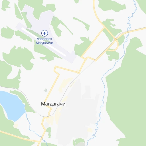
- Magdagachi, 11,739 inhabitants. 8 km
- Skovorodino, 10,007 inhabitants. 129 km
- Srednebelaya, 6,148 inhabitants. 349 km
- Urusha, 4,252 inhabitants. 196 km
- Ovsyanka, 3,588 inhabitants. 82 km
- Tygda, 3,510 inhabitants. 57 km
- Taldan, 3,436 inhabitants. 63 km
- Solovjevsk, 3,066 inhabitants. 120 km
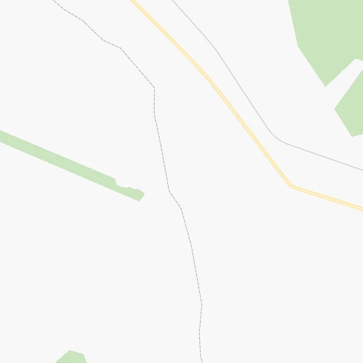
Location Stantsiya Glukhari (Amur Oblast) :
| Country flag |  |
| Location | Stantsiya Glukhari |
| State | Amur Oblast |
| County | |
| Country | Russia |
| Country code / ISO 2 | RU |
| Latitude | 53.4500000 |
| Longitude | 125.6833300 |
| Altitude | 0 meters |
| Time zone | Asia/Yakutsk |
Location Naberezhnye Chelny (Tatarstan Republic) :
| Country flag | |
| Location | Naberezhnye Chelny |
| State | Tatarstan Republic |
| County | Tukayevskiy Rayon |
| Country | Russia |
| Country code / ISO 2 | RU |
| Latitude | 55.7254500 |
| Longitude | 52.4112200 |
| Altitude | 0 meters |
| Time zone | Europe/Moscow |


