


How to get from Maḩaţţat Qal‘at Ḑab‘ah (Amman) to Malkā (Irbid)
Calculate route from Maḩaţţat Qal‘at Ḑab‘ah (Amman, Jordan) to Malkā (Irbid, Jordan).
The flight distance (as the crow flies) between Maḩaţţat Qal‘at Ḑab‘ah and Malkā is 123.7 km.
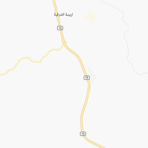
Roadmap (route) to go from Maḩaţţat Qal‘at Ḑab‘ah to Malkā detailed above, you can also see the course layout on the map.
While doing trip Maḩaţţat Qal‘at Ḑab‘ah - Malkā by car, the calculated route ends at a distance , or more straight.
Distance and duration of the route between Maḩaţţat Qal‘at Ḑab‘ah and Malkā
An error occured: undefined - for url https://router.cartes.cc/route?point=31.59486%2C36.06014&point=32.67645%2C35.74851&vehicle=car&debug=false&data_type=application%2Fjson&locale=en&points_encoded=true&instructions=true&elevation=false&optimize=false&timeout=10000&skip.host=true&skip.basePath=true&graphhopper_maps_host=https%3A%2F%2Fgraphhopper.com%2Fmaps%2F%3F&turn_sign_map.0=continue&turn_sign_map.1=turn%20slight%20right&turn_sign_map.2=turn%20right&turn_sign_map.3=turn%20sharp%20right&turn_sign_map.4=finish&turn_sign_map.5=reached%20via%20point&turn_sign_map.6=enter%20roundabout&turn_sign_map.-6=leave%20roundabout&turn_sign_map.-3=turn%20sharp%20left&turn_sign_map.-2=turn%20left&turn_sign_map.-1=turn%20slight%20left&key=&position=topleft
Calculation of distance and route from Malkā to Maḩaţţat Qal‘at Ḑab‘ah :
123.7151.6 km2h18mn
Continue 0h8mn 4.0 kmTurn left 0h4mn 1.9 kmTurn sharp right 0h1mn 383 mTurn left 0h1mn 630 mTurn right onto شارع مطار الملكة علياء 0h25mn 39.4 kmKeep right onto شارع الملك عبدالله بن الحسين الثاني and drive toward Jerash, Irbid, Salt 1h56mn 65.5 kmKeep right 0h13mn 14.7 kmAt roundabout, take exit 2 onto الملك عبدالله الثاني بن الحسين 0h0mn 432 mAt roundabout, take exit 2 onto الملك عبدالله الثاني بن الحسين 0h2mn 1.7 kmAt roundabout, take exit 3 onto الملك عبدالله الثاني بن الحسين 0h1mn 1.2 kmTurn slight right 0h0mn 300 mTurn sharp left onto شارع الهاشمي 0h0mn 335 mKeep right onto الخلود 0h0mn 104 mTurn sharp left 0h1mn 830 mAt roundabout, take exit 2 0h0mn 457 mAt roundabout, take exit 2 0h1mn 642 mAt roundabout, take exit 2 0h1mn 476 mAt roundabout, take exit 1 0h0mn 31 mKeep left 0h1mn 436 mAt roundabout, take exit 1 0h0mn 145 mAt roundabout, take exit 1 0h0mn 143 mAt roundabout, take exit 2 0h0mn 207 mAt roundabout, take exit 2 0h0mn 254 mAt roundabout, take exit 2 0h0mn 239 mAt roundabout, take exit 1 0h6mn 4.8 kmAt roundabout, take exit 1 0h3mn 2.2 kmTurn left 0h3mn 2.9 kmTurn right 0h0mn 133 mTurn slight right 0h0mn 37 mTurn left 0h0mn 135 mTurn right 0h0mn 88 mTurn left 0h4mn 3.3 kmTurn right 0h4mn 3.4 kmTurn right 0h0mn 117 mTurn right 0h0mn 67 mArrive at destination 0h0mn 0 m
Travel from Maḩaţţat Qal‘at Ḑab‘ah (Irbid) to a selection of major cities.
Distances from Maḩaţţat Qal‘at Ḑab‘ah to biggest cities in Amman
Other major cities in country :
Route from Malkā to major cities (Jordan).
- Distance Malkā Amman82 km
- Distance Malkā Zarqa74 km
- Distance Malkā Russeifa78 km
- Distance Malkā Wadi as Sir81 km
- Distance Malkā 'Ajlun38 km
- Distance Malkā Aqaba358 km
- Distance Malkā Rukban285 km
- Distance Malkā Madaba107 km
- Distance Malkā As Salt71 km
- Distance Malkā Mafraq57 km
- Distance Malkā Ma'an276 km
Nearest cities to Maḩaţţat Qal‘at Ḑab‘ah :
- Amman, 1,275,857 inhabitants. 42 km
- Zarqa, 792,665 inhabitants. 53 km
- Irbid, 307,480 inhabitants. 109 km
- Russeifa, 268,237 inhabitants. 47 km
- Wadi as Sir, 181,212 inhabitants. 46 km
- 'Ajlun, 125,557 inhabitants. 87 km
- Aqaba, 95,048 inhabitants. 251 km
- Rukban, 85,000 inhabitants. 313 km
- Madaba, 82,335 inhabitants. 29 km
- As Salt, 80,189 inhabitants. 59 km
- Ar Ramtha, 74,901 inhabitants. 107 km
- Mafraq, 57,118 inhabitants. 84 km
- Ma'an, 50,350 inhabitants. 159 km
- Al Jubayhah, 46,834 inhabitants. 49 km
- Sahab, 40,241 inhabitants. 31 km
- Hayy al Quwaysimah, 32,396 inhabitants. 37 km
- Jarash, 27,046 inhabitants. 78 km
- At Tafilah, 25,429 inhabitants. 95 km
- `Izra, 22,756 inhabitants. 60 km
- Qir Moav, 22,581 inhabitants. 57 km
- Karak City, 21,678 inhabitants. 56 km
- Judita, 20,000 inhabitants. 96 km
- Aydun, 18,376 inhabitants. 103 km
- Umm as Summaq, 18,274 inhabitants. 38 km
- Kurayyimah, 17,837 inhabitants. 87 km
- `Anjarah, 17,634 inhabitants. 84 km
- Safi, 15,200 inhabitants. 84 km
- Al Azraq ash Shamali, 14,800 inhabitants. 80 km
- At Turrah, 14,619 inhabitants. 117 km
- Petra, 14,000 inhabitants. 152 km
- Suf, 12,942 inhabitants. 83 km
- At Tayyibah, 12,615 inhabitants. 110 km
- Sakib, 11,586 inhabitants. 80 km
- Ash Shajarah, 11,243 inhabitants. 117 km
- Jawa, 10,628 inhabitants. 31 km
- Sakhrah, 10,616 inhabitants. 89 km
- Rehab, 10,000 inhabitants. 81 km
- `Ayn Jannah, 9,586 inhabitants. 87 km
- Al Karamah, 9,384 inhabitants. 61 km
- Al Mazar al Janubi, 9,383 inhabitants. 68 km
- Samma, 8,926 inhabitants. 114 km
- Kafr Asad, 8,203 inhabitants. 116 km
- Bayt Yafa, 7,788 inhabitants. 106 km
- Al Quwayrah, 7,372 inhabitants. 212 km
- `Ayy, 7,340 inhabitants. 65 km
- Busayra, 7,154 inhabitants. 105 km
- Kafr Sawm, 7,152 inhabitants. 124 km
- Hakama, 7,075 inhabitants. 112 km
- Sal, 6,896 inhabitants. 109 km
- Malka, 6,856 inhabitants. 124 km
Location Maḩaţţat Qal‘at Ḑab‘ah (Amman) :
| Country flag |  |
| Location | Maḩaţţat Qal‘at Ḑab‘ah |
| State | Amman |
| County | |
| Country | Jordan |
| Country code / ISO 2 | JO |
| Latitude | 31.5948600 |
| Longitude | 36.0601400 |
| Altitude | 0 meters |
| Time zone | Asia/Amman |
Location Malkā (Irbid) :
| Country flag | |
| Location | Malkā |
| State | Irbid |
| County | |
| Country | Jordan |
| Country code / ISO 2 | JO |
| Latitude | 32.6764500 |
| Longitude | 35.7485100 |
| Altitude | 0 meters |
| Time zone | Asia/Amman |