


How to get from Bab Tisra (Rabat-Salé-Kénitra) to Nador (Oriental)
Calculate route from Bab Tisra (Rabat-Salé-Kénitra, Morocco) to Nador (Oriental, Morocco).
The flight distance (as the crow flies) between Bab Tisra and Nador is 276.3 km.
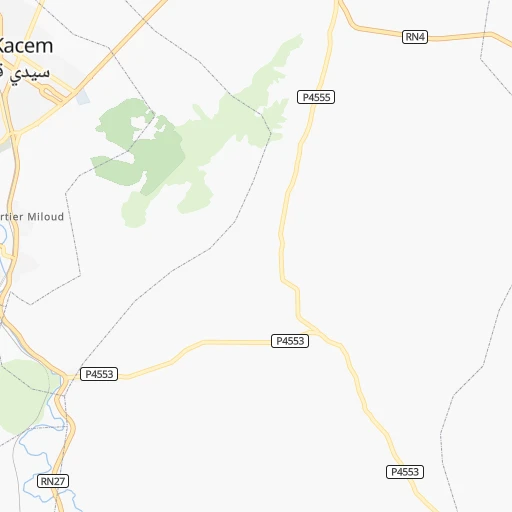
Roadmap (route) to go from Bab Tisra to Nador detailed above, you can also see the course layout on the map.
While doing trip Bab Tisra - Nador by car, the calculated route ends at a distance , or more straight.
Distance and duration of the route between Bab Tisra and Nador
An error occured: undefined - for url https://router.cartes.cc/route?point=34.17729%2C-5.70621&point=35.16813%2C-2.93352&vehicle=car&debug=false&data_type=application%2Fjson&locale=en&points_encoded=true&instructions=true&elevation=false&optimize=false&timeout=10000&skip.host=true&skip.basePath=true&graphhopper_maps_host=https%3A%2F%2Fgraphhopper.com%2Fmaps%2F%3F&turn_sign_map.0=continue&turn_sign_map.1=turn%20slight%20right&turn_sign_map.2=turn%20right&turn_sign_map.3=turn%20sharp%20right&turn_sign_map.4=finish&turn_sign_map.5=reached%20via%20point&turn_sign_map.6=enter%20roundabout&turn_sign_map.-6=leave%20roundabout&turn_sign_map.-3=turn%20sharp%20left&turn_sign_map.-2=turn%20left&turn_sign_map.-1=turn%20slight%20left&key=&position=topleft
Calculation of distance and route from Nador to Bab Tisra :
276.3401.0 km5h46mn
Continue onto RN27 1h34mn 30.6 kmAt roundabout, take exit 1 onto RN13 0h6mn 6.5 kmAt roundabout, take exit 2 onto RN13 0h3mn 2.8 kmTurn right onto RN13 0h1mn 502 mAt roundabout, take exit 2 onto Avenue Bir Anzarene شارع بئر أنزران 0h0mn 198 mTurn right 0h0mn 339 mAt roundabout, take exit 1 0h0mn 33 mTurn slight right 0h1mn 802 mKeep left 0h0mn 8 mTurn sharp left onto Avenue Abderahmane Ben Zidane عبد الرحمن بن زيدان 0h2mn 1.7 kmAt roundabout, take exit 1 onto Avenue Bir Anzarene شارع بئر أنزران 0h1mn 780 mAt roundabout, take exit 2 onto Avenue Bir Anzarene شارع بئر أنزران 0h1mn 688 mAt roundabout, take exit 2 onto Avenue Bir Anzarene شارع بئر أنزران 0h3mn 2.3 kmAt roundabout, take exit 2 onto RN13 0h1mn 1.3 kmAt roundabout, take exit 2 onto Autoroute Rabat-Fès 0h0mn 361 mContinue onto Autoroute Rabat-Fès and drive toward Fès, Oujda, فاس, وجدة 0h25mn 44.8 kmKeep right onto A2 2h44mn 186.4 kmKeep right and take N15 toward Guercif, Saka, Missour, جرسیف, صاکة, میسور 0h1mn 1.2 kmAt roundabout, take exit 2 onto RN15 0h2mn 1.8 kmTurn right 0h8mn 10.0 kmKeep left 0h4mn 4.3 kmKeep right 0h5mn 5.4 kmKeep left 0h3mn 3.1 kmKeep right 0h5mn 6.6 kmKeep right 0h2mn 2.3 kmTurn right onto RR512 0h4mn 4.8 kmTurn left onto RN19 1h32mn 38.9 kmAt roundabout, take exit 2 onto RN19 0h22mn 26.9 kmAt roundabout, take exit 1 onto RN2, RN19 0h2mn 2.0 kmAt roundabout, take exit 2 onto RN2, RN19 0h2mn 1.8 kmAt roundabout, take exit 2 onto RN19 0h1mn 744 mAt roundabout, take exit 2 onto RN19 0h1mn 1.1 kmAt roundabout, take exit 1 onto Rd Point Selouane 0h1mn 569 mAt roundabout, take exit 1 onto RN19 0h1mn 1.1 kmAt roundabout, take exit 1 onto RN19 0h3mn 3.1 kmAt roundabout, take exit 1 onto RN19 0h0mn 298 mAt roundabout, take exit 2 onto RN19 0h1mn 478 mAt roundabout, take exit 3 onto RN19 0h1mn 923 mAt roundabout, take exit 1 onto RN19 0h4mn 3.3 kmTurn left 0h0mn 87 mTurn sharp right 0h0mn 53 mArrive at destination 0h0mn 0 m
Travel from Bab Tisra (Oriental) to a selection of major cities.
Distances from Bab Tisra to biggest cities in Rabat-Salé-Kénitra
Other major cities in country :
- Guelmim [10], 98,229 inhabitants. 710 km
- Berrechid [06], 93,954 inhabitants. 202 km
- Errachidia [08], 92,374 inhabitants. 277 km
- Oued Zem [05], 84,910 inhabitants. 167 km
- Al Fqih Ben Calah [05], 84,072 inhabitants. 208 km
- Taourirt [02], 82,518 inhabitants. 260 km
- Berkane [02], 80,721 inhabitants. 321 km
- Khenifra [05], 73,906 inhabitants. 138 km
- Ifrane [03], 73,782 inhabitants. 91 km
- Taroudant [09], 71,133 inhabitants. 509 km
- Essaouira [07], 70,634 inhabitants. 482 km
- Oulad Teima [09], 66,832 inhabitants. 535 km
- Sefrou [03], 65,150 inhabitants. 90 km
- Youssoufia [07], 64,910 inhabitants. 340 km
- Tan-Tan [10], 61,924 inhabitants. 819 km
- Ouezzane [01], 58,684 inhabitants. 70 km
- Guercif [03], 57,544 inhabitants. 217 km
- Ouarzazat [08], 57,245 inhabitants. 379 km
- Tirhanimine [01], 55,827 inhabitants. 199 km
- Dakhla [EH], 55,618 inhabitants. 554 km
Route from Nador to major cities (Morocco).
- Distance Nador Casablanca464 km
- Distance Nador Rabat380 km
- Distance Nador Fes228 km
- Distance Nador Sale375 km
- Distance Nador Marrakesh613 km
- Distance Nador Agadir817 km
- Distance Nador Tangier268 km
- Distance Nador Meknes279 km
- Distance Nador Al Hoceima92 km
- Distance Nador Kenitra349 km
- Distance Nador Tetouan226 km
- Distance Nador Temara389 km
- Distance Nador Safi665 km
- Distance Nador Mohammedia441 km
- Distance Nador Khouribga446 km
- Distance Nador Beni Mellal446 km
- Distance Nador Fes al Bali222 km
- Distance Nador El Jadid555 km
- Distance Nador Taza145 km
- Distance Nador Settat495 km
Nearest cities to Bab Tisra :
- Casablanca, 3,144,909 inhabitants. 188 km
- Rabat, 1,655,753 inhabitants. 105 km
- Fes, 964,891 inhabitants. 67 km
- Sale, 903,485 inhabitants. 102 km
- Marrakesh, 839,296 inhabitants. 355 km
- Tangier, 688,356 inhabitants. 177 km
- Meknes, 545,705 inhabitants. 35 km
- Al Hoceima, 395,644 inhabitants. 201 km
- Kenitra, 366,570 inhabitants. 81 km
- Tetouan, 326,261 inhabitants. 159 km
- Temara, 313,510 inhabitants. 114 km
- Mohammedia, 187,708 inhabitants. 164 km
- Khouribga, 167,673 inhabitants. 182 km
- Beni Mellal, 166,399 inhabitants. 213 km
- Fes al Bali, 156,000 inhabitants. 70 km
- El Jadid, 147,549 inhabitants. 279 km
- Taza, 141,890 inhabitants. 156 km
- Nador, 129,260 inhabitants. 277 km
- Settat, 119,082 inhabitants. 220 km
- Larache, 109,294 inhabitants. 120 km
- Ksar El Kebir, 108,753 inhabitants. 93 km
- Khemisset, 106,991 inhabitants. 51 km
- Berrechid, 93,954 inhabitants. 202 km
- Errachidia, 92,374 inhabitants. 277 km
- Oued Zem, 84,910 inhabitants. 167 km
- Al Fqih Ben Calah, 84,072 inhabitants. 208 km
- Taourirt, 82,518 inhabitants. 260 km
- Sidi Slimane, 79,437 inhabitants. 22 km
- Sidi Qacem, 74,755 inhabitants. 5 km
- Khenifra, 73,906 inhabitants. 138 km
- Ifrane, 73,782 inhabitants. 91 km
- Tiflet, 70,010 inhabitants. 64 km
- Sefrou, 65,150 inhabitants. 90 km
- Youssoufia, 64,910 inhabitants. 340 km
- Ouezzane, 58,684 inhabitants. 70 km
- Guercif, 57,544 inhabitants. 217 km
- Tirhanimine, 55,827 inhabitants. 199 km
- Fnidek, 53,559 inhabitants. 189 km
- Azrou, 48,249 inhabitants. 94 km
- Midelt, 45,159 inhabitants. 189 km
- Skhirate, 44,850 inhabitants. 128 km
- Souq Larb'a al Gharb, 44,059 inhabitants. 63 km
- Kasba Tadla, 41,199 inhabitants. 183 km
- Sidi Bennour, 40,044 inhabitants. 305 km
- Imzouren, 40,000 inhabitants. 201 km
- Martil, 39,738 inhabitants. 165 km
- Azemmour, 37,140 inhabitants. 263 km
- Tinghir, 36,795 inhabitants. 297 km
- Chefchaouene, 36,280 inhabitants. 118 km
- Al Aaroui, 36,021 inhabitants. 264 km
Location Bab Tisra (Rabat-Salé-Kénitra) :
| Country flag |  |
| Location | Bab Tisra |
| State | Rabat-Salé-Kénitra |
| County | |
| Country | Morocco |
| Country code / ISO 2 | MA |
| Latitude | 34.1772900 |
| Longitude | -5.7062100 |
| Altitude | 0 meters |
| Time zone | Africa/Casablanca |
Location Nador (Oriental) :
| Country flag | |
| Location | Nador |
| State | Oriental |
| County | Nador |
| Country | Morocco |
| Country code / ISO 2 | MA |
| Latitude | 35.1681300 |
| Longitude | -2.9335200 |
| Altitude | 0 meters |
| Time zone | Africa/Casablanca |


