


How to get from Haltepunkt Kaiserweg (Lower Saxony) to Nienburg (Lower Saxony)
Calculate route from Haltepunkt Kaiserweg (Lower Saxony, Germany) to Nienburg (Lower Saxony, Germany).
The flight distance (as the crow flies) between Haltepunkt Kaiserweg and Nienburg is 143.8 km.
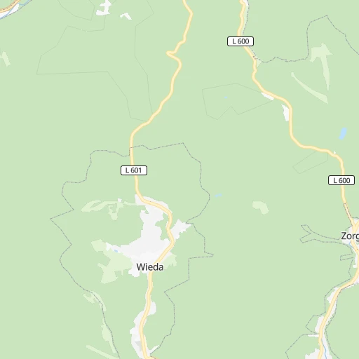
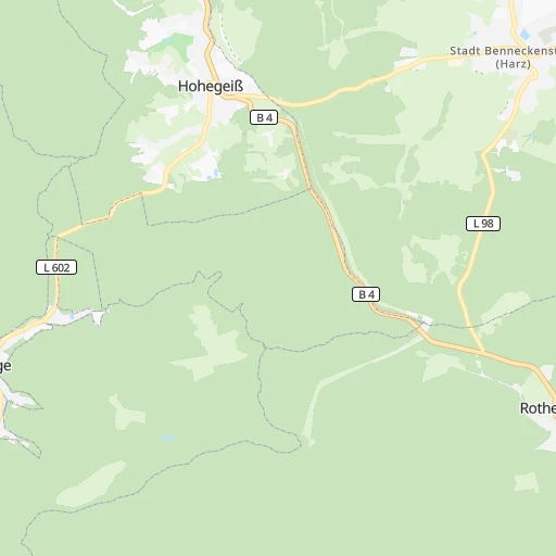
Roadmap (route) to go from Haltepunkt Kaiserweg to Nienburg detailed above, you can also see the course layout on the map.
While doing trip Haltepunkt Kaiserweg - Nienburg by car, the calculated route ends at a distance , or more straight.
Distance and duration of the route between Haltepunkt Kaiserweg and Nienburg
Calculation of distance and route from Nienburg to Haltepunkt Kaiserweg :
143.8180.6 km2h13mn
Continue 0h7mn 2.0 kmTurn right 0h0mn 41 mTurn right onto L 601 0h6mn 6.0 kmAt roundabout, take exit 3 onto B 4, B 242 0h7mn 8.6 kmTurn left onto Harzhochstraße and take B 242 toward Kassel, Seesen, St. Andreasberg, Sonnenberg 0h13mn 17.6 kmContinue onto An der Marktkirche 0h0mn 92 mContinue onto Silberstraße 0h13mn 14.4 kmKeep right onto B 242 and take B 242, B 243 toward Seesen 0h7mn 8.4 kmTurn left and take A 7 toward Hannover, Kassel 0h0mn 128 mKeep right and take A 7 toward Hannover 0h27mn 57.6 kmKeep right onto A 37 and drive toward Hannover, Messe 0h7mn 12.1 kmKeep right and drive toward H-Kleefeld, Zentrum, Congress-Centrum, Zoo 0h0mn 305 mKeep left and drive toward H-Zentrum, Congress-Centrum, Zoo, Tierärtzliche Hochschule 0h2mn 1.2 kmContinue onto Marienstraße 0h2mn 1.3 kmTurn left onto Aegidientorplatz 0h0mn 30 mKeep right onto Friedrichswall 0h1mn 755 mKeep right onto Friederikenplatz and drive toward Fernverkehr, Herrenhäuser Gärten, Cityring 0h2mn 1.2 kmKeep left onto Königsworther Platz 0h0mn 59 mContinue onto Bremer Damm 0h2mn 1.8 kmTurn right onto Westschnellweg and drive toward Nienburg, Neustadt a. Rbge., H.-Herrenhausen 1h35mn 45.0 kmKeep right and drive toward Stadtmitte, Kräher Weg, Nienburg-Mitte 0h0mn 377 mKeep right and take B 215 toward Minden, Stadtmitte, Kräher Weg 0h0mn 257 mKeep right onto B 215 and take B 215 toward Stadtmitte, Kräher Weg 0h1mn 644 mTurn right onto Doktor-Franck-Straße 0h1mn 508 mTurn right onto Amselhof 0h0mn 124 mArrive at destination 0h0mn 0 m
Travel from Haltepunkt Kaiserweg (Lower Saxony) to a selection of major cities.
Distances from Haltepunkt Kaiserweg to biggest cities in Lower Saxony
- Peine,49,953 inhabitants.77 km
- Melle,46,514 inhabitants.166 km
- Neustadt am Ruebenberge,45,942 inhabitants.122 km
- Stade,45,634 inhabitants.228 km
- Lehrte,43,920 inhabitants.89 km
- Goslar,43,560 inhabitants.29 km
- Gifhorn,43,000 inhabitants.90 km
- Wunstorf,42,080 inhabitants.116 km
- Seevetal,41,266 inhabitants.198 km
- Aurich,40,319 inhabitants.291 km
- Laatzen,40,038 inhabitants.91 km
- Buxtehude,38,192 inhabitants.210 km
- Buchholz in der Nordheide,37,404 inhabitants.191 km
- Uelzen,34,996 inhabitants.145 km
- Meppen,34,198 inhabitants.253 km
- Papenburg,34,117 inhabitants.268 km
- Leer,33,886 inhabitants.275 km
- Seelze,32,899 inhabitants.106 km
- Winsen,32,662 inhabitants.190 km
- Nienburg,32,629 inhabitants.144 km
Other major cities in country :
- Mannheim [01], 307,960 inhabitants. 285 km
- Marienthal [04], 287,101 inhabitants. 214 km
- Karlsruhe [01], 283,799 inhabitants. 334 km
- Hamburg-Nord [04], 280,000 inhabitants. 218 km
- Wiesbaden [05], 272,432 inhabitants. 242 km
- Muenster [07], 270,184 inhabitants. 207 km
- Gelsenkirchen [07], 270,028 inhabitants. 243 km
- Aachen [07], 265,208 inhabitants. 330 km
- Moenchengladbach [07], 261,742 inhabitants. 294 km
- Augsburg [02], 259,196 inhabitants. 367 km
- Eimsbuettel [04], 251,907 inhabitants. 217 km
- Altona [04], 250,192 inhabitants. 214 km
- Chemnitz [13], 247,220 inhabitants. 187 km
- Krefeld [07], 237,984 inhabitants. 283 km
- Halle (Saale) [14], 234,107 inhabitants. 98 km
- Hamburg-Mitte [04], 233,144 inhabitants. 213 km
- Kiel [10], 232,758 inhabitants. 297 km
- Magdeburg [14], 229,826 inhabitants. 87 km
- Neue Neustadt [14], 226,851 inhabitants. 89 km
- Oberhausen [07], 219,176 inhabitants. 259 km
Route from Nienburg to major cities (Germany).
- Distance Nienburg Berlin284 km
- Distance Nienburg Hamburg116 km
- Distance Nienburg Munich529 km
- Distance Nienburg Koeln247 km
- Distance Nienburg Frankfurt am Main284 km
- Distance Nienburg Essen201 km
- Distance Nienburg Stuttgart430 km
- Distance Nienburg Dortmund174 km
- Distance Nienburg Duesseldorf231 km
- Distance Nienburg Bremen55 km
- Distance Nienburg Leipzig260 km
- Distance Nienburg Duisburg216 km
- Distance Nienburg Nuernberg378 km
- Distance Nienburg Dresden358 km
- Distance Nienburg Wandsbek119 km
- Distance Nienburg Bochum189 km
- Distance Nienburg Bochum-Hordel189 km
- Distance Nienburg Wuppertal210 km
- Distance Nienburg Bielefeld83 km
- Distance Nienburg Bonn258 km
Nearest cities to Haltepunkt Kaiserweg :
- Berlin, 3,426,354 inhabitants. 215 km
- Hamburg, 1,739,117 inhabitants. 216 km
- Frankfurt am Main, 650,000 inhabitants. 219 km
- Stuttgart, 589,793 inhabitants. 337 km
- Bremen, 546,501 inhabitants. 199 km
- Hannover, 515,140 inhabitants. 98 km
- Leipzig, 504,971 inhabitants. 128 km
- Nuernberg, 499,237 inhabitants. 249 km
- Wandsbek, 411,422 inhabitants. 216 km
- Bielefeld, 331,906 inhabitants. 148 km
- Mannheim, 307,960 inhabitants. 285 km
- Marienthal, 287,101 inhabitants. 214 km
- Karlsruhe, 283,799 inhabitants. 334 km
- Hamburg-Nord, 280,000 inhabitants. 218 km
- Wiesbaden, 272,432 inhabitants. 242 km
- Muenster, 270,184 inhabitants. 207 km
- Eimsbuettel, 251,907 inhabitants. 217 km
- Altona, 250,192 inhabitants. 214 km
- Chemnitz, 247,220 inhabitants. 187 km
- Braunschweig, 244,715 inhabitants. 67 km
- Halle (Saale), 234,107 inhabitants. 98 km
- Hamburg-Mitte, 233,144 inhabitants. 213 km
- Kiel, 232,758 inhabitants. 297 km
- Magdeburg, 229,826 inhabitants. 87 km
- Neue Neustadt, 226,851 inhabitants. 89 km
- Luebeck, 212,207 inhabitants. 245 km
- Erfurt, 203,254 inhabitants. 82 km
- Harburg, 202,571 inhabitants. 204 km
- Rostock, 198,293 inhabitants. 289 km
- Kassel, 194,501 inhabitants. 86 km
- Hamm, 185,327 inhabitants. 192 km
- Mainz, 184,997 inhabitants. 248 km
- Neukoelln, 167,248 inhabitants. 214 km
- Osnabrueck, 166,462 inhabitants. 187 km
- Ludwigshafen am Rhein, 163,196 inhabitants. 287 km
- Oldenburg, 159,218 inhabitants. 231 km
- Prenzlauer Berg Bezirk, 148,878 inhabitants. 216 km
- Bezirk Kreuzberg, 147,532 inhabitants. 213 km
- Potsdam, 145,292 inhabitants. 187 km
- Heidelberg, 143,345 inhabitants. 285 km
- Paderborn, 142,161 inhabitants. 127 km
- Darmstadt, 140,385 inhabitants. 242 km
- Wuerzburg, 133,731 inhabitants. 213 km
- Regensburg, 129,151 inhabitants. 314 km
- Wolfsburg, 123,064 inhabitants. 85 km
- Goettingen, 122,149 inhabitants. 48 km
- Heilbronn, 120,733 inhabitants. 298 km
- Ingolstadt, 120,658 inhabitants. 328 km
- Charlottenburg Bezirk, 119,857 inhabitants. 206 km
- Bergedorf, 119,665 inhabitants. 204 km
Location Haltepunkt Kaiserweg (Lower Saxony) :
| Country flag |  |
| Location | Haltepunkt Kaiserweg |
| State | Lower Saxony |
| County | |
| Country | Germany |
| Country code / ISO 2 | DE |
| Latitude | 51.6666700 |
| Longitude | 10.6000000 |
| Altitude | 0 meters |
| Time zone | Europe/Berlin |
Location Nienburg (Lower Saxony) :
| Country flag | |
| Location | Nienburg |
| State | Lower Saxony |
| County | |
| Country | Germany |
| Country code / ISO 2 | DE |
| Latitude | 52.6461000 |
| Longitude | 9.2208600 |
| Altitude | 0 meters |
| Time zone | Europe/Berlin |
