


How to get from Gedera (Central District) to Shoham (Central District)
Calculate route from Gedera (Central District, Israel) to Shoham (Central District, Israel).
The flight distance (as the crow flies) between Gedera and Shoham is 25.7 km.
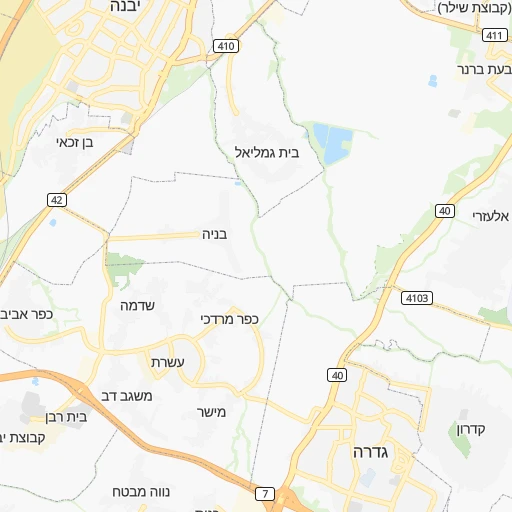
Roadmap (route) to go from Gedera to Shoham detailed above, you can also see the course layout on the map.
While doing trip Gedera - Shoham by car, the calculated route ends at a distance , or more straight.
Distance and duration of the route between Gedera and Shoham
An error occured: undefined - for url https://router.cartes.cc/route?point=31.81456%2C34.77998&point=31.99866%2C34.94559&vehicle=car&debug=false&data_type=application%2Fjson&locale=en&points_encoded=true&instructions=true&elevation=false&optimize=false&timeout=10000&skip.host=true&skip.basePath=true&graphhopper_maps_host=https%3A%2F%2Fgraphhopper.com%2Fmaps%2F%3F&turn_sign_map.0=continue&turn_sign_map.1=turn%20slight%20right&turn_sign_map.2=turn%20right&turn_sign_map.3=turn%20sharp%20right&turn_sign_map.4=finish&turn_sign_map.5=reached%20via%20point&turn_sign_map.6=enter%20roundabout&turn_sign_map.-6=leave%20roundabout&turn_sign_map.-3=turn%20sharp%20left&turn_sign_map.-2=turn%20left&turn_sign_map.-1=turn%20slight%20left&key=&position=topleft
Calculation of distance and route from Shoham to Gedera :
25.731.5 km0h25mn
Continue onto כצנלסון 0h0mn 3 mTurn right onto שפק שלמה 0h0mn 128 mTurn right onto רמז 0h0mn 207 mAt roundabout, take exit 3 onto ויצמן 0h0mn 191 mAt roundabout, take exit 2 onto ויצמן 0h0mn 161 mAt roundabout, take exit 1 onto ויצמן 0h0mn 148 mAt roundabout, take exit 2 onto ויצמן 0h0mn 96 mKeep right 0h18mn 24.7 kmKeep right onto זמני 0h3mn 3.4 kmTurn left onto שדרות עמק איילון 0h0mn 347 mAt roundabout, take exit 2 onto שדרות עמק איילון 0h1mn 887 mAt roundabout, take exit 2 onto שדרות עמק איילון 0h0mn 421 mAt roundabout, take exit 2 onto שדרות עמק איילון 0h0mn 418 mAt roundabout, take exit 2 onto שדרות עמק איילון 0h0mn 198 mAt roundabout, take exit 4 onto שדרות עמק איילון 0h0mn 205 mTurn right onto האודם 0h0mn 57 mArrive at destination 0h0mn 0 m
Travel from Gedera (Central District) to a selection of major cities.
Distances from Gedera to biggest cities in Central District
Other major cities in country :
Route from Shoham to major cities (Israel).
- Distance Shoham Jerusalem36 km
- Distance Shoham Tel Aviv18 km
- Distance Shoham West Jerusalem35 km
- Distance Shoham Haifa91 km
- Distance Shoham Ashdod36 km
- Distance Shoham Beersheba84 km
- Distance Shoham Holon16 km
- Distance Shoham Bnei Brak14 km
- Distance Shoham Bat Yam19 km
- Distance Shoham Ramat Gan16 km
- Distance Shoham Ashkelon51 km
- Distance Shoham Jaffa19 km
- Distance Shoham Herzliya22 km
- Distance Shoham Hadera49 km
- Distance Shoham Bet Shemesh30 km
- Distance Shoham Nazareth85 km
- Distance Shoham Modiin Ilit12 km
- Distance Shoham Nahariyya113 km
Nearest cities to Gedera :
- Jerusalem, 801,000 inhabitants. 42 km
- Tel Aviv, 432,892 inhabitants. 30 km
- West Jerusalem, 400,000 inhabitants. 42 km
- Haifa, 267,300 inhabitants. 113 km
- Ashdod, 224,656 inhabitants. 13 km
- Rishon LeZiyyon, 220,492 inhabitants. 17 km
- Petah Tiqwa, 200,000 inhabitants. 32 km
- Beersheba, 186,600 inhabitants. 63 km
- Netanya, 171,676 inhabitants. 58 km
- Holon, 165,787 inhabitants. 22 km
- Bnei Brak, 154,400 inhabitants. 30 km
- Rehovot, 132,671 inhabitants. 9 km
- Bat Yam, 128,979 inhabitants. 23 km
- Ramat Gan, 128,095 inhabitants. 30 km
- Ashkelon, 105,995 inhabitants. 26 km
- Jaffa, 100,000 inhabitants. 26 km
- Modi'in Makkabbim Re'ut, 88,749 inhabitants. 24 km
- Herzliya, 83,600 inhabitants. 39 km
- Kfar Saba, 80,773 inhabitants. 42 km
- Ra'anana, 80,000 inhabitants. 42 km
- Hadera, 75,854 inhabitants. 71 km
- Bet Shemesh, 67,100 inhabitants. 22 km
- Lod, 66,589 inhabitants. 18 km
- Nazareth, 64,800 inhabitants. 110 km
- Modiin Ilit, 64,179 inhabitants. 28 km
- Ramla, 63,860 inhabitants. 15 km
- Nahariyya, 51,200 inhabitants. 136 km
- Qiryat Ata, 48,966 inhabitants. 115 km
- Givatayim, 48,000 inhabitants. 29 km
- Qiryat Gat, 47,450 inhabitants. 23 km
- Acre, 45,603 inhabitants. 127 km
- Eilat, 45,588 inhabitants. 252 km
- Afula, 44,930 inhabitants. 101 km
- Karmi'el, 44,382 inhabitants. 132 km
- Hod HaSharon, 43,185 inhabitants. 40 km
- Umm el Fahm, 41,030 inhabitants. 86 km
- Tiberias, 39,790 inhabitants. 130 km
- Qiryat Mozqin, 39,404 inhabitants. 117 km
- Qiryat Yam, 39,273 inhabitants. 118 km
- Rosh Ha'Ayin, 39,215 inhabitants. 35 km
- Ness Ziona, 38,700 inhabitants. 13 km
- Kiryat Ono, 37,791 inhabitants. 28 km
- Qiryat Bialik, 36,551 inhabitants. 116 km
- Ramat HaSharon, 36,137 inhabitants. 37 km
- Dimona, 33,558 inhabitants. 86 km
- Et Taiyiba, 32,978 inhabitants. 55 km
- Yavne, 31,774 inhabitants. 8 km
- Or Yehuda, 30,802 inhabitants. 25 km
- Yehud-Monosson, 29,312 inhabitants. 26 km
- Safed, 27,816 inhabitants. 145 km
Location Gedera (Central District) :
| Country flag |  |
| Location | Gedera |
| State | Central District |
| County | |
| Country | Israel |
| Country code / ISO 2 | IL |
| Latitude | 31.8145600 |
| Longitude | 34.7799800 |
| Altitude | 0 meters |
| Time zone | Asia/Jerusalem |
Location Shoham (Central District) :
| Country flag | |
| Location | Shoham |
| State | Central District |
| County | |
| Country | Israel |
| Country code / ISO 2 | IL |
| Latitude | 31.9986600 |
| Longitude | 34.9455900 |
| Altitude | 0 meters |
| Time zone | Asia/Jerusalem |
