


How to get from Kołobrzeg (West Pomerania) to Wałcz (West Pomerania)
Calculate route from Kołobrzeg (West Pomerania, Poland) to Wałcz (West Pomerania, Poland).
The flight distance (as the crow flies) between Kołobrzeg and Wałcz is 115.6 km.
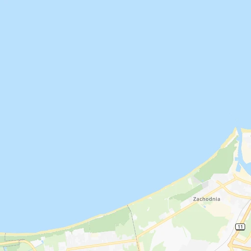
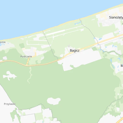
Roadmap (route) to go from Kołobrzeg to Wałcz detailed above, you can also see the course layout on the map.
While doing trip Kołobrzeg - Wałcz by car, the calculated route ends at a distance , or more straight.
Distance and duration of the route between Kołobrzeg and Wałcz
An error occured: undefined - for url https://router.cartes.cc/route?point=54.17565%2C15.58342&point=53.27787%2C16.47122&vehicle=car&debug=false&data_type=application%2Fjson&locale=en&points_encoded=true&instructions=true&elevation=false&optimize=false&timeout=10000&skip.host=true&skip.basePath=true&graphhopper_maps_host=https%3A%2F%2Fgraphhopper.com%2Fmaps%2F%3F&turn_sign_map.0=continue&turn_sign_map.1=turn%20slight%20right&turn_sign_map.2=turn%20right&turn_sign_map.3=turn%20sharp%20right&turn_sign_map.4=finish&turn_sign_map.5=reached%20via%20point&turn_sign_map.6=enter%20roundabout&turn_sign_map.-6=leave%20roundabout&turn_sign_map.-3=turn%20sharp%20left&turn_sign_map.-2=turn%20left&turn_sign_map.-1=turn%20slight%20left&key=&position=topleft
Calculation of distance and route from Wałcz to Kołobrzeg :
115.6132.7 km2h5mn
Continue onto Lipowa 0h0mn 19 mTurn right onto Koszalińska 0h0mn 266 mKeep right onto Bolesława Krzywoustego 0h0mn 150 mTurn slight right onto Bolesława Krzywoustego 0h1mn 429 mAt roundabout, take exit 2 onto Rondo im. Jerzego Patana 0h1mn 876 mAt roundabout, take exit 2 onto Rondo Światowida 0h1mn 636 mAt roundabout, take exit 3 onto Bolesława Krzywoustego 0h0mn 310 mAt roundabout, take exit 2 onto Bolesława Krzywoustego 0h20mn 24.4 kmTurn right onto Koszalińska 0h2mn 1.4 kmTurn left onto Plac Jana Pawła II 0h1mn 1.1 kmContinue onto 163 0h5mn 4.9 kmAt roundabout, take exit 2 onto Kołobrzeska 0h4mn 2.8 kmAt roundabout, take exit 2 onto Szosa Połczyńska 0h25mn 25.1 kmKeep left onto 163 0h0mn 31 mTurn left onto 163 0h3mn 3.3 kmAt roundabout, take exit 2 onto Wojska Polskiego 0h1mn 770 mKeep right onto Warszawska 0h0mn 189 mAt roundabout, take exit 3 onto Warszawska 0h22mn 27.4 kmTurn right 0h0mn 34 mContinue onto Drahimska 0h1mn 1.0 kmAt roundabout, take exit 3 onto Wałecka 1h37mn 36.8 kmAt roundabout, take exit 3 onto Aleja Marszałka Józefa Piłsudskiego 0h1mn 570 mArrive at destination 0h0mn 0 m
Travel from Kołobrzeg (West Pomerania) to a selection of major cities.
Distances from Kołobrzeg to biggest cities in West Pomerania
Other major cities in country :
- Praga Poludnie [78], 187,845 inhabitants. 425 km
- Bielsko-Biala [83], 176,515 inhabitants. 539 km
- Olsztyn [85], 171,803 inhabitants. 324 km
- Rzeszow [80], 158,382 inhabitants. 635 km
- Ursynow [78], 147,676 inhabitants. 429 km
- Ruda Slaska [83], 146,189 inhabitants. 490 km
- Wola [78], 143,996 inhabitants. 420 km
- Rybnik [83], 142,510 inhabitants. 497 km
- Bielany [78], 134,854 inhabitants. 413 km
- Srodmiescie [78], 134,306 inhabitants. 422 km
- Dabrowa Gornicza [83], 130,601 inhabitants. 496 km
- Tychy [83], 130,000 inhabitants. 505 km
- Opole [79], 127,676 inhabitants. 421 km
- Elblag [85], 127,558 inhabitants. 249 km
- Plock [78], 127,474 inhabitants. 328 km
- Walbrzych [72], 127,431 inhabitants. 382 km
- Gorzow Wielkopolski [76], 124,430 inhabitants. 162 km
- Targowek [78], 124,316 inhabitants. 420 km
- Wloclawek [73], 120,339 inhabitants. 287 km
- Zielona Gora [76], 118,433 inhabitants. 249 km
Route from Wałcz to major cities (Poland).
- Distance Wałcz Warsaw327 km
- Distance Wałcz Lodz264 km
- Distance Wałcz Krakow431 km
- Distance Wałcz Wroclaw245 km
- Distance Wałcz Poznan102 km
- Distance Wałcz Gdansk186 km
- Distance Wałcz Bydgoszcz104 km
- Distance Wałcz Lublin472 km
- Distance Wałcz Katowice379 km
- Distance Wałcz Bialystok446 km
- Distance Wałcz Gdynia193 km
- Distance Wałcz Czestochowa331 km
- Distance Wałcz Sosnowiec379 km
- Distance Wałcz Radom380 km
- Distance Wałcz Mokotow330 km
- Distance Wałcz Torun145 km
- Distance Wałcz Kielce391 km
- Distance Wałcz Gliwice365 km
- Distance Wałcz Zabrze365 km
- Distance Wałcz Bytom367 km
Nearest cities to Kołobrzeg :
- Poznan, 570,352 inhabitants. 216 km
- Szczecin, 407,811 inhabitants. 107 km
- Bydgoszcz, 366,452 inhabitants. 198 km
- Gdynia, 253,730 inhabitants. 195 km
- Gorzow Wielkopolski, 124,430 inhabitants. 162 km
- Zielona Gora, 118,433 inhabitants. 249 km
- Kalisz, 108,759 inhabitants. 317 km
- Koszalin, 107,450 inhabitants. 38 km
- Legnica, 106,033 inhabitants. 332 km
- Slupsk, 98,608 inhabitants. 99 km
- Konin, 81,258 inhabitants. 281 km
- Inowroclaw, 77,597 inhabitants. 235 km
- Lubin, 77,532 inhabitants. 312 km
- Pila, 75,532 inhabitants. 137 km
- Ostrow Wielkopolski, 72,898 inhabitants. 318 km
- Stargard, 71,224 inhabitants. 100 km
- Gniezno, 70,269 inhabitants. 226 km
- Fordon, 70,000 inhabitants. 205 km
- Glogow, 68,530 inhabitants. 282 km
- Leszno, 63,565 inhabitants. 268 km
- Starogard Gdanski, 48,202 inhabitants. 194 km
- Wejherowo, 46,820 inhabitants. 178 km
- Rumia, 44,791 inhabitants. 187 km
- Kolobrzeg, 44,377 inhabitants. 0 km
- Swinoujscie, 40,919 inhabitants. 92 km
- Boleslawiec, 40,682 inhabitants. 324 km
- Nowa Sol, 40,354 inhabitants. 264 km
- Sopot, 40,142 inhabitants. 196 km
- Chojnice, 39,407 inhabitants. 140 km
- Zary, 38,779 inhabitants. 284 km
- Szczecinek, 38,496 inhabitants. 90 km
- Olesnica, 36,956 inhabitants. 352 km
- Lebork, 35,161 inhabitants. 146 km
- Police, 34,350 inhabitants. 96 km
- Srem, 30,404 inhabitants. 251 km
- Turek, 29,533 inhabitants. 310 km
- Krotoszyn, 29,231 inhabitants. 302 km
- Swarzedz, 29,010 inhabitants. 220 km
- Wrzesnia, 28,703 inhabitants. 245 km
- Lubon, 26,431 inhabitants. 221 km
- Zagan, 26,251 inhabitants. 285 km
- Walcz, 25,971 inhabitants. 116 km
- Swiecie, 25,843 inhabitants. 207 km
- Jarocin, 25,665 inhabitants. 277 km
- Wagrowiec, 24,428 inhabitants. 186 km
- Wielun, 24,384 inhabitants. 386 km
- Bialogard, 24,265 inhabitants. 32 km
- Koscian, 24,096 inhabitants. 243 km
- Koscierzyna, 23,361 inhabitants. 156 km
- Goleniow, 22,505 inhabitants. 84 km
Location Kołobrzeg (West Pomerania) :
| Country flag |  |
| Location | Kołobrzeg |
| State | West Pomerania |
| County | Powiat kołobrzeski |
| Country | Poland |
| Country code / ISO 2 | PL |
| Latitude | 54.1756500 |
| Longitude | 15.5834200 |
| Altitude | 0 meters |
| Time zone | Europe/Warsaw |
Location Wałcz (West Pomerania) :
| Country flag | |
| Location | Wałcz |
| State | West Pomerania |
| County | Powiat wałecki |
| Country | Poland |
| Country code / ISO 2 | PL |
| Latitude | 53.2778700 |
| Longitude | 16.4712200 |
| Altitude | 0 meters |
| Time zone | Europe/Warsaw |