
How to get from Chojna (West Pomerania) to Włocławek (Kujawsko-Pomorskie)
Calculate route from Chojna (West Pomerania, Poland) to Włocławek (Kujawsko-Pomorskie, Poland).
The flight distance (as the crow flies) between Chojna and Włocławek is 314.2 km.
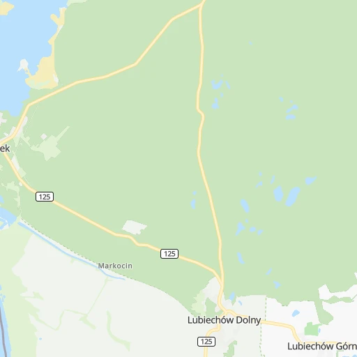
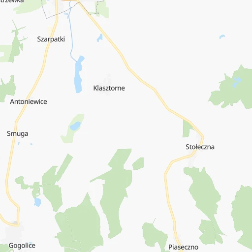
Roadmap (route) to go from Chojna to Włocławek detailed above, you can also see the course layout on the map.
While doing trip Chojna - Włocławek by car, the calculated route ends at a distance , or more straight.
Distance and duration of the route between Chojna and Włocławek
An error occured: undefined - for url https://router.cartes.cc/route?point=52.95%2C14.41667&point=52.64817%2C19.0678&vehicle=car&debug=false&data_type=application%2Fjson&locale=en&points_encoded=true&instructions=true&elevation=false&optimize=false&timeout=10000&skip.host=true&skip.basePath=true&graphhopper_maps_host=https%3A%2F%2Fgraphhopper.com%2Fmaps%2F%3F&turn_sign_map.0=continue&turn_sign_map.1=turn%20slight%20right&turn_sign_map.2=turn%20right&turn_sign_map.3=turn%20sharp%20right&turn_sign_map.4=finish&turn_sign_map.5=reached%20via%20point&turn_sign_map.6=enter%20roundabout&turn_sign_map.-6=leave%20roundabout&turn_sign_map.-3=turn%20sharp%20left&turn_sign_map.-2=turn%20left&turn_sign_map.-1=turn%20slight%20left&key=&position=topleft
Calculation of distance and route from Włocławek to Chojna :
314.2370.5 km5h11mn
Continue 0h2mn 293 mTurn left 0h0mn 8 mTurn right onto Narciarska 0h0mn 164 mTurn right onto Czereśniowa 0h1mn 489 mTurn right onto Czereśniowa 0h0mn 37 mContinue onto Orzechowa 0h0mn 57 mTurn left onto Owocowa 0h0mn 20 mTurn right onto Willowa 0h0mn 119 mTurn slight left onto Willowa 0h1mn 571 mTurn right 0h0mn 60 mTurn left onto Tadeusza Kościuszki 0h0mn 24 mTurn right onto Jagiellońska 0h3mn 2.1 kmContinue onto 26 0h9mn 9.8 kmTurn slight right onto Aleja Wolności 0h1mn 432 mContinue onto Dworcowa 0h12mn 14.1 kmTurn left onto 26 0h6mn 5.8 kmAt roundabout, take exit 3 onto rondo imienia Steponasa Dariusa i Stasysa Girenasa 0h2mn 1.5 kmTurn right onto Łużycka and drive toward Ławy 0h0mn 282 mKeep left onto Gorzowska 0h6mn 6.7 kmTurn right 0h2mn 3.1 kmTurn right onto 119 0h15mn 19.4 kmAt roundabout, take exit 3 onto Szczecińska 0h0mn 248 mKeep right and take S3 toward Zielona Góra 0h21mn 35.8 kmKeep right onto 24 and take , 24 toward Skwierzyna, Poznań 0h0mn 209 mKeep right onto 24 and take 24 toward Poznań 1h9mn 81.5 kmAt roundabout, take exit 2 onto Rondo Lecha Wałęsy 0h10mn 14.0 kmKeep right onto Jana Henryka Dąbrowskiego 0h5mn 4.9 kmContinue onto Świętego Wawrzyńca 0h0mn 23 mTurn slight left 0h0mn 11 mTurn left onto Kościelna 0h0mn 12 mContinue onto Nad Wierzbakiem 0h0mn 202 mKeep right onto Nad Wierzbakiem 0h0mn 96 mTurn right onto Aleja Wielkopolska 0h5mn 3.6 kmAt roundabout, take exit 2 onto Warszawska 0h18mn 21.2 kmKeep right and take S5 toward Bydgoszcz 0h1mn 572 mKeep left onto S5 and take S5 toward Bydgoszcz 0h12mn 21.5 kmKeep right and take 15, 194 toward Września, Gniezno, Poznań 0h0mn 380 mKeep right and take 15 toward Września, Gniezno 0h9mn 9.2 kmKeep right onto Trasa Zjazdu Gnieźnieńskiego and drive toward Toruń, Inowrocław 0h0mn 263 mContinue onto Obwodnica Toruńska 0h26mn 29.3 kmAt roundabout, take exit 2 onto 15 0h12mn 11.5 kmAt roundabout, take exit 1 onto Plac Ignacego Daszyńskiego 0h0mn 79 mAt roundabout, take exit 2 onto Świętego Ducha 0h1mn 362 mContinue onto Rynek 0h2mn 1.2 kmAt roundabout, take exit 1 onto 62 0h3mn 3.9 kmAt roundabout, take exit 2 onto 62 0h5mn 6.2 kmAt roundabout, take exit 1 onto 62 0h2mn 2.1 kmTurn left onto Rynek 0h1mn 698 mAt roundabout, take exit 2 onto Tadeusza Kościuszki 0h1mn 449 mAt roundabout, take exit 1 onto Tadeusza Kościuszki 1h36mn 42.7 kmTurn left onto Kolejowa 0h9mn 9.4 kmAt roundabout, take exit 1 onto Szosa Brzeska 0h1mn 1.4 kmAt roundabout, take exit 2 onto Kruszyńska 0h1mn 1.1 kmAt roundabout, take exit 2 0h2mn 1.1 kmContinue onto Plac 11 Listopada 0h0mn 34 mTurn left onto Plac 11 Listopada 0h0mn 22 mArrive at destination 0h0mn 0 m
Travel from Chojna (Kujawsko-Pomorskie) to a selection of major cities.
Distances from Chojna to biggest cities in West Pomerania
Other major cities in country :
- Praga Poludnie [78], 187,845 inhabitants. 458 km
- Bielsko-Biala [83], 176,515 inhabitants. 474 km
- Olsztyn [85], 171,803 inhabitants. 414 km
- Rzeszow [80], 158,382 inhabitants. 617 km
- Ursynow [78], 147,676 inhabitants. 458 km
- Ruda Slaska [83], 146,189 inhabitants. 429 km
- Wola [78], 143,996 inhabitants. 451 km
- Rybnik [83], 142,510 inhabitants. 427 km
- Bielany [78], 134,854 inhabitants. 446 km
- Srodmiescie [78], 134,306 inhabitants. 453 km
- Dabrowa Gornicza [83], 130,601 inhabitants. 443 km
- Tychy [83], 130,000 inhabitants. 444 km
- Opole [79], 127,676 inhabitants. 350 km
- Elblag [85], 127,558 inhabitants. 356 km
- Plock [78], 127,474 inhabitants. 359 km
- Walbrzych [72], 127,431 inhabitants. 274 km
- Gorzow Wielkopolski [76], 124,430 inhabitants. 60 km
- Targowek [78], 124,316 inhabitants. 454 km
- Wloclawek [73], 120,339 inhabitants. 315 km
- Zielona Gora [76], 118,433 inhabitants. 135 km
Route from Włocławek to major cities (Poland).
- Distance Włocławek Warsaw140 km
- Distance Włocławek Lodz102 km
- Distance Włocławek Krakow294 km
- Distance Włocławek Wroclaw222 km
- Distance Włocławek Poznan147 km
- Distance Włocławek Gdansk192 km
- Distance Włocławek Szczecin314 km
- Distance Włocławek Lublin286 km
- Distance Włocławek Katowice266 km
- Distance Włocławek Bialystok280 km
- Distance Włocławek Gdynia211 km
- Distance Włocławek Czestochowa206 km
- Distance Włocławek Sosnowiec263 km
- Distance Włocławek Radom199 km
- Distance Włocławek Mokotow143 km
- Distance Włocławek Kielce225 km
- Distance Włocławek Gliwice263 km
- Distance Włocławek Zabrze259 km
- Distance Włocławek Bytom256 km
- Distance Włocławek Praga Poludnie144 km
Nearest cities to Chojna :
- Wroclaw, 634,893 inhabitants. 273 km
- Poznan, 570,352 inhabitants. 180 km
- Szczecin, 407,811 inhabitants. 54 km
- Walbrzych, 127,431 inhabitants. 274 km
- Gorzow Wielkopolski, 124,430 inhabitants. 60 km
- Zielona Gora, 118,433 inhabitants. 135 km
- Koszalin, 107,450 inhabitants. 181 km
- Legnica, 106,033 inhabitants. 228 km
- Slupsk, 98,608 inhabitants. 241 km
- Jelenia Gora, 87,310 inhabitants. 245 km
- Lubin, 77,532 inhabitants. 211 km
- Pila, 75,532 inhabitants. 157 km
- Stargard, 71,224 inhabitants. 60 km
- Glogow, 68,530 inhabitants. 183 km
- Leszno, 63,565 inhabitants. 192 km
- Swidnica, 60,351 inhabitants. 274 km
- Nysa, 47,283 inhabitants. 341 km
- Kolobrzeg, 44,377 inhabitants. 157 km
- Swinoujscie, 40,919 inhabitants. 108 km
- Boleslawiec, 40,682 inhabitants. 204 km
- Nowa Sol, 40,354 inhabitants. 155 km
- Zary, 38,779 inhabitants. 154 km
- Szczecinek, 38,496 inhabitants. 174 km
- Olesnica, 36,956 inhabitants. 281 km
- Police, 34,350 inhabitants. 68 km
- Dzierzoniow, 34,168 inhabitants. 291 km
- Zgorzelec, 33,247 inhabitants. 204 km
- Olawa, 30,898 inhabitants. 298 km
- Bielawa, 30,824 inhabitants. 294 km
- Srem, 30,404 inhabitants. 200 km
- Swarzedz, 29,010 inhabitants. 190 km
- Klodzko, 27,941 inhabitants. 320 km
- Lubon, 26,431 inhabitants. 180 km
- Zagan, 26,251 inhabitants. 160 km
- Walcz, 25,971 inhabitants. 142 km
- Nowa Ruda, 24,753 inhabitants. 300 km
- Wagrowiec, 24,428 inhabitants. 188 km
- Bialogard, 24,265 inhabitants. 157 km
- Koscian, 24,096 inhabitants. 179 km
- Jawor, 23,865 inhabitants. 244 km
- Swiebodzice, 23,228 inhabitants. 267 km
- Goleniow, 22,505 inhabitants. 74 km
- Luban, 22,245 inhabitants. 212 km
- Sroda Wielkopolska, 21,757 inhabitants. 209 km
- Swiebodzin, 21,757 inhabitants. 109 km
- Kamienna Gora, 21,743 inhabitants. 265 km
- Polkowice, 21,565 inhabitants. 197 km
- Rawicz, 21,380 inhabitants. 223 km
- Gryfino, 21,270 inhabitants. 34 km
- Gostyn, 20,771 inhabitants. 213 km
Location Chojna (West Pomerania) :
| Country flag |  |
| Location | Chojna |
| State | West Pomerania |
| County | Powiat gryfiński |
| Country | Poland |
| Country code / ISO 2 | PL |
| Latitude | 52.9500000 |
| Longitude | 14.4166700 |
| Altitude | 0 meters |
| Time zone | Europe/Warsaw |
Location Włocławek (Kujawsko-Pomorskie) :
| Country flag | |
| Location | Włocławek |
| State | Kujawsko-Pomorskie |
| County | Włocławek |
| Country | Poland |
| Country code / ISO 2 | PL |
| Latitude | 52.6481700 |
| Longitude | 19.0678000 |
| Altitude | 0 meters |
| Time zone | Europe/Warsaw |


