

How to get from Çamlıbel İstasyonu (Sivas) to Kâhta (Adıyaman)
Calculate route from Çamlıbel İstasyonu (Sivas, Turkey) to Kâhta (Adıyaman, Turkey).
The flight distance (as the crow flies) between Çamlıbel İstasyonu and Kâhta is 307.8 km.
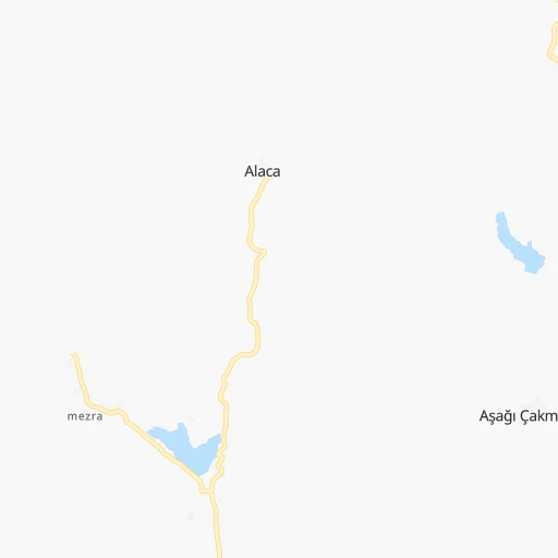
Roadmap (route) to go from Çamlıbel İstasyonu to Kâhta detailed above, you can also see the course layout on the map.
While doing trip Çamlıbel İstasyonu - Kâhta by car, the calculated route ends at a distance , or more straight.
Distance and duration of the route between Çamlıbel İstasyonu and Kâhta
An error occured: undefined - for url https://router.cartes.cc/route?point=39.94955%2C36.40294&point=37.78552%2C38.6237&vehicle=car&debug=false&data_type=application%2Fjson&locale=en&points_encoded=true&instructions=true&elevation=false&optimize=false&timeout=10000&skip.host=true&skip.basePath=true&graphhopper_maps_host=https%3A%2F%2Fgraphhopper.com%2Fmaps%2F%3F&turn_sign_map.0=continue&turn_sign_map.1=turn%20slight%20right&turn_sign_map.2=turn%20right&turn_sign_map.3=turn%20sharp%20right&turn_sign_map.4=finish&turn_sign_map.5=reached%20via%20point&turn_sign_map.6=enter%20roundabout&turn_sign_map.-6=leave%20roundabout&turn_sign_map.-3=turn%20sharp%20left&turn_sign_map.-2=turn%20left&turn_sign_map.-1=turn%20slight%20left&key=&position=topleft
Calculation of distance and route from Kâhta to Çamlıbel İstasyonu :
307.8412.3 km6h24mn
Continue 0h1mn 363 mTurn left 0h0mn 33 mTurn sharp right 0h8mn 6.8 kmTurn sharp right 0h2mn 2.1 kmTurn sharp left 0h1mn 318 mKeep left 0h14mn 8.6 kmTurn right 0h5mn 4.3 kmTurn right onto Tokat-Sivas yolu 0h4mn 4.2 kmKeep right onto Sivas-Yozgat yolu 0h2mn 2.1 kmAt roundabout, take exit 2 onto Sivas-Yozgat yolu 1h35mn 40.3 kmTurn right onto Kesikköprü Caddesi 0h1mn 707 mKeep right 0h2mn 1.3 kmTurn right 0h0mn 32 mTurn right 0h3mn 2.8 kmTurn right 0h0mn 348 mTurn left 0h1mn 914 mTurn right onto Sivas-Kayseri yolu 0h7mn 7.7 kmAt roundabout, take exit 2 onto Sivas-Kayseri yolu 0h3mn 4.6 kmAt roundabout, take exit 1 onto Sivas-Kayseri yolu 0h3mn 2.9 kmAt roundabout, take exit 1 onto Sivas-Kayseri yolu 0h5mn 5.4 kmContinue onto Sivas-Malatya yolu 0h3mn 2.9 kmAt roundabout, take exit 2 onto Sivas-Malatya yolu 0h1mn 1.4 kmAt roundabout, take exit 1 onto Sivas-Malatya yolu 0h2mn 2.4 kmAt roundabout, take exit 2 onto Sivas-Malatya yolu 0h3mn 3.3 kmContinue onto Sivas-Malatya yolu 0h2mn 2.6 kmAt roundabout, take exit 1 onto Sivas-Malatya yolu 0h2mn 2.5 kmAt roundabout, take exit 1 onto Sivas-Malatya yolu 0h2mn 1.8 kmKeep right onto Sivas-Malatya yolu 0h2mn 2.0 kmKeep right onto Sivas-Malatya yolu 0h9mn 11.1 kmAt roundabout, take exit 2 onto Sivas-Malatya yolu 0h3mn 4.2 kmAt roundabout, take exit 2 onto Sivas-Malatya yolu 0h2mn 3.4 kmAt roundabout, take exit 1 onto Sivas-Malatya yolu 1h26mn 112.4 kmContinue onto Malatya - Hekimhan Yolu 0h3mn 3.0 kmContinue onto Malatya - Hekimhan Yolu 0h4mn 4.2 kmKeep right onto Malatya - Hekimhan Yolu 0h7mn 8.0 kmContinue onto Malatya - Hekimhan Yolu 0h3mn 3.8 kmContinue onto Malatya - Hekimhan Yolu 0h5mn 5.3 kmContinue onto Malatya - Hekimhan Yolu 0h3mn 3.0 kmContinue onto Malatya - Hekimhan Yolu 0h2mn 2.6 kmContinue onto Malatya - Hekimhan Yolu 0h2mn 2.4 kmContinue onto Malatya - Hekimhan Yolu 0h5mn 6.1 kmContinue onto Malatya-Keban yolu 0h4mn 4.1 kmAt roundabout, take exit 2 onto Malatya-Keban yolu 0h3mn 3.9 kmAt roundabout, take exit 2 onto Malatya-Keban yolu 0h6mn 7.1 kmAt roundabout, take exit 1 onto Malatya-Keban yolu 0h2mn 2.0 kmAt roundabout, take exit 2 onto Malatya-Keban yolu 0h2mn 1.8 kmTurn slight right 0h4mn 4.0 kmKeep right onto 44-50 1h41mn 52.6 kmTurn left 0h8mn 6.8 kmTurn slight right 0h0mn 194 mKeep right 0h15mn 7.6 kmKeep right 0h6mn 3.0 kmKeep right 0h5mn 2.5 kmTurn sharp left 0h1mn 334 mTurn right 0h0mn 134 mKeep right 0h1mn 502 mTurn slight right 0h4mn 1.9 kmTurn left 0h7mn 3.5 kmTurn sharp left 0h0mn 54 mKeep right 0h1mn 546 mTurn slight right 0h2mn 1.6 kmKeep left 0h1mn 360 mKeep left 0h3mn 1.4 kmTurn sharp left 0h4mn 3.3 kmTurn right 0h11mn 8.9 kmTurn right 0h0mn 178 mTurn slight right onto 02-03 0h1mn 1.2 kmTurn slight right onto D360 (eski) 0h6mn 6.6 kmAt roundabout, take exit 2 onto D360 0h1mn 1.2 kmTurn left onto Mustafa Kemal Caddesi 0h0mn 256 mContinue onto Mustafa Kemal Caddesi 0h0mn 262 mKeep right onto Mustafa Kemal Caddesi 0h0mn 243 mMake a U-turn onto Mustafa Kemal Caddesi 0h0mn 72 mArrive at destination 0h0mn 0 m
Travel from Çamlıbel İstasyonu (Adıyaman) to a selection of major cities.
Distances from Çamlıbel İstasyonu to biggest cities in Sivas
Other major cities in country :
- Sanliurfa [63], 449,549 inhabitants. 373 km
- Malatya [44], 441,805 inhabitants. 243 km
- Sultangazi [34], 436,935 inhabitants. 650 km
- Maltepe [34], 427,040 inhabitants. 624 km
- Erzurum [25], 420,691 inhabitants. 416 km
- Samsun [55], 394,050 inhabitants. 148 km
- Batman [76], 381,990 inhabitants. 469 km
- Kahramanmaras [46], 376,045 inhabitants. 267 km
- Van [65], 371,713 inhabitants. 623 km
- Atasehir [34], 361,615 inhabitants. 628 km
- Sisli [34], 314,684 inhabitants. 640 km
- Denizli [20], 313,238 inhabitants. 679 km
- Batikent [68], 300,000 inhabitants. 313 km
- Elazig [23], 298,004 inhabitants. 281 km
- Zeytinburnu [34], 288,743 inhabitants. 645 km
- Adapazari [54], 286,787 inhabitants. 517 km
- Sultanbeyli [34], 286,622 inhabitants. 614 km
- Gebze [41], 281,436 inhabitants. 599 km
- Merkezefendi [20], 280,341 inhabitants. 681 km
- Tarsus [32], 256,482 inhabitants. 362 km
Route from Kâhta to major cities (Turkey).
- Distance Kâhta Istanbul906 km
- Distance Kâhta Ankara554 km
- Distance Kâhta Izmir1,008 km
- Distance Kâhta Bursa869 km
- Distance Kâhta Adana304 km
- Distance Kâhta Gaziantep136 km
- Distance Kâhta Konya540 km
- Distance Kâhta Cankaya553 km
- Distance Kâhta Antalya708 km
- Distance Kâhta Bagcilar914 km
- Distance Kâhta Diyarbakir141 km
- Distance Kâhta Kayseri294 km
- Distance Kâhta UEskuedar900 km
- Distance Kâhta Bahcelievler912 km
- Distance Kâhta Umraniye892 km
- Distance Kâhta Mersin369 km
- Distance Kâhta Esenler913 km
- Distance Kâhta Eskisehir737 km
- Distance Kâhta Karabaglar1,008 km
- Distance Kâhta Muratpasa702 km
Nearest cities to Çamlıbel İstasyonu :
- Adana, 1,248,988 inhabitants. 341 km
- Gaziantep, 1,065,975 inhabitants. 333 km
- Kayseri, 592,840 inhabitants. 157 km
- Sanliurfa, 449,549 inhabitants. 373 km
- Malatya, 441,805 inhabitants. 243 km
- Samsun, 394,050 inhabitants. 148 km
- Kahramanmaras, 376,045 inhabitants. 267 km
- Elazig, 298,004 inhabitants. 281 km
- Sivas, 264,022 inhabitants. 57 km
- Adiyaman, 223,744 inhabitants. 292 km
- Kirikkale, 211,138 inhabitants. 248 km
- Osmaniye, 202,837 inhabitants. 320 km
- Corum, 183,418 inhabitants. 140 km
- Siverek, 175,341 inhabitants. 351 km
- Aksaray, 152,201 inhabitants. 270 km
- Tokat, 129,702 inhabitants. 43 km
- Ordu, 116,788 inhabitants. 170 km
- Turhal, 110,884 inhabitants. 56 km
- Giresun, 98,864 inhabitants. 200 km
- Ceyhan, 96,303 inhabitants. 330 km
- Kirsehir, 94,336 inhabitants. 212 km
- Bafra, 92,944 inhabitants. 185 km
- Eregli, 92,117 inhabitants. 340 km
- Nigde, 91,039 inhabitants. 266 km
- Kozan, 88,115 inhabitants. 282 km
- Yozgat, 87,881 inhabitants. 137 km
- Amasya, 82,896 inhabitants. 92 km
- Nizip, 82,308 inhabitants. 349 km
- Fatsa, 82,160 inhabitants. 152 km
- Elbistan, 80,456 inhabitants. 206 km
- UEnye, 77,585 inhabitants. 151 km
- Nevsehir, 75,527 inhabitants. 207 km
- Kahta, 73,105 inhabitants. 308 km
- Khanjarah, 71,379 inhabitants. 248 km
- Kastamonu, 70,402 inhabitants. 273 km
- Kadirli, 70,248 inhabitants. 288 km
- Sorgun, 62,862 inhabitants. 105 km
- Zile, 55,680 inhabitants. 59 km
- Erbaa, 52,185 inhabitants. 81 km
- Merzifon, 50,658 inhabitants. 130 km
- Carsamba, 50,459 inhabitants. 142 km
- Niksar, 49,865 inhabitants. 85 km
- Keskin, 49,679 inhabitants. 240 km
- Karapinar, 49,509 inhabitants. 351 km
- Suluova, 47,572 inhabitants. 117 km
- Sebin Karahisar, 47,360 inhabitants. 176 km
- Suruc, 46,694 inhabitants. 375 km
- Birecik, 44,284 inhabitants. 353 km
- Sereflikochisar, 44,101 inhabitants. 271 km
- Bulancak, 43,635 inhabitants. 190 km
Location Çamlıbel İstasyonu (Sivas) :
| Country flag |  |
| Location | Çamlıbel İstasyonu |
| State | Sivas |
| County | |
| Country | Turkey |
| Country code / ISO 2 | TR |
| Latitude | 39.9495500 |
| Longitude | 36.4029400 |
| Altitude | 0 meters |
| Time zone | Europe/Istanbul |
Location Kâhta (Adıyaman) :
| Country flag | |
| Location | Kâhta |
| State | Adıyaman |
| County | |
| Country | Turkey |
| Country code / ISO 2 | TR |
| Latitude | 37.7855200 |
| Longitude | 38.6237000 |
| Altitude | 0 meters |
| Time zone | Europe/Istanbul |