
How to get from Stantsiya Gmelinskaya (Volgograd Oblast) to Srednyaya Akhtuba (Volgograd Oblast)
Calculate route from Stantsiya Gmelinskaya (Volgograd Oblast, Russia) to Srednyaya Akhtuba (Volgograd Oblast, Russia).
The flight distance (as the crow flies) between Stantsiya Gmelinskaya and Srednyaya Akhtuba is 236.2 km.
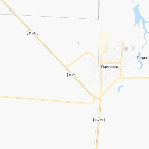
Roadmap (route) to go from Stantsiya Gmelinskaya to Srednyaya Akhtuba detailed above, you can also see the course layout on the map.
While doing trip Stantsiya Gmelinskaya - Srednyaya Akhtuba by car, the calculated route ends at a distance , or more straight.
Distance and duration of the route between Stantsiya Gmelinskaya and Srednyaya Akhtuba
An error occured: undefined - for url https://router.cartes.cc/route?point=50.37477%2C46.90456&point=48.70998%2C44.86724&vehicle=car&debug=false&data_type=application%2Fjson&locale=en&points_encoded=true&instructions=true&elevation=false&optimize=false&timeout=10000&skip.host=true&skip.basePath=true&graphhopper_maps_host=https%3A%2F%2Fgraphhopper.com%2Fmaps%2F%3F&turn_sign_map.0=continue&turn_sign_map.1=turn%20slight%20right&turn_sign_map.2=turn%20right&turn_sign_map.3=turn%20sharp%20right&turn_sign_map.4=finish&turn_sign_map.5=reached%20via%20point&turn_sign_map.6=enter%20roundabout&turn_sign_map.-6=leave%20roundabout&turn_sign_map.-3=turn%20sharp%20left&turn_sign_map.-2=turn%20left&turn_sign_map.-1=turn%20slight%20left&key=&position=topleft
Calculation of distance and route from Srednyaya Akhtuba to Stantsiya Gmelinskaya :
236.2309.8 km4h11mn
Continue onto улица Космоча 0h1mn 1.1 kmTurn slight right onto Гмелинка - Палласовка 0h0mn 110 mTurn sharp left onto Р-229 0h24mn 33.1 kmTurn right onto Р-229 0h1mn 1.1 kmTurn left onto Р-229 0h3mn 3.2 kmTurn right onto Р-229 1h23mn 96.1 kmTurn left onto Р-229 2h54mn 155.7 kmTurn left 0h0mn 40 mTurn right 0h3mn 1.7 kmTurn right 0h0mn 3 mTurn left onto улица имени Ф. Г. Логинова 0h2mn 1.8 kmTurn right onto улица Автодорога 9 0h3mn 2.5 kmAt roundabout, take exit 3 onto улица Химиков 0h1mn 1.3 kmAt roundabout, take exit 1 onto бульвар Профсоюзов 0h1mn 1.0 kmTurn left onto улица Карбышева 0h4mn 3.7 kmTurn right onto улица 87-й Гвардейской Дивизии 0h1mn 504 mTurn left onto проспект Ленина 0h7mn 5.7 kmTurn right onto Пригородный переулок 0h1mn 273 mTurn left 0h0mn 108 mTurn right onto улица Льва Толстого 0h0mn 138 mTurn left onto Сибирская улица 0h1mn 350 mKeep right onto Сибирская улица 0h0mn 69 mTurn right onto Больничный переулок 0h0mn 116 mArrive at destination 0h0mn 0 m
Travel from Stantsiya Gmelinskaya (Volgograd Oblast) to a selection of major cities.
Distances from Stantsiya Gmelinskaya to biggest cities in Volgograd Oblast
Other major cities in country :
- Barnaul [04], 599,579 inhabitants. 2,527 km
- Vladivostok [59], 587,022 inhabitants. 6,172 km
- Irkutsk [20], 586,695 inhabitants. 3,891 km
- Khabarovsk [30], 579,000 inhabitants. 5,993 km
- Khabarovsk Vtoroy [30], 578,303 inhabitants. 5,999 km
- Orenburg [55], 550,204 inhabitants. 594 km
- Novokuznetsk [29], 539,616 inhabitants. 2,739 km
- Ryazan' [62], 520,173 inhabitants. 680 km
- Tyumen [78], 519,119 inhabitants. 1,432 km
- Lipetsk [43], 515,655 inhabitants. 565 km
- Penza [57], 512,602 inhabitants. 341 km
- Naberezhnyye Chelny [73], 509,870 inhabitants. 700 km
- Kalininskiy [42], 504,641 inhabitants. 1,492 km
- Astrakhan [07], 502,533 inhabitants. 456 km
- Makhachkala [17], 497,959 inhabitants. 825 km
- Tomsk [75], 485,519 inhabitants. 2,578 km
- Kemerovo [29], 477,090 inhabitants. 2,653 km
- Tula [76], 468,825 inhabitants. 761 km
- Kirov [33], 457,383 inhabitants. 932 km
- Cheboksary [16], 446,781 inhabitants. 641 km
Route from Srednyaya Akhtuba to major cities (Russia).
- Distance Srednyaya Akhtuba Moscow926 km
- Distance Srednyaya Akhtuba Saint Petersburg1,560 km
- Distance Srednyaya Akhtuba Novosibirsk2,673 km
- Distance Srednyaya Akhtuba Yekaterinburg1,389 km
- Distance Srednyaya Akhtuba Nizhniy Novgorod850 km
- Distance Srednyaya Akhtuba Samara622 km
- Distance Srednyaya Akhtuba Omsk2,064 km
- Distance Srednyaya Akhtuba Kazan839 km
- Distance Srednyaya Akhtuba Rostov-na-Donu417 km
- Distance Srednyaya Akhtuba Chelyabinsk1,339 km
- Distance Srednyaya Akhtuba Ufa1,016 km
- Distance Srednyaya Akhtuba Perm1,278 km
- Distance Srednyaya Akhtuba Krasnoyarsk3,291 km
- Distance Srednyaya Akhtuba Saratov325 km
- Distance Srednyaya Akhtuba Voronezh522 km
- Distance Srednyaya Akhtuba Tol'yatti621 km
- Distance Srednyaya Akhtuba Krasnodar606 km
- Distance Srednyaya Akhtuba Ulyanovsk671 km
- Distance Srednyaya Akhtuba Izhevsk1,064 km
- Distance Srednyaya Akhtuba Yaroslavl1,047 km
Nearest cities to Stantsiya Gmelinskaya :
- Volgograd, 1,011,417 inhabitants. 253 km
- Saratov, 863,725 inhabitants. 144 km
- Penza, 512,602 inhabitants. 341 km
- Volzhskiy, 323,293 inhabitants. 234 km
- Balakovo, 199,572 inhabitants. 194 km
- Engel's, 196,011 inhabitants. 136 km
- Syzran', 189,338 inhabitants. 328 km
- Kamyshin, 128,626 inhabitants. 110 km
- Kuznetsk, 90,480 inhabitants. 306 km
- Vol'sk, 70,500 inhabitants. 189 km
- Chapayevsk, 70,147 inhabitants. 348 km
- Zarechnyy, 63,579 inhabitants. 336 km
- Zarechnyy, 62,139 inhabitants. 308 km
- Akhtubinsk, 44,551 inhabitants. 239 km
- Pugachev, 41,375 inhabitants. 225 km
- Serdobsk, 36,652 inhabitants. 298 km
- Petrovsk, 33,622 inhabitants. 239 km
- Marks, 32,929 inhabitants. 149 km
- Znamensk, 31,922 inhabitants. 217 km
- Privolzhskiy, 31,849 inhabitants. 130 km
- Atkarsk, 27,554 inhabitants. 213 km
- Kotovo, 26,981 inhabitants. 150 km
- Krasnoarmeysk, 25,841 inhabitants. 112 km
- Bezenchuk, 23,736 inhabitants. 339 km
- Yershov, 23,681 inhabitants. 145 km
- Gorodishche, 19,509 inhabitants. 248 km
- Kalininsk, 18,685 inhabitants. 211 km
- Kharabali, 18,223 inhabitants. 330 km
- Zhirnovsk, 17,887 inhabitants. 165 km
- Pallasovka, 17,139 inhabitants. 36 km
- Novouzensk, 16,932 inhabitants. 88 km
- Nikolayevsk, 16,044 inhabitants. 110 km
- Dubovka, 15,217 inhabitants. 209 km
- Leninsk, 15,167 inhabitants. 223 km
- Krasnyy Kut, 14,956 inhabitants. 64 km
- Petrov Val, 14,853 inhabitants. 123 km
- Krasnoslobodsk, 14,334 inhabitants. 250 km
- Stepnoye, 14,035 inhabitants. 112 km
- Srednyaya Akhtuba, 13,887 inhabitants. 237 km
- Khvalynsk, 13,437 inhabitants. 250 km
- Svetlyy Yar, 13,131 inhabitants. 261 km
- Svetlyy, 12,222 inhabitants. 170 km
- Ilovlya, 11,930 inhabitants. 241 km
- Novospasskoye, 10,941 inhabitants. 314 km
- Bazarnyy Karabulak, 10,389 inhabitants. 214 km
- Aleksandrov Gay, 9,919 inhabitants. 121 km
- Bessonovka, 9,880 inhabitants. 351 km
- Staryye Ozinki, 9,733 inhabitants. 215 km
- Dergachi, 9,570 inhabitants. 162 km
- Verkhniy Baskunchak, 8,745 inhabitants. 240 km
Location Stantsiya Gmelinskaya (Volgograd Oblast) :
| Country flag |  |
| Location | Stantsiya Gmelinskaya |
| State | Volgograd Oblast |
| County | |
| Country | Russia |
| Country code / ISO 2 | RU |
| Latitude | 50.3747700 |
| Longitude | 46.9045600 |
| Altitude | 0 meters |
| Time zone | Europe/Volgograd |
Location Srednyaya Akhtuba (Volgograd Oblast) :
| Country flag | |
| Location | Srednyaya Akhtuba |
| State | Volgograd Oblast |
| County | |
| Country | Russia |
| Country code / ISO 2 | RU |
| Latitude | 48.7099800 |
| Longitude | 44.8672400 |
| Altitude | 0 meters |
| Time zone | Europe/Volgograd |
