

How to get from Höga Kusten (airport) (Västernorrland) to Kramfors (Västernorrland)
Calculate route from Höga Kusten (airport) (Västernorrland, Sweden) to Kramfors (Västernorrland, Sweden).
The flight distance (as the crow flies) between Höga Kusten (airport) and Kramfors is 13.0 km.
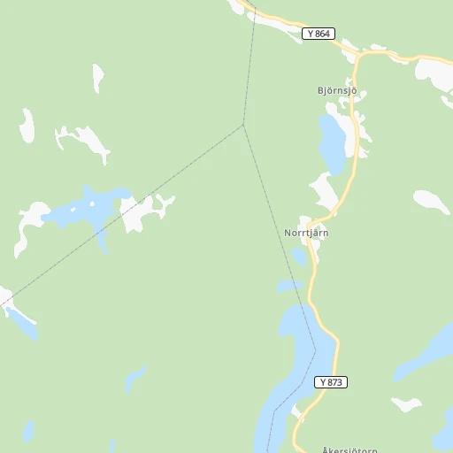
Roadmap (route) to go from Höga Kusten Airport to Kramfors detailed above, you can also see the course layout on the map.
While doing trip Höga Kusten (airport) - Kramfors by car, the calculated route ends at a distance , or more straight.
Distance and duration of the route between Höga Kusten (airport) and Kramfors
An error occured: undefined - for url https://router.cartes.cc/route?point=63.0486%2C17.76886&point=62.93161%2C17.77646&vehicle=car&debug=false&data_type=application%2Fjson&locale=en&points_encoded=true&instructions=true&elevation=false&optimize=false&timeout=10000&skip.host=true&skip.basePath=true&graphhopper_maps_host=https%3A%2F%2Fgraphhopper.com%2Fmaps%2F%3F&turn_sign_map.0=continue&turn_sign_map.1=turn%20slight%20right&turn_sign_map.2=turn%20right&turn_sign_map.3=turn%20sharp%20right&turn_sign_map.4=finish&turn_sign_map.5=reached%20via%20point&turn_sign_map.6=enter%20roundabout&turn_sign_map.-6=leave%20roundabout&turn_sign_map.-3=turn%20sharp%20left&turn_sign_map.-2=turn%20left&turn_sign_map.-1=turn%20slight%20left&key=&position=topleft
Calculation of distance and route from Kramfors to Höga Kusten (airport) :
13.021.5 km0h23mn
Continue 0h0mn 16 mTurn right 0h1mn 977 mTurn left onto Y 786 0h2mn 2.8 kmTurn right onto Storgatan 0h2mn 2.0 kmTurn right onto Klockstapelvägen 0h0mn 39 mTurn left onto Sveavägen 0h0mn 182 mTurn right onto Parkvägen 0h0mn 134 mKeep left 0h0mn 95 mTurn right 0h1mn 378 mTurn right onto 333 0h3mn 3.9 kmTurn left onto Ådalsvägen 0h12mn 10.5 kmAt roundabout, take exit 2 onto Järnvägsgatan 0h1mn 444 mTurn left 0h0mn 83 mArrive at destination 0h0mn 0 m
Travel from Höga Kusten (airport) (Västernorrland) to a selection of major cities.
Distances from Höga Kusten Airport to biggest cities in Västernorrland
Other major cities in country :
- Eskilstuna [18], 67,359 inhabitants. 415 km
- Solna [26], 66,909 inhabitants. 411 km
- Halmstad [06], 66,124 inhabitants. 760 km
- Vaexjoe [12], 65,383 inhabitants. 706 km
- Karlstad [22], 61,492 inhabitants. 468 km
- Bromma [26], 61,000 inhabitants. 413 km
- Moelndal [28], 59,430 inhabitants. 678 km
- Vasastan [26], 58,458 inhabitants. 412 km
- Taby [26], 58,123 inhabitants. 402 km
Route from Kramfors to major cities (Sweden).
- Distance Kramfors Stockholm401 km
- Distance Kramfors Goeteborg663 km
- Distance Kramfors Malmoe859 km
- Distance Kramfors Uppsala342 km
- Distance Kramfors Sollentuna390 km
- Distance Kramfors Soedermalm403 km
- Distance Kramfors Vaesteras375 km
- Distance Kramfors OErebro430 km
- Distance Kramfors Linkoeping517 km
- Distance Kramfors Helsingborg818 km
- Distance Kramfors Joenkoeping607 km
- Distance Kramfors Norrkoeping491 km
- Distance Kramfors Huddinge411 km
- Distance Kramfors Lund845 km
- Distance Kramfors Umea159 km
- Distance Kramfors Haninge419 km
- Distance Kramfors Gaevle253 km
- Distance Kramfors Boras638 km
- Distance Kramfors Soedertaelje416 km
- Distance Kramfors Kungsholmen401 km
Nearest cities to Höga Kusten (airport) :
- Umea, 83,249 inhabitants. 151 km
- Gaevle, 74,884 inhabitants. 266 km
- Sundsvall, 57,606 inhabitants. 77 km
- Borlaenge, 41,955 inhabitants. 311 km
- Falun, 37,000 inhabitants. 295 km
- OErnskoeldsvik, 32,493 inhabitants. 55 km
- Sandviken, 24,724 inhabitants. 276 km
- Haernoesand, 18,426 inhabitants. 47 km
- Hudiksvall, 16,081 inhabitants. 151 km
- Ludvika, 15,245 inhabitants. 350 km
- Bollnaes, 13,716 inhabitants. 202 km
- Soederhamn, 12,259 inhabitants. 198 km
- Avesta, 11,949 inhabitants. 334 km
- Timra, 10,495 inhabitants. 67 km
- Kvissleby, 8,785 inhabitants. 86 km
- Lycksele, 8,545 inhabitants. 178 km
- Solleftea, 7,399 inhabitants. 28 km
- Hedemora, 7,371 inhabitants. 322 km
- Ljusdal, 7,259 inhabitants. 161 km
- Valbo, 7,147 inhabitants. 270 km
- Kramfors, 6,582 inhabitants. 13 km
- Skutskaer, 6,279 inhabitants. 270 km
- Leksand, 6,107 inhabitants. 296 km
- Hofors, 6,090 inhabitants. 289 km
- Holmsund, 5,962 inhabitants. 149 km
- Vi, 5,841 inhabitants. 71 km
- Tierp, 5,826 inhabitants. 302 km
- Smedjebacken, 5,258 inhabitants. 347 km
- Raettvik, 5,160 inhabitants. 278 km
- Vi, 4,757 inhabitants. 89 km
- OEsthammar, 4,726 inhabitants. 312 km
- Arvidsjaur, 4,655 inhabitants. 291 km
- Norberg, 4,653 inhabitants. 346 km
- Saeter, 4,613 inhabitants. 319 km
- Hallstavik, 4,536 inhabitants. 337 km
- Vaennaes, 4,373 inhabitants. 137 km
- Edsbyn, 4,179 inhabitants. 212 km
- Krylbo, 4,072 inhabitants. 335 km
- Arno, 3,925 inhabitants. 330 km
- Brunflo, 3,916 inhabitants. 148 km
- Brunna, 3,861 inhabitants. 324 km
- Stroemsund, 3,690 inhabitants. 142 km
- Vilhelmina, 3,572 inhabitants. 184 km
- Smedby, 3,530 inhabitants. 298 km
- Matfors, 3,437 inhabitants. 87 km
- Iggesund, 3,419 inhabitants. 161 km
Location Höga Kusten (airport) (Västernorrland) :
| Country flag |  |
| Location | Höga Kusten (airport) |
| State | Västernorrland |
| County | Kramfors Kommun |
| Country | Sweden |
| Country code / ISO 2 | SE |
| Latitude | 63.0486000 |
| Longitude | 17.7688600 |
| Altitude | 10 meters |
| Time zone | Europe/Stockholm |
Location Kramfors (Västernorrland) :
| Country flag | |
| Location | Kramfors |
| State | Västernorrland |
| County | Kramfors Kommun |
| Country | Sweden |
| Country code / ISO 2 | SE |
| Latitude | 62.9316100 |
| Longitude | 17.7764600 |
| Altitude | 0 meters |
| Time zone | Europe/Stockholm |
