

How to get from Mersa Matruh (airport) (Matruh) to Damanhūr (Beheira)
Calculate route from Mersa Matruh (airport) (Matruh, Egypt) to Damanhūr (Beheira, Egypt).
The flight distance (as the crow flies) between Mersa Matruh (airport) and Damanhūr is 310.3 km.
Roadmap (route) to go from Mersa Matruh Airport to Damanhūr detailed above, you can also see the course layout on the map.
While doing trip Mersa Matruh (airport) - Damanhūr by car, the calculated route ends at a distance , or more straight.
Distance and duration of the route between Mersa Matruh (airport) and Damanhūr
An error occured: undefined - for url https://router.cartes.cc/route?point=31.32536%2C27.22169&point=31.03408%2C30.46823&vehicle=car&debug=false&data_type=application%2Fjson&locale=en&points_encoded=true&instructions=true&elevation=false&optimize=false&timeout=10000&skip.host=true&skip.basePath=true&graphhopper_maps_host=https%3A%2F%2Fgraphhopper.com%2Fmaps%2F%3F&turn_sign_map.0=continue&turn_sign_map.1=turn%20slight%20right&turn_sign_map.2=turn%20right&turn_sign_map.3=turn%20sharp%20right&turn_sign_map.4=finish&turn_sign_map.5=reached%20via%20point&turn_sign_map.6=enter%20roundabout&turn_sign_map.-6=leave%20roundabout&turn_sign_map.-3=turn%20sharp%20left&turn_sign_map.-2=turn%20left&turn_sign_map.-1=turn%20slight%20left&key=&position=topleft
Calculation of distance and route from Damanhūr to Mersa Matruh (airport) :
310.3353.6 km4h15mn
Continue 0h1mn 380 mTurn right 0h2mn 887 mTurn left 0h1mn 373 mKeep right 0h0mn 153 mTurn right 0h1mn 636 mTurn sharp right onto شارع الجلاء 0h3mn 2.9 kmAt roundabout, take exit 1 onto شارع الريفيه 3h53mn 243.6 kmTurn left 0h0mn 16 mTurn right onto الطريق الساحلى الدولى 0h6mn 8.4 kmKeep right 0h1mn 500 mKeep right onto طريق مطار برج العرب, الساحل الشمالي 0h1mn 862 mKeep right onto طريق مطار برج العرب, الساحل الشمالى الجانبي 0h1mn 561 mKeep right 0h1mn 1.3 kmKeep left 1h31mn 47.3 kmKeep right 0h5mn 6.1 kmKeep left 0h27mn 36.2 kmKeep right 0h1mn 1.1 kmTurn left 0h0mn 135 mTurn right onto شارع شجرة الدر 0h1mn 948 mTurn right 0h0mn 100 mTurn left onto شارع صلاح سالم 0h1mn 851 mMake a U-turn onto شارع صلاح سالم 0h0mn 52 mTurn right onto شارع ابو جاموس 0h0mn 75 mTurn right onto شارع الشهيد عبد العظيم بديوي 0h0mn 71 mTurn right onto طريق النصر 0h0mn 55 mMake a U-turn onto طريق النصر 0h0mn 101 mArrive at destination 0h0mn 0 m
Travel from Mersa Matruh (airport) (Beheira) to a selection of major cities.
Distances from Mersa Matruh Airport to biggest cities in Matruh
Other major cities in country :
- Sohag [24], 209,419 inhabitants. 687 km
- New Cairo [11], 200,000 inhabitants. 432 km
- Bani Suwayf [18], 189,624 inhabitants. 449 km
- Shibin al Kawm [09], 186,345 inhabitants. 372 km
- Banha [12], 167,029 inhabitants. 390 km
- Talkha [01], 157,737 inhabitants. 397 km
- Kafr ash Shaykh [21], 143,970 inhabitants. 355 km
- Mallawi [10], 142,504 inhabitants. 532 km
- Dikirnis [01], 137,542 inhabitants. 417 km
- Idfu [16], 133,000 inhabitants. 898 km
- Bilbays [14], 129,211 inhabitants. 427 km
- Arish [27], 128,855 inhabitants. 626 km
- Jirja [24], 128,250 inhabitants. 718 km
- Al Hawamidiyah [08], 106,841 inhabitants. 417 km
- Bilqas [01], 103,596 inhabitants. 394 km
- Disuq [21], 102,037 inhabitants. 327 km
- Abu Kabir [14], 100,684 inhabitants. 430 km
- Qalyub [12], 100,495 inhabitants. 402 km
- Akhmim [24], 99,446 inhabitants. 689 km
- Al Matariyah [01], 99,357 inhabitants. 458 km
Route from Damanhūr to major cities (Egypt).
- Distance Damanhūr Cairo132 km
- Distance Damanhūr Alexandria56 km
- Distance Damanhūr Giza135 km
- Distance Damanhūr Port Said175 km
- Distance Damanhūr Suez230 km
- Distance Damanhūr Al Mahallah al Kubra67 km
- Distance Damanhūr Luxor631 km
- Distance Damanhūr Asyut435 km
- Distance Damanhūr Al Mansurah87 km
- Distance Damanhūr Tanda58 km
- Distance Damanhūr Al Fayyum195 km
- Distance Damanhūr Zagazig111 km
- Distance Damanhūr Ismailia179 km
- Distance Damanhūr Aswan809 km
- Distance Damanhūr Qina585 km
- Distance Damanhūr Halwan155 km
- Distance Damanhūr Al Minya327 km
- Distance Damanhūr Sohag513 km
- Distance Damanhūr New Cairo147 km
- Distance Damanhūr Bani Suwayf226 km
Nearest cities to Mersa Matruh (airport) :
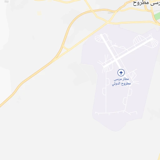
Location Mersa Matruh (airport) (Matruh) :
| Country flag |  |
| Location | Mersa Matruh (airport) |
| State | Matruh |
| County | Markaz Maţrūḩ |
| Country | Egypt |
| Country code / ISO 2 | EG |
| Latitude | 31.3253600 |
| Longitude | 27.2216900 |
| Altitude | 28 meters |
| Time zone | Africa/Cairo |
Location Damanhūr (Beheira) :
| Country flag | |
| Location | Damanhūr |
| State | Beheira |
| County | |
| Country | Egypt |
| Country code / ISO 2 | EG |
| Latitude | 31.0340800 |
| Longitude | 30.4682300 |
| Altitude | 0 meters |
| Time zone | Africa/Cairo |