

How to get from Gachsaran (airport) (Kohgīlūyeh va Būyer Aḩmad) to Shūshtar (Khuzestan)
Calculate route from Gachsaran (airport) (Kohgīlūyeh va Būyer Aḩmad, Iran) to Shūshtar (Khuzestan, Iran).
The flight distance (as the crow flies) between Gachsaran (airport) and Shūshtar is 267.6 km.
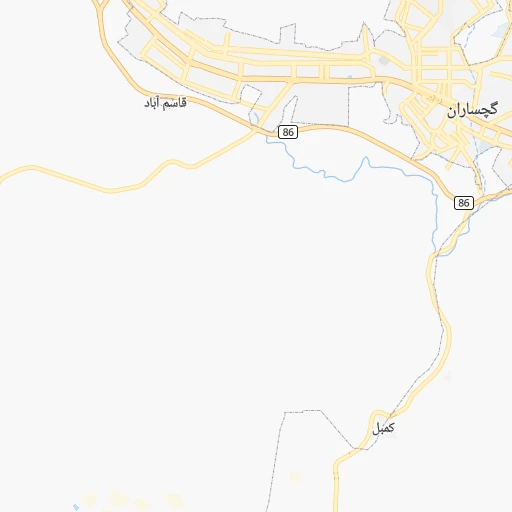
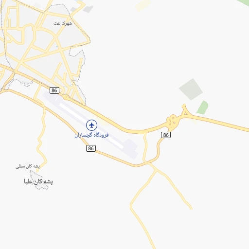
Roadmap (route) to go from Gachsaran Airport to Shūshtar detailed above, you can also see the course layout on the map.
While doing trip Gachsaran (airport) - Shūshtar by car, the calculated route ends at a distance , or more straight.
Distance and duration of the route between Gachsaran (airport) and Shūshtar
An error occured: undefined - for url https://router.cartes.cc/route?point=30.33757%2C50.82796&point=32.04972%2C48.84843&vehicle=car&debug=false&data_type=application%2Fjson&locale=en&points_encoded=true&instructions=true&elevation=false&optimize=false&timeout=10000&skip.host=true&skip.basePath=true&graphhopper_maps_host=https%3A%2F%2Fgraphhopper.com%2Fmaps%2F%3F&turn_sign_map.0=continue&turn_sign_map.1=turn%20slight%20right&turn_sign_map.2=turn%20right&turn_sign_map.3=turn%20sharp%20right&turn_sign_map.4=finish&turn_sign_map.5=reached%20via%20point&turn_sign_map.6=enter%20roundabout&turn_sign_map.-6=leave%20roundabout&turn_sign_map.-3=turn%20sharp%20left&turn_sign_map.-2=turn%20left&turn_sign_map.-1=turn%20slight%20left&key=&position=topleft
Calculation of distance and route from Shūshtar to Gachsaran (airport) :
267.6318.1 km5h34mn
Continue onto گچساران - بابامیدان 0h2mn 3.0 kmKeep right 0h0mn 329 mTurn sharp left onto 86 0h0mn 488 mKeep right 0h3mn 4.3 kmAt roundabout, take exit 2 onto بلوار ولیعصر 0h5mn 6.3 kmAt roundabout, take exit 2 onto بلوار ولیعصر 0h2mn 3.4 kmAt roundabout, take exit 3 onto فلکه نرگس 1h35mn 40.3 kmTurn slight right onto 86 0h11mn 15.3 kmKeep right onto کمر بندی به طرف اهواز 0h4mn 4.1 kmAt roundabout, take exit 3 onto بلوار جانبازان انقلاب اسلامی 0h0mn 291 mKeep right onto بلوار شهید پیشبهار 0h1mn 1.1 kmAt roundabout, take exit 2 onto بلوار شهریاری 0h1mn 602 mAt roundabout, take exit 1 onto بلوار آیت الله بهبهانی 0h0mn 452 mAt roundabout, take exit 2 onto میدان یادمان 0h19mn 25.5 kmContinue onto آغاجاری - بهبهان 1h58mn 70.4 kmAt roundabout, take exit 1 onto 45 0h6mn 5.6 kmAt roundabout, take exit 1 onto فلکه سیلو 0h5mn 6.0 kmKeep right onto 45, 72 0h0mn 181 mAt roundabout, take exit 2 0h21mn 24.2 kmContinue onto جاده باغ ملک - هفتکل - اهواز 0h1mn 1.1 kmKeep left onto جاده رغیوه 0h24mn 24.0 kmTurn right 0h15mn 12.4 kmTurn left onto جاده هفتکل - شوشتر 1h47mn 52.0 kmKeep left 0h0mn 94 mKeep right onto مسجدسلیمان - شوشتر 0h10mn 14.0 kmAt roundabout, take exit 2 onto آیت الله آل طیب 0h1mn 1.3 kmAt roundabout, take exit 2 onto شریعتی 0h0mn 485 mAt roundabout, take exit 2 onto شریعتی 0h1mn 699 mAt roundabout, take exit 4 onto بلوار علامه شیخ شوشتری 0h0mn 166 mTurn right 0h0mn 31 mArrive at destination 0h0mn 0 m
Travel from Gachsaran (airport) (Khuzestan) to a selection of major cities.
Distances from Gachsaran Airport to biggest cities in Kohgīlūyeh va Būyer Aḩmad
Other major cities in country :
- Abadan [15], 370,180 inhabitants. 242 km
- Zanjan [36], 357,471 inhabitants. 738 km
- Bandar Abbas [11], 352,173 inhabitants. 637 km
- Sanandaj [16], 349,176 inhabitants. 660 km
- Qazvin [38], 333,635 inhabitants. 665 km
- Khorramshahr [15], 330,606 inhabitants. 254 km
- Khorramabad [23], 329,825 inhabitants. 421 km
- Khomeyni Shahr [28], 277,334 inhabitants. 270 km
- Sari [35], 255,396 inhabitants. 723 km
- Borujerd [23], 251,958 inhabitants. 442 km
- Qarchak [26], 251,834 inhabitants. 571 km
- Gorgan [37], 244,937 inhabitants. 798 km
- Sabzevar [42], 226,183 inhabitants. 913 km
- Najafabad [28], 223,450 inhabitants. 261 km
- Neyshabur [42], 220,929 inhabitants. 988 km
- Nazarabad [44], 213,388 inhabitants. 626 km
- Bukan [01], 213,331 inhabitants. 811 km
- Sirjan [29], 207,645 inhabitants. 479 km
- Babol [35], 202,796 inhabitants. 713 km
- Amol [35], 199,382 inhabitants. 697 km
Route from Shūshtar to major cities (Iran).
- Distance Shūshtar Tehran470 km
- Distance Shūshtar Mashhad1,095 km
- Distance Shūshtar Isfahan274 km
- Distance Shūshtar Karaj465 km
- Distance Shūshtar Tabriz710 km
- Distance Shūshtar Shiraz445 km
- Distance Shūshtar Qom345 km
- Distance Shūshtar Pasragad Branch306 km
- Distance Shūshtar Kahriz309 km
- Distance Shūshtar Kermanshah302 km
- Distance Shūshtar Rasht586 km
- Distance Shūshtar Kerman808 km
- Distance Shūshtar Orumiyeh703 km
- Distance Shūshtar Zahedan1,183 km
- Distance Shūshtar Hamadan308 km
- Distance Shūshtar Azadshahr306 km
- Distance Shūshtar Arak241 km
- Distance Shūshtar Yazd521 km
- Distance Shūshtar Ardabil692 km
- Distance Shūshtar Zanjan516 km
Nearest cities to Gachsaran (airport) :
- Isfahan, 1,547,164 inhabitants. 270 km
- Shiraz, 1,249,942 inhabitants. 183 km
- Ahvaz, 841,145 inhabitants. 232 km
- Abadan, 370,180 inhabitants. 242 km
- Khorramshahr, 330,606 inhabitants. 254 km
- Khomeyni Shahr, 277,334 inhabitants. 270 km
- Najafabad, 223,450 inhabitants. 261 km
- Bushehr, 165,377 inhabitants. 152 km
- Shahr-e Kord, 129,153 inhabitants. 221 km
- Masjed Soleyman, 111,510 inhabitants. 230 km
- Shahreza, 100,790 inhabitants. 214 km
- Akbarabad, 98,342 inhabitants. 224 km
- Fasa, 98,061 inhabitants. 314 km
- Yasuj, 96,786 inhabitants. 82 km
- Dogonbadan, 94,638 inhabitants. 4 km
- Kazerun, 94,511 inhabitants. 113 km
- Borazjan, 86,059 inhabitants. 125 km
- Behbahan, 79,327 inhabitants. 63 km
- Shushtar, 77,507 inhabitants. 268 km
- Dehdasht, 69,726 inhabitants. 57 km
- Firuzabad, 66,558 inhabitants. 237 km
- Nurabad, 64,041 inhabitants. 71 km
- Abadeh, 56,988 inhabitants. 197 km
- Bandar-e Genaveh, 52,750 inhabitants. 90 km
- Borujen, 52,654 inhabitants. 186 km
- Shush, 52,284 inhabitants. 321 km
- Falavarjan, 49,843 inhabitants. 255 km
- Rehnan, 49,143 inhabitants. 271 km
- Omidiyeh, 46,983 inhabitants. 118 km
- Susangerd, 41,443 inhabitants. 286 km
- Ramhormoz, 38,821 inhabitants. 157 km
- Dorcheh Piaz, 37,462 inhabitants. 263 km
- Shadegan, 37,220 inhabitants. 210 km
- Mohr, 35,000 inhabitants. 369 km
- Kelishad va Sudarjan, 33,630 inhabitants. 255 km
- Dowlatabad, 33,607 inhabitants. 286 km
- Farrokh Shahr, 32,391 inhabitants. 216 km
- Pasargad, 29,825 inhabitants. 227 km
- Qahderijan, 29,392 inhabitants. 256 km
- Semirom, 27,220 inhabitants. 139 km
- Farsan, 25,071 inhabitants. 215 km
- Aghajari, 21,785 inhabitants. 104 km
- Khvansar, 21,146 inhabitants. 325 km
- Ramshir, 19,454 inhabitants. 149 km
- Fareydunshahr, 11,562 inhabitants. 297 km
- Khark, 8,196 inhabitants. 129 km
- Jongiyeh, 4,183 inhabitants. 235 km
Location Gachsaran (airport) (Kohgīlūyeh va Būyer Aḩmad) :
| Country flag |  |
| Location | Gachsaran (airport) |
| State | Kohgīlūyeh va Būyer Aḩmad |
| County | |
| Country | Iran |
| Country code / ISO 2 | IR |
| Latitude | 30.3375700 |
| Longitude | 50.8279600 |
| Altitude | 735 meters |
| Time zone | Asia/Tehran |
Location Shūshtar (Khuzestan) :
| Country flag | |
| Location | Shūshtar |
| State | Khuzestan |
| County | |
| Country | Iran |
| Country code / ISO 2 | IR |
| Latitude | 32.0497200 |
| Longitude | 48.8484300 |
| Altitude | 0 meters |
| Time zone | Asia/Tehran |