


Home
››
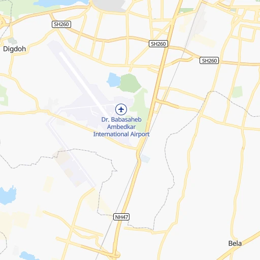
Dr. Babasaheb Ambedkar International Airport
››
Roadmap from Dr. Babasaheb Ambedkar International Airport to Achalpur
How to get from Dr. Babasaheb Ambedkar International (airport) (Maharashtra) to Achalpur (Maharashtra)
Calculate route from Dr. Babasaheb Ambedkar International (airport) (Maharashtra, India) to Achalpur (Maharashtra, India).
The flight distance (as the crow flies) between Dr. Babasaheb Ambedkar International (airport) and Achalpur is 160.3 km.
Roadmap (route) to go from Dr. Babasaheb Ambedkar International Airport to Achalpur detailed above, you can also see the course layout on the map.
While doing trip Dr. Babasaheb Ambedkar International (airport) - Achalpur by car, the calculated route ends at a distance , or more straight.
Distance and duration of the route between Dr. Babasaheb Ambedkar International (airport) and Achalpur
An error occured: undefined - for url https://router.cartes.cc/route?point=21.09219%2C79.04718&point=21.25665%2C77.51006&vehicle=car&debug=false&data_type=application%2Fjson&locale=en&points_encoded=true&instructions=true&elevation=false&optimize=false&timeout=10000&skip.host=true&skip.basePath=true&graphhopper_maps_host=https%3A%2F%2Fgraphhopper.com%2Fmaps%2F%3F&turn_sign_map.0=continue&turn_sign_map.1=turn%20slight%20right&turn_sign_map.2=turn%20right&turn_sign_map.3=turn%20sharp%20right&turn_sign_map.4=finish&turn_sign_map.5=reached%20via%20point&turn_sign_map.6=enter%20roundabout&turn_sign_map.-6=leave%20roundabout&turn_sign_map.-3=turn%20sharp%20left&turn_sign_map.-2=turn%20left&turn_sign_map.-1=turn%20slight%20left&key=&position=topleft
Calculation of distance and route from Achalpur to Dr. Babasaheb Ambedkar International (airport) :
160.3185.1 km3h48mn
Continue 0h0mn 79 mTurn left 0h0mn 31 mTurn right 0h0mn 57 mTurn left 0h0mn 189 mTurn right 0h0mn 10 mTurn left 0h0mn 124 mTurn left 0h0mn 156 mTurn right 0h0mn 42 mTurn left 0h0mn 21 mTurn right 0h0mn 244 mTurn sharp right 0h0mn 26 mTurn left 0h0mn 71 mTurn right 0h0mn 72 mTurn left 0h0mn 36 mTurn right 0h0mn 79 mTurn left 0h0mn 37 mTurn right 0h0mn 109 mTurn right 0h0mn 45 mTurn left 0h1mn 287 mTurn left onto Wankhede Road 0h2mn 2.1 kmTurn right onto Jaitala Road 0h0mn 63 mTurn left 0h1mn 252 mTurn sharp right 0h0mn 18 mTurn sharp left onto Ring Road 0h0mn 327 mKeep left onto SH260 0h2mn 1.7 kmTurn right onto NH353I 0h4mn 4.4 kmTurn left onto Nagpur Amravati Road 1h15mn 87.9 kmKeep right onto NH53 0h13mn 15.1 kmTurn right onto Chandurbazar Tiwsa Road 0h9mn 10.4 kmTurn left 0h5mn 4.4 kmTurn slight left onto Chandurbazar Teosa Road 0h23mn 23.6 kmTurn left 0h0mn 73 mKeep right 0h1mn 259 mKeep left 0h0mn 197 mTurn right 0h0mn 102 mTurn slight right 0h0mn 137 mTurn left onto Paratwada Morshi Road 0h27mn 29.2 kmContinue onto SH203 0h2mn 1.7 kmTurn right 0h1mn 1.1 kmTurn left 0h0mn 220 mTurn right 0h0mn 186 mArrive at destination 0h0mn 0 m
Travel from Dr. Babasaheb Ambedkar International (airport) (Maharashtra) to a selection of major cities.
Distances from Dr. Babasaheb Ambedkar International Airport to biggest cities in Maharashtra
- Malegaon,435,362 inhabitants.473 km
- Jalgaon,429,298 inhabitants.362 km
- Akola,428,857 inhabitants.217 km
- Ahmadnagar,367,140 inhabitants.502 km
- Dhulia,366,980 inhabitants.444 km
- Latur,348,967 inhabitants.397 km
- Chanda,328,351 inhabitants.130 km
- Parbhani,289,629 inhabitants.313 km
- Ichalkaranji,274,383 inhabitants.688 km
- Jalna,262,034 inhabitants.358 km
- Amarnath,217,780 inhabitants.650 km
- Bhusaval,183,001 inhabitants.339 km
- Virar,150,357 inhabitants.676 km
- Yavatmal,128,175 inhabitants.123 km
- Panvel,128,046 inhabitants.663 km
- Gondia,124,897 inhabitants.126 km
- Wardha,113,759 inhabitants.61 km
- Satara,112,793 inhabitants.652 km
- Achalpur,111,278 inhabitants.161 km
- Barsi,110,983 inhabitants.474 km
Other major cities in country :
- Faridabad [10], 1,220,229 inhabitants. 833 km
- Ghaziabad [36], 1,199,191 inhabitants. 859 km
- Rajkot [09], 1,177,362 inhabitants. 864 km
- Varanasi [36], 1,164,404 inhabitants. 621 km
- Amritsar [23], 1,092,450 inhabitants. 1,244 km
- Allahabad [36], 1,073,438 inhabitants. 563 km
- Visakhapatnam [02], 1,063,178 inhabitants. 578 km
- Teni [25], 1,034,724 inhabitants. 1,245 km
- Jabalpur [35], 1,030,168 inhabitants. 249 km
- Haora [28], 1,027,672 inhabitants. 972 km
- Srinagar [12], 975,857 inhabitants. 1,505 km
- Chandigarh [05], 960,787 inhabitants. 1,097 km
- Coimbatore [25], 959,823 inhabitants. 1,145 km
- Jodhpur [24], 921,476 inhabitants. 843 km
- Madurai [25], 909,908 inhabitants. 1,248 km
- Guwahati [03], 899,094 inhabitants. 1,413 km
- Gwalior [35], 882,458 inhabitants. 579 km
- Vijayawada [02], 874,587 inhabitants. 537 km
- Mysore [19], 868,313 inhabitants. 1,012 km
- Ranchi [38], 846,454 inhabitants. 692 km
Route from Achalpur to major cities (India).
- Distance Achalpur Delhi824 km
- Distance Achalpur Bengaluru922 km
- Distance Achalpur Kolkata1,130 km
- Distance Achalpur Chennai956 km
- Distance Achalpur Ahmedabad544 km
- Distance Achalpur Hyderabad442 km
- Distance Achalpur Surat486 km
- Distance Achalpur Kanpur648 km
- Distance Achalpur Jaipur654 km
- Distance Achalpur Lucknow712 km
- Distance Achalpur Indore238 km
- Distance Achalpur Patna916 km
- Distance Achalpur Bhopal223 km
- Distance Achalpur Ludhiana1,087 km
- Distance Achalpur Tirunelveli1,395 km
- Distance Achalpur Agra662 km
- Distance Achalpur Vadodara460 km
- Distance Achalpur Gorakhpur930 km
- Distance Achalpur Meerut860 km
- Distance Achalpur Nowrangapur572 km
Nearest cities to Dr. Babasaheb Ambedkar International (airport) :
- Nagpur, 2,228,018 inhabitants. 7 km
- Bhopal, 1,599,914 inhabitants. 294 km
- Jabalpur, 1,030,168 inhabitants. 249 km
- Raipur, 679,995 inhabitants. 269 km
- Bhilai, 625,138 inhabitants. 248 km
- Amravati, 603,837 inhabitants. 136 km
- Nanded, 550,564 inhabitants. 281 km
- Ramgundam, 452,261 inhabitants. 259 km
- Akola, 428,857 inhabitants. 217 km
- Punasa, 350,000 inhabitants. 303 km
- Latur, 348,967 inhabitants. 397 km
- Chanda, 328,351 inhabitants. 130 km
- Nizamabad, 305,438 inhabitants. 287 km
- Parbhani, 289,629 inhabitants. 313 km
- Dewas, 261,218 inhabitants. 373 km
- Durg, 255,283 inhabitants. 232 km
- Saugor, 247,333 inhabitants. 307 km
- Ramagundam, 235,000 inhabitants. 264 km
- Karimnagar, 228,745 inhabitants. 295 km
- Burhanpur, 202,695 inhabitants. 293 km
- Murwara, 195,856 inhabitants. 336 km
- Khandwa, 182,841 inhabitants. 291 km
- Raj-Nandgaon, 150,755 inhabitants. 206 km
- Vidisha, 140,045 inhabitants. 299 km
- Chhindwara, 134,847 inhabitants. 108 km
- Yavatmal, 128,175 inhabitants. 123 km
- Gondia, 124,897 inhabitants. 126 km
- Damoh, 118,776 inhabitants. 308 km
- Adilabad, 118,526 inhabitants. 167 km
- Wardha, 113,759 inhabitants. 61 km
- Achalpur, 111,278 inhabitants. 161 km
- Hoshangabad, 109,358 inhabitants. 229 km
- Seoni, 101,379 inhabitants. 122 km
- Udgir, 101,064 inhabitants. 362 km
- Itarsi, 100,574 inhabitants. 215 km
- Sehore, 99,284 inhabitants. 310 km
- Jagtial, 99,035 inhabitants. 256 km
- Hinganghat, 97,568 inhabitants. 64 km
- Parli Vaijnath, 94,863 inhabitants. 363 km
- Khamgaon, 94,604 inhabitants. 261 km
- Ballalpur, 92,146 inhabitants. 142 km
- Betul, 91,953 inhabitants. 149 km
- Bhandara, 90,183 inhabitants. 63 km
- Shahdol, 89,289 inhabitants. 342 km
- Dhamtari, 87,151 inhabitants. 264 km
- Akot, 86,917 inhabitants. 207 km
- Kamthi, 86,213 inhabitants. 21 km
- Nirmal, 80,982 inhabitants. 234 km
- Balaghat, 80,360 inhabitants. 143 km
- Mancheral, 77,998 inhabitants. 250 km
Location Dr. Babasaheb Ambedkar International (airport) (Maharashtra) :
| Country flag |  |
| Location | Dr. Babasaheb Ambedkar International (airport) |
| State | Maharashtra |
| County | Nagpur Division |
| Country | India |
| Country code / ISO 2 | IN |
| Latitude | 21.0921900 |
| Longitude | 79.0471800 |
| Altitude | 314 meters |
| Time zone | Asia/Kolkata |
Location Achalpur (Maharashtra) :
| Country flag | |
| Location | Achalpur |
| State | Maharashtra |
| County | Amravati Division |
| Country | India |
| Country code / ISO 2 | IN |
| Latitude | 21.2566500 |
| Longitude | 77.5100600 |
| Altitude | 0 meters |
| Time zone | Asia/Kolkata |