
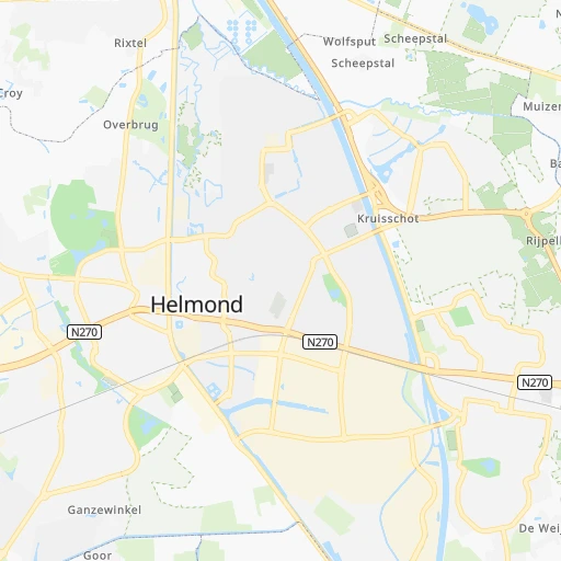


How to get from Station Helmond Brouwhuis (North Brabant) to Lelystad (Flevoland)
Calculate route from Station Helmond Brouwhuis (North Brabant, Netherlands) to Lelystad (Flevoland, Netherlands).
The flight distance (as the crow flies) between Station Helmond Brouwhuis and Lelystad is 116.4 km.
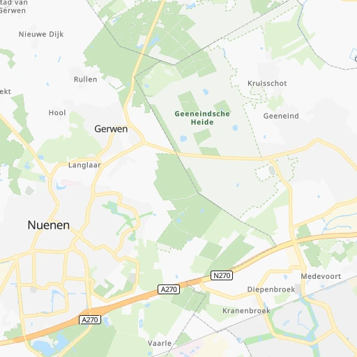
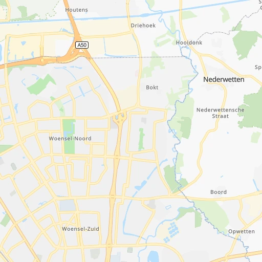
Roadmap (route) to go from Station Helmond Brouwhuis to Lelystad detailed above, you can also see the course layout on the map.
While doing trip Station Helmond Brouwhuis - Lelystad by car, the calculated route ends at a distance , or more straight.
Distance and duration of the route between Station Helmond Brouwhuis and Lelystad
An error occured: undefined - for url https://router.cartes.cc/route?point=51.47005%2C5.70461&point=52.50833%2C5.475&vehicle=car&debug=false&data_type=application%2Fjson&locale=en&points_encoded=true&instructions=true&elevation=false&optimize=false&timeout=10000&skip.host=true&skip.basePath=true&graphhopper_maps_host=https%3A%2F%2Fgraphhopper.com%2Fmaps%2F%3F&turn_sign_map.0=continue&turn_sign_map.1=turn%20slight%20right&turn_sign_map.2=turn%20right&turn_sign_map.3=turn%20sharp%20right&turn_sign_map.4=finish&turn_sign_map.5=reached%20via%20point&turn_sign_map.6=enter%20roundabout&turn_sign_map.-6=leave%20roundabout&turn_sign_map.-3=turn%20sharp%20left&turn_sign_map.-2=turn%20left&turn_sign_map.-1=turn%20slight%20left&key=&position=topleft
Calculation of distance and route from Lelystad to Station Helmond Brouwhuis :
116.4148.0 km2h52mn
Continue onto Grevelingen 0h0mn 102 mTurn right onto Amer 0h0mn 46 mTurn left onto Amer 0h0mn 52 mTurn left onto Biesbosch 0h0mn 130 mTurn left onto Rivierensingel 0h0mn 376 mTurn left onto Deurneseweg 0h1mn 870 mTurn right onto Rivierensingel 0h0mn 287 mAt roundabout, take exit 1 onto Rijpelbaan 0h1mn 403 mAt roundabout, take exit 2 onto Rijpelbaan 0h1mn 1.5 kmAt roundabout, take exit 1 onto Rembrandtlaan 0h0mn 105 mTurn slight left 0h0mn 314 mContinue onto Wolfsputterbaan 0h5mn 5.4 kmAt roundabout, take exit 2 onto Broekdalerbaan 0h3mn 3.3 kmAt roundabout, take exit 2 onto Bosscheweg 0h20mn 24.1 kmKeep right onto Hoge Poeldonk and take A2 toward Utrecht, Nijmegen 0h0mn 192 mTurn right onto A2 and drive toward Nijmegen, Utrecht 0h3mn 4.8 kmKeep left onto A2 and take A2 toward Amsterdam, Utrecht 0h17mn 26.2 kmKeep right onto A2 and take N320 toward Culemborg 0h0mn 345 mKeep left onto A2 0h1mn 1.7 kmKeep right onto A2 and drive toward Everdingen 0h0mn 422 mAt roundabout, take exit 2 onto A2 0h3mn 4.0 kmKeep right onto A2 and take A27 toward Almere, Utrecht 0h13mn 19.7 kmKeep right onto A27 and take N234 toward Bilthoven, Maartensdijk 0h0mn 516 mKeep left onto A27 toward N234 0h0mn 35 mContinue onto Nieuwe Weteringseweg 0h0mn 15 mContinue onto A27 and take A27 toward Hilversum 0h5mn 7.1 kmKeep right onto A27 and drive toward Hilversum, Loosdrecht 0h0mn 426 mTurn right onto A27 and take A27 toward Almere, Amersfoort, Amsterdam 0h13mn 19.9 kmKeep right onto A27 and drive toward Almere-Hout 0h0mn 437 mTurn sharp right onto Vogelweg 0h1mn 1.6 kmTurn left onto Wulpweg 0h3mn 3.5 kmTurn right onto Ibisweg 0h5mn 6.4 kmTurn left onto Praamweg 0h0mn 27 mTurn slight right onto Praamweg 0h9mn 10.5 kmTurn left onto Zuiderpoort 0h0mn 313 mTurn right onto Valkendreef 0h0mn 158 mAt roundabout, take exit 2 onto Larserdreef 0h1mn 489 mKeep right onto Larserdreef 0h0mn 26 mAt roundabout, take exit 1 onto Middendreef 0h2mn 1.2 kmAt roundabout, take exit 2 onto Middenweg 0h0mn 367 mAt roundabout, take exit 1 onto Stationsplein 0h0mn 332 mAt roundabout, take exit 1 onto Stationsweg 0h0mn 90 mTurn right onto Stationsweg 0h0mn 16 mTurn right onto Stationsweg 0h0mn 184 mTurn left onto Stationsweg 0h0mn 18 mArrive at destination 0h0mn 0 m
Travel from Station Helmond Brouwhuis (Flevoland) to a selection of major cities.
Distances from Station Helmond Brouwhuis to biggest cities in North Brabant
- Steenbergen,23,582 inhabitants.97 km
- Schijndel,23,239 inhabitants.25 km
- Nuenen,23,223 inhabitants.11 km
- Loon op Zand,23,000 inhabitants.47 km
- Goirle,22,646 inhabitants.45 km
- Geertruidenberg,20,941 inhabitants.64 km
Other major cities in country :
- Delft [11], 95,060 inhabitants. 111 km
- Alkmaar [07], 94,853 inhabitants. 145 km
- Heerlen [05], 93,084 inhabitants. 68 km
- Venlo [05], 92,403 inhabitants. 34 km
- Leeuwarden [02], 91,424 inhabitants. 193 km
- Amsterdam-Zuidoost [07], 84,811 inhabitants. 106 km
- Hilversum [07], 83,640 inhabitants. 91 km
- Hengelo [15], 80,809 inhabitants. 116 km
- Amstelveen [07], 79,639 inhabitants. 109 km
- Purmerend [07], 76,745 inhabitants. 126 km
- Schiedam [11], 75,438 inhabitants. 104 km
- Spijkenisse [11], 74,988 inhabitants. 104 km
- Vlaardingen [11], 73,798 inhabitants. 106 km
- Almelo [15], 72,725 inhabitants. 119 km
- Gouda [11], 71,952 inhabitants. 92 km
- Zaandam [07], 71,708 inhabitants. 124 km
- Lelystad [16], 70,741 inhabitants. 117 km
- Alphen aan den Rijn [11], 70,251 inhabitants. 103 km
- Hoorn [07], 68,852 inhabitants. 138 km
- Velsen-Zuid [07], 67,758 inhabitants. 132 km
Route from Lelystad to major cities (Netherlands).
- Distance Lelystad Amsterdam42 km
- Distance Lelystad Rotterdam94 km
- Distance Lelystad The Hague93 km
- Distance Lelystad Utrecht52 km
- Distance Lelystad Eindhoven119 km
- Distance Lelystad Tilburg109 km
- Distance Lelystad Groningen108 km
- Distance Lelystad Breda113 km
- Distance Lelystad Nijmegen78 km
- Distance Lelystad Enschede102 km
- Distance Lelystad Haarlem59 km
- Distance Lelystad Arnhem66 km
- Distance Lelystad Zaanstad45 km
- Distance Lelystad Amersfoort40 km
- Distance Lelystad Apeldoorn47 km
- Distance Lelystad 's-Hertogenbosch91 km
- Distance Lelystad Hoofddorp58 km
- Distance Lelystad Maastricht185 km
- Distance Lelystad Leiden77 km
- Distance Lelystad Dordrecht95 km
Nearest cities to Station Helmond Brouwhuis :
- Amsterdam, 741,636 inhabitants. 115 km
- Rotterdam, 598,199 inhabitants. 98 km
- The Hague, 474,292 inhabitants. 118 km
- Utrecht, 290,529 inhabitants. 80 km
- Eindhoven, 209,620 inhabitants. 16 km
- Tilburg, 199,613 inhabitants. 44 km
- Groningen, 181,194 inhabitants. 203 km
- Almere Stad, 176,432 inhabitants. 106 km
- Breda, 167,673 inhabitants. 66 km
- Nijmegen, 158,732 inhabitants. 43 km
- Enschede, 153,655 inhabitants. 117 km
- Haarlem, 147,590 inhabitants. 125 km
- Arnhem, 141,674 inhabitants. 59 km
- Zaanstad, 140,085 inhabitants. 125 km
- Amersfoort, 139,914 inhabitants. 79 km
- Apeldoorn, 136,670 inhabitants. 84 km
- 's-Hertogenbosch, 134,520 inhabitants. 38 km
- Hoofddorp, 132,734 inhabitants. 116 km
- Maastricht, 122,378 inhabitants. 69 km
- Leiden, 119,713 inhabitants. 113 km
- Dordrecht, 119,260 inhabitants. 81 km
- Zoetermeer, 115,845 inhabitants. 106 km
- Zwolle, 111,805 inhabitants. 119 km
- Deventer, 97,331 inhabitants. 93 km
- Delft, 95,060 inhabitants. 111 km
- Alkmaar, 94,853 inhabitants. 145 km
- Heerlen, 93,084 inhabitants. 68 km
- Venlo, 92,403 inhabitants. 34 km
- Leeuwarden, 91,424 inhabitants. 193 km
- Amsterdam-Zuidoost, 84,811 inhabitants. 106 km
- Hilversum, 83,640 inhabitants. 91 km
- Hengelo, 80,809 inhabitants. 116 km
- Amstelveen, 79,639 inhabitants. 109 km
- Roosendaal, 77,725 inhabitants. 86 km
- Purmerend, 76,745 inhabitants. 126 km
- Oss, 76,430 inhabitants. 35 km
- Schiedam, 75,438 inhabitants. 104 km
- Spijkenisse, 74,988 inhabitants. 104 km
- Helmond, 74,740 inhabitants. 3 km
- Vlaardingen, 73,798 inhabitants. 106 km
- Almelo, 72,725 inhabitants. 119 km
- Gouda, 71,952 inhabitants. 92 km
- Zaandam, 71,708 inhabitants. 124 km
- Lelystad, 70,741 inhabitants. 117 km
- Alphen aan den Rijn, 70,251 inhabitants. 103 km
- Hoorn, 68,852 inhabitants. 138 km
- Velsen-Zuid, 67,758 inhabitants. 132 km
- Ede, 67,670 inhabitants. 63 km
- Bergen op Zoom, 66,256 inhabitants. 98 km
- Capelle aan den IJssel, 65,255 inhabitants. 93 km
Location Station Helmond Brouwhuis (North Brabant) :
| Country flag |  |
| Location | Station Helmond Brouwhuis |
| State | North Brabant |
| County | Gemeente Helmond |
| Country | Netherlands |
| Country code / ISO 2 | NL |
| Latitude | 51.4700500 |
| Longitude | 5.7046100 |
| Altitude | 0 meters |
| Time zone | Europe/Amsterdam |
Location Lelystad (Flevoland) :
| Country flag | |
| Location | Lelystad |
| State | Flevoland |
| County | Gemeente Lelystad |
| Country | Netherlands |
| Country code / ISO 2 | NL |
| Latitude | 52.5083300 |
| Longitude | 5.4750000 |
| Altitude | 0 meters |
| Time zone | Europe/Amsterdam |


