

How to get from Gara Topleţ (Caraş-Severin) to Aiud (Alba)
Calculate route from Gara Topleţ (Caraş-Severin, Romania) to Aiud (Alba, Romania).
The flight distance (as the crow flies) between Gara Topleţ and Aiud is 195.9 km.
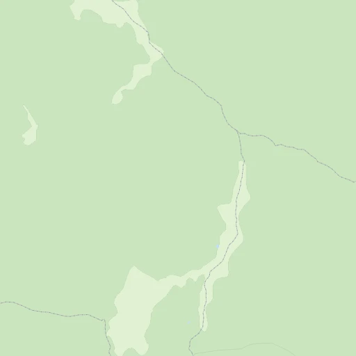
Roadmap (route) to go from Gara Topleţ to Aiud detailed above, you can also see the course layout on the map.
While doing trip Gara Topleţ - Aiud by car, the calculated route ends at a distance , or more straight.
Distance and duration of the route between Gara Topleţ and Aiud
An error occured: undefined - for url https://router.cartes.cc/route?point=44.81667%2C22.38333&point=46.31006%2C23.72128&vehicle=car&debug=false&data_type=application%2Fjson&locale=en&points_encoded=true&instructions=true&elevation=false&optimize=false&timeout=10000&skip.host=true&skip.basePath=true&graphhopper_maps_host=https%3A%2F%2Fgraphhopper.com%2Fmaps%2F%3F&turn_sign_map.0=continue&turn_sign_map.1=turn%20slight%20right&turn_sign_map.2=turn%20right&turn_sign_map.3=turn%20sharp%20right&turn_sign_map.4=finish&turn_sign_map.5=reached%20via%20point&turn_sign_map.6=enter%20roundabout&turn_sign_map.-6=leave%20roundabout&turn_sign_map.-3=turn%20sharp%20left&turn_sign_map.-2=turn%20left&turn_sign_map.-1=turn%20slight%20left&key=&position=topleft
Calculation of distance and route from Aiud to Gara Topleţ :
195.9264.0 km4h49mn
Continue 0h2mn 1.1 kmTurn right 0h0mn 120 mTurn left onto DN6 1h8mn 71.6 kmAt roundabout, take exit 2 onto Varianta de ocolire a municipiului Caransebeș 0h4mn 4.7 kmAt roundabout, take exit 2 onto Varianta de ocolire a municipiului Caransebeș 0h3mn 3.8 kmContinue onto Varianta de ocolire a municipiului Caransebeș and take DN68 toward Hațeg, Caransebeș 0h0mn 427 mAt roundabout, take exit 2 onto DN68 1h5mn 66.2 kmAt roundabout, take exit 2 onto Strada Munților Retezat 0h1mn 522 mTurn left onto DN68 0h0mn 8 mContinue onto Strada Timișoarei 0h0mn 375 mTurn right onto Strada Mihai Eminescu 0h0mn 382 mTurn left onto Strada Nicolae Titulescu 0h17mn 16.6 kmAt roundabout, take exit 2 onto DN66 0h12mn 12.3 kmAt roundabout, take exit 2 0h2mn 1.5 kmKeep right and take A1 toward București, Orăștie 0h22mn 42.5 kmKeep right and take A10 toward Borș, Cluj-Napoca, Turda, Câmpia Turzii 0h10mn 17.7 kmKeep right toward DN1 0h1mn 446 mAt roundabout, take exit 2 onto DN1 0h3mn 2.6 kmAt roundabout, take exit 2 onto DN1 0h5mn 7.6 kmContinue onto Calea Clujului 0h12mn 13.1 kmTurn right onto Piața Consiliul Europei 0h0mn 113 mTurn right onto Piața Cuza Vodă 0h0mn 113 mTurn slight left onto Strada Băilor 0h0mn 312 mArrive at destination 0h0mn 0 m
Travel from Gara Topleţ (Alba) to a selection of major cities.
Distances from Gara Topleţ to biggest cities in Caraş-Severin
Other major cities in country :
- Sibiu [33], 151,894 inhabitants. 176 km
- Targu-Mures [27], 146,863 inhabitants. 256 km
- Baia Mare [25], 136,553 inhabitants. 329 km
- Buzau [11], 130,954 inhabitants. 352 km
- Botosani [07], 114,783 inhabitants. 464 km
- Satu Mare [32], 112,490 inhabitants. 334 km
- Ramnicu Valcea [39], 107,558 inhabitants. 159 km
- Suceava [34], 105,796 inhabitants. 432 km
- Piatra Neamt [28], 102,688 inhabitants. 385 km
- Drobeta-Turnu Severin [26], 102,346 inhabitants. 30 km
- Targu Jiu [19], 97,179 inhabitants. 76 km
- Tulcea [37], 92,475 inhabitants. 507 km
- Targoviste [16], 88,435 inhabitants. 243 km
- Bistrita [06], 81,318 inhabitants. 305 km
- Slatina [29], 78,988 inhabitants. 163 km
- Focsani [40], 77,313 inhabitants. 389 km
- Vaslui [38], 69,225 inhabitants. 462 km
- Hunedoara [21], 69,136 inhabitants. 112 km
- Giurgiu [42], 69,067 inhabitants. 304 km
- Roman [28], 67,819 inhabitants. 423 km
Route from Aiud to major cities (Romania).
- Distance Aiud Bucharest280 km
- Distance Aiud Sector 3284 km
- Distance Aiud Sector 6275 km
- Distance Aiud Sector 2280 km
- Distance Aiud Iasi311 km
- Distance Aiud Cluj-Napoca52 km
- Distance Aiud Timisoara203 km
- Distance Aiud Craiova222 km
- Distance Aiud Constanta452 km
- Distance Aiud Galati349 km
- Distance Aiud Sector 4286 km
- Distance Aiud Brasov163 km
- Distance Aiud Sector 5282 km
- Distance Aiud Ploiesti234 km
- Distance Aiud Sector 1272 km
- Distance Aiud Braila351 km
- Distance Aiud Oradea160 km
- Distance Aiud Bacau247 km
- Distance Aiud Arad186 km
- Distance Aiud Pitesti185 km
Nearest cities to Gara Topleţ :
- Cluj-Napoca, 316,748 inhabitants. 237 km
- Timisoara, 315,053 inhabitants. 138 km
- Craiova, 304,142 inhabitants. 125 km
- Oradea, 206,614 inhabitants. 251 km
- Arad, 169,065 inhabitants. 173 km
- Pitesti, 167,669 inhabitants. 196 km
- Sibiu, 151,894 inhabitants. 176 km
- Targu-Mures, 146,863 inhabitants. 256 km
- Baia Mare, 136,553 inhabitants. 329 km
- Satu Mare, 112,490 inhabitants. 334 km
- Ramnicu Valcea, 107,558 inhabitants. 159 km
- Drobeta-Turnu Severin, 102,346 inhabitants. 30 km
- Targu Jiu, 97,179 inhabitants. 76 km
- Bistrita, 81,318 inhabitants. 305 km
- Resita, 81,228 inhabitants. 66 km
- Slatina, 78,988 inhabitants. 163 km
- Hunedoara, 69,136 inhabitants. 112 km
- Deva, 67,802 inhabitants. 125 km
- Alba Iulia, 66,085 inhabitants. 168 km
- Zalau, 63,232 inhabitants. 270 km
- Turda, 54,586 inhabitants. 223 km
- Medias, 53,040 inhabitants. 215 km
- Alexandria, 49,346 inhabitants. 252 km
- Petrosani, 44,187 inhabitants. 102 km
- Lugoj, 43,243 inhabitants. 104 km
- Dej, 38,033 inhabitants. 284 km
- Odorheiu Secuiesc, 36,532 inhabitants. 281 km
- Reghin-Sat, 35,490 inhabitants. 284 km
- Sighisoara, 34,537 inhabitants. 244 km
- Caracal, 33,761 inhabitants. 175 km
- Curtea de Arges, 32,178 inhabitants. 184 km
- Fagaras, 30,714 inhabitants. 233 km
- Lupeni, 30,488 inhabitants. 90 km
- Mioveni, 29,062 inhabitants. 202 km
- Vulcan, 28,869 inhabitants. 94 km
- Turnu Magurele, 28,783 inhabitants. 231 km
- Tarnaveni, 28,634 inhabitants. 225 km
- Aiud, 28,341 inhabitants. 196 km
- Caransebes, 27,521 inhabitants. 68 km
- Rosiorii de Vede, 27,416 inhabitants. 221 km
- Sebes, 27,246 inhabitants. 157 km
- Borsa, 26,966 inhabitants. 361 km
- Campia Turzii, 26,457 inhabitants. 225 km
- Petrila, 25,234 inhabitants. 107 km
- Zarnesti, 24,926 inhabitants. 245 km
- Cugir, 24,734 inhabitants. 137 km
- Gherla, 23,741 inhabitants. 274 km
- Motru, 22,319 inhabitants. 47 km
- Carei, 20,775 inhabitants. 319 km
- Orastie, 20,763 inhabitants. 130 km
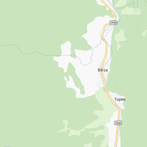
Location Gara Topleţ (Caraş-Severin) :
| Country flag |  |
| Location | Gara Topleţ |
| State | Caraş-Severin |
| County | Comuna Topleţ |
| Country | Romania |
| Country code / ISO 2 | RO |
| Latitude | 44.8166700 |
| Longitude | 22.3833300 |
| Altitude | 0 meters |
| Time zone | Europe/Bucharest |
Location Aiud (Alba) :
| Country flag | |
| Location | Aiud |
| State | Alba |
| County | Municipiul Aiud |
| Country | Romania |
| Country code / ISO 2 | RO |
| Latitude | 46.3100600 |
| Longitude | 23.7212800 |
| Altitude | 0 meters |
| Time zone | Europe/Bucharest |

