


How to get from Station Doetinchem-De Huet (Gelderland) to Roosendaal (North Brabant)
Calculate route from Station Doetinchem-De Huet (Gelderland, Netherlands) to Roosendaal (North Brabant, Netherlands).
The flight distance (as the crow flies) between Station Doetinchem-De Huet and Roosendaal is 132.2 km.
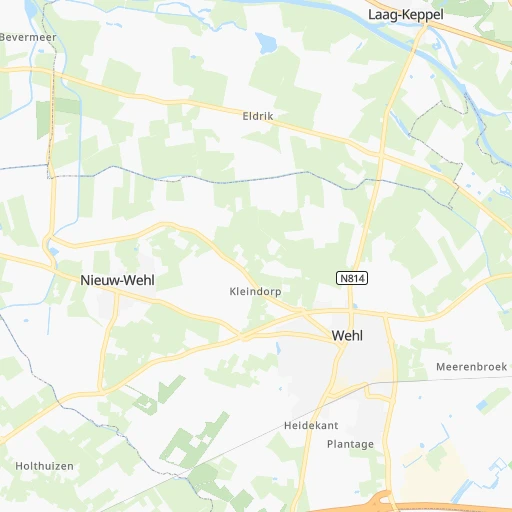
Roadmap (route) to go from Station Doetinchem-De Huet to Roosendaal detailed above, you can also see the course layout on the map.
While doing trip Station Doetinchem-De Huet - Roosendaal by car, the calculated route ends at a distance , or more straight.
Distance and duration of the route between Station Doetinchem-De Huet and Roosendaal
An error occured: undefined - for url https://router.cartes.cc/route?point=51.959%2C6.25852&point=51.53083%2C4.46528&vehicle=car&debug=false&data_type=application%2Fjson&locale=en&points_encoded=true&instructions=true&elevation=false&optimize=false&timeout=10000&skip.host=true&skip.basePath=true&graphhopper_maps_host=https%3A%2F%2Fgraphhopper.com%2Fmaps%2F%3F&turn_sign_map.0=continue&turn_sign_map.1=turn%20slight%20right&turn_sign_map.2=turn%20right&turn_sign_map.3=turn%20sharp%20right&turn_sign_map.4=finish&turn_sign_map.5=reached%20via%20point&turn_sign_map.6=enter%20roundabout&turn_sign_map.-6=leave%20roundabout&turn_sign_map.-3=turn%20sharp%20left&turn_sign_map.-2=turn%20left&turn_sign_map.-1=turn%20slight%20left&key=&position=topleft
Calculation of distance and route from Roosendaal to Station Doetinchem-De Huet :
132.2165.3 km2h56mn
Continue onto Hof van Cambridge 0h0mn 28 mTurn right onto Jan Willinkstraat 0h0mn 67 mTurn right onto Wehlseweg 0h2mn 1.1 kmTurn right onto Notenstraatje 0h1mn 1.2 kmTurn right onto Groenestraat 0h1mn 989 mTurn sharp left onto Kelderweg 0h0mn 24 mAt roundabout, take exit 1 onto Weemstraat 0h0mn 315 mAt roundabout, take exit 2 onto Broekhuizerstraat 0h0mn 455 mAt roundabout, take exit 2 onto Broekhuizerstraat 0h0mn 561 mAt roundabout, take exit 2 onto Broekhuizerstraat 0h1mn 823 mAt roundabout, take exit 2 onto Broekhuizerstraat 0h1mn 1.8 kmAt roundabout, take exit 2 onto Broekhuizerstraat 0h1mn 1.3 kmAt roundabout, take exit 2 onto Doetinchemseweg 0h1mn 1.1 kmAt roundabout, take exit 2 onto Doetinchemseweg 0h0mn 561 mAt roundabout, take exit 2 onto Doetinchemseweg 0h1mn 824 mAt roundabout, take exit 2 onto Doetinchemseweg 0h1mn 766 mAt roundabout, take exit 1 onto Tatelaarweg 0h2mn 2.1 kmTurn left onto A12 and drive toward Zevenaar 0h6mn 8.8 kmKeep right onto Europaweg and take A348, N325 toward Arnhem, Nijmegen, Zutphen, Velp 0h0mn 487 mAt roundabout, take exit 4 onto IJsseloordweg 0h6mn 7.4 kmContinue onto Nijmeegseweg 0h5mn 6.8 kmKeep right onto A325 and drive toward Bemmel, Eindhoven, Venlo, Tiel, Rotterdam 0h0mn 467 mKeep right onto A325 toward A15 0h5mn 6.8 kmKeep right onto A15 toward A50 0h0mn 497 mKeep left onto A15 and take A50 toward Venlo, Eindhoven 0h16mn 24.5 kmKeep right onto A59 and take A59, N329 toward Oss, Heesch, 's-Hertogenbosch 0h10mn 14.7 kmKeep right onto Graafsebaan and drive toward Rosmalen-Oost, Maliskamp 0h0mn 526 mAt roundabout, take exit 2 onto Graafsebaan 0h3mn 5.4 kmKeep right onto A59 and take A59 toward RING-Noord, Waalwijk 0h18mn 27.5 kmKeep right onto A59 and drive toward Waspik, Raamsdonk, 's-Gravemoer 0h7mn 10.9 kmKeep right onto A59 and drive toward Made 0h2mn 3.1 kmKeep right onto A59 and drive toward Terheijden 0h3mn 4.9 kmKeep left onto A59 and take A16 toward Antwerpen, Roosendaal, Breda 0h4mn 5.7 kmKeep right onto A16 and drive toward Breda-Noord, Prinsenbeek, Breda 0-5000 0h0mn 370 mKeep left onto A16 and drive toward Breda-Noord, Prinsenbeek, Breda 0-5000 0h1mn 1.7 kmKeep right onto A16 and take A58 toward Bergen op Zoom, Roosendaal, Breda-West 0h1mn 799 mKeep right onto A16 and drive toward Breda-West 0h0mn 368 mTurn right 0h2mn 3.5 kmKeep right onto A58 and drive toward Etten-Leur 0h3mn 4.4 kmKeep right onto A58 and drive toward Etten-Leur-West, Hoeven, Sprundel 0h0mn 474 mKeep left onto A58 0h6mn 9.1 kmKeep right onto A58 and drive toward Roosendaal-Oost, -Centrum 0h0mn 472 mTurn right onto Van Beethovenlaan 0h2mn 1.3 kmAt roundabout, take exit 3 onto Boulevard 0h1mn 612 mArrive at destination 0h0mn 0 m
Travel from Station Doetinchem-De Huet (North Brabant) to a selection of major cities.
Distances from Station Doetinchem-De Huet to biggest cities in Gelderland
- Putten,23,168 inhabitants.56 km
- Elburg,21,844 inhabitants.61 km
- Brummen,21,344 inhabitants.16 km
- Elst,20,488 inhabitants.29 km
Other major cities in country :
- Deventer [15], 97,331 inhabitants. 34 km
- Delft [11], 95,060 inhabitants. 131 km
- Alkmaar [07], 94,853 inhabitants. 127 km
- Heerlen [05], 93,084 inhabitants. 121 km
- Venlo [05], 92,403 inhabitants. 66 km
- Leeuwarden [02], 91,424 inhabitants. 142 km
- Amsterdam-Zuidoost [07], 84,811 inhabitants. 96 km
- Hilversum [07], 83,640 inhabitants. 80 km
- Hengelo [15], 80,809 inhabitants. 50 km
- Amstelveen [07], 79,639 inhabitants. 103 km
- Roosendaal [06], 77,725 inhabitants. 132 km
- Purmerend [07], 76,745 inhabitants. 107 km
- Oss [06], 76,430 inhabitants. 55 km
- Schiedam [11], 75,438 inhabitants. 128 km
- Spijkenisse [11], 74,988 inhabitants. 133 km
- Helmond [06], 74,740 inhabitants. 67 km
- Vlaardingen [11], 73,798 inhabitants. 132 km
- Almelo [15], 72,725 inhabitants. 52 km
- Gouda [11], 71,952 inhabitants. 106 km
- Zaandam [07], 71,708 inhabitants. 111 km
Route from Roosendaal to major cities (Netherlands).
- Distance Roosendaal Amsterdam98 km
- Distance Roosendaal Rotterdam44 km
- Distance Roosendaal The Hague62 km
- Distance Roosendaal Utrecht77 km
- Distance Roosendaal Groningen236 km
- Distance Roosendaal Almere Stad107 km
- Distance Roosendaal Nijmegen102 km
- Distance Roosendaal Enschede184 km
- Distance Roosendaal Haarlem95 km
- Distance Roosendaal Arnhem111 km
- Distance Roosendaal Zaanstad105 km
- Distance Roosendaal Amersfoort94 km
- Distance Roosendaal Apeldoorn128 km
- Distance Roosendaal Hoofddorp87 km
- Distance Roosendaal Maastricht114 km
- Distance Roosendaal Leiden70 km
- Distance Roosendaal Dordrecht34 km
- Distance Roosendaal Zoetermeer59 km
- Distance Roosendaal Zwolle156 km
- Distance Roosendaal Deventer142 km
Nearest cities to Station Doetinchem-De Huet :
- Amsterdam, 741,636 inhabitants. 104 km
- Rotterdam, 598,199 inhabitants. 122 km
- The Hague, 474,292 inhabitants. 135 km
- Utrecht, 290,529 inhabitants. 79 km
- Eindhoven, 209,620 inhabitants. 79 km
- Tilburg, 199,613 inhabitants. 92 km
- Groningen, 181,194 inhabitants. 142 km
- Almere Stad, 176,432 inhabitants. 85 km
- Breda, 167,673 inhabitants. 110 km
- Nijmegen, 158,732 inhabitants. 31 km
- Enschede, 153,655 inhabitants. 52 km
- Haarlem, 147,590 inhabitants. 120 km
- Arnhem, 141,674 inhabitants. 24 km
- Zaanstad, 140,085 inhabitants. 113 km
- Amersfoort, 139,914 inhabitants. 63 km
- Apeldoorn, 136,670 inhabitants. 34 km
- 's-Hertogenbosch, 134,520 inhabitants. 72 km
- Hoofddorp, 132,734 inhabitants. 114 km
- Maastricht, 122,378 inhabitants. 130 km
- Leiden, 119,713 inhabitants. 123 km
- Dordrecht, 119,260 inhabitants. 110 km
- Zoetermeer, 115,845 inhabitants. 121 km
- Zwolle, 111,805 inhabitants. 63 km
- Deventer, 97,331 inhabitants. 34 km
- Delft, 95,060 inhabitants. 131 km
- Alkmaar, 94,853 inhabitants. 127 km
- Heerlen, 93,084 inhabitants. 121 km
- Venlo, 92,403 inhabitants. 66 km
- Leeuwarden, 91,424 inhabitants. 142 km
- Amsterdam-Zuidoost, 84,811 inhabitants. 96 km
- Hilversum, 83,640 inhabitants. 80 km
- Hengelo, 80,809 inhabitants. 50 km
- Amstelveen, 79,639 inhabitants. 103 km
- Roosendaal, 77,725 inhabitants. 132 km
- Purmerend, 76,745 inhabitants. 107 km
- Oss, 76,430 inhabitants. 55 km
- Schiedam, 75,438 inhabitants. 128 km
- Spijkenisse, 74,988 inhabitants. 133 km
- Helmond, 74,740 inhabitants. 67 km
- Vlaardingen, 73,798 inhabitants. 132 km
- Almelo, 72,725 inhabitants. 52 km
- Gouda, 71,952 inhabitants. 106 km
- Zaandam, 71,708 inhabitants. 111 km
- Lelystad, 70,741 inhabitants. 81 km
- Alphen aan den Rijn, 70,251 inhabitants. 111 km
- Hoorn, 68,852 inhabitants. 112 km
- Velsen-Zuid, 67,758 inhabitants. 123 km
- Ede, 67,670 inhabitants. 42 km
- Bergen op Zoom, 66,256 inhabitants. 145 km
- Capelle aan den IJssel, 65,255 inhabitants. 115 km
Location Station Doetinchem-De Huet (Gelderland) :
| Country flag |  |
| Location | Station Doetinchem-De Huet |
| State | Gelderland |
| County | Gemeente Doetinchem |
| Country | Netherlands |
| Country code / ISO 2 | NL |
| Latitude | 51.9590000 |
| Longitude | 6.2585200 |
| Altitude | 0 meters |
| Time zone | Europe/Amsterdam |
Location Roosendaal (North Brabant) :
| Country flag | |
| Location | Roosendaal |
| State | North Brabant |
| County | Roosendaal |
| Country | Netherlands |
| Country code / ISO 2 | NL |
| Latitude | 51.5308300 |
| Longitude | 4.4652800 |
| Altitude | 0 meters |
| Time zone | Europe/Amsterdam |


