

How to get from Station Deventer Colmschate (Overijssel) to Zoetermeer (South Holland)
Calculate route from Station Deventer Colmschate (Overijssel, Netherlands) to Zoetermeer (South Holland, Netherlands).
The flight distance (as the crow flies) between Station Deventer Colmschate and Zoetermeer is 119.4 km.
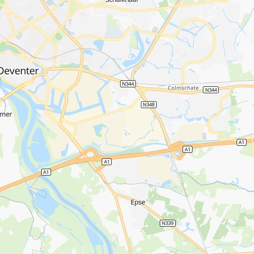
Roadmap (route) to go from Station Deventer Colmschate to Zoetermeer detailed above, you can also see the course layout on the map.
While doing trip Station Deventer Colmschate - Zoetermeer by car, the calculated route ends at a distance , or more straight.
Distance and duration of the route between Station Deventer Colmschate and Zoetermeer
An error occured: undefined - for url https://router.cartes.cc/route?point=52.25035%2C6.21536&point=52.0575%2C4.49306&vehicle=car&debug=false&data_type=application%2Fjson&locale=en&points_encoded=true&instructions=true&elevation=false&optimize=false&timeout=10000&skip.host=true&skip.basePath=true&graphhopper_maps_host=https%3A%2F%2Fgraphhopper.com%2Fmaps%2F%3F&turn_sign_map.0=continue&turn_sign_map.1=turn%20slight%20right&turn_sign_map.2=turn%20right&turn_sign_map.3=turn%20sharp%20right&turn_sign_map.4=finish&turn_sign_map.5=reached%20via%20point&turn_sign_map.6=enter%20roundabout&turn_sign_map.-6=leave%20roundabout&turn_sign_map.-3=turn%20sharp%20left&turn_sign_map.-2=turn%20left&turn_sign_map.-1=turn%20slight%20left&key=&position=topleft
Calculation of distance and route from Zoetermeer to Station Deventer Colmschate :
119.4134.1 km2h37mn
Continue onto Oostriklaan 0h0mn 186 mTurn right onto Holterweg 0h1mn 859 mTurn left onto Zweedsestraat 0h0mn 39 mKeep left onto Zweedsestraat 0h1mn 653 mKeep right onto Zweedsestraat 0h0mn 42 mAt roundabout, take exit 2 onto Zweedsestraat 0h2mn 1.4 kmContinue onto Noorwegenstraat 0h0mn 193 mTurn left onto Zutphenseweg 0h0mn 447 mKeep right onto A1 and take A1 toward Apeldoorn 0h21mn 29.6 kmKeep right onto A1 and take N302 toward Kootwijk, Harderwijk 0h16mn 24.0 kmKeep right onto A1 and take A28 toward Hoevelaken, Zwolle, Amersfoort, Utrecht 0h0mn 247 mKeep right onto A1 and drive toward Hoevelaken 0h0mn 413 mContinue onto Nijkerkerstraat 0h0mn 9 mTurn left onto Amersfoortsestraat 0h0mn 320 mTurn right onto Energieweg 0h2mn 2.2 kmKeep left onto Hogeweg 0h0mn 25 mTurn left onto Hogeweg 0h0mn 21 mTurn right onto Hogeweg 0h0mn 54 mTurn left onto A28 and take A28 toward Leusden, Utrecht 0h1mn 1.5 kmKeep right onto A28 and drive toward Leusden 0h0mn 335 mTurn right onto A28 and take A28 toward Utrecht, Amersfoort-Zuid 0h10mn 15.6 kmKeep left onto A28 and drive toward Rijnsweerd 0h3mn 4.0 kmTurn left onto Waterlinieweg and drive toward Stadion, Centrum, Lunetten 0h4mn 4.0 kmAt roundabout, take exit 1 onto Knooppunt Laagraven 0h23mn 33.8 kmKeep left onto A12 and take A12 toward Den Haag, Zoetermeer, Waddinxveen 0h7mn 10.9 kmKeep right onto A12 and take N470 toward Zoetermeer, Pijnacker, Berkel en Rodenrijs 0h0mn 459 mTurn sharp right onto Oostweg and drive toward Zoetermeer, Andere industrie, Centrum, Silverdome, Wildwaterbaan, SnowWorld 0h0mn 225 mKeep right and drive toward Wijk 12 Prisma 0h0mn 154 mKeep left 0h0mn 68 mTurn left onto Bleiswijkseweg 0h0mn 57 mContinue onto Bleiswijkseweg 0h0mn 356 mTurn left onto Binnenweg 0h0mn 381 mTurn slight right onto Karel Doormanlaan 0h2mn 1.3 kmAt roundabout, take exit 1 onto Bijdorplaan 0h0mn 203 mTurn slight right onto Vlamingstraat 0h0mn 67 mTurn right onto Vlamingstraat 0h0mn 58 mArrive at destination 0h0mn 0 m
Travel from Station Deventer Colmschate (South Holland) to a selection of major cities.
Distances from Station Deventer Colmschate to biggest cities in Overijssel
Other major cities in country :
- Zoetermeer [11], 115,845 inhabitants. 120 km
- Delft [11], 95,060 inhabitants. 130 km
- Alkmaar [07], 94,853 inhabitants. 108 km
- Heerlen [05], 93,084 inhabitants. 153 km
- Venlo [05], 92,403 inhabitants. 98 km
- Leeuwarden [02], 91,424 inhabitants. 109 km
- Amsterdam-Zuidoost [07], 84,811 inhabitants. 85 km
- Hilversum [07], 83,640 inhabitants. 71 km
- Amstelveen [07], 79,639 inhabitants. 92 km
- Roosendaal [06], 77,725 inhabitants. 144 km
- Purmerend [07], 76,745 inhabitants. 90 km
- Oss [06], 76,430 inhabitants. 72 km
- Schiedam [11], 75,438 inhabitants. 130 km
- Spijkenisse [11], 74,988 inhabitants. 137 km
- Helmond [06], 74,740 inhabitants. 94 km
- Vlaardingen [11], 73,798 inhabitants. 134 km
- Gouda [11], 71,952 inhabitants. 106 km
- Zaandam [07], 71,708 inhabitants. 97 km
- Lelystad [16], 70,741 inhabitants. 58 km
- Alphen aan den Rijn [11], 70,251 inhabitants. 107 km
Route from Zoetermeer to major cities (Netherlands).
- Distance Zoetermeer Amsterdam44 km
- Distance Zoetermeer Utrecht43 km
- Distance Zoetermeer Eindhoven97 km
- Distance Zoetermeer Tilburg69 km
- Distance Zoetermeer Groningen191 km
- Distance Zoetermeer Almere Stad60 km
- Distance Zoetermeer Breda56 km
- Distance Zoetermeer Nijmegen96 km
- Distance Zoetermeer Enschede165 km
- Distance Zoetermeer Haarlem37 km
- Distance Zoetermeer Arnhem98 km
- Distance Zoetermeer Zaanstad49 km
- Distance Zoetermeer Amersfoort62 km
- Distance Zoetermeer Apeldoorn102 km
- Distance Zoetermeer 's-Hertogenbosch69 km
- Distance Zoetermeer Hoofddorp30 km
- Distance Zoetermeer Maastricht158 km
- Distance Zoetermeer Zwolle120 km
- Distance Zoetermeer Deventer116 km
- Distance Zoetermeer Alkmaar66 km
Nearest cities to Station Deventer Colmschate :
- Amsterdam, 741,636 inhabitants. 91 km
- Rotterdam, 598,199 inhabitants. 124 km
- The Hague, 474,292 inhabitants. 132 km
- Utrecht, 290,529 inhabitants. 77 km
- Eindhoven, 209,620 inhabitants. 103 km
- Tilburg, 199,613 inhabitants. 109 km
- Groningen, 181,194 inhabitants. 110 km
- Almere Stad, 176,432 inhabitants. 69 km
- Breda, 167,673 inhabitants. 123 km
- Nijmegen, 158,732 inhabitants. 52 km
- Enschede, 153,655 inhabitants. 47 km
- Haarlem, 147,590 inhabitants. 108 km
- Arnhem, 141,674 inhabitants. 37 km
- Zaanstad, 140,085 inhabitants. 98 km
- Amersfoort, 139,914 inhabitants. 57 km
- Apeldoorn, 136,670 inhabitants. 17 km
- 's-Hertogenbosch, 134,520 inhabitants. 88 km
- Hoofddorp, 132,734 inhabitants. 104 km
- Maastricht, 122,378 inhabitants. 160 km
- Leiden, 119,713 inhabitants. 118 km
- Dordrecht, 119,260 inhabitants. 116 km
- Zoetermeer, 115,845 inhabitants. 120 km
- Zwolle, 111,805 inhabitants. 30 km
- Deventer, 97,331 inhabitants. 4 km
- Delft, 95,060 inhabitants. 130 km
- Alkmaar, 94,853 inhabitants. 108 km
- Heerlen, 93,084 inhabitants. 153 km
- Venlo, 92,403 inhabitants. 98 km
- Leeuwarden, 91,424 inhabitants. 109 km
- Amsterdam-Zuidoost, 84,811 inhabitants. 85 km
- Hilversum, 83,640 inhabitants. 71 km
- Hengelo, 80,809 inhabitants. 39 km
- Amstelveen, 79,639 inhabitants. 92 km
- Roosendaal, 77,725 inhabitants. 144 km
- Purmerend, 76,745 inhabitants. 90 km
- Oss, 76,430 inhabitants. 72 km
- Schiedam, 75,438 inhabitants. 130 km
- Spijkenisse, 74,988 inhabitants. 137 km
- Helmond, 74,740 inhabitants. 94 km
- Vlaardingen, 73,798 inhabitants. 134 km
- Almelo, 72,725 inhabitants. 33 km
- Gouda, 71,952 inhabitants. 106 km
- Zaandam, 71,708 inhabitants. 97 km
- Lelystad, 70,741 inhabitants. 58 km
- Alphen aan den Rijn, 70,251 inhabitants. 107 km
- Hoorn, 68,852 inhabitants. 90 km
- Velsen-Zuid, 67,758 inhabitants. 109 km
- Ede, 67,670 inhabitants. 45 km
- Bergen op Zoom, 66,256 inhabitants. 157 km
- Capelle aan den IJssel, 65,255 inhabitants. 118 km
Location Station Deventer Colmschate (Overijssel) :
| Country flag |  |
| Location | Station Deventer Colmschate |
| State | Overijssel |
| County | Gemeente Deventer |
| Country | Netherlands |
| Country code / ISO 2 | NL |
| Latitude | 52.2503500 |
| Longitude | 6.2153600 |
| Altitude | 0 meters |
| Time zone | Europe/Amsterdam |
Location Zoetermeer (South Holland) :
| Country flag | |
| Location | Zoetermeer |
| State | South Holland |
| County | Gemeente Zoetermeer |
| Country | Netherlands |
| Country code / ISO 2 | NL |
| Latitude | 52.0575000 |
| Longitude | 4.4930600 |
| Altitude | 0 meters |
| Time zone | Europe/Amsterdam |


