

How to get from Mykhaylivka (Zaporizhia) to Yalta (Republic of Crimea)
Calculate route from Mykhaylivka (Zaporizhia, Ukraine) to Yalta (Republic of Crimea, Ukraine).
The flight distance (as the crow flies) between Mykhaylivka and Yalta is 318.5 km.
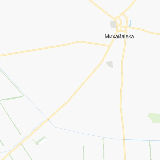
Roadmap (route) to go from Mykhaylivka to Yalta detailed above, you can also see the course layout on the map.
While doing trip Mykhaylivka - Yalta by car, the calculated route ends at a distance , or more straight.
Distance and duration of the route between Mykhaylivka and Yalta
An error occured: undefined - for url https://router.cartes.cc/route?point=47.27235%2C35.22235&point=44.50218%2C34.16624&vehicle=car&debug=false&data_type=application%2Fjson&locale=en&points_encoded=true&instructions=true&elevation=false&optimize=false&timeout=10000&skip.host=true&skip.basePath=true&graphhopper_maps_host=https%3A%2F%2Fgraphhopper.com%2Fmaps%2F%3F&turn_sign_map.0=continue&turn_sign_map.1=turn%20slight%20right&turn_sign_map.2=turn%20right&turn_sign_map.3=turn%20sharp%20right&turn_sign_map.4=finish&turn_sign_map.5=reached%20via%20point&turn_sign_map.6=enter%20roundabout&turn_sign_map.-6=leave%20roundabout&turn_sign_map.-3=turn%20sharp%20left&turn_sign_map.-2=turn%20left&turn_sign_map.-1=turn%20slight%20left&key=&position=topleft
Calculation of distance and route from Yalta to Mykhaylivka :
318.5387.9 km6h34mn
Continue onto Центральна вулиця 0h0mn 261 mContinue onto Т-08-10 0h0mn 71 mTurn left onto Т-08-10 0h8mn 6.8 kmTurn right onto Степова вулиця 0h6mn 7.4 kmTurn right onto М-18 1h34mn 42.6 kmContinue onto Гетьмана Сагайдачного вулиця 0h0mn 243 mTurn right onto Богдана Хмельницького проспект 0h5mn 4.1 kmAt roundabout, take exit 2 onto М-18 2h3mn 150.1 kmContinue onto 35А-002, М-18, 35А-001 1h15mn 90.1 kmKeep left 0h2mn 1.9 kmAt roundabout, take exit 2 onto Киевская улица 0h2mn 2.0 kmAt roundabout, take exit 2 onto Киевская улица 0h2mn 2.3 kmAt roundabout, take exit 3 onto улица Беспалова 0h3mn 2.6 kmTurn sharp left 0h0mn 170 mTurn right onto 35А-002, М-18 1h2mn 66.4 kmContinue onto Южнобережное шоссе 0h7mn 7.3 kmKeep left 0h2mn 2.2 kmTurn right onto улица Карла Маркса 0h0mn 300 mTurn sharp right onto Садовая улица 0h1mn 790 mTurn left onto переулок Карла Либкнехта 0h0mn 135 mTurn right onto переулок Карла Либкнехта 0h0mn 112 mArrive at destination 0h0mn 0 m
Travel from Mykhaylivka (Republic of Crimea) to a selection of major cities.
Distances from Mykhaylivka to biggest cities in Zaporizhia
Other major cities in country :
- Zhytomyr [27], 282,192 inhabitants. 584 km
- Horlivka [05], 278,550 inhabitants. 242 km
- Rivne [19], 255,106 inhabitants. 755 km
- Kropyvnytskyi [10], 249,454 inhabitants. 261 km
- Kamianske [04], 248,575 inhabitants. 145 km
- Chernivtsi [03], 236,250 inhabitants. 703 km
- Ternopil [22], 235,676 inhabitants. 755 km
- Kremenchuk [18], 227,494 inhabitants. 241 km
- Lutsk [24], 213,661 inhabitants. 818 km
- Ivano-Frankivsk [06], 204,200 inhabitants. 802 km
- Bila Tserkva [13], 199,163 inhabitants. 471 km
- Kramators'k [05], 173,700 inhabitants. 237 km
- Kerch [11], 148,932 inhabitants. 234 km
- Nikopol [04], 130,500 inhabitants. 71 km
- Syevyerodonets'k [14], 130,000 inhabitants. 306 km
- Sloviansk [05], 124,800 inhabitants. 251 km
- Uzhgorod [25], 117,878 inhabitants. 974 km
- Alchevs'k [14], 116,000 inhabitants. 300 km
- Pavlohrad [04], 115,932 inhabitants. 149 km
- Lysychans'k [14], 111,600 inhabitants. 301 km
Route from Yalta to major cities (Ukraine).
- Distance Yalta Kyiv717 km
- Distance Yalta Kharkiv630 km
- Distance Yalta Dnipro446 km
- Distance Yalta Donetsk481 km
- Distance Yalta Odessa347 km
- Distance Yalta Zaporizhia378 km
- Distance Yalta Lviv969 km
- Distance Yalta Kryvyi Rih384 km
- Distance Yalta Mykolayiv322 km
- Distance Yalta Mariupol390 km
- Distance Yalta Luhansk600 km
- Distance Yalta Sevastopol52 km
- Distance Yalta Khmelnytskyi772 km
- Distance Yalta Makiyivka489 km
- Distance Yalta Vinnytsia681 km
- Distance Yalta Kherson268 km
- Distance Yalta Poltava567 km
- Distance Yalta Chernihiv808 km
- Distance Yalta Cherkasy571 km
- Distance Yalta Sumy716 km
Nearest cities to Mykhaylivka :
- Kharkiv, 1,430,885 inhabitants. 311 km
- Dnipro, 1,032,822 inhabitants. 133 km
- Donetsk, 1,024,700 inhabitants. 211 km
- Zaporizhia, 796,217 inhabitants. 61 km
- Kryvyi Rih, 652,380 inhabitants. 155 km
- Mariupol, 481,626 inhabitants. 177 km
- Sevastopol, 416,263 inhabitants. 326 km
- Makiyivka, 376,610 inhabitants. 220 km
- Simferopol, 336,460 inhabitants. 272 km
- Kherson, 320,477 inhabitants. 209 km
- Poltava, 317,847 inhabitants. 263 km
- Horlivka, 278,550 inhabitants. 242 km
- Kropyvnytskyi, 249,454 inhabitants. 261 km
- Kamianske, 248,575 inhabitants. 145 km
- Kremenchuk, 227,494 inhabitants. 241 km
- Kramators'k, 173,700 inhabitants. 237 km
- Melitopol, 158,000 inhabitants. 48 km
- Kerch, 148,932 inhabitants. 234 km
- Nikopol, 130,500 inhabitants. 71 km
- Sloviansk, 124,800 inhabitants. 251 km
- Berdyansk, 118,284 inhabitants. 132 km
- Pavlohrad, 115,932 inhabitants. 149 km
- Yevpatoriya, 106,202 inhabitants. 271 km
- Yenakiyeve, 104,101 inhabitants. 248 km
- Oleksandriya, 103,000 inhabitants. 221 km
- Kostyantynivka, 91,259 inhabitants. 232 km
- Bakhmut, 80,500 inhabitants. 254 km
- Yalta, 77,003 inhabitants. 319 km
- Novomoskovs'k, 73,100 inhabitants. 152 km
- Feodosiya, 68,562 inhabitants. 249 km
- Pokrovsk, 68,263 inhabitants. 184 km
- Khartsyz'k, 64,000 inhabitants. 235 km
- Druzhkivka, 62,315 inhabitants. 230 km
- Lozova, 62,311 inhabitants. 198 km
- Energodar, 55,800 inhabitants. 49 km
- Izyum, 53,778 inhabitants. 263 km
- Lubny, 52,600 inhabitants. 347 km
- Horishni Plavni, 51,740 inhabitants. 227 km
- Zhovti Vody, 51,559 inhabitants. 175 km
- Nova Kakhovka, 50,672 inhabitants. 153 km
- Marhanets', 50,443 inhabitants. 60 km
- Myrnohrad, 49,646 inhabitants. 191 km
- Svitlovods'k, 47,946 inhabitants. 246 km
- Toretsk, 41,758 inhabitants. 233 km
- Dzhankoy, 41,731 inhabitants. 185 km
- Myrhorod, 41,377 inhabitants. 323 km
- Yasynuvata, 37,600 inhabitants. 219 km
- Kakhovka, 36,816 inhabitants. 141 km
- Chuhuyiv, 36,519 inhabitants. 305 km
- Dobropillya, 35,977 inhabitants. 192 km
Location Mykhaylivka (Zaporizhia) :
| Country flag |  |
| Location | Mykhaylivka |
| State | Zaporizhia |
| County | |
| Country | Ukraine |
| Country code / ISO 2 | UA |
| Latitude | 47.2723500 |
| Longitude | 35.2223500 |
| Altitude | 0 meters |
| Time zone | Europe/Zaporozhye |
Location Yalta (Republic of Crimea) :
| Country flag | |
| Location | Yalta |
| State | Republic of Crimea |
| County | Gorodskoy okrug Yalta |
| Country | Ukraine |
| Country code / ISO 2 | UA |
| Latitude | 44.5021800 |
| Longitude | 34.1662400 |
| Altitude | 54 meters |
| Time zone | Europe/Simferopol |