

How to get from Belogorsk (Republic of Crimea) to Mariupol (Donetsk)
Calculate route from Belogorsk (Republic of Crimea, Ukraine) to Mariupol (Donetsk, Ukraine).
The flight distance (as the crow flies) between Belogorsk and Mariupol is 320.5 km.
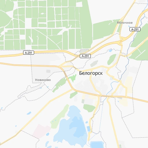
Roadmap (route) to go from Belogorsk to Mariupol detailed above, you can also see the course layout on the map.
While doing trip Belogorsk - Mariupol by car, the calculated route ends at a distance , or more straight.
Distance and duration of the route between Belogorsk and Mariupol
An error occured: undefined - for url https://router.cartes.cc/route?point=45.05462%2C34.60185&point=47.09514%2C37.54131&vehicle=car&debug=false&data_type=application%2Fjson&locale=en&points_encoded=true&instructions=true&elevation=false&optimize=false&timeout=10000&skip.host=true&skip.basePath=true&graphhopper_maps_host=https%3A%2F%2Fgraphhopper.com%2Fmaps%2F%3F&turn_sign_map.0=continue&turn_sign_map.1=turn%20slight%20right&turn_sign_map.2=turn%20right&turn_sign_map.3=turn%20sharp%20right&turn_sign_map.4=finish&turn_sign_map.5=reached%20via%20point&turn_sign_map.6=enter%20roundabout&turn_sign_map.-6=leave%20roundabout&turn_sign_map.-3=turn%20sharp%20left&turn_sign_map.-2=turn%20left&turn_sign_map.-1=turn%20slight%20left&key=&position=topleft
Calculation of distance and route from Mariupol to Belogorsk :
320.5441.2 km6h22mn
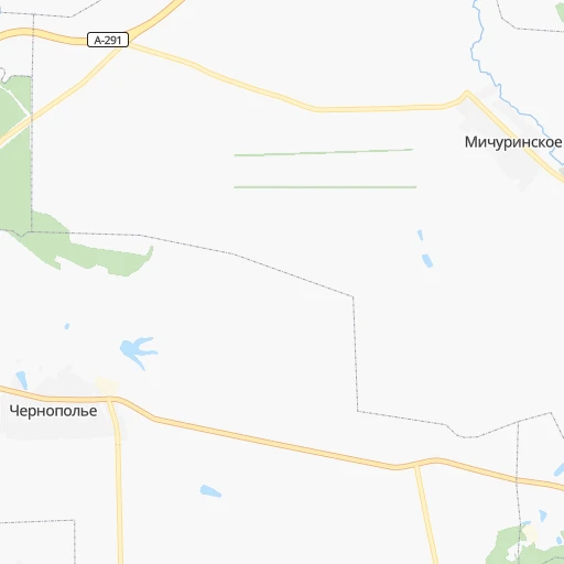
Continue 0h0mn 69 mTurn left 0h0mn 92 mTurn right 0h0mn 73 mTurn left onto улица Семашко 0h0mn 236 mTurn right onto улица Бекира Чобан-Зале 0h0mn 94 mTurn left 0h0mn 373 mTurn right onto Нижнегорская улица 0h3mn 2.7 kmContinue onto 35К-016, Т-01-12 0h25mn 24.9 kmTurn right onto Садовая улица 0h3mn 2.2 kmTurn right onto Первомайская улица 0h2mn 1.7 kmTurn slight right onto 35К-016, Т-01-12 0h14mn 14.1 kmTurn right onto 35К-016, Т-01-12 0h7mn 6.8 kmTurn left onto 35А-001, М-17 1h32mn 42.4 kmTurn right onto 35А-002, М-18, 35А-001 0h2mn 2.0 kmContinue onto 35А-002, М-18 2h59mn 145.4 kmTurn right onto М-14-03 0h14mn 16.8 kmTurn right onto М-14 1h24mn 97.7 kmAt roundabout, take exit 2 onto М-14 1h54mn 62.9 kmKeep right onto М-14 0h0mn 78 mAt roundabout, take exit 2 onto М-14 0h2mn 2.1 kmAt roundabout, take exit 4 onto Миру проспект 0h2mn 2.3 kmContinue onto М-14 0h15mn 15.9 kmTurn right onto Казанцева вулиця 0h0mn 164 mTurn left onto Університетська вулиця 0h0mn 187 mTurn right 0h0mn 25 mArrive at destination 0h0mn 0 m
Travel from Belogorsk (Donetsk) to a selection of major cities.
Distances from Belogorsk to biggest cities in Republic of Crimea
Other major cities in country :
- Zhytomyr [27], 282,192 inhabitants. 730 km
- Horlivka [05], 278,550 inhabitants. 450 km
- Rivne [19], 255,106 inhabitants. 880 km
- Kropyvnytskyi [10], 249,454 inhabitants. 424 km
- Kamianske [04], 248,575 inhabitants. 385 km
- Chernivtsi [03], 236,250 inhabitants. 753 km
- Ternopil [22], 235,676 inhabitants. 844 km
- Kremenchuk [18], 227,494 inhabitants. 456 km
- Lutsk [24], 213,661 inhabitants. 937 km
- Ivano-Frankivsk [06], 204,200 inhabitants. 865 km
- Bila Tserkva [13], 199,163 inhabitants. 628 km
- Kramators'k [05], 173,700 inhabitants. 466 km
- Melitopol [26], 158,000 inhabitants. 208 km
- Nikopol [04], 130,500 inhabitants. 281 km
- Syevyerodonets'k [14], 130,000 inhabitants. 524 km
- Sloviansk [05], 124,800 inhabitants. 482 km
- Berdyansk [26], 118,284 inhabitants. 255 km
- Uzhgorod [25], 117,878 inhabitants. 1,016 km
- Alchevs'k [14], 116,000 inhabitants. 498 km
- Pavlohrad [04], 115,932 inhabitants. 399 km
Route from Mariupol to major cities (Ukraine).
- Distance Mariupol Kyiv636 km
- Distance Mariupol Kharkiv335 km
- Distance Mariupol Dnipro241 km
- Distance Mariupol Odessa523 km
- Distance Mariupol Zaporizhia195 km
- Distance Mariupol Lviv1,042 km
- Distance Mariupol Kryvyi Rih326 km
- Distance Mariupol Mykolayiv421 km
- Distance Mariupol Luhansk211 km
- Distance Mariupol Sevastopol418 km
- Distance Mariupol Khmelnytskyi822 km
- Distance Mariupol Vinnytsia713 km
- Distance Mariupol Simferopol356 km
- Distance Mariupol Kherson378 km
- Distance Mariupol Poltava356 km
- Distance Mariupol Chernihiv668 km
- Distance Mariupol Cherkasy482 km
- Distance Mariupol Sumy471 km
- Distance Mariupol Zhytomyr740 km
- Distance Mariupol Rivne916 km
Nearest cities to Belogorsk :
- Zaporizhia, 796,217 inhabitants. 311 km
- Kryvyi Rih, 652,380 inhabitants. 331 km
- Mykolayiv, 510,840 inhabitants. 293 km
- Mariupol, 481,626 inhabitants. 321 km
- Sevastopol, 416,263 inhabitants. 100 km
- Simferopol, 336,460 inhabitants. 40 km
- Kherson, 320,477 inhabitants. 235 km
- Melitopol, 158,000 inhabitants. 208 km
- Kerch, 148,932 inhabitants. 151 km
- Nikopol, 130,500 inhabitants. 281 km
- Berdyansk, 118,284 inhabitants. 255 km
- Yevpatoriya, 106,202 inhabitants. 98 km
- Yalta, 77,003 inhabitants. 70 km
- Feodosiya, 68,562 inhabitants. 61 km
- Energodar, 55,800 inhabitants. 272 km
- Nova Kakhovka, 50,672 inhabitants. 213 km
- Marhanets', 50,443 inhabitants. 287 km
- Dzhankoy, 41,731 inhabitants. 75 km
- Kakhovka, 36,816 inhabitants. 214 km
- Tokmak, 34,926 inhabitants. 259 km
- Krasnoperekops'k, 30,700 inhabitants. 118 km
- Alushta, 29,586 inhabitants. 45 km
- Tsyurupyns'k, 28,800 inhabitants. 227 km
- Saki, 28,322 inhabitants. 79 km
- Bakhchisaray, 27,351 inhabitants. 67 km
- Armyansk, 24,442 inhabitants. 137 km
- Volnovakha, 23,731 inhabitants. 360 km
- Heniches'k, 21,663 inhabitants. 126 km
- Polohy, 21,380 inhabitants. 299 km
- Kurakhovo, 20,700 inhabitants. 385 km
- Dniprorudne, 20,271 inhabitants. 261 km
- Skadovs'k, 19,404 inhabitants. 177 km
- Balaklava, 18,649 inhabitants. 100 km
- Orikhiv, 17,287 inhabitants. 294 km
- Sudak, 16,597 inhabitants. 37 km
- Hulyaypole, 16,442 inhabitants. 317 km
- Belogorsk, 16,428 inhabitants. 0 km
- Hola Prystan', 16,102 inhabitants. 230 km
- Apostolove, 15,828 inhabitants. 298 km
- Novyy Buh, 15,646 inhabitants. 334 km
- Vasylivka, 15,012 inhabitants. 270 km
- Beryslav, 14,880 inhabitants. 219 km
- Snihurivka, 14,873 inhabitants. 264 km
- Prymors'k, 13,900 inhabitants. 231 km
- Nova Odesa, 13,547 inhabitants. 332 km
- Mykhaylivka, 13,216 inhabitants. 251 km
- Bashtanka, 12,657 inhabitants. 310 km
- Gvardeyskoye, 12,589 inhabitants. 46 km
- Primorskiy, 12,560 inhabitants. 69 km
- Yakymivka, 12,353 inhabitants. 188 km
Location Belogorsk (Republic of Crimea) :
| Country flag |  |
| Location | Belogorsk |
| State | Republic of Crimea |
| County | Belogorskiy rayon |
| Country | Ukraine |
| Country code / ISO 2 | UA |
| Latitude | 45.0546200 |
| Longitude | 34.6018500 |
| Altitude | 0 meters |
| Time zone | Europe/Simferopol |
Location Mariupol (Donetsk) :
| Country flag | |
| Location | Mariupol |
| State | Donetsk |
| County | |
| Country | Ukraine |
| Country code / ISO 2 | UA |
| Latitude | 47.0951400 |
| Longitude | 37.5413100 |
| Altitude | 0 meters |
| Time zone | Europe/Kiev |


