
How to get from Edirne (Edirne) to İnegöl (Bursa)
Calculate route from Edirne (Edirne, Turkey) to İnegöl (Bursa, Turkey).
The flight distance (as the crow flies) between Edirne and İnegöl is 305.5 km.
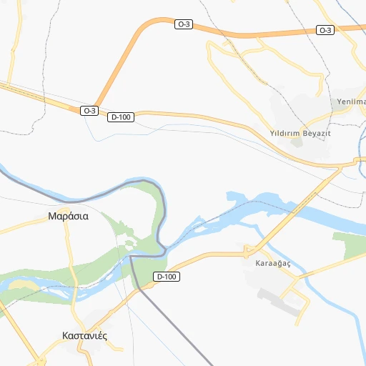
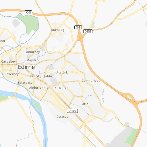
Roadmap (route) to go from Edirne to İnegöl detailed above, you can also see the course layout on the map.
While doing trip Edirne - İnegöl by car, the calculated route ends at a distance , or more straight.
Distance and duration of the route between Edirne and İnegöl
An error occured: undefined - for url https://router.cartes.cc/route?point=41.67719%2C26.55597&point=40.07806%2C29.51333&vehicle=car&debug=false&data_type=application%2Fjson&locale=en&points_encoded=true&instructions=true&elevation=false&optimize=false&timeout=10000&skip.host=true&skip.basePath=true&graphhopper_maps_host=https%3A%2F%2Fgraphhopper.com%2Fmaps%2F%3F&turn_sign_map.0=continue&turn_sign_map.1=turn%20slight%20right&turn_sign_map.2=turn%20right&turn_sign_map.3=turn%20sharp%20right&turn_sign_map.4=finish&turn_sign_map.5=reached%20via%20point&turn_sign_map.6=enter%20roundabout&turn_sign_map.-6=leave%20roundabout&turn_sign_map.-3=turn%20sharp%20left&turn_sign_map.-2=turn%20left&turn_sign_map.-1=turn%20slight%20left&key=&position=topleft
Calculation of distance and route from İnegöl to Edirne :
305.5406.9 km4h18mn
Continue onto Atatürk Bulvarı 0h0mn 41 mTurn left 0h0mn 149 mTurn left onto D535 0h2mn 2.1 kmAt roundabout, take exit 2 onto Lalapaşa Yolu 0h1mn 964 mTurn slight right onto D535 0h0mn 97 mKeep right onto Lalapaşa Kavşağı and take O-3 toward İstanbul, Kırklareli, Havsa 2h55mn 219.3 kmKeep left onto 2. İstanbul Çevre Yolu and drive toward Otogar, GaziosmanpaşaKadıköy, Ankara 0h16mn 27.5 kmContinue onto 2. Çevre Yolu 0h4mn 6.0 kmKeep right onto K-10 Anadolu Otoyolu Kavşağı 0h22mn 42.5 kmKeep right onto K-7-1 Muallimköy Köprülü Kavşağı and take O-5 toward Osmangazi̇ Köprüsü, Yalova, Bursa, İzmi̇r, Bi̇li̇şi̇m Vadi̇si̇ 0h2mn 1.7 kmKeep left onto Kocaeli - İzmir Otoyolu and take O-5 toward Osmangazi̇ Köprüsü, Yalova, Bursa, İzmi̇r, Bi̇li̇şi̇m Vadi̇si̇ 0h21mn 37.7 kmKeep right onto Orhangazi Kavşağı and drive toward Orhangazi, İznik 0h1mn 1.8 kmKeep right 0h2mn 2.3 kmTurn left 0h3mn 1.4 kmTurn right 0h0mn 198 mTurn left 0h0mn 36 mContinue 0h3mn 971 mKeep right 0h1mn 701 mKeep right 0h12mn 6.0 kmTurn left onto Gemlik-İznik yolu 0h6mn 6.2 kmKeep right onto 16-10 0h18mn 19.8 kmTurn right 0h4mn 3.6 kmTurn right 0h5mn 3.9 kmKeep right 0h1mn 624 mTurn left 0h0mn 274 mTurn right 0h1mn 654 mKeep right 0h3mn 2.3 kmTurn right 0h1mn 921 mTurn right onto D595 0h14mn 15.9 kmContinue onto Ahmet Akyollu Caddesi 0h1mn 764 mTurn left 0h0mn 286 mTurn right 0h0mn 152 mArrive at destination 0h0mn 0 m
Travel from Edirne (Bursa) to a selection of major cities.
Distances from Edirne to biggest cities in Edirne
Other major cities in country :
- Sanliurfa [63], 449,549 inhabitants. 1,165 km
- Malatya [44], 441,805 inhabitants. 1,068 km
- Sultangazi [34], 436,935 inhabitants. 203 km
- Maltepe [34], 427,040 inhabitants. 232 km
- Erzurum [25], 420,691 inhabitants. 1,255 km
- Samsun [55], 394,050 inhabitants. 816 km
- Batman [76], 381,990 inhabitants. 1,314 km
- Kahramanmaras [46], 376,045 inhabitants. 998 km
- Van [65], 371,713 inhabitants. 1,474 km
- Atasehir [34], 361,615 inhabitants. 228 km
- Sisli [34], 314,684 inhabitants. 214 km
- Denizli [20], 313,238 inhabitants. 485 km
- Batikent [68], 300,000 inhabitants. 554 km
- Elazig [23], 298,004 inhabitants. 1,127 km
- Zeytinburnu [34], 288,743 inhabitants. 210 km
- Adapazari [54], 286,787 inhabitants. 337 km
- Sultanbeyli [34], 286,622 inhabitants. 241 km
- Gebze [41], 281,436 inhabitants. 260 km
- Merkezefendi [20], 280,341 inhabitants. 481 km
- Sivas [58], 264,022 inhabitants. 908 km
Route from İnegöl to major cities (Turkey).
- Distance İnegöl Istanbul115 km
- Distance İnegöl Ankara285 km
- Distance İnegöl Izmir276 km
- Distance İnegöl Adana611 km
- Distance İnegöl Gaziantep763 km
- Distance İnegöl Konya356 km
- Distance İnegöl Cankaya286 km
- Distance İnegöl Antalya368 km
- Distance İnegöl Bagcilar121 km
- Distance İnegöl Diyarbakir956 km
- Distance İnegöl Kayseri535 km
- Distance İnegöl UEskuedar113 km
- Distance İnegöl Bahcelievler117 km
- Distance İnegöl Umraniye110 km
- Distance İnegöl Mersin576 km
- Distance İnegöl Esenler120 km
- Distance İnegöl Eskisehir92 km
- Distance İnegöl Karabaglar279 km
- Distance İnegöl Muratpasa371 km
- Distance İnegöl Sanliurfa869 km
Nearest cities to Edirne :
- Istanbul, 14,804,116 inhabitants. 213 km
- Bursa, 1,412,701 inhabitants. 267 km
- Bagcilar, 724,270 inhabitants. 205 km
- UEskuedar, 582,666 inhabitants. 219 km
- Bahcelievler, 576,799 inhabitants. 207 km
- Umraniye, 573,265 inhabitants. 227 km
- Esenler, 520,235 inhabitants. 206 km
- Sultangazi, 436,935 inhabitants. 203 km
- Maltepe, 427,040 inhabitants. 232 km
- Atasehir, 361,615 inhabitants. 228 km
- Sisli, 314,684 inhabitants. 214 km
- Zeytinburnu, 288,743 inhabitants. 210 km
- Sultanbeyli, 286,622 inhabitants. 241 km
- Gebze, 281,436 inhabitants. 260 km
- Sancaktepe, 241,000 inhabitants. 236 km
- Balikesir, 238,151 inhabitants. 252 km
- Esenyurt, 211,330 inhabitants. 191 km
- Corlu, 202,578 inhabitants. 119 km
- Arnavutkoey, 198,165 inhabitants. 190 km
- Basaksehir, 193,750 inhabitants. 199 km
- Bueyuekcekmece, 163,140 inhabitants. 185 km
- Inegol, 133,959 inhabitants. 306 km
- Edirne, 126,470 inhabitants. 0 km
- Beylikduezue, 122,452 inhabitants. 191 km
- Tekirdag, 122,287 inhabitants. 111 km
- Bandirma, 107,631 inhabitants. 190 km
- Mustafakemalpasa, 101,412 inhabitants. 240 km
- Luleburgaz, 90,899 inhabitants. 74 km
- Canakkale, 87,791 inhabitants. 170 km
- Akhisar, 84,659 inhabitants. 326 km
- Cerkezkoey, 84,234 inhabitants. 128 km
- Yalova, 71,289 inhabitants. 255 km
- Gemlik, 71,063 inhabitants. 259 km
- Ayvalik, 70,002 inhabitants. 263 km
- Soma, 65,934 inhabitants. 291 km
- Kirklareli, 58,223 inhabitants. 56 km
- Bergama, 57,200 inhabitants. 289 km
- Eminoenue, 55,548 inhabitants. 215 km
- Silivri, 53,167 inhabitants. 156 km
- Tavsanli, 52,182 inhabitants. 344 km
- Orhangazi, 51,792 inhabitants. 266 km
- Kavakli, 50,502 inhabitants. 162 km
- guengoeren merter, 50,000 inhabitants. 209 km
- Merter Keresteciler, 50,000 inhabitants. 208 km
- Aliaga, 44,883 inhabitants. 322 km
- Kesan, 44,644 inhabitants. 92 km
- Karacabey, 44,256 inhabitants. 223 km
- Edremit, 40,777 inhabitants. 235 km
- Gonen, 40,763 inhabitants. 198 km
- Burhaniye, 38,083 inhabitants. 245 km
Location Edirne (Edirne) :
| Country flag |  |
| Location | Edirne |
| State | Edirne |
| County | |
| Country | Turkey |
| Country code / ISO 2 | TR |
| Latitude | 41.6771900 |
| Longitude | 26.5559700 |
| Altitude | 0 meters |
| Time zone | Europe/Istanbul |
Location İnegöl (Bursa) :
| Country flag | |
| Location | İnegöl |
| State | Bursa |
| County | İnegöl |
| Country | Turkey |
| Country code / ISO 2 | TR |
| Latitude | 40.0780600 |
| Longitude | 29.5133300 |
| Altitude | 0 meters |
| Time zone | Europe/Istanbul |


