


How to get from Beypazarı (Ankara) to Kastamonu (Kastamonu)
Calculate route from Beypazarı (Ankara, Turkey) to Kastamonu (Kastamonu, Turkey).
The flight distance (as the crow flies) between Beypazarı and Kastamonu is 206.0 km.
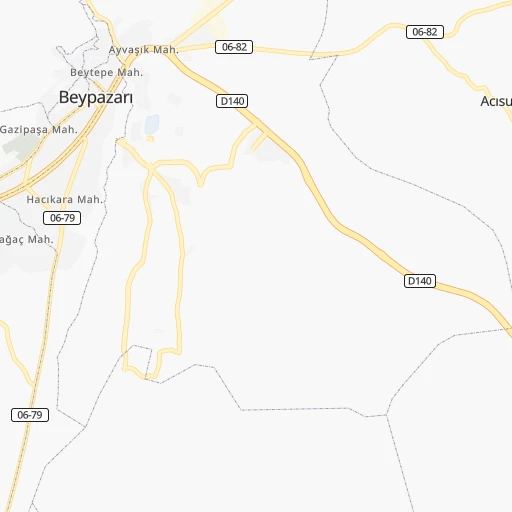
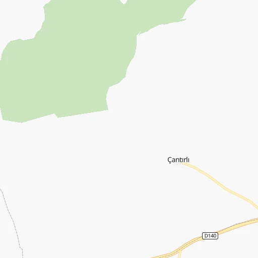
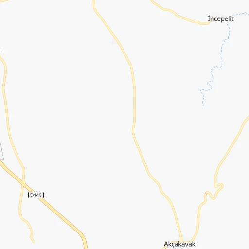
Roadmap (route) to go from Beypazarı to Kastamonu detailed above, you can also see the course layout on the map.
While doing trip Beypazarı - Kastamonu by car, the calculated route ends at a distance , or more straight.
Distance and duration of the route between Beypazarı and Kastamonu
An error occured: undefined - for url https://router.cartes.cc/route?point=40.1675%2C31.92111&point=41.37805%2C33.77528&vehicle=car&debug=false&data_type=application%2Fjson&locale=en&points_encoded=true&instructions=true&elevation=false&optimize=false&timeout=10000&skip.host=true&skip.basePath=true&graphhopper_maps_host=https%3A%2F%2Fgraphhopper.com%2Fmaps%2F%3F&turn_sign_map.0=continue&turn_sign_map.1=turn%20slight%20right&turn_sign_map.2=turn%20right&turn_sign_map.3=turn%20sharp%20right&turn_sign_map.4=finish&turn_sign_map.5=reached%20via%20point&turn_sign_map.6=enter%20roundabout&turn_sign_map.-6=leave%20roundabout&turn_sign_map.-3=turn%20sharp%20left&turn_sign_map.-2=turn%20left&turn_sign_map.-1=turn%20slight%20left&key=&position=topleft
Calculation of distance and route from Kastamonu to Beypazarı :
206.0266.7 km4h10mn
Continue onto Avlu Bostanları Sokak 0h0mn 23 mTurn sharp right onto İrfan Gümüşel Caddesi 0h0mn 230 mTurn left onto Alparslan Türkeş Bulvarı 0h1mn 1.2 kmKeep left 0h0mn 56 mTurn right onto 06-82 0h20mn 19.9 kmKeep right onto Güdül - Beypazarı yolu 0h0mn 29 mTurn slight right onto Güdül - Beypazarı yolu 1h42mn 41.5 kmKeep right 0h2mn 1.6 kmTurn slight right onto Güdül - Kızılcahamam yolu 0h22mn 21.8 kmTurn left onto Ankara-Bolu yolu 0h5mn 6.2 kmKeep right 0h0mn 183 mContinue onto 06-88 1h46mn 46.1 kmTurn right 0h3mn 2.8 kmContinue 1h48mn 56.4 kmAt roundabout, take exit 2 onto İstanbul-Samsun yolu 0h5mn 6.3 kmKeep right 0h1mn 776 mTurn left onto Şht. Cemil Çelik Cd. 0h1mn 1.3 kmContinue 0h0mn 35 mKeep left 0h0mn 131 mTurn slight left onto İstanbul Caddesi 0h0mn 59 mTurn right 0h0mn 15 mTurn right onto Hafız Ahmet Efendi Caddesi 0h2mn 2.1 kmKeep left 0h0mn 32 mTurn left 0h11mn 13.1 kmAt roundabout, take exit 1 onto Kastamonu-Çankırı yolu 0h2mn 2.2 kmAt roundabout, take exit 2 onto D765 0h7mn 8.5 kmTurn slight right onto Kastamonu-Çankırı yolu 0h22mn 25.8 kmKeep right 0h1mn 724 mTurn sharp left onto Kastamonu-Çankırı yolu 0h0mn 102 mContinue onto Kastamonu-Çankırı yolu 0h0mn 209 mKeep left onto Kastamonu-Çankırı yolu 0h4mn 5.0 kmKeep right onto Ankara Caddesi 0h0mn 369 mContinue onto Ankara Caddesi 0h2mn 1.7 kmTurn left 0h0mn 26 mTurn left onto Cumhuriyet Caddesi 0h0mn 152 mTurn right 0h0mn 97 mArrive at destination 0h0mn 0 m
Travel from Beypazarı (Kastamonu) to a selection of major cities.
Distances from Beypazarı to biggest cities in Ankara
Other major cities in country :
- Sultangazi [34], 436,935 inhabitants. 278 km
- Maltepe [34], 427,040 inhabitants. 249 km
- Erzurum [25], 420,691 inhabitants. 798 km
- Samsun [55], 394,050 inhabitants. 392 km
- Batman [76], 381,990 inhabitants. 836 km
- Kahramanmaras [46], 376,045 inhabitants. 520 km
- Van [65], 371,713 inhabitants. 1,004 km
- Atasehir [34], 361,615 inhabitants. 254 km
- Sisli [34], 314,684 inhabitants. 267 km
- Denizli [20], 313,238 inhabitants. 362 km
- Elazig [23], 298,004 inhabitants. 649 km
- Zeytinburnu [34], 288,743 inhabitants. 271 km
- Adapazari [54], 286,787 inhabitants. 146 km
- Sultanbeyli [34], 286,622 inhabitants. 241 km
- Gebze [41], 281,436 inhabitants. 222 km
- Merkezefendi [20], 280,341 inhabitants. 362 km
- Sivas [58], 264,022 inhabitants. 437 km
- Tarsus [32], 256,482 inhabitants. 445 km
- Trabzon [61], 244,083 inhabitants. 666 km
- Manisa [45], 243,971 inhabitants. 424 km
Route from Kastamonu to major cities (Turkey).
- Distance Kastamonu Istanbul406 km
- Distance Kastamonu Ankara180 km
- Distance Kastamonu Izmir656 km
- Distance Kastamonu Bursa419 km
- Distance Kastamonu Adana505 km
- Distance Kastamonu Gaziantep572 km
- Distance Kastamonu Konya406 km
- Distance Kastamonu Cankaya180 km
- Distance Kastamonu Antalya564 km
- Distance Kastamonu Bagcilar414 km
- Distance Kastamonu Diyarbakir673 km
- Distance Kastamonu Kayseri329 km
- Distance Kastamonu UEskuedar400 km
- Distance Kastamonu Bahcelievler414 km
- Distance Kastamonu Umraniye392 km
- Distance Kastamonu Mersin514 km
- Distance Kastamonu Esenler412 km
- Distance Kastamonu Eskisehir328 km
- Distance Kastamonu Karabaglar658 km
- Distance Kastamonu Muratpasa563 km
Nearest cities to Beypazarı :
- Istanbul, 14,804,116 inhabitants. 268 km
- Ankara, 3,517,182 inhabitants. 84 km
- Bursa, 1,412,701 inhabitants. 243 km
- Konya, 875,530 inhabitants. 260 km
- Cankaya, 792,189 inhabitants. 85 km
- UEskuedar, 582,666 inhabitants. 263 km
- Umraniye, 573,265 inhabitants. 255 km
- Eskisehir, 514,869 inhabitants. 127 km
- Maltepe, 427,040 inhabitants. 249 km
- Atasehir, 361,615 inhabitants. 254 km
- Sisli, 314,684 inhabitants. 267 km
- Denizli, 313,238 inhabitants. 362 km
- Batikent, 300,000 inhabitants. 72 km
- Adapazari, 286,787 inhabitants. 146 km
- Sultanbeyli, 286,622 inhabitants. 241 km
- Gebze, 281,436 inhabitants. 222 km
- Merkezefendi, 280,341 inhabitants. 362 km
- Sancaktepe, 241,000 inhabitants. 246 km
- Kirikkale, 211,138 inhabitants. 140 km
- Izmit, 196,571 inhabitants. 182 km
- Kutahya, 185,008 inhabitants. 185 km
- Isparta, 172,334 inhabitants. 293 km
- Usak, 152,862 inhabitants. 273 km
- Aksaray, 152,201 inhabitants. 270 km
- Afyonkarahisar, 146,136 inhabitants. 197 km
- Inegol, 133,959 inhabitants. 205 km
- Karaman, 120,399 inhabitants. 351 km
- Zonguldak, 100,229 inhabitants. 143 km
- Karabuk, 97,481 inhabitants. 130 km
- Bolu, 96,629 inhabitants. 69 km
- Kirsehir, 94,336 inhabitants. 223 km
- Polatli, 93,262 inhabitants. 68 km
- Eregli, 92,117 inhabitants. 348 km
- Nigde, 91,039 inhabitants. 342 km
- Korfez, 90,580 inhabitants. 193 km
- Eregli, 88,848 inhabitants. 131 km
- Yozgat, 87,881 inhabitants. 249 km
- Nevsehir, 75,527 inhabitants. 295 km
- Khanjarah, 71,379 inhabitants. 152 km
- Yalova, 71,289 inhabitants. 231 km
- Gemlik, 71,063 inhabitants. 236 km
- Kastamonu, 70,402 inhabitants. 206 km
- Burdur, 66,158 inhabitants. 307 km
- Aksehir, 64,446 inhabitants. 206 km
- Cubuk, 62,602 inhabitants. 95 km
- Duzce, 57,739 inhabitants. 98 km
- Goelcuek, 56,189 inhabitants. 184 km
- Bolvadin, 55,870 inhabitants. 179 km
- Eminoenue, 55,548 inhabitants. 266 km
- Bozuyuk, 55,365 inhabitants. 163 km
Location Beypazarı (Ankara) :
| Country flag |  |
| Location | Beypazarı |
| State | Ankara |
| County | |
| Country | Turkey |
| Country code / ISO 2 | TR |
| Latitude | 40.1675000 |
| Longitude | 31.9211100 |
| Altitude | 840 meters |
| Time zone | Europe/Istanbul |
Location Kastamonu (Kastamonu) :
| Country flag | |
| Location | Kastamonu |
| State | Kastamonu |
| County | Cide |
| Country | Turkey |
| Country code / ISO 2 | TR |
| Latitude | 41.3780500 |
| Longitude | 33.7752800 |
| Altitude | 0 meters |
| Time zone | Europe/Istanbul |
