
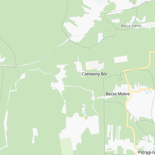
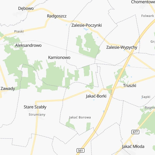
How to get from Czerwony Bór (Podlasie) to Łapy (Podlasie)
Calculate route from Czerwony Bór (Podlasie, Poland) to Łapy (Podlasie, Poland).
The flight distance (as the crow flies) between Czerwony Bór and Łapy is 49.9 km.
Roadmap (route) to go from Czerwony Bór to Łapy detailed above, you can also see the course layout on the map.
While doing trip Czerwony Bór - Łapy by car, the calculated route ends at a distance , or more straight.
Distance and duration of the route between Czerwony Bór and Łapy
An error occured: undefined - for url https://router.cartes.cc/route?point=53.05891%2C22.14632&point=52.9911%2C22.88422&vehicle=car&debug=false&data_type=application%2Fjson&locale=en&points_encoded=true&instructions=true&elevation=false&optimize=false&timeout=10000&skip.host=true&skip.basePath=true&graphhopper_maps_host=https%3A%2F%2Fgraphhopper.com%2Fmaps%2F%3F&turn_sign_map.0=continue&turn_sign_map.1=turn%20slight%20right&turn_sign_map.2=turn%20right&turn_sign_map.3=turn%20sharp%20right&turn_sign_map.4=finish&turn_sign_map.5=reached%20via%20point&turn_sign_map.6=enter%20roundabout&turn_sign_map.-6=leave%20roundabout&turn_sign_map.-3=turn%20sharp%20left&turn_sign_map.-2=turn%20left&turn_sign_map.-1=turn%20slight%20left&key=&position=topleft
Calculation of distance and route from Łapy to Czerwony Bór :
49.956.4 km1h7mn
Continue 0h0mn 116 mTurn right 0h1mn 603 mTurn left onto 63 0h1mn 958 mAt roundabout, take exit 1 onto Kościelna 0h16mn 13.7 kmAt roundabout, take exit 2 0h1mn 427 mAt roundabout, take exit 2 0h3mn 2.3 kmTurn left onto Krzywa 0h11mn 9.0 kmAt roundabout, take exit 2 onto Główna 0h1mn 546 mTurn right onto Główna 0h11mn 9.4 kmTurn left 0h0mn 69 mTurn right 0h1mn 419 mContinue 0h1mn 552 mKeep right 0h5mn 2.5 kmTurn left onto 678 0h0mn 623 mAt roundabout, take exit 2 onto 678 0h1mn 1.5 kmAt roundabout, take exit 3 onto 678 0h5mn 4.9 kmTurn right onto 681 0h7mn 6.9 kmContinue onto Płonkowska 0h2mn 1.7 kmTurn right 0h0mn 15 mTurn left 0h0mn 31 mArrive at destination 0h0mn 0 m
Travel from Czerwony Bór (Podlasie) to a selection of major cities.
Distances from Czerwony Bór to biggest cities in Podlasie
Other major cities in country :
- Praga Poludnie [78], 187,845 inhabitants. 116 km
- Bielsko-Biala [83], 176,515 inhabitants. 419 km
- Olsztyn [85], 171,803 inhabitants. 136 km
- Rzeszow [80], 158,382 inhabitants. 336 km
- Ursynow [78], 147,676 inhabitants. 125 km
- Ruda Slaska [83], 146,189 inhabitants. 386 km
- Wola [78], 143,996 inhabitants. 120 km
- Rybnik [83], 142,510 inhabitants. 413 km
- Bielany [78], 134,854 inhabitants. 118 km
- Srodmiescie [78], 134,306 inhabitants. 120 km
- Dabrowa Gornicza [83], 130,601 inhabitants. 365 km
- Tychy [83], 130,000 inhabitants. 393 km
- Opole [79], 127,676 inhabitants. 393 km
- Elblag [85], 127,558 inhabitants. 218 km
- Plock [78], 127,474 inhabitants. 174 km
- Walbrzych [72], 127,431 inhabitants. 476 km
- Gorzow Wielkopolski [76], 124,430 inhabitants. 466 km
- Targowek [78], 124,316 inhabitants. 113 km
- Wloclawek [73], 120,339 inhabitants. 212 km
- Zielona Gora [76], 118,433 inhabitants. 467 km
Route from Łapy to major cities (Poland).
- Distance Łapy Warsaw152 km
- Distance Łapy Lodz269 km
- Distance Łapy Krakow385 km
- Distance Łapy Wroclaw452 km
- Distance Łapy Poznan407 km
- Distance Łapy Gdansk318 km
- Distance Łapy Szczecin557 km
- Distance Łapy Bydgoszcz327 km
- Distance Łapy Lublin195 km
- Distance Łapy Katowice404 km
- Distance Łapy Gdynia333 km
- Distance Łapy Czestochowa355 km
- Distance Łapy Sosnowiec398 km
- Distance Łapy Radom213 km
- Distance Łapy Mokotow153 km
- Distance Łapy Torun287 km
- Distance Łapy Kielce282 km
- Distance Łapy Gliwice417 km
- Distance Łapy Zabrze410 km
- Distance Łapy Bytom401 km
Nearest cities to Czerwony Bór :
- Warsaw, 1,702,139 inhabitants. 120 km
- Lodz, 768,755 inhabitants. 231 km
- Krakow, 755,050 inhabitants. 367 km
- Lublin, 360,044 inhabitants. 203 km
- Bialystok, 291,855 inhabitants. 69 km
- Radom, 226,794 inhabitants. 197 km
- Mokotow, 212,670 inhabitants. 122 km
- Kielce, 208,598 inhabitants. 265 km
- Praga Poludnie, 187,845 inhabitants. 116 km
- Olsztyn, 171,803 inhabitants. 136 km
- Ursynow, 147,676 inhabitants. 125 km
- Wola, 143,996 inhabitants. 120 km
- Bielany, 134,854 inhabitants. 118 km
- Srodmiescie, 134,306 inhabitants. 120 km
- Dabrowa Gornicza, 130,601 inhabitants. 365 km
- Elblag, 127,558 inhabitants. 218 km
- Plock, 127,474 inhabitants. 174 km
- Targowek, 124,316 inhabitants. 113 km
- Bemowo, 102,393 inhabitants. 122 km
- Jaworzno, 96,541 inhabitants. 374 km
- Praga Polnoc, 93,192 inhabitants. 117 km
- Ochota, 93,192 inhabitants. 122 km
- Bialoleka, 89,324 inhabitants. 114 km
- Piotrkow Trybunalski, 80,128 inhabitants. 248 km
- Siedlce, 77,185 inhabitants. 100 km
- Myslowice, 75,281 inhabitants. 378 km
- Ostrowiec Swietokrzyski, 73,989 inhabitants. 243 km
- Pabianice, 70,542 inhabitants. 245 km
- Suwalki, 69,222 inhabitants. 128 km
- Chelm, 68,043 inhabitants. 232 km
- Tomaszow Mazowiecki, 67,197 inhabitants. 224 km
- Stalowa Wola, 66,495 inhabitants. 276 km
- Zamosc, 66,034 inhabitants. 271 km
- Lomza, 63,723 inhabitants. 14 km
- Belchatow, 62,896 inhabitants. 268 km
- Wawer, 62,656 inhabitants. 116 km
- Mielec, 60,993 inhabitants. 313 km
- Zgierz, 58,036 inhabitants. 229 km
- Biala Podlaska, 57,541 inhabitants. 132 km
- Elk, 55,769 inhabitants. 87 km
- Pruszkow, 55,371 inhabitants. 134 km
- Ostroleka, 53,740 inhabitants. 38 km
- Starachowice, 53,739 inhabitants. 237 km
- Zawiercie, 53,159 inhabitants. 342 km
- Zoliborz, 50,934 inhabitants. 118 km
- Legionowo, 50,786 inhabitants. 110 km
- Tarnobrzeg, 50,459 inhabitants. 279 km
- Pulawy, 49,759 inhabitants. 183 km
- Skarzysko-Kamienna, 49,410 inhabitants. 233 km
- Radomsko, 49,175 inhabitants. 289 km
Location Czerwony Bór (Podlasie) :
| Country flag |  |
| Location | Czerwony Bór |
| State | Podlasie |
| County | Powiat zambrowski |
| Country | Poland |
| Country code / ISO 2 | PL |
| Latitude | 53.0589100 |
| Longitude | 22.1463200 |
| Altitude | 0 meters |
| Time zone | Europe/Warsaw |
Location Łapy (Podlasie) :
| Country flag | |
| Location | Łapy |
| State | Podlasie |
| County | Powiat białostocki |
| Country | Poland |
| Country code / ISO 2 | PL |
| Latitude | 52.9911000 |
| Longitude | 22.8842200 |
| Altitude | 0 meters |
| Time zone | Europe/Warsaw |