


How to get from Vias Railway Station (Occitanie) to Auch (Occitanie)
Calculate route from Vias Railway Station (Occitanie, France) to Auch (Occitanie, France).
The flight distance (as the crow flies) between Vias Railway Station and Auch is 231.7 km.
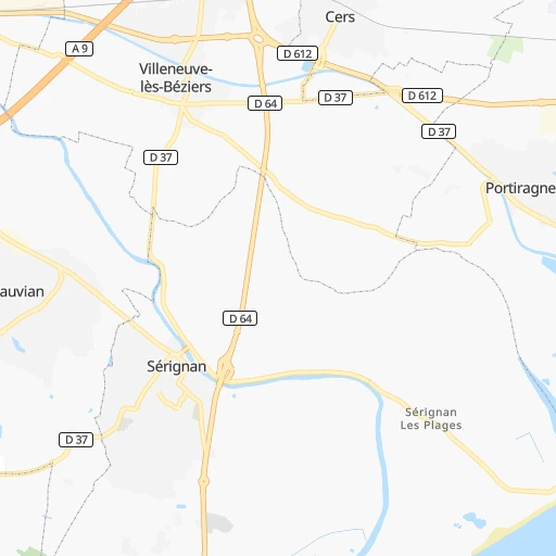
Roadmap (route) to go from Vias Railway Station to Auch detailed above, you can also see the course layout on the map.
While doing trip Vias Railway Station - Auch by car, the calculated route ends at a distance , or more straight.
Distance and duration of the route between Vias Railway Station and Auch
An error occured: undefined - for url https://router.cartes.cc/route?point=43.31623%2C3.42538&point=43.6454%2C0.58793&vehicle=car&debug=false&data_type=application%2Fjson&locale=en&points_encoded=true&instructions=true&elevation=false&optimize=false&timeout=10000&skip.host=true&skip.basePath=true&graphhopper_maps_host=https%3A%2F%2Fgraphhopper.com%2Fmaps%2F%3F&turn_sign_map.0=continue&turn_sign_map.1=turn%20slight%20right&turn_sign_map.2=turn%20right&turn_sign_map.3=turn%20sharp%20right&turn_sign_map.4=finish&turn_sign_map.5=reached%20via%20point&turn_sign_map.6=enter%20roundabout&turn_sign_map.-6=leave%20roundabout&turn_sign_map.-3=turn%20sharp%20left&turn_sign_map.-2=turn%20left&turn_sign_map.-1=turn%20slight%20left&key=&position=topleft
Calculation of distance and route from Auch to Vias Railway Station :
231.7273.9 km3h43mn
Continue 0h0mn 0 mTurn left onto Avenue de la Gare 0h0mn 116 mTurn right onto Chemin de Pierrefeu 0h0mn 80 mTurn right onto Avenue d'Agde 0h1mn 446 mAt roundabout, take exit 3 onto Avenue de Béziers 0h1mn 419 mAt roundabout, take exit 1 onto Avenue de Béziers 0h1mn 513 mAt roundabout, take exit 3 onto Avenue de Béziers 0h1mn 984 mContinue onto D 612 0h2mn 2.9 kmAt roundabout, take exit 3 onto D 612 0h2mn 1.9 kmAt roundabout, take exit 2 onto D 612 0h3mn 3.6 kmKeep right onto D 612 and drive toward A 9, A 75, Béziers-Centre, Pézenas 0h2mn 1.9 kmKeep right and take A 75, A 9 toward Clermont-Ferrand, Montpellier, Narbonne, Pézenas, Béziers-La Devèze 0h0mn 277 mAt roundabout, take exit 2 onto Barreau de la Devèze 0h1mn 1.1 kmKeep right onto Barreau de la Devèze and take A 9 toward Barcelone, Narbonne, Montpellier, Sète, Béziers-Ouest 0h1mn 1.3 kmKeep right onto La Méridienne and take A 9 toward Barcelone, Toulouse, Narbonne, Béziers-Ouest 0h18mn 34.1 kmKeep right and take A 61 toward Carcassonne, Toulouse 1h10mn 136.6 kmKeep left onto A 620 and take A 620 toward Le Palays, Toulouse-Centre, Blagnac, Tarbes, Autres Directions 0h10mn 13.6 kmKeep right onto A 624 0h21mn 32.5 kmAt roundabout, take exit 2 onto N 124 0h9mn 11.1 kmAt roundabout, take exit 2 onto N 124 0h15mn 25.4 kmAt roundabout, take exit 3 onto Route de Toulouse 0h0mn 151 mTurn right onto Route de Toulouse 0h2mn 2.6 kmAt roundabout, take exit 2 onto Avenue de la 1re Armée Française 0h2mn 1.7 kmAt roundabout, take exit 2 onto Avenue d'Alsace 0h0mn 314 mTurn left onto Boulevard Sadi Carnot 0h1mn 420 mArrive at destination 0h0mn 0 m
Travel from Vias Railway Station (Occitanie) to a selection of major cities.
Distances from Vias Railway Station to biggest cities in Occitanie
- Cahors,23,331 inhabitants.203 km
- Millau,23,307 inhabitants.91 km
- Agde,23,001 inhabitants.4 km
- Frontignan,22,251 inhabitants.30 km
Other major cities in country :
- Le Mans [52], 144,515 inhabitants. 578 km
- Amiens [32], 143,086 inhabitants. 738 km
- Tours [24], 141,621 inhabitants. 501 km
- Limoges [75], 141,176 inhabitants. 329 km
- Clermont-Ferrand [84], 138,681 inhabitants. 276 km
- Villeurbanne [84], 131,445 inhabitants. 296 km
- Besancon [27], 128,426 inhabitants. 483 km
- Orleans [24], 124,149 inhabitants. 524 km
- Metz [44], 123,914 inhabitants. 680 km
- Rouen [28], 112,787 inhabitants. 705 km
- Mulhouse [44], 111,430 inhabitants. 580 km
- Caen [28], 110,624 inhabitants. 715 km
- Boulogne-Billancourt [11], 108,782 inhabitants. 621 km
- Nancy [44], 105,334 inhabitants. 634 km
- Argenteuil [11], 101,475 inhabitants. 634 km
- Saint-Denis [11], 96,128 inhabitants. 631 km
- Roubaix [32], 95,721 inhabitants. 822 km
- Tourcoing [32], 91,574 inhabitants. 825 km
- Montreuil [11], 90,652 inhabitants. 622 km
- Avignon [93], 89,769 inhabitants. 132 km
Route from Auch to major cities (France).
- Distance Auch Paris595 km
- Distance Auch Marseille389 km
- Distance Auch Lyon410 km
- Distance Auch Nice538 km
- Distance Auch Nantes431 km
- Distance Auch Strasbourg779 km
- Distance Auch Bordeaux162 km
- Distance Auch Lille800 km
- Distance Auch Rennes527 km
- Distance Auch Reims677 km
- Distance Auch Le Havre652 km
- Distance Auch Cergy-Pontoise611 km
- Distance Auch Saint-Etienne361 km
- Distance Auch Toulon436 km
- Distance Auch Angers435 km
- Distance Auch Grenoble442 km
- Distance Auch Dijon535 km
- Distance Auch Aix-en-Provence392 km
- Distance Auch Saint-Quentin-en-Yvelines581 km
- Distance Auch Brest658 km
Nearest cities to Vias Railway Station :
- Marseille, 794,811 inhabitants. 158 km
- Lyon, 472,317 inhabitants. 293 km
- Toulouse, 433,055 inhabitants. 163 km
- Montpellier, 248,252 inhabitants. 49 km
- Saint-Etienne, 176,280 inhabitants. 248 km
- Toulon, 168,701 inhabitants. 204 km
- Grenoble, 158,552 inhabitants. 276 km
- Nimes, 148,236 inhabitants. 95 km
- Aix-en-Provence, 146,821 inhabitants. 165 km
- Limoges, 141,176 inhabitants. 329 km
- Clermont-Ferrand, 138,681 inhabitants. 276 km
- Villeurbanne, 131,445 inhabitants. 296 km
- Perpignan, 110,706 inhabitants. 81 km
- Avignon, 89,769 inhabitants. 132 km
- Marseille 13, 89,316 inhabitants. 161 km
- Marseille 08, 78,837 inhabitants. 159 km
- Marseille 15, 77,770 inhabitants. 156 km
- Marseille 09, 76,868 inhabitants. 161 km
- Beziers, 74,081 inhabitants. 17 km
- Valence, 63,864 inhabitants. 214 km
- La Seyne-sur-Mer, 62,330 inhabitants. 201 km
- Marseille 14, 61,920 inhabitants. 158 km
- Chambery, 61,640 inhabitants. 320 km
- Marseille 12, 58,734 inhabitants. 163 km
- Venissieux, 57,584 inhabitants. 289 km
- Marseille 11, 56,792 inhabitants. 163 km
- Brive-la-Gaillarde, 53,466 inhabitants. 254 km
- Arles, 53,431 inhabitants. 105 km
- Montauban, 52,434 inhabitants. 183 km
- Albi, 52,409 inhabitants. 124 km
- Marseille 10, 51,299 inhabitants. 161 km
- Narbonne, 50,776 inhabitants. 37 km
- Hyeres, 50,487 inhabitants. 220 km
- Carcassonne, 49,600 inhabitants. 88 km
- Annecy, 49,232 inhabitants. 359 km
- Castres, 47,275 inhabitants. 100 km
- Marseille 04, 47,193 inhabitants. 160 km
- Martigues, 45,749 inhabitants. 132 km
- Marseille 03, 45,414 inhabitants. 158 km
- Bourg-en-Bresse, 45,340 inhabitants. 352 km
- Aubagne, 44,844 inhabitants. 174 km
- Marseille 05, 44,583 inhabitants. 160 km
- Istres, 44,373 inhabitants. 128 km
- Marseille 06, 43,360 inhabitants. 158 km
- Caluire-et-Cuire, 42,763 inhabitants. 297 km
- Gap, 42,715 inhabitants. 254 km
- Ales, 42,410 inhabitants. 104 km
- Saint-Priest, 41,641 inhabitants. 291 km
- Salon-de-Provence, 41,397 inhabitants. 140 km
- Marseille 01, 40,919 inhabitants. 159 km
Location Vias Railway Station (Occitanie) :
| Country flag |  |
| Location | Vias Railway Station |
| State | Occitanie |
| County | Département de l'Hérault |
| Country | France |
| Country code / ISO 2 | FR |
| Latitude | 43.3162300 |
| Longitude | 3.4253800 |
| Altitude | 0 meters |
| Time zone | Europe/Paris |
Location Auch (Occitanie) :
| Country flag | |
| Location | Auch |
| State | Occitanie |
| County | Gers |
| Country | France |
| Country code / ISO 2 | FR |
| Latitude | 43.6454000 |
| Longitude | 0.5879300 |
| Altitude | 0 meters |
| Time zone | Europe/Paris |


