
How to get from Yevpatoria (airport) (Republic of Crimea) to Sumy (Sumy)
Calculate route from Yevpatoria (airport) (Republic of Crimea, Ukraine) to Sumy (Sumy, Ukraine).
The flight distance (as the crow flies) between Yevpatoria (airport) and Sumy is 641.7 km.
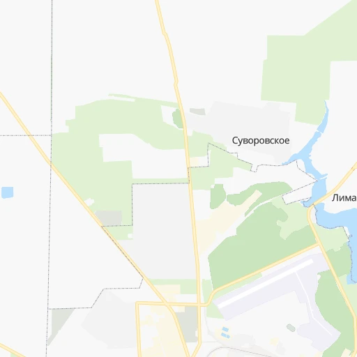
Roadmap (route) to go from Yevpatoria Airport to Sumy detailed above, you can also see the course layout on the map.
While doing trip Yevpatoria (airport) - Sumy by car, the calculated route ends at a distance , or more straight.
Distance and duration of the route between Yevpatoria (airport) and Sumy
An error occured: undefined - for url https://router.cartes.cc/route?point=45.22567%2C33.37621&point=50.9216%2C34.80029&vehicle=car&debug=false&data_type=application%2Fjson&locale=en&points_encoded=true&instructions=true&elevation=false&optimize=false&timeout=10000&skip.host=true&skip.basePath=true&graphhopper_maps_host=https%3A%2F%2Fgraphhopper.com%2Fmaps%2F%3F&turn_sign_map.0=continue&turn_sign_map.1=turn%20slight%20right&turn_sign_map.2=turn%20right&turn_sign_map.3=turn%20sharp%20right&turn_sign_map.4=finish&turn_sign_map.5=reached%20via%20point&turn_sign_map.6=enter%20roundabout&turn_sign_map.-6=leave%20roundabout&turn_sign_map.-3=turn%20sharp%20left&turn_sign_map.-2=turn%20left&turn_sign_map.-1=turn%20slight%20left&key=&position=topleft
Calculation of distance and route from Sumy to Yevpatoria (airport) :
641.7852.5 km13h51mn
Continue 0h3mn 700 mKeep right 0h1mn 237 mTurn right 0h0mn 71 mTurn right 0h0mn 89 mTurn slight right onto Лесное шоссе 0h2mn 2.4 kmTurn left onto 35К-015, Т-01-11 0h30mn 29.9 kmKeep right onto 35К-008, Т-01-02 0h4mn 4.2 kmTurn right onto Евпаторийская улица 0h20mn 22.0 kmTurn right onto улица Ленина 0h4mn 4.6 kmTurn left 1h34mn 28.4 kmTurn slight right 0h4mn 3.2 kmTurn right onto Солнечная улица 0h2mn 1.3 kmTurn left onto улица Строителей 0h2mn 1.3 kmTurn left onto улица Титова 0h1mn 975 mTurn sharp right onto улица 60 Лет Октября 0h1mn 1.0 kmTurn left onto 35А-002, М-18 0h23mn 28.1 kmContinue onto 35А-002, М-18 2h3mn 150.0 kmAt roundabout, take exit 2 onto Богдана Хмельницького проспект 0h5mn 4.2 kmContinue onto 50 років Перемоги проспект 0h2mn 2.3 kmTurn slight right onto 50 років Перемоги проспект 0h0mn 327 mTurn right onto Олександра Тишлера провулок 0h2mn 1.5 kmTurn left onto Незалежності вулиця 0h1mn 539 mTurn right onto Суворова вулиця 0h0mn 72 mTurn right onto Т-04-01 0h16mn 15.8 kmTurn left onto Т-04-01 1h34mn 38.9 kmAt roundabout, take exit 2 onto Гоголя вулиця 0h0mn 437 mAt roundabout, take exit 3 onto Гоголя вулиця 1h32mn 31.2 kmContinue onto Н-08, Т-04-08 0h6mn 5.3 kmTurn left onto Овчаренка вулиця 0h5mn 3.7 kmTurn right onto Запорізька вулиця 0h0mn 435 mAt roundabout, take exit 2 onto Н-08 1h44mn 50.9 kmTurn right onto М-18 1h29mn 101.6 kmTurn right onto Гетьманська вулиця 0h16mn 16.5 kmKeep right and take М-29 toward Харків 1h59mn 98.5 kmKeep right and drive toward Миколо-Комишувата, Оленівка 0h0mn 256 mKeep left onto О-211718 and drive toward Миколо-Комишувата 0h11mn 9.3 kmTurn left onto О-211718 0h27mn 22.3 kmTurn right onto Шляхова вулиця 0h1mn 1.2 kmTurn right onto О-210618 0h1mn 602 mTurn left onto Благовіщенська вулиця 0h1mn 824 mTurn right onto Грабовського вулиця 0h0mn 124 mTurn sharp left onto вулиця Свободи 0h1mn 506 mTurn right onto Ков’язька вулиця 0h1mn 789 mTurn left onto Ков’язька вулиця 0h0mn 111 mTurn right onto Ков’язька вулиця 0h11mn 9.5 kmTurn right onto Привокзальна вулиця 0h1mn 977 mTurn left onto О-210612 0h16mn 13.6 kmTurn left onto О-210412 0h18mn 15.1 kmContinue onto Харківська вулиця 0h0mn 546 mTurn right onto Леонова вулиця 0h0mn 447 mTurn slight right onto Свято-Духівська площа 0h2mn 1.6 kmKeep left onto вулиця Захисників України 1h42mn 50.0 kmAt roundabout, take exit 1 onto Сумська вулиця 0h0mn 113 mContinue onto Сумська вулиця 0h12mn 13.4 kmTurn slight left onto Вознесенська вулиця 0h4mn 2.9 kmKeep left onto Благовіщенська вулиця 0h0mn 82 mKeep left 1h33mn 37.1 kmAt roundabout, take exit 1 onto Н-12 0h16mn 18.3 kmKeep right 0h0mn 111 mTurn slight right onto вулиця Героїв Сумщини 0h1mn 760 mTurn left onto вулиця Набережна річки Сумка 0h0mn 349 mTurn right onto Британська вулиця 0h1mn 924 mTurn right 0h0mn 17 mKeep left 0h0mn 59 mArrive at destination 0h0mn 0 m
Travel from Yevpatoria (airport) (Sumy) to a selection of major cities.
Distances from Yevpatoria Airport to biggest cities in Republic of Crimea
Other major cities in country :
- Zhytomyr [27], 282,192 inhabitants. 662 km
- Horlivka [05], 278,550 inhabitants. 497 km
- Rivne [19], 255,106 inhabitants. 803 km
- Kropyvnytskyi [10], 249,454 inhabitants. 376 km
- Kamianske [04], 248,575 inhabitants. 377 km
- Chernivtsi [03], 236,250 inhabitants. 661 km
- Ternopil [22], 235,676 inhabitants. 759 km
- Kremenchuk [18], 227,494 inhabitants. 428 km
- Lutsk [24], 213,661 inhabitants. 858 km
- Ivano-Frankivsk [06], 204,200 inhabitants. 775 km
- Bila Tserkva [13], 199,163 inhabitants. 566 km
- Kramators'k [05], 173,700 inhabitants. 502 km
- Melitopol [26], 158,000 inhabitants. 237 km
- Nikopol [04], 130,500 inhabitants. 273 km
- Syevyerodonets'k [14], 130,000 inhabitants. 567 km
- Sloviansk [05], 124,800 inhabitants. 517 km
- Berdyansk [26], 118,284 inhabitants. 315 km
- Uzhgorod [25], 117,878 inhabitants. 922 km
- Alchevs'k [14], 116,000 inhabitants. 549 km
- Pavlohrad [04], 115,932 inhabitants. 414 km
Route from Sumy to major cities (Ukraine).
- Distance Sumy Kyiv306 km
- Distance Sumy Kharkiv147 km
- Distance Sumy Dnipro275 km
- Distance Sumy Donetsk389 km
- Distance Sumy Odessa578 km
- Distance Sumy Zaporizhia346 km
- Distance Sumy Lviv774 km
- Distance Sumy Kryvyi Rih351 km
- Distance Sumy Mykolayiv486 km
- Distance Sumy Mariupol471 km
- Distance Sumy Luhansk417 km
- Distance Sumy Sevastopol711 km
- Distance Sumy Khmelnytskyi581 km
- Distance Sumy Makiyivka392 km
- Distance Sumy Vinnytsia489 km
- Distance Sumy Simferopol666 km
- Distance Sumy Kherson501 km
- Distance Sumy Poltava149 km
- Distance Sumy Chernihiv254 km
- Distance Sumy Cherkasy256 km
Nearest cities to Yevpatoria (airport) :
- Odessa, 1,001,558 inhabitants. 248 km
- Zaporizhia, 796,217 inhabitants. 321 km
- Kryvyi Rih, 652,380 inhabitants. 299 km
- Mykolayiv, 510,840 inhabitants. 221 km
- Sevastopol, 416,263 inhabitants. 72 km
- Simferopol, 336,460 inhabitants. 65 km
- Kherson, 320,477 inhabitants. 170 km
- Melitopol, 158,000 inhabitants. 237 km
- Nikopol, 130,500 inhabitants. 273 km
- Yevpatoriya, 106,202 inhabitants. 3 km
- Yalta, 77,003 inhabitants. 102 km
- Pervomays'k, 70,746 inhabitants. 368 km
- Feodosiya, 68,562 inhabitants. 159 km
- Energodar, 55,800 inhabitants. 271 km
- Chornomors'k, 54,102 inhabitants. 243 km
- Nova Kakhovka, 50,672 inhabitants. 170 km
- Marhanets', 50,443 inhabitants. 285 km
- Voznesensk, 42,248 inhabitants. 304 km
- Dzhankoy, 41,731 inhabitants. 96 km
- Yuzhnoukrains'k, 39,430 inhabitants. 334 km
- Kakhovka, 36,816 inhabitants. 177 km
- Tokmak, 34,926 inhabitants. 289 km
- Dolyns'ka, 34,267 inhabitants. 325 km
- Krasnoperekops'k, 30,700 inhabitants. 88 km
- Alushta, 29,586 inhabitants. 102 km
- Tsyurupyns'k, 28,800 inhabitants. 163 km
- Saki, 28,322 inhabitants. 20 km
- Bakhchisaray, 27,351 inhabitants. 65 km
- Yuzhne, 25,000 inhabitants. 235 km
- Armyansk, 24,442 inhabitants. 101 km
- Heniches'k, 21,663 inhabitants. 153 km
- Polohy, 21,380 inhabitants. 335 km
- Dniprorudne, 20,271 inhabitants. 270 km
- Skadovs'k, 19,404 inhabitants. 106 km
- Balaklava, 18,649 inhabitants. 81 km
- Orikhiv, 17,287 inhabitants. 320 km
- Sudak, 16,597 inhabitants. 133 km
- Hulyaypole, 16,442 inhabitants. 350 km
- Belogorsk, 16,428 inhabitants. 98 km
- Ochakiv, 16,300 inhabitants. 209 km
- Hola Prystan', 16,102 inhabitants. 159 km
- Apostolove, 15,828 inhabitants. 272 km
- Novyy Buh, 15,646 inhabitants. 282 km
- Vasylivka, 15,012 inhabitants. 286 km
- Beryslav, 14,880 inhabitants. 180 km
- Snihurivka, 14,873 inhabitants. 211 km
- Prymors'k, 13,900 inhabitants. 284 km
- Nova Odesa, 13,547 inhabitants. 262 km
- Mykhaylivka, 13,216 inhabitants. 269 km
- Bashtanka, 12,657 inhabitants. 253 km
Location Yevpatoria (airport) (Republic of Crimea) :
| Country flag |  |
| Location | Yevpatoria (airport) |
| State | Republic of Crimea |
| County | |
| Country | Ukraine |
| Country code / ISO 2 | UA |
| Latitude | 45.2256700 |
| Longitude | 33.3762100 |
| Altitude | 0 meters |
| Time zone | Europe/Simferopol |
Location Sumy (Sumy) :
| Country flag | |
| Location | Sumy |
| State | Sumy |
| County | |
| Country | Ukraine |
| Country code / ISO 2 | UA |
| Latitude | 50.9216000 |
| Longitude | 34.8002900 |
| Altitude | 0 meters |
| Time zone | Europe/Kiev |


