
How to get from Chistopol (airport) (Tatarstan Republic) to Novokuybyshevsk (Samara Oblast)
Calculate route from Chistopol (airport) (Tatarstan Republic, Russia) to Novokuybyshevsk (Samara Oblast, Russia).
The flight distance (as the crow flies) between Chistopol (airport) and Novokuybyshevsk is 249.3 km.
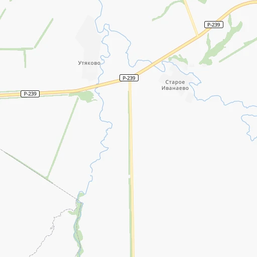
Roadmap (route) to go from Chistopol Airport to Novokuybyshevsk detailed above, you can also see the course layout on the map.
While doing trip Chistopol (airport) - Novokuybyshevsk by car, the calculated route ends at a distance , or more straight.
Distance and duration of the route between Chistopol (airport) and Novokuybyshevsk
An error occured: undefined - for url https://router.cartes.cc/route?point=55.30516%2C50.61539&point=53.0959%2C49.9462&vehicle=car&debug=false&data_type=application%2Fjson&locale=en&points_encoded=true&instructions=true&elevation=false&optimize=false&timeout=10000&skip.host=true&skip.basePath=true&graphhopper_maps_host=https%3A%2F%2Fgraphhopper.com%2Fmaps%2F%3F&turn_sign_map.0=continue&turn_sign_map.1=turn%20slight%20right&turn_sign_map.2=turn%20right&turn_sign_map.3=turn%20sharp%20right&turn_sign_map.4=finish&turn_sign_map.5=reached%20via%20point&turn_sign_map.6=enter%20roundabout&turn_sign_map.-6=leave%20roundabout&turn_sign_map.-3=turn%20sharp%20left&turn_sign_map.-2=turn%20left&turn_sign_map.-1=turn%20slight%20left&key=&position=topleft
Calculation of distance and route from Novokuybyshevsk to Chistopol (airport) :
249.3312.1 km5h39mn
Continue 0h4mn 2.0 kmTurn right onto Чистополь — Аксубаево — Нурлат 2h43mn 111.1 kmTurn right onto улица Самаренкина 0h0mn 155 mTurn left onto улица Хамадеева 0h1mn 547 mAt roundabout, take exit 2 onto улица Карла Маркса 0h1mn 788 mTurn right onto улица Гиматдинова 0h2mn 1.4 kmTurn left 0h0mn 20 mTurn left 0h3mn 566 mTurn right onto улица Куйбышева 0h3mn 3.0 kmTurn right onto Нурлат — Нижний Нурлат — Степное Мамыково 0h14mn 17.8 kmTurn right onto Кошки - Нурлат 0h10mn 13.6 kmTurn right onto «Сергиевск — Челно-Вершины» — Кошки 0h5mn 6.1 kmTurn left onto Куйбышевская улица 0h1mn 909 mTurn right onto Лесная улица 0h0mn 127 mTurn left onto улица 60 лет Октября 0h1mn 804 mTurn slight left onto Борма — Кошки — Погрузная 0h21mn 27.8 kmContinue onto Р-241 1h43mn 56.6 kmAt roundabout, take exit 2 0h6mn 6.0 kmTurn right onto Кооперативная улица 0h1mn 769 mTurn right onto Комсомольская улица 0h2mn 2.0 kmKeep right 0h29mn 29.8 kmTurn sharp right onto Ново-Вокзальная улица 0h0mn 125 mTurn right onto Ново-Вокзальная улица 0h1mn 502 mTurn left onto Ново-Садовая улица 0h4mn 3.7 kmTurn right onto Ново-Садовая улица 0h5mn 4.8 kmTurn left onto Самарская улица 0h2mn 1.9 kmTurn right onto улица Венцека 0h0mn 156 mTurn left onto Галактионовская улица 0h0mn 275 mTurn right onto Пионерская улица 0h0mn 338 mTurn right onto Пионерская улица 0h0mn 143 mTurn left onto улица Фрунзе 0h2mn 2.0 kmKeep right 0h0mn 260 mTurn sharp left 0h0mn 417 mTurn slight right onto Шоссейная улица 0h0mn 165 mTurn left onto Народная улица 0h7mn 7.6 kmKeep right onto 36Н-816 0h0mn 44 mContinue onto Самарское шоссе 0h4mn 4.1 kmTurn sharp left onto Самарское шоссе 0h0mn 296 mTurn left onto Садовая улица 0h2mn 1.9 kmKeep right onto улица Суворова 0h1mn 530 mTurn left onto улица 50-летия НПЗ 0h0mn 289 mTurn right onto Коммунистическая улица 0h0mn 161 mTurn right onto улица Чапаева 0h0mn 60 mTurn left 0h0mn 99 mKeep right onto Коммунистическая улица 0h0mn 165 mArrive at destination 0h0mn 0 m
Travel from Chistopol (airport) (Samara Oblast) to a selection of major cities.
Distances from Chistopol Airport to biggest cities in Tatarstan Republic
Other major cities in country :
- Barnaul [04], 599,579 inhabitants. 2,142 km
- Vladivostok [59], 587,022 inhabitants. 5,713 km
- Irkutsk [20], 586,695 inhabitants. 3,457 km
- Khabarovsk [30], 579,000 inhabitants. 5,489 km
- Khabarovsk Vtoroy [30], 578,303 inhabitants. 5,495 km
- Orenburg [55], 550,204 inhabitants. 492 km
- Novokuznetsk [29], 539,616 inhabitants. 2,337 km
- Ryazan' [62], 520,173 inhabitants. 701 km
- Tyumen [78], 519,119 inhabitants. 943 km
- Lipetsk [43], 515,655 inhabitants. 782 km
- Penza [57], 512,602 inhabitants. 433 km
- Kalininskiy [42], 504,641 inhabitants. 1,306 km
- Astrakhan [07], 502,533 inhabitants. 1,013 km
- Makhachkala [17], 497,959 inhabitants. 1,391 km
- Tomsk [75], 485,519 inhabitants. 2,126 km
- Kemerovo [29], 477,090 inhabitants. 2,222 km
- Tula [76], 468,825 inhabitants. 843 km
- Kirov [33], 457,383 inhabitants. 371 km
- Cheboksary [16], 446,781 inhabitants. 230 km
- Kaliningrad [23], 434,954 inhabitants. 1,908 km
Route from Novokuybyshevsk to major cities (Russia).
- Distance Novokuybyshevsk Moscow850 km
- Distance Novokuybyshevsk Saint Petersburg1,418 km
- Distance Novokuybyshevsk Novosibirsk2,146 km
- Distance Novokuybyshevsk Yekaterinburg798 km
- Distance Novokuybyshevsk Nizhniy Novgorod525 km
- Distance Novokuybyshevsk Omsk1,538 km
- Distance Novokuybyshevsk Kazan304 km
- Distance Novokuybyshevsk Rostov-na-Donu977 km
- Distance Novokuybyshevsk Chelyabinsk782 km
- Distance Novokuybyshevsk Ufa435 km
- Distance Novokuybyshevsk Volgograd619 km
- Distance Novokuybyshevsk Perm675 km
- Distance Novokuybyshevsk Krasnoyarsk2,744 km
- Distance Novokuybyshevsk Saratov319 km
- Distance Novokuybyshevsk Voronezh747 km
- Distance Novokuybyshevsk Krasnodar1,199 km
- Distance Novokuybyshevsk Ulyanovsk171 km
- Distance Novokuybyshevsk Izhevsk467 km
- Distance Novokuybyshevsk Yaroslavl812 km
- Distance Novokuybyshevsk Barnaul2,233 km
Nearest cities to Chistopol (airport) :
- Samara, 1,134,730 inhabitants. 236 km
- Kazan, 1,104,738 inhabitants. 108 km
- Tol'yatti, 702,879 inhabitants. 214 km
- Ulyanovsk, 640,680 inhabitants. 180 km
- Izhevsk, 631,038 inhabitants. 235 km
- Naberezhnyye Chelny, 509,870 inhabitants. 122 km
- Yoshkar-Ola, 279,100 inhabitants. 225 km
- Nizhnekamsk, 234,297 inhabitants. 85 km
- Syzran', 189,338 inhabitants. 277 km
- Al'met'yevsk, 140,437 inhabitants. 117 km
- Dimitrovgrad, 132,226 inhabitants. 137 km
- Novokuybyshevsk, 111,800 inhabitants. 250 km
- Oktyabr'skiy, 108,200 inhabitants. 205 km
- Glazov, 100,676 inhabitants. 339 km
- Zelenodolsk, 99,600 inhabitants. 145 km
- Bugul'ma, 91,900 inhabitants. 164 km
- Buzuluk, 87,714 inhabitants. 301 km
- Yelabuga, 72,643 inhabitants. 104 km
- Chapayevsk, 70,147 inhabitants. 266 km
- Leninogorsk, 66,263 inhabitants. 142 km
- Chistopol', 62,200 inhabitants. 7 km
- Volzhsk, 58,000 inhabitants. 155 km
- Zhigulevsk, 57,094 inhabitants. 224 km
- Buguruslan, 53,511 inhabitants. 218 km
- Otradnyy, 50,127 inhabitants. 220 km
- Mozhga, 47,270 inhabitants. 162 km
- Zainsk, 42,044 inhabitants. 92 km
- Vyatskiye Polyany, 39,534 inhabitants. 106 km
- Nurlat, 34,451 inhabitants. 98 km
- Kinel', 34,336 inhabitants. 231 km
- Sorochinsk, 30,731 inhabitants. 361 km
- Pokhvistnevo, 28,300 inhabitants. 208 km
- Bezenchuk, 23,736 inhabitants. 270 km
- Bavly, 22,982 inhabitants. 198 km
- Mendeleyevsk, 22,969 inhabitants. 125 km
- Igra, 22,033 inhabitants. 292 km
- Buinsk, 20,266 inhabitants. 152 km
- Yaransk, 19,557 inhabitants. 279 km
- Neftegorsk, 19,542 inhabitants. 281 km
- Uva, 19,143 inhabitants. 211 km
- Agryz, 18,601 inhabitants. 201 km
- Kinel'-Cherkassy, 18,393 inhabitants. 212 km
- Sovetsk, 17,869 inhabitants. 273 km
- Arsk, 17,243 inhabitants. 99 km
- Novoul'yanovsk, 17,139 inhabitants. 192 km
- Menzelinsk, 16,858 inhabitants. 164 km
- Vasil'yevo, 16,800 inhabitants. 137 km
- Kukmor, 16,795 inhabitants. 100 km
- Balezino, 16,618 inhabitants. 332 km
- Medvedevo, 16,407 inhabitants. 229 km
Location Chistopol (airport) (Tatarstan Republic) :
| Country flag |  |
| Location | Chistopol (airport) |
| State | Tatarstan Republic |
| County | |
| Country | Russia |
| Country code / ISO 2 | RU |
| Latitude | 55.3051600 |
| Longitude | 50.6153900 |
| Altitude | 0 meters |
| Time zone | Europe/Moscow |
Location Novokuybyshevsk (Samara Oblast) :
| Country flag | |
| Location | Novokuybyshevsk |
| State | Samara Oblast |
| County | |
| Country | Russia |
| Country code / ISO 2 | RU |
| Latitude | 53.0959000 |
| Longitude | 49.9462000 |
| Altitude | 0 meters |
| Time zone | Europe/Samara |
