
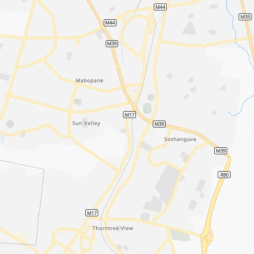
How to get from Mabopane (Gauteng) to Uitenhage (Eastern Cape)
Calculate route from Mabopane (Gauteng, South Africa) to Uitenhage (Eastern Cape, South Africa).
The flight distance (as the crow flies) between Mabopane and Uitenhage is 954.2 km.
Roadmap (route) to go from Mabopane to Uitenhage detailed above, you can also see the course layout on the map.
While doing trip Mabopane - Uitenhage by car, the calculated route ends at a distance , or more straight.
Distance and duration of the route between Mabopane and Uitenhage
An error occured: undefined - for url https://router.cartes.cc/route?point=-25.49768%2C28.10065&point=-33.75757%2C25.3971&vehicle=car&debug=false&data_type=application%2Fjson&locale=en&points_encoded=true&instructions=true&elevation=false&optimize=false&timeout=10000&skip.host=true&skip.basePath=true&graphhopper_maps_host=https%3A%2F%2Fgraphhopper.com%2Fmaps%2F%3F&turn_sign_map.0=continue&turn_sign_map.1=turn%20slight%20right&turn_sign_map.2=turn%20right&turn_sign_map.3=turn%20sharp%20right&turn_sign_map.4=finish&turn_sign_map.5=reached%20via%20point&turn_sign_map.6=enter%20roundabout&turn_sign_map.-6=leave%20roundabout&turn_sign_map.-3=turn%20sharp%20left&turn_sign_map.-2=turn%20left&turn_sign_map.-1=turn%20slight%20left&key=&position=topleft
Calculation of distance and route from Uitenhage to Mabopane :
954.21,149.0 km13h5mn
Continue 0h0mn 132 mTurn sharp right 0h0mn 52 mTurn left 0h3mn 1.3 kmTurn left onto Buitekant Road 0h2mn 1.8 kmKeep left toward M39 0h18mn 27.1 kmTurn right onto Es'kia Mphahlele Drive 0h4mn 4.1 kmKeep left toward M4 0h1mn 1,000 mTurn right onto Sophie de Bruyn Street 0h2mn 2.4 kmKeep right onto Ben Schoeman Highway and drive toward Johannesburg, Krugersdorp 1h39mn 61.9 kmKeep left onto R553 0h4mn 5.2 kmKeep left and take N1, N12 toward Bloemfontein, Kimberley 0h2mn 2.3 kmKeep right onto N1 2h20mn 249.6 kmTurn left 0h8mn 3.9 kmTurn right 0h14mn 6.9 kmContinue onto S463 0h4mn 2.0 kmTurn slight right onto S463 0h29mn 14.4 kmTurn slight left onto S463 0h0mn 510 mTurn right onto N5, R708 0h2mn 3.6 kmTurn left and take N1 toward Bloemfontein 1h17mn 136.3 kmContinue onto N1 2h52mn 198.9 kmKeep left and take N9 toward Port Elizabeth 0h1mn 1.2 kmContinue onto N9 3h37mn 197.6 kmTurn right onto Caledon Street 0h0mn 237 mTurn left onto Church Street 0h0mn 138 mTurn left onto Church Street 0h3mn 2.5 kmKeep left 0h0mn 133 mTurn slight left onto R63 3h39mn 218.4 kmTurn right onto Graaff Reinet Road 0h4mn 4.5 kmTurn right onto High Street 0h1mn 734 mTurn left onto Innes Street 0h0mn 135 mTurn right onto Scanlan Street 0h0mn 38 mArrive at destination 0h0mn 0 m
Travel from Mabopane (Eastern Cape) to a selection of major cities.
Distances from Mabopane to biggest cities in Gauteng
- Alberton,121,536 inhabitants.86 km
- Heidelberg,64,199 inhabitants.115 km
- Edenvale,49,292 inhabitants.72 km
- Ekangala,37,650 inhabitants.69 km
- Bronkhorstspruit,27,343 inhabitants.73 km
- Cullinan,25,490 inhabitants.47 km
- Midstream,25,000 inhabitants.48 km
Other major cities in country :
- Bhisho [05], 137,287 inhabitants. 821 km
- Worcester [11], 127,597 inhabitants. 1,234 km
- Rustenburg [10], 124,064 inhabitants. 88 km
- Polokwane [09], 123,749 inhabitants. 225 km
- Potchefstroom [10], 123,669 inhabitants. 169 km
- Virginia [03], 122,502 inhabitants. 315 km
- Brits [10], 122,497 inhabitants. 36 km
- Nelspruit [07], 110,159 inhabitants. 288 km
- Phalaborwa [09], 109,468 inhabitants. 353 km
- Queenstown [05], 105,309 inhabitants. 722 km
- Kroonstad [03], 103,992 inhabitants. 255 km
- Bethal [07], 101,919 inhabitants. 173 km
- Mokopane [09], 101,090 inhabitants. 172 km
- Kutloanong [03], 95,008 inhabitants. 293 km
- Stellenbosch [11], 94,263 inhabitants. 1,295 km
- Stilfontein [10], 93,110 inhabitants. 201 km
- Delmas [07], 92,046 inhabitants. 93 km
- Grahamstown [05], 91,548 inhabitants. 882 km
- Warmbaths [09], 90,210 inhabitants. 71 km
- Louis Trichardt [09], 86,854 inhabitants. 329 km
Route from Uitenhage to major cities (South Africa).
- Distance Uitenhage Cape Town645 km
- Distance Uitenhage Durban687 km
- Distance Uitenhage Johannesburg879 km
- Distance Uitenhage Soweto867 km
- Distance Uitenhage Pretoria932 km
- Distance Uitenhage Pietermaritzburg660 km
- Distance Uitenhage Benoni888 km
- Distance Uitenhage Tembisa906 km
- Distance Uitenhage Vereeniging825 km
- Distance Uitenhage Bloemfontein522 km
- Distance Uitenhage Boksburg884 km
- Distance Uitenhage Welkom656 km
- Distance Uitenhage Newcastle796 km
- Distance Uitenhage Krugersdorp884 km
- Distance Uitenhage Diepsloot907 km
- Distance Uitenhage Randburg889 km
- Distance Uitenhage Botshabelo515 km
- Distance Uitenhage Brakpan885 km
- Distance Uitenhage Witbank953 km
- Distance Uitenhage Richards Bay840 km
Nearest cities to Mabopane :
- Johannesburg, 2,026,469 inhabitants. 79 km
- Soweto, 1,695,047 inhabitants. 89 km
- Pretoria, 1,619,438 inhabitants. 29 km
- Benoni, 605,344 inhabitants. 80 km
- Tembisa, 511,655 inhabitants. 57 km
- Vereeniging, 474,681 inhabitants. 132 km
- Boksburg, 445,168 inhabitants. 81 km
- Welkom, 431,944 inhabitants. 308 km
- Newcastle, 404,838 inhabitants. 311 km
- Krugersdorp, 378,821 inhabitants. 73 km
- Diepsloot, 350,000 inhabitants. 49 km
- Randburg, 337,053 inhabitants. 67 km
- Brakpan, 305,692 inhabitants. 87 km
- Witbank, 262,491 inhabitants. 121 km
- Vanderbijlpark, 246,754 inhabitants. 138 km
- Centurion, 233,386 inhabitants. 41 km
- Roodepoort, 225,000 inhabitants. 77 km
- Springs, 186,394 inhabitants. 89 km
- Carletonville, 182,304 inhabitants. 119 km
- Klerksdorp, 178,921 inhabitants. 208 km
- Midrand, 173,009 inhabitants. 55 km
- Westonaria, 156,831 inhabitants. 102 km
- Middelburg, 154,706 inhabitants. 140 km
- Vryheid, 150,012 inhabitants. 368 km
- Orkney, 145,801 inhabitants. 218 km
- eMbalenhle, 141,741 inhabitants. 150 km
- Nigel, 140,644 inhabitants. 111 km
- Randfontein, 133,654 inhabitants. 86 km
- Rustenburg, 124,064 inhabitants. 88 km
- Polokwane, 123,749 inhabitants. 225 km
- Potchefstroom, 123,669 inhabitants. 169 km
- Virginia, 122,502 inhabitants. 315 km
- Brits, 122,497 inhabitants. 36 km
- Alberton, 121,536 inhabitants. 86 km
- Nelspruit, 110,159 inhabitants. 288 km
- Kroonstad, 103,992 inhabitants. 255 km
- Bethal, 101,919 inhabitants. 173 km
- Mokopane, 101,090 inhabitants. 172 km
- Mabopane, 97,417 inhabitants. 0 km
- Kutloanong, 95,008 inhabitants. 293 km
- Stilfontein, 93,110 inhabitants. 201 km
- Delmas, 92,046 inhabitants. 93 km
- Warmbaths, 90,210 inhabitants. 71 km
- Louis Trichardt, 86,854 inhabitants. 329 km
- Dundee, 84,413 inhabitants. 365 km
- Piet Retief, 84,349 inhabitants. 319 km
- Bethlehem, 83,654 inhabitants. 305 km
- Sasolburg, 77,016 inhabitants. 149 km
- Mmabatho, 76,754 inhabitants. 251 km
- Standerton, 74,021 inhabitants. 196 km
Location Mabopane (Gauteng) :
| Country flag |  |
| Location | Mabopane |
| State | Gauteng |
| County | City of Tshwane Metropolitan Municipality |
| Country | South Africa |
| Country code / ISO 2 | ZA |
| Latitude | -25.4976800 |
| Longitude | 28.1006500 |
| Altitude | 0 meters |
| Time zone | Africa/Johannesburg |
Location Uitenhage (Eastern Cape) :
| Country flag | |
| Location | Uitenhage |
| State | Eastern Cape |
| County | Nelson Mandela Bay Metropolitan Municipality |
| Country | South Africa |
| Country code / ISO 2 | ZA |
| Latitude | -33.7575700 |
| Longitude | 25.3971000 |
| Altitude | 0 meters |
| Time zone | Africa/Johannesburg |


