


How to get from Maḩaţţat Qiţār ad Darrājī (Al Muthanná) to Mosul (Nineveh)
Calculate route from Maḩaţţat Qiţār ad Darrājī (Al Muthanná, Iraq) to Mosul (Nineveh, Iraq).
The flight distance (as the crow flies) between Maḩaţţat Qiţār ad Darrājī and Mosul is 625.2 km.
Roadmap (route) to go from Maḩaţţat Qiţār ad Darrājī to Mosul detailed above, you can also see the course layout on the map.
While doing trip Maḩaţţat Qiţār ad Darrājī - Mosul by car, the calculated route ends at a distance , or more straight.
Distance and duration of the route between Maḩaţţat Qiţār ad Darrājī and Mosul
An error occured: undefined - for url https://router.cartes.cc/route?point=31.13257%2C45.69801&point=36.335%2C43.11889&vehicle=car&debug=false&data_type=application%2Fjson&locale=en&points_encoded=true&instructions=true&elevation=false&optimize=false&timeout=10000&skip.host=true&skip.basePath=true&graphhopper_maps_host=https%3A%2F%2Fgraphhopper.com%2Fmaps%2F%3F&turn_sign_map.0=continue&turn_sign_map.1=turn%20slight%20right&turn_sign_map.2=turn%20right&turn_sign_map.3=turn%20sharp%20right&turn_sign_map.4=finish&turn_sign_map.5=reached%20via%20point&turn_sign_map.6=enter%20roundabout&turn_sign_map.-6=leave%20roundabout&turn_sign_map.-3=turn%20sharp%20left&turn_sign_map.-2=turn%20left&turn_sign_map.-1=turn%20slight%20left&key=&position=topleft
Calculation of distance and route from Mosul to Maḩaţţat Qiţār ad Darrājī :
625.2714.9 km9h10mn
Continue onto طريق سماوه ناصريه 0h3mn 3.7 kmTurn left 0h0mn 18 mTurn left onto طريق ناصريه سماوه 1h43mn 50.1 kmKeep right onto 8 0h8mn 8.8 kmKeep right 0h24mn 26.8 kmKeep right toward 1 2h54mn 205.8 kmKeep right and drive toward الدورة 0h14mn 20.8 kmAt roundabout, take exit 2 onto شارع بدر 0h1mn 767 mAt roundabout, take exit 2 onto جسر 14 تموز 0h1mn 1.1 kmAt roundabout, take exit 2 onto شارع 14 تموز 0h1mn 999 mContinue onto شارع 14 تموز 0h1mn 1.4 kmKeep left onto شارع 14 تموز 0h4mn 6.7 kmTurn left 0h0mn 22 mContinue onto شارع الشمال 0h2mn 2.5 kmAt roundabout, take exit 1 onto شارع الشمال 2h30mn 105.0 kmKeep right onto طريق بغداد 0h6mn 6.5 kmTurn left onto طريق بغداد 1h39mn 44.3 kmKeep right 0h5mn 5.1 kmAt roundabout, take exit 2 onto دوار المقاتل 0h1mn 1.4 kmKeep left 3h34mn 178.9 kmKeep left onto طريق بغداد -الموصل 1h35mn 40.6 kmKeep right 0h2mn 1.7 kmKeep right 0h0mn 137 mKeep left onto الجسر الرابع 0h0mn 24 mTurn slight left 0h1mn 1.2 kmTurn sharp right 0h0mn 64 mTurn left 0h1mn 375 mTurn right 0h0mn 49 mArrive at destination 0h0mn 0 m
Travel from Maḩaţţat Qiţār ad Darrājī (Nineveh) to a selection of major cities.
Distances from Maḩaţţat Qiţār ad Darrājī to biggest cities in Al Muthanná
Other major cities in country :
- Baqubah [10], 152,550 inhabitants. 309 km
- Sinah [08], 128,776 inhabitants. 678 km
- Az Zubayr [02], 122,676 inhabitants. 209 km
- Kufa [17], 110,000 inhabitants. 157 km
- Umm Qasr [02], 107,620 inhabitants. 245 km
- Al Faw [02], 104,569 inhabitants. 296 km
- Zaxo [08], 95,052 inhabitants. 725 km
- Al Harithah [02], 92,395 inhabitants. 206 km
- Ash Shatrah [09], 82,732 inhabitants. 55 km
- Al Hayy [16], 78,272 inhabitants. 120 km
- Jamjamal [05], 75,634 inhabitants. 496 km
- Khalis [10], 70,046 inhabitants. 317 km
- Tozkhurmato [18], 59,886 inhabitants. 430 km
- Ash Shamiyah [04], 57,661 inhabitants. 139 km
- Al Hindiyah [12], 57,490 inhabitants. 210 km
- Halabjah [05], 57,333 inhabitants. 451 km
- Al Miqdadiyah [10], 50,698 inhabitants. 325 km
Route from Mosul to major cities (Iraq).
- Distance Mosul Baghdad353 km
- Distance Mosul Basrah780 km
- Distance Mosul Al Basrah al Qadimah782 km
- Distance Mosul Erbil82 km
- Distance Mosul Abu Ghurayb351 km
- Distance Mosul As Sulaymaniyah225 km
- Distance Mosul Kirkuk150 km
- Distance Mosul Najaf493 km
- Distance Mosul Karbala422 km
- Distance Mosul Nasiriyah655 km
- Distance Mosul Al 'Amarah623 km
- Distance Mosul Ad Diwaniyah511 km
- Distance Mosul Al Kut492 km
- Distance Mosul Al Hillah447 km
- Distance Mosul Dihok60 km
- Distance Mosul Ramadi325 km
- Distance Mosul Al Fallujah338 km
- Distance Mosul Samarra'248 km
- Distance Mosul As Samawah592 km
- Distance Mosul Baqubah318 km
Nearest cities to Maḩaţţat Qiţār ad Darrājī :
- Baghdad, 7,216,000 inhabitants. 274 km
- Basrah, 2,600,000 inhabitants. 211 km
- Al Basrah al Qadimah, 2,015,483 inhabitants. 214 km
- Abu Ghurayb, 900,000 inhabitants. 281 km
- Najaf, 482,576 inhabitants. 162 km
- Karbala, 434,450 inhabitants. 229 km
- Nasiriyah, 400,249 inhabitants. 54 km
- Al 'Amarah, 323,302 inhabitants. 158 km
- Ad Diwaniyah, 318,801 inhabitants. 121 km
- Al Kut, 315,162 inhabitants. 154 km
- Al Hillah, 289,709 inhabitants. 191 km
- Ramadi, 274,539 inhabitants. 340 km
- Al Fallujah, 190,159 inhabitants. 305 km
- As Samawah, 152,890 inhabitants. 44 km
- Baqubah, 152,550 inhabitants. 309 km
- Az Zubayr, 122,676 inhabitants. 209 km
- Kufa, 110,000 inhabitants. 157 km
- Umm Qasr, 107,620 inhabitants. 245 km
- Al Faw, 104,569 inhabitants. 296 km
- Al Harithah, 92,395 inhabitants. 206 km
- Ash Shatrah, 82,732 inhabitants. 55 km
- Al Hayy, 78,272 inhabitants. 120 km
- Khalis, 70,046 inhabitants. 317 km
- Ash Shamiyah, 57,661 inhabitants. 139 km
- Al Hindiyah, 57,490 inhabitants. 210 km
- Al Miqdadiyah, 50,698 inhabitants. 325 km
- Ar Rumaythah, 47,248 inhabitants. 64 km
- Al 'Aziziyah, 44,751 inhabitants. 207 km
- Al Musayyib, 42,901 inhabitants. 226 km
- As Suwayrah, 42,354 inhabitants. 218 km
- Balad, 42,088 inhabitants. 352 km
- Imam Qasim, 36,992 inhabitants. 161 km
- Hit, 31,901 inhabitants. 388 km
- Nahiyat Ghammas, 30,909 inhabitants. 123 km
- Nahiyat Saddat al Hindiyah, 30,622 inhabitants. 221 km
- Mandali, 29,785 inhabitants. 291 km
- Ad Dujayl, 26,362 inhabitants. 332 km
- Al Mishkhab, 23,189 inhabitants. 137 km
- Nahiyat ash Shinafiyah, 22,643 inhabitants. 112 km
- 'Afak, 21,888 inhabitants. 112 km
- Nahiyat al Fuhud, 21,551 inhabitants. 99 km
- 'Ali al Gharbi, 19,711 inhabitants. 175 km
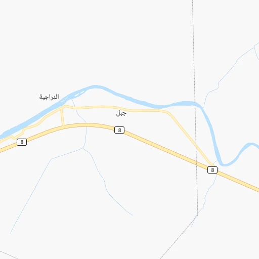
Location Maḩaţţat Qiţār ad Darrājī (Al Muthanná) :
| Country flag |  |
| Location | Maḩaţţat Qiţār ad Darrājī |
| State | Al Muthanná |
| County | Al-Khidir District |
| Country | Iraq |
| Country code / ISO 2 | IQ |
| Latitude | 31.1325700 |
| Longitude | 45.6980100 |
| Altitude | 0 meters |
| Time zone | Asia/Baghdad |
Location Mosul (Nineveh) :
| Country flag | |
| Location | Mosul |
| State | Nineveh |
| County | Mosul |
| Country | Iraq |
| Country code / ISO 2 | IQ |
| Latitude | 36.3350000 |
| Longitude | 43.1188900 |
| Altitude | 0 meters |
| Time zone | Asia/Baghdad |